コース・マップ検索
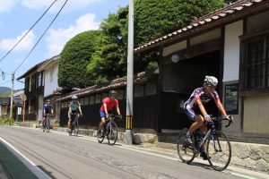
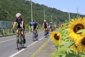
八頭・若桜周遊サイクリングコースマップ
距離 Distance:
44.7km
獲得標高 上り Elevation Gain (Up):
171.6m
獲得標高 下り Elevation Gain (Down):
ー
最大標高差 Maximum elevation difference:
ー
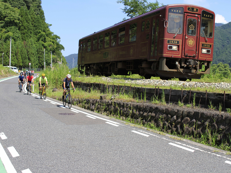
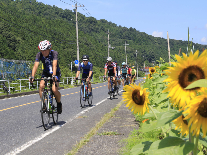
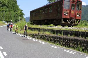
田園風景の中、若桜鉄道とサイクリングを同時に楽しむことができるサイクリングルート。若桜鉄道と並走できる区間があるほか、季節ごとに桜やひまわり、梨や柿などの果実畑を見ながら走ることができます。サイクリングを楽しみたい初級者やグループにおすすめです。
A cycling route where you can enjoy cycling with the Wakasa Railway at the same time in a rural landscape. There is a section where you can run in parallel with the Wakasa Railway, and you can run while looking at fruit fields such as cherry blossoms, sunflowers, pears, and persimmons every season. Recommended for beginners and groups who want to enjoy cycling.
オススメスポット ビュースポット いきもの・植物 グルメ ショッピング 道の駅 温泉 宿泊 病院 レンタサイクル 自転車販売店 サイクリングサポート トイレ その他
※オンラインの地図上でサイクリングルートが閲覧できるウェブサイト「ルートラボ」が2020年3月末でサービス終了したため、「bikemap」に変更したことで、bikemap内の距離や高低差に誤差が生じている場合がありますが、ご理解ご了承の程、よろしくお願いします。
コース周辺スポット
全て
オススメスポット
ビュースポット
グルメ
温泉
宿泊
その他
で絞り込む
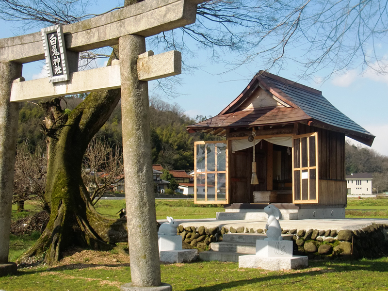
福本白兎神社
神代のころ、この地域に天照大神が降臨され、その案内役を務めたうさぎを祀ったといわれる神社。現在は鳥居とお社の面影が残るのみだが、その社殿は町内の「成田山青龍寺」に移築している。
住所:鳥取県八頭郡八頭町福本
TEL:0858-72-6007(八頭町観光協会)
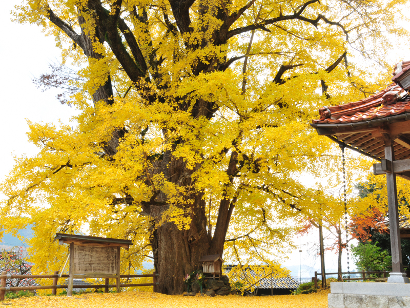
西御門の大イチョウ
西御門にある推定樹齢500~600年大イチョウ。後醍醐天皇が京都への遷幸(せんこう)の途中に立ち寄られたという伝承があり、現在も地元民によって大切に守られている県指定天然記念物。
住所:鳥取県八頭郡八頭町西御門106
TEL:0858-84-1232(八頭町教育委員会事務局社会教育課)
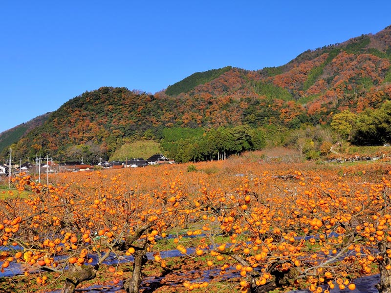
柿畑(物産館みかど付近)
八頭町は日本随一の甘い柿としてGI(地理的表示保護制度)にも登録されている花御所柿の産地。11月下旬にはあたり一面の柿色の景色を楽しめる。
住所:鳥取県八頭郡八頭町大門
TEL:0858-72-3730(物産館みかど)
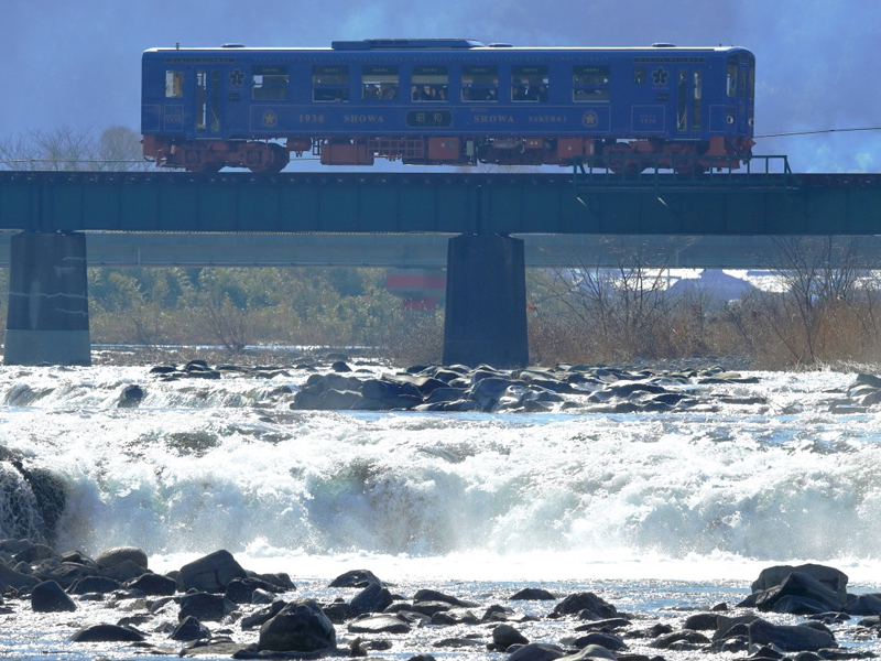
徳丸親水公園(徳丸ドンド)
一級河川八東川の水流が生み出した全国的にも珍しい川の中の自然滝。鉄橋を走る「若桜鉄道」や近傍の山々の景色を楽しめる。
住所:鳥取県八頭郡八頭町徳丸
TEL:0858-72-6007(八頭町観光協会)
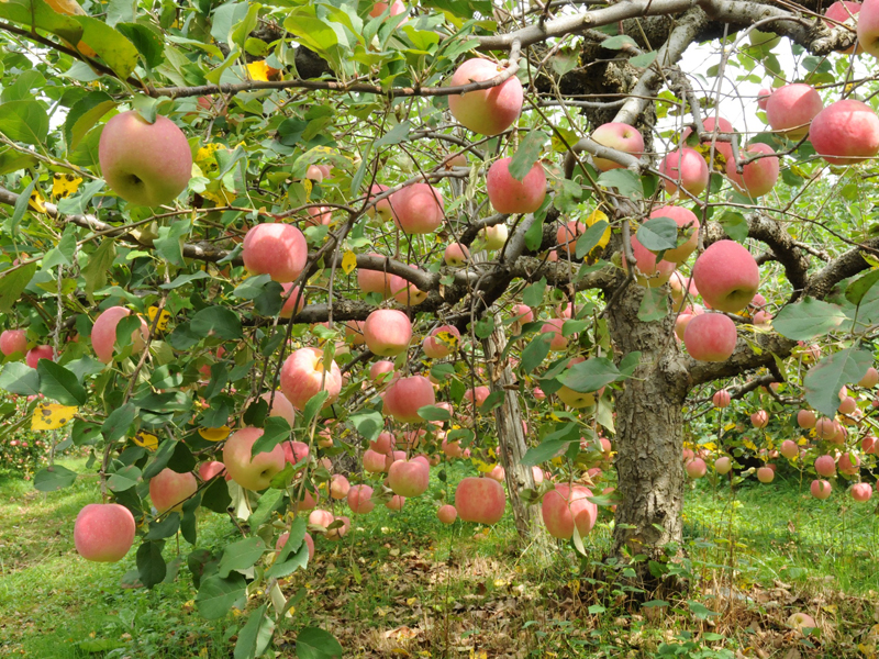
はっとうフルーツ観光園
りんご・梨・ぶどう・栗の4つのフルーツ狩りが楽しめる観光園。もぎとった旬のフルーツを、園内でそのまま食べることができる。
住所:鳥取県八頭郡八頭町徳丸745
TEL:0858-84-6030
営業時間:
10:00~16:00
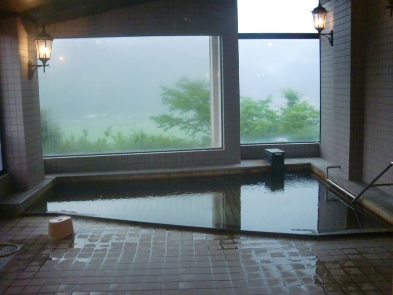
鍛冶屋温泉
小高い丘の上に立つ温泉施設。大浴場からは山々が見渡せる絶景。大自然と温泉が同時に満喫でき、心も体も温まる温泉。
住所:鳥取県八頭郡八頭町東593-1
TEL:0858-84-2210
営業時間:
9:00~17:00(3月下旬~11月の土日・祝日は19:00まで営業)
《閉館時間30分前に受付終了》
定休日:
火曜日(祝日の場合は翌営業日) 12月29日から1月3日までの年末年始
料金:八頭町内:300円
八頭町外:400円
障がい者・小学生:200円
タオル:150円
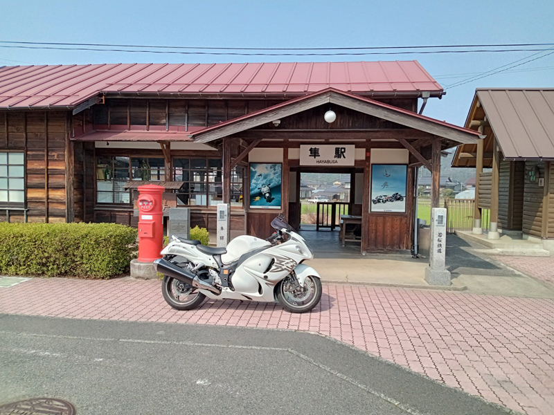
隼駅
若桜鉄道の駅でその名前から、SUZUKIの大型バイク「隼」ライダーの聖地としても知られている。昭和5年までは終着駅だったため、本屋のほかにも乗務員休憩所など、他の駅ではみられない構造もあり、国の登録有形文化財にも登録されている。
住所:鳥取県八頭郡八頭町福井
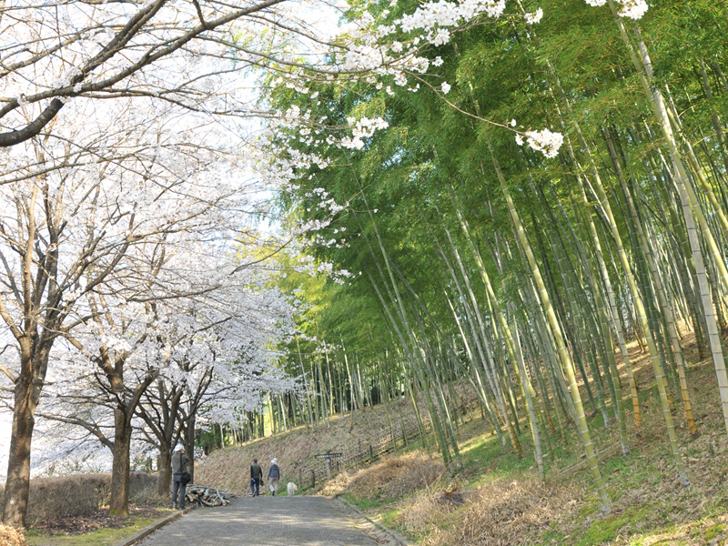
船岡竹林公園
国内外の珍しい竹と笹が生い茂る国内有数の本格的な竹林公園。春は桜、夏はあじさいなどの四季折々の花も楽しめる。広い駐車場と更衣室があるため、サイクリングの起点としてもおすすめ。
住所:鳥取県八頭郡八頭町西谷564-1
TEL:・3月~11月末日 船岡竹林公園 TEL.0858‐73‐8100
営業時間:
3月~11月末日
8:30~17:30
定休日:
毎週水曜日(祝祭日の場合はその翌日)
料金:・バンガロー(宿泊) 1棟1泊 (定員8名) 16,500円
・バンガロー(休憩) 1棟2時間 (定員8名) 2,750円
※2時間を超える場合、 1時間につき延長料金 1,100円
・BBQテーブル 1基 (2時間、定員6名) 1,100円
※2時間を超える場合、 1時間につき延長料金550円
・レンガ炉 1基 (定員6名) 550円
※ご利用時間 10:00~17:00 ご宿泊の場合、 夜間 早朝の利用も受け付けます。
・テントサイト 1ヶ所(1泊) 2,750円
・テントサイト 1ヶ所(デイキャンプ) 2,750円
・管理棟 (多目的室) 4 時間 3,300円
・コインシャワー(3分間) 200円
・芝生広場ステージ(4時間) 11,000円
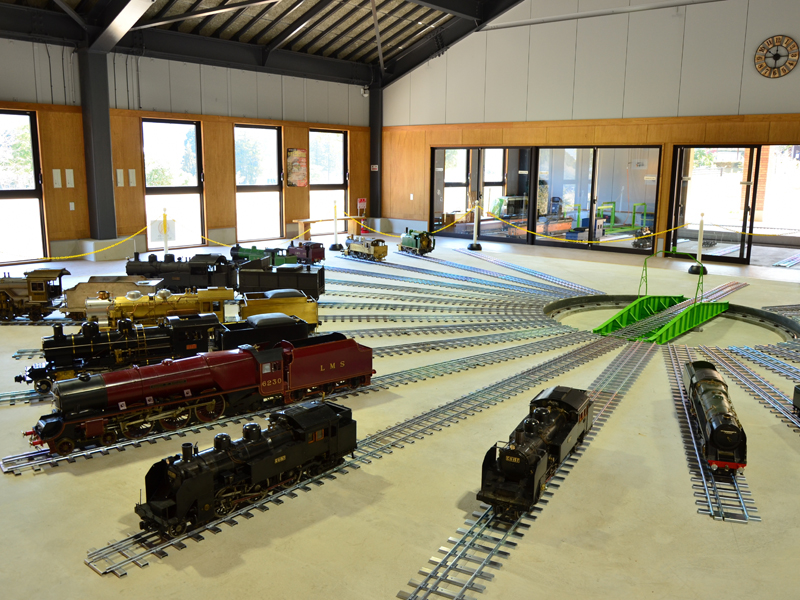
やずミニSL博物館
船岡竹林公園内にある8.4分の1スケールのミニ蒸気機関車(SL)など18車両を常時展示し、乗って楽しめる全国初のミニSL博物館。
住所:鳥取県八頭郡八頭町西谷564-1(船岡竹林公園内)
TEL:0858-71-0032
営業時間:
平日 10:00~15:00
土日祝 10:00~16:00
※12月~2月末は閉館
定休日:
毎週水曜日 ※祝日の場合は翌日
料金:大人(高校生以上)200円
小人(中学生以下)無料
団体割引(20人以上) 大人 160円
障がい者・障がい者介助者は無料
若桜鉄道利用して来場され、降車証明書持参の場合は無料
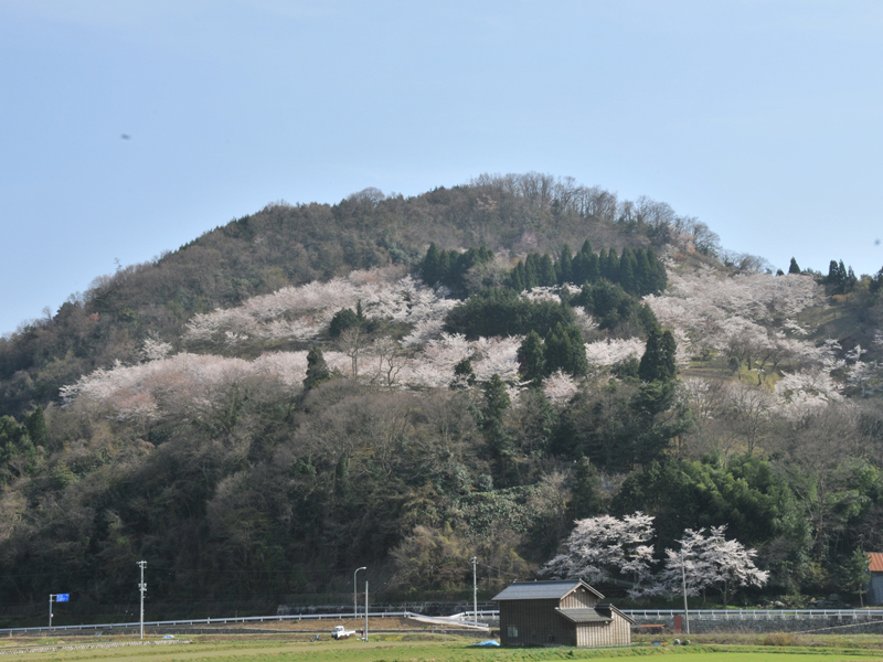
天満山公園
200mの小高い丘にあり、毎年春には千本余りの桜が咲き誇る桜の名所。
桜の見ごろ:3月下旬~4月上旬
住所:鳥取県八頭郡八頭町船岡
TEL:0858-72-6007(八頭町観光協会)
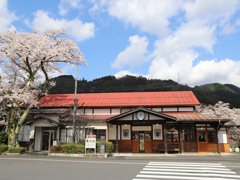
若桜駅
若桜鉄道の終着駅。昭和初期の木造駅舎が現役で使われ、機関車を方向転換させるための手動式転車台や給水塔など見学だけでもレトロモダンな昭和の香りを満喫することができる。
住所:鳥取県八頭郡若桜町若桜345-2
TEL:0858-82-0919
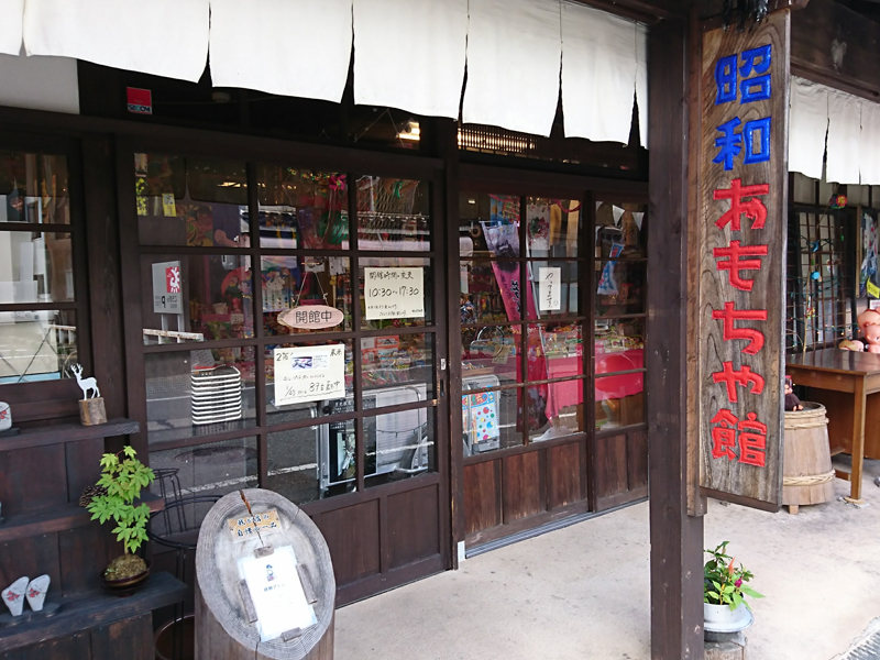
昭和おもちゃ館
築100年以上の古民家を改修し、今では見かけることも少なくなった駄菓子やおもちゃを販売。昭和にタイムスリップした気分を味わえる。
住所:鳥取県八頭郡若桜町若桜430
TEL:0858-71-0003
営業時間:
10:30~12:00、13:00~17:30
定休日:
毎週火曜日・水曜日、年末年始
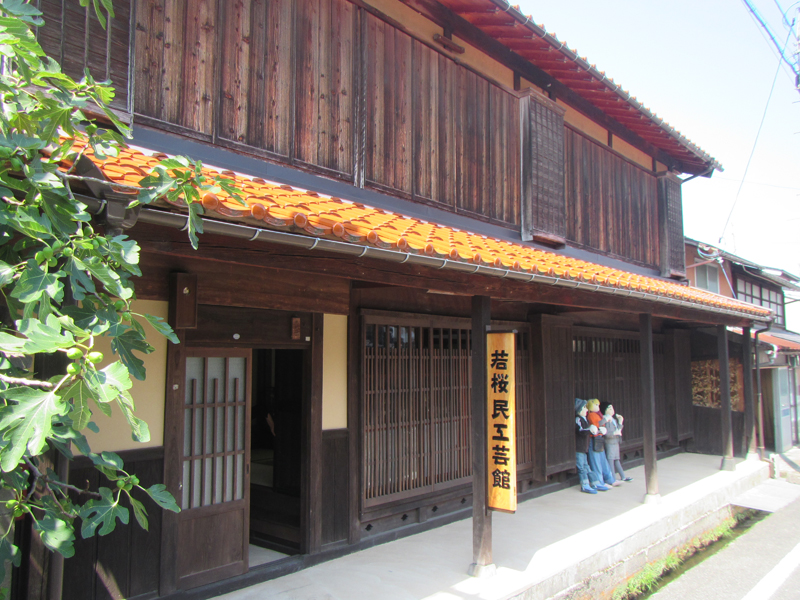
若桜民工芸館
築約100年の古民家を改修し、若桜町に縁のある作家の民工芸品を展示している施設。風情ある古民家で、若桜町の民工芸品の土鈴約2000点を楽しめる。
住所:鳥取県八頭郡若桜町若桜268
TEL:0858-82-1289
営業時間:
10:00~17:00
(12月1日~2月末は、16:00に閉館)
定休日:
12月29日~1月4日
料金:入館料無料
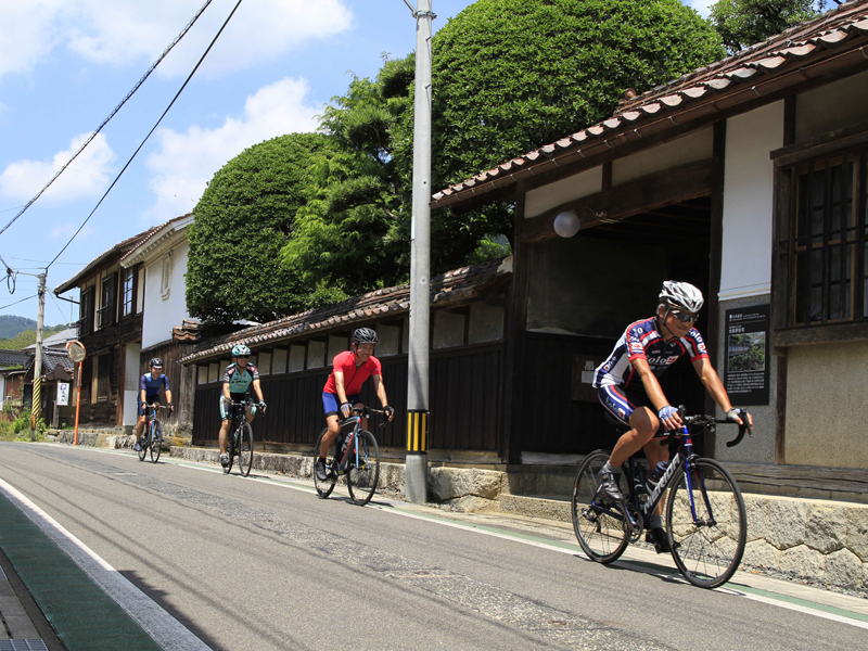
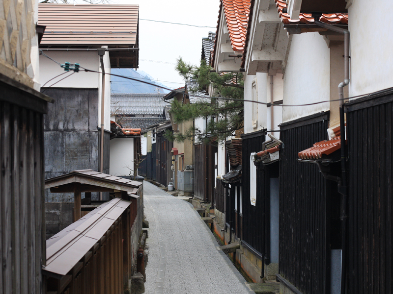
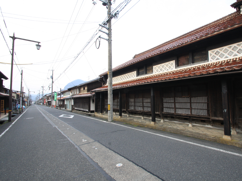
蔵通り・寺通り
かつての城下町・宿場町の名残で、情緒のある土蔵群とお寺が建ち並ぶ細道。水路を流れる水のせせらぎを聞きながら散策できる。
住所:鳥取県八頭郡若桜町若桜
TEL:0858-82-2237(若桜町観光協会)
カリヤ通り
「カリヤ」は道路側に長く伸ばしたひさしで、昔は通りを連続していて、雪や雨風を避けて通ることができた。現在はその一部が残されている。
住所:鳥取県八頭郡若桜町若桜
TEL:0858-82-2237(若桜町観光協会)
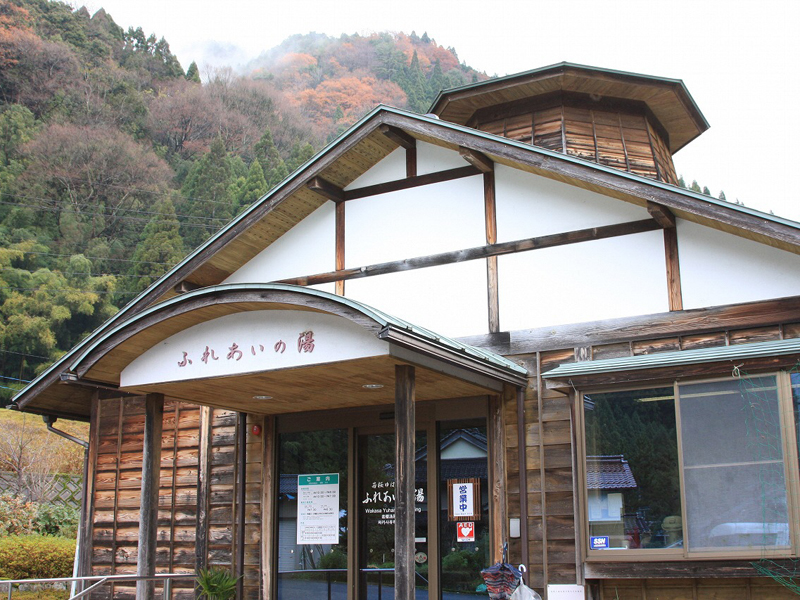
ゆはら温泉ふれあいの湯
氷ノ山の麓にある町営の温泉施設。氷ノ山への道中にあり、近隣の愛好者はもちろん登山やスキー客からも人気がある。
住所:鳥取県八頭郡若桜町湯原627
TEL:0858-82-1177
営業時間:
10:00~19:00(最終入館時間18:30)
定休日:
毎週月曜日(月曜日が祝祭日の場合は翌日)・年末年始
料金:町内利用者:大人200円・小中学生100円/町外利用者:大人400円・小中学生200円 ※65歳以上の方、障がい者の方は半額免除となります。モンベル会員、温泉博士減免あり。
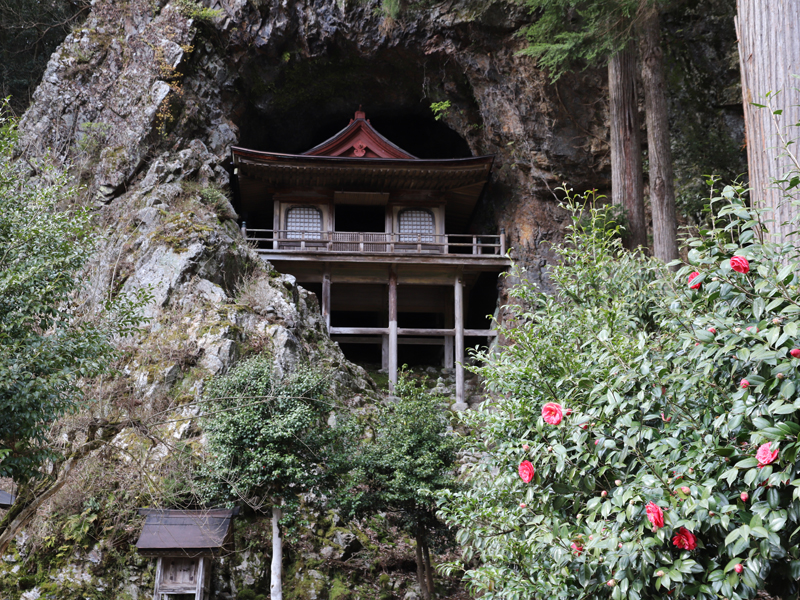
不動院岩屋堂
日本三大投入堂のひとつで国の重要文化財に指定されている。約600年前に建立されたといわれ、羽柴秀吉が鳥取城攻めの際にこの付近を焼き払ったが、この岩屋堂だけ焼け残ったと言われている。
住所:鳥取県八頭郡若桜町岩屋堂
TEL:0858-82-2237(若桜町観光協会)
料金:無料
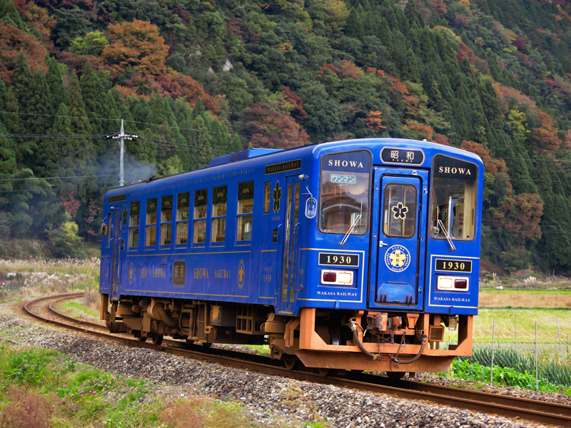
若桜鉄道
郡家駅と若桜駅を結ぶ9駅・19.2kmのローカル鉄道。終着駅の若桜駅を含む関連する23施設が国の登録有形文化財へ登録されている。昭和レトロの雰囲気が漂う各駅舎にはトイレも併設されており、立ち寄り・休憩にもおすすめ。
TEL:0858-82-0919(若桜鉄道)
料金:若桜駅のみ入構料300円(未就学児無料)
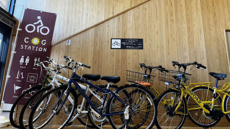
ぷらっとぴあやず(コグステーション八頭)
もうひとつの「白兎伝説」縁の地、八頭町の観光拠点として、情報発信や「若桜鉄道」切符・グッズや特産品を販売、レンタサイクルの貸出を行っている。レンタサイクルは「#やずわかさいくる」として若桜鉄道各駅での乗り捨ても可能。
住所:鳥取県八頭郡八頭町郡家648-6
TEL:0858-72-6007
営業時間:
9:15~18:00
定休日:
12月31日~1月2日
料金:スポーツタイプ500円/日、電動アシスト800円/日、事前予約不可
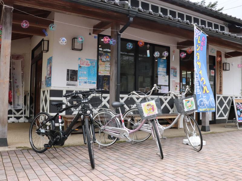
若桜町観光協会
レンタサイクル
住所:鳥取県若桜町若桜356-1
TEL:0858-82-2237
営業時間:
8:30~17:15
定休日:
年末年始
料金:Eバイク1,000円/日(2台)
電動アシスト付き自転車1,000円/日(3台)
シティサイクル200円/日(10台)若桜鉄道利用者は無料
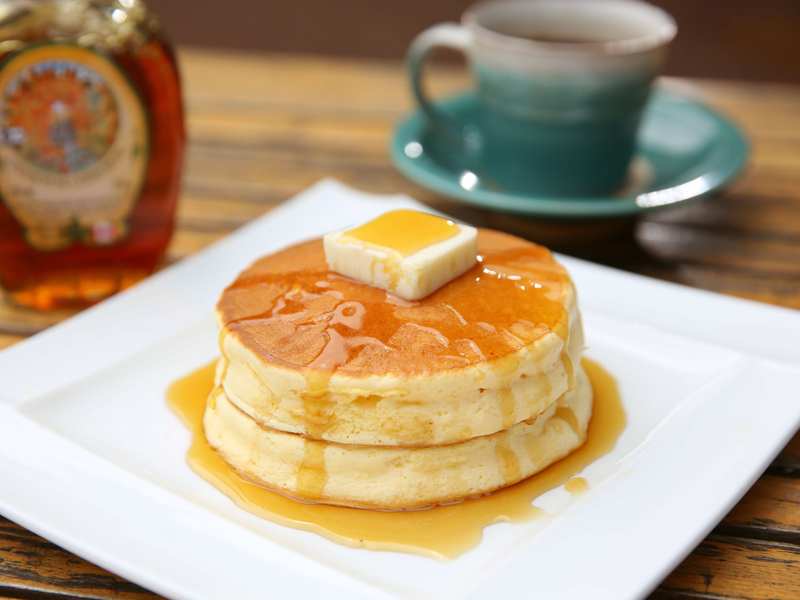
大江ノ郷ヴィレッジ(サイクルカフェ)
農と食のナチュラルリゾート施設。レストラン・カフェ・スイーツ・ベーカリーから燻製商品まで、様々な食を楽しめる。賞味期限10分の名物パンケーキは、ぜひ一度食べていただきたい珠玉の一皿。
住所:鳥取県八頭郡八頭町橋本877番地
TEL:0570-077-505
営業時間:
10:00~17:30
定休日:
年内無休
料金:・大江ノ郷パンケーキ:968円
・YAZUバーガー:990円
・ジェラート:380円~
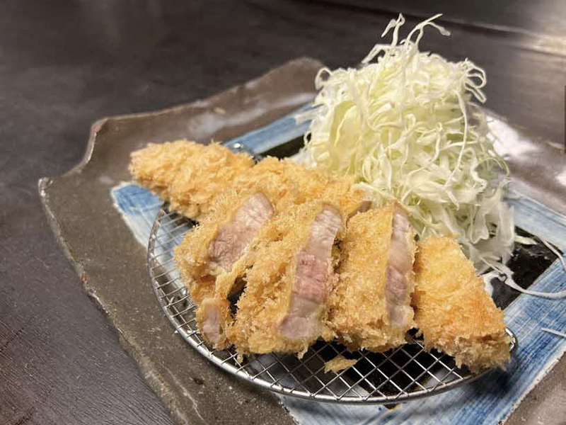
とんかつ新(あらた)(サイクルカフェ)
若桜町吉川地内で育った豚肉を使い、パン粉、揚げ油、揚げ方全てにこだわった極上のとんかつを作る専門店。店舗は築130年以上の古民家を改修しており、国の登録有形文化財に登録されている。
住所:鳥取県八頭郡若桜町若桜298
TEL:0858-71-0002
営業時間:
(平日)11:00~14:00
(土日祝)11:00~15:00
定休日:
月曜日・第3日曜日
料金:・ロースかつ定食:1,628円
・上ロースかつ定食:2,063円
・ヒレかつ定食:1,958円
ごはんとおみやげyamaneya(サイクルカフェ)
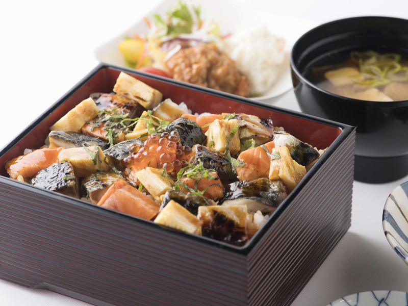
若桜駅前にあるお土産とランチのお店。若桜町のお土産品や焼きさば寿司などを販売。ランチは地元の豚肉や鹿肉料理、店自慢の焼きさば重がおすすめ。
住所:鳥取県八頭郡若桜町若桜356-1
TEL:0858-71-1020
営業時間:
10:00~17:00
(ランチタイムは11:00~15:00)
定休日:
水曜日
料金:・しょうが焼き定食 :980円
・鹿肉ハンバーグ定食 :980円
・焼きさば重定食 :1,280円
わかさcafe retro(サイクルカフェ)
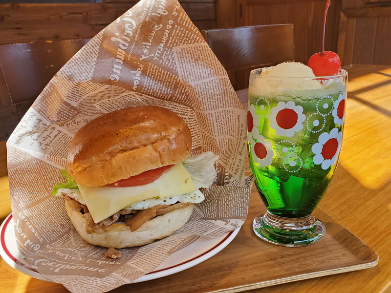
若桜駅に併設されたカフェ。駅舎をそのまま生かした昭和レトロをコンセプトに、ミックスジュースやメロンクリームソーダなど懐かしいメニューや大人気のドリップコーヒー、retroハンバーガーもぜひどうぞ。
住所:鳥取県八頭郡若桜町若桜345-2(若桜駅構内)
TEL:0858-71-1020
営業時間:
9:00~18:00
定休日:
火曜日
料金:・ミックスジュース、メロンソーダ :各440円
・コーヒー:380円
・retroハンバーガー:600円
道の駅 若桜「桜ん坊」(サイクルカフェ)
国道29号沿いに位置し、若桜鉄道の終着駅・若桜駅に隣接する全国でも珍しい道の駅。農産品・畜産品・ジビエ肉加工品等、特色のある産物を販売。また、町内の特産物を使った「レストラン29」を併設。
住所:鳥取県八頭郡若桜町若桜983-2
TEL:0858-76-5760
営業時間:
(物販)9:00~18:00
※12月~2月 17:00まで
(食堂)11:00~15:00
定休日:
月曜不定休
料金:・吉川豚のとんかつ定食(えごま付):1,450円
・手づくりベーコンカレー :1,250円
・ミルクソフトクリーム :500円
Fam(サイクルカフェ)
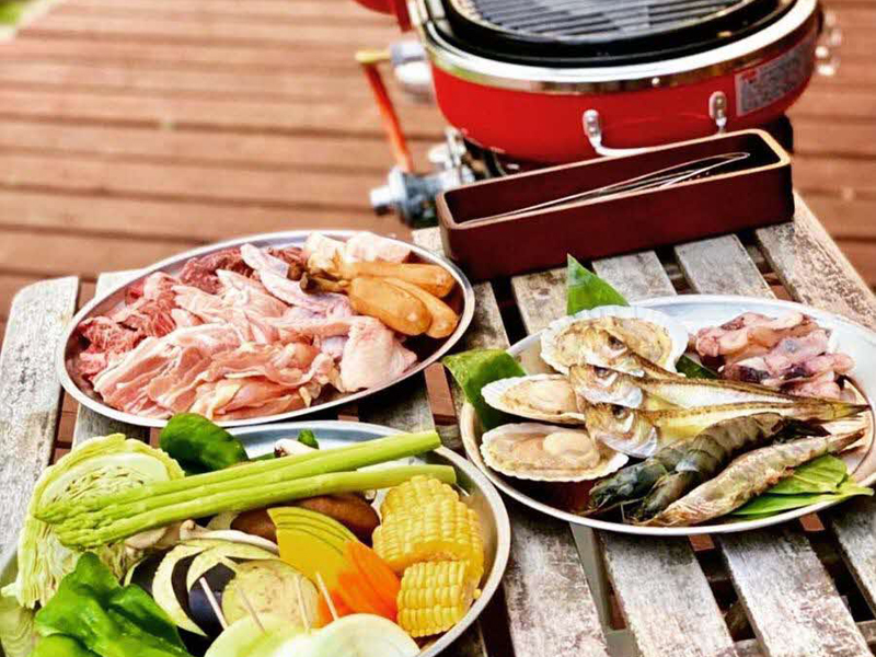
1日1組限定の貸切宿。宿泊以外にも日帰りのBBQ営業も楽しめる。
住所:鳥取県八頭郡八頭町隼福245-6
TEL:0858-71-0823
営業時間:
12:00~18:00
※宿泊予約がある場合は15:00まで
定休日:
月曜日 (宿泊)無休
料金:【手ぶらでBBQ】
・大人:5,500円
・中高生:4,500円
・小学生:2,500円
・幼児:無料
【宿泊料金】
一棟貸切:35,000円(6名様まで)
・7名様以降お一人につき5,000円追加
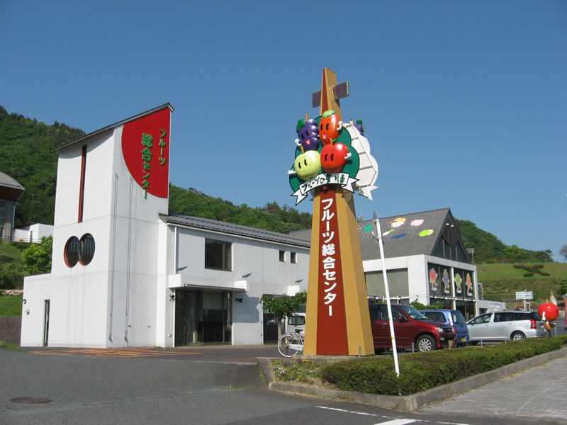
道の駅はっとう フルーツ総合センター(サイクルカフェ)
地元地域で生産される旬のフルーツを中心に様々な特産品を販売。町内にはライダーの聖地若桜鉄道隼駅があるため、鉄道グッズ、バイクメンテナンス用品も販売。
住所:鳥取県八頭町徳丸625
TEL:0858-84-3870
営業時間:
9:00~17:45
(11月~3月は17:15閉店)
注:店内の喫茶ドントーレは木曜日定休
定休日:
年末年始・不定休 (営業状況はFacebook等SNSで告知)
料金:・「喫茶ドントーレ」
・コーヒー:300円
・ソフトクリーム:300円
・チキンカレー:750円
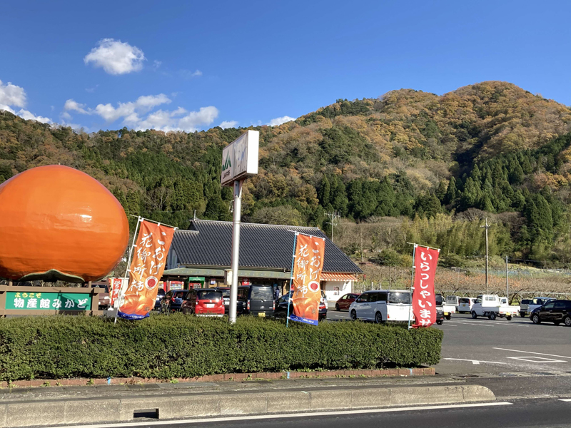
物産館みかど(サイクルカフェ)
R29号線の八頭町にある農産物直売所。地元の美味しい野菜・果物を販売。特に花御所柿の名産地。
住所:鳥取県八頭郡八頭町大門389-1
TEL:0858-72-3730
営業時間:
8:30~18:00
(1、2月は17:30まで)
定休日:
1月1日~1月5日のみ
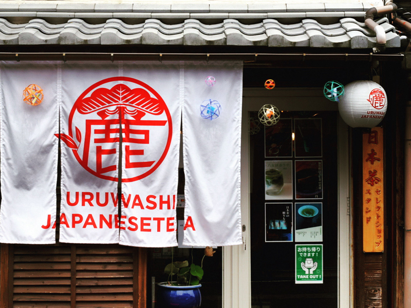
URUWASHI JAPANESE TEA(サイクルカフェ)
店主セレクトの日本茶やお茶を使ったドリンク、甘味などを提供する日本茶専門店。落ち着きのある店内で気さくな店主とのトークとともにゆったりとお茶を愉しめる。
住所:鳥取県八頭郡若桜町若桜379
TEL:070-2361-0369
営業時間:
平日:11:00~17:00
土日祝:10:00~17:00
定休日:
不定休(SNS・Google店舗ページにてご案内)
料金:・抹茶ラテ :850円
・みたらしだんご(2本): 350円
・抹茶うどん :1,000円(11時~13時までの提供)
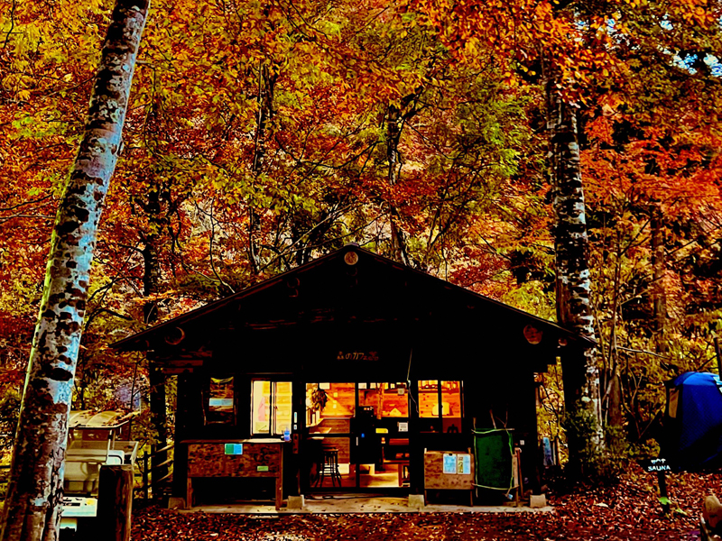
八東ふる里の森 森のカフェ(サイクルカフェ)
西日本でも数少ない、貴重なブナの群生林に囲まれた「八東ふる里の森 森のカフェ」名物の「鹿かつカレー」や「森のパスタ」など、オリジナルメニューをご用意。ご宿泊の方には鳥取県産の食材をふんだんに使ったグリルディナー&朝食セットも。
住所:鳥取県八頭郡八頭町妻鹿野1572
TEL:0858-84-3799
営業時間:
11:00~15:00(HPにて確認)
定休日:
12月1日より4月28日まで閉園 (HPにて確認)
料金:・鹿かつカレー:1,000円
・スパゲティー(ミートソース):1,000円