コース・マップ検索
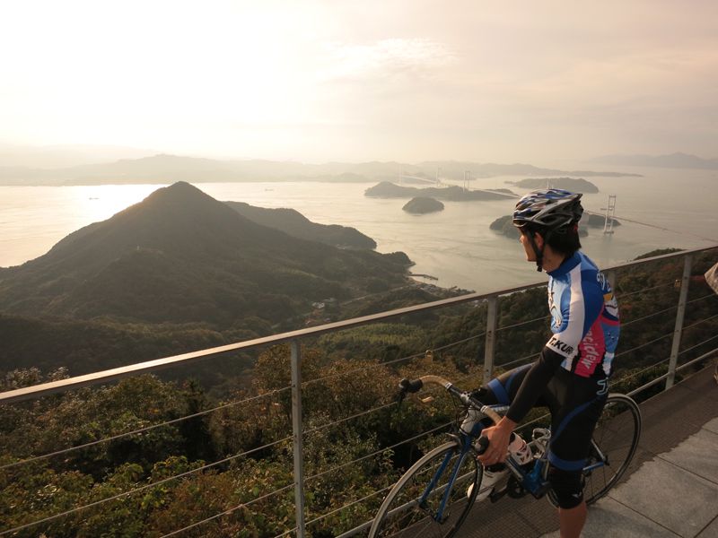
しまなみ海道サイクリングロード
距離 Distance:
69.9km
獲得標高 上り Elevation Gain (Up):
938m
獲得標高 下り Elevation Gain (Down):
970m
最大標高差 Maximum elevation difference:
947m
車の交通量も少なく、ブルーラインや安全標識も充実したサイクリングには最適なコース。海岸沿いの爽快な景色と長閑な漁村風景を眺めながらのライドが楽しめる。道の駅などの休憩スポットも各所に点在しており、特にベンチ、給水、空気入れの貸出などのサービスを提供してくれる「しまなみサイクルオアシス」が充実している。
There is little car traffic, and the course is perfect for cycling with plenty of blue lines and safety signs. You can enjoy riding while taking in the exhilarating scenery along the coast and tranquil fishing village scenery. Rest spots such as roadside stations are scattered all over the place, and in particular, there are plenty of “Shimanami Cycle Oasis,” which provides services such as benches, water supply, and air pump rental.
コース掲載マップ 愛媛マルゴト自転車道「しまなみ海道サイクリングロード」
しまなみ海道を中心に全県域を誰もが自転車に親しみ、誰もが自転車を楽しめる「愛媛マルゴト自転車道」を展開することで、“愛媛がサイクリングパラダイス”となることを目指している。
マップ詳細へ
関連記事
オススメスポット ビュースポット いきもの・植物 グルメ ショッピング 道の駅 温泉 宿泊 病院 レンタサイクル 自転車販売店 サイクリングサポート トイレ その他
※オンラインの地図上でサイクリングルートが閲覧できるウェブサイト「ルートラボ」が2020年3月末でサービス終了したため、「bikemap」に変更したことで、bikemap内の距離や高低差に誤差が生じている場合がありますが、ご理解ご了承の程、よろしくお願いします。
コース周辺スポット
全て
オススメスポット
ビュースポット
グルメ
道の駅
温泉
宿泊
病院
レンタサイクル
サイクリングサポート
その他
で絞り込む
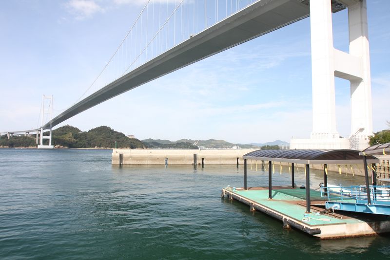
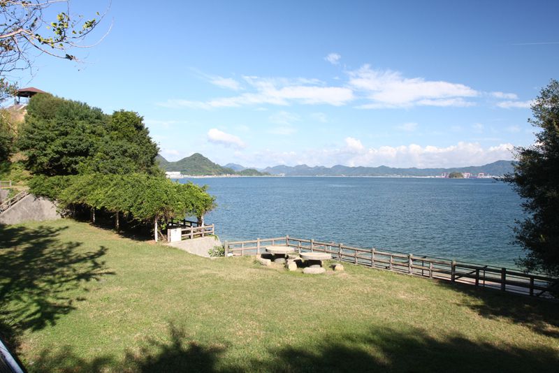
サンライズ糸山
来島海峡大橋のたもとにあるサイクリングの出発点。ここから橋に登れば、瀬戸内海の絶景を一望できる。また、レストランや宿泊施設も併設され、しまなみ海道観光の拠点となっている。宿泊部屋の窓から眺める来島海峡大橋は圧巻で、橋がライトアップされる日には、夜の瀬戸内海が美しく彩られる。
住所:今治市砂場町2-8-1
TEL:0898-41-3196
営業時間:
[4月~9月]8:00~20:00[10月~3月]8:00~17:00
定休日:
年中無休
料金:施設により異なる
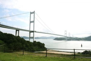
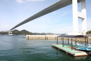
糸山公園(来島海峡展望台)
日本三大潮流の一つで知られている来島海峡を一望できる公園。高台に建つ展望台からも絶景が臨める。
住所:愛媛県今治市小浦町2-5-2
TEL:0898-41-5002
営業時間:
[来島海峡展望館]9:00~18:00
定休日:
年末(12/29~12/31)
料金:無料
馬島
来島海峡大橋の中問に位置する島。島の周囲を激しい潮流が流れており、島の南側に現れる「八幡渦」と呼ばれる渦潮は圧巻の迫力。
住所:愛媛県今治市馬島
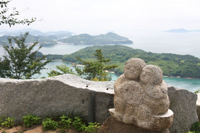
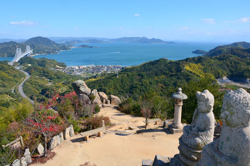
亀老山展望公園
大島の南に位置する亀老山頂上の展望公園。眺望はしまなみ海道随一と言われ、天気が良ければ石鎚山まで見渡すことができる。
住所:愛媛県今治市吉海町南浦487-4
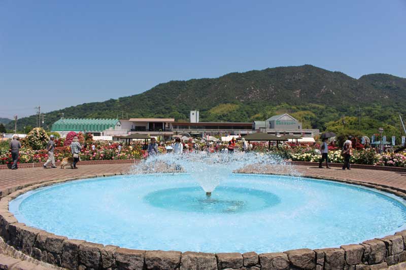
よしうみバラ公園
広大な敷地に、世界各地のバラ400種、約3500株が咲き誇る口ーズガーデン。隣接する口ーズ館には園内を一望できるテラスがある。
住所:愛媛県今治市吉海町福田1292
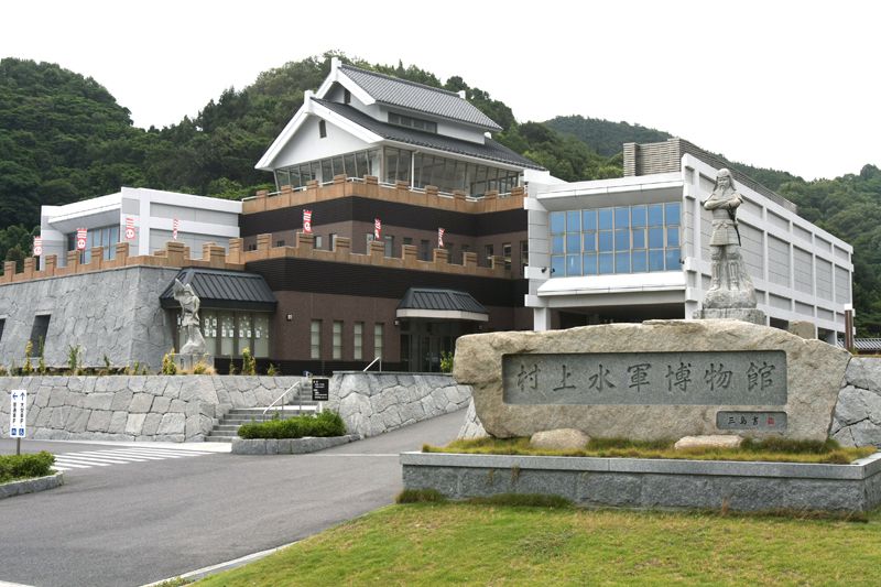
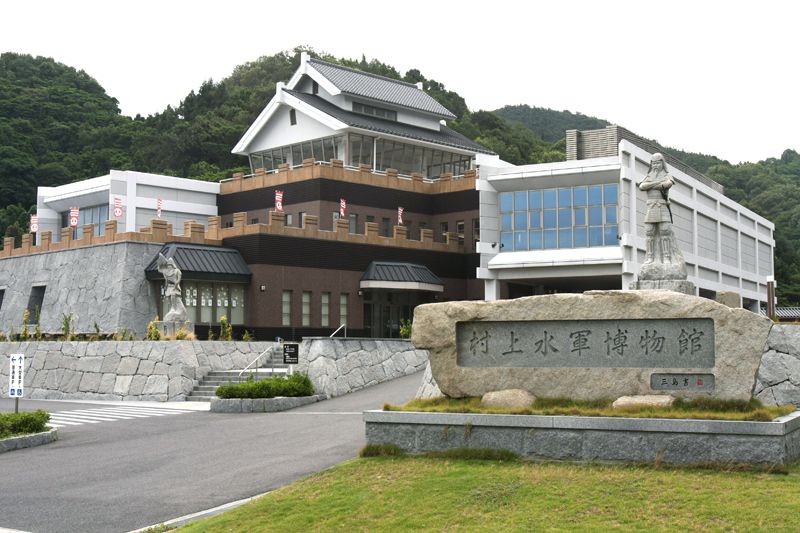
村上水軍博物館
戦国時代に「海の大名」と呼ばれ、瀬戸内海を支配した村上水軍の歴史博物館。わくわく体験ルームでは、甲冑や小袖を着用できる。
住所:愛媛県今治市宮窪町宮窪1285
TEL:0897-74-1065
営業時間:
9:00~17:00(入館は16:30まで)
定休日:
月曜日(祝日の場合は翌日)、年末年始(12/29~1/3)
料金:大人300円、学生150円、高校生以下または18歳未満無料、高齢者(65歳以上)240円、「身体障害者手帳」「療育手帳」「精神障害者保健福祉手帳」所持者及びその介助者(障害者1人につき1人)は無料
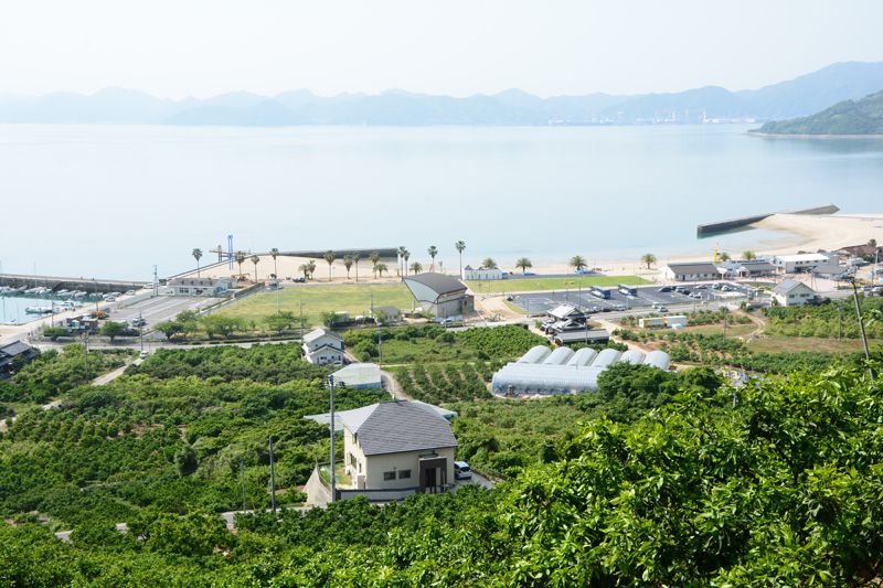
カレイ山展望公園
標高232mのカレイ山山頂にある展望台からは、伯方・大島大橋を始め能島城跡や瀬戸内海の潮流や島々を眺望することができる。
住所:愛媛県今治市宮窪町宮窪6355-2
多々羅キャンプ場
多々羅大橋を見上げる場所に位置するキャンプ場。広々とした敷地にはオートキャンプ場やコテージ、炊事棟などが整備されている。
住所:愛媛県今治市上浦町井口7523
TEL:0897-87-3855(多々羅インフォメーションセンター)
営業時間:
9:00~17:00
定休日:
年中無休
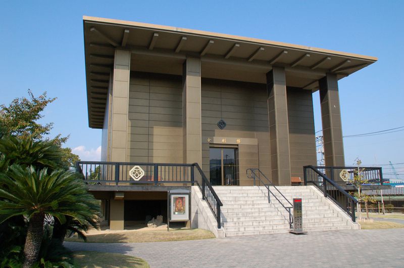
村上三島記念館(上浦歴史民俗資料館)
大三島出身で現代書道の巨匠と呼ばれる村上三島の作品を多数収蔵する書道美術館。、初めて書に接する人にも深い感動を与えてくれる。
住所:愛媛県今治市上浦町井口7505
TEL:0897-87-4288
営業時間:
9:00~17:00
定休日:
月曜日(祝日の場合は原則翌日)、年末年始(12/29~1/2)
料金:大人500円、学生250円、高校生以下または18歳未満 無料、高齢者(65歳以上)400円
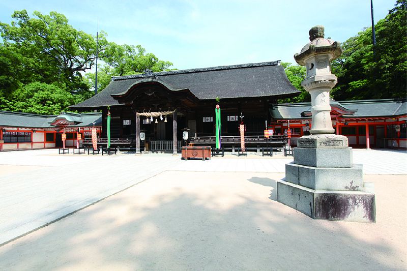
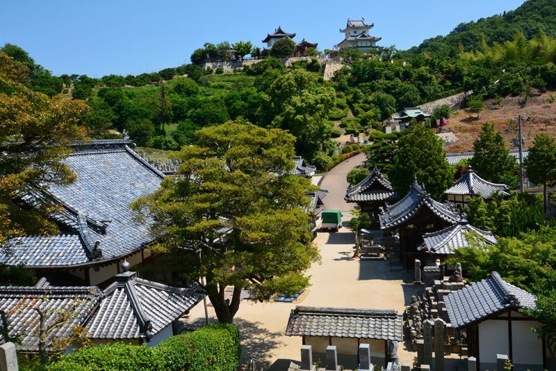
大山祇神社
全国一万社余りある山祇神社と三島神社の総本社といわれる県内最古の神社。境内には樹齢約2600年の大楠が神木として鎮座。
住所:愛媛県今治市大三島町宮浦3327
TEL:0897-82-0032
営業時間:
日の出頃~17:00[宝物館・海事博物館]8:30~17:00(入館は16:30まで)
定休日:
年末年始
料金:[大山祇神社]無料 [宝物館・海事博物館]大人1000円、高校・大学生800円、小・中学生400円
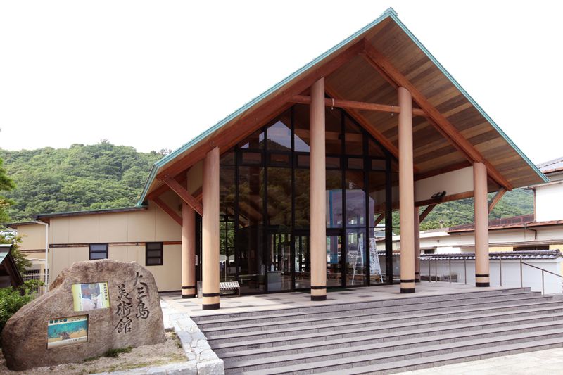
今治市大三島美術館
自然の緑と白壁のコントラストが印象的な美術館。現代日本画壇を担う画家たちの作品など約1000点が展示されている。
住所:愛媛県今治市大三島町宮浦9099-1
TEL:0897-82-1234
営業時間:
9:00~17:00
定休日:
月曜日(祝祭日の場合は翌日)、年末(12/27~12/31)
料金:大人500円、学生250円、高校生以下または18歳未満無料、高齢者(65歳以上)400円
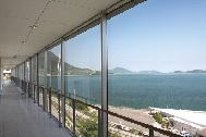
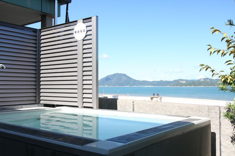
海洋温泉施設 マーレ・グラッシア大三島
タラソテラピー(海洋療法)の考え方を取り入れた海水風呂のある総合リラクゼーション施設。館内にはレストランも併設。
住所:愛媛県今治市大三島町宮浦5902
TEL:0897-82-0100
営業時間:
[入浴]10:00~21:00(入館は20:30まで) [レストラン御島]11:00~14:00、16:30~19:30(土・日曜日、祝日)
定休日:
水曜日(水曜日が盆・12月29日~1月4日・GWの場合は営業)、2月の第1火~木曜日
料金:大人(中学生以上)510円、小人(3歳~小学生)260円、3歳未満無料、高齢者(65歳以上)410円、身障者(障害者手帳1級~4級)260円
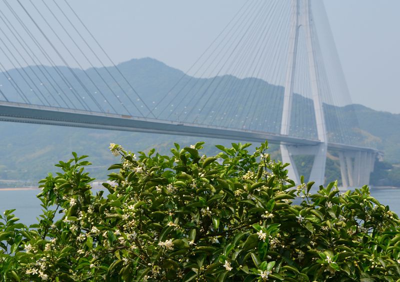
レモン谷
生口島の瀬戸田町は国産レモン生産量日本一。多々羅大橋のたもとにある、この一帯を中心にレモンブームが巻き起こったとされている。
住所:広島県尾道市瀬戸田町
料金:見学自由・無料
瀬戸田サンセットビーチ
日本の名海水浴場88選に選ばれた、長さ800mの美しい白砂ビーチに遠浅の海水浴場。瀬戸内海の美しいタ陽が見える。
住所:広島県尾道市瀬戸田町垂水1506-15
耕三寺博物館
耕三寺家の美術コレクションを公開するため昭和28年に国の登録博物館として開館。仏教、茶道、近代美術を公開。
住所:広島県尾道市瀬戸田町瀬戸田553-2
TEL:0845-27-0800
営業時間:
9:00~17:00
定休日:
年中無休
料金:大人1,400円、大学生1,000円、高校生800円、シニア(65歳以上)1,200円、中学生以下無料、「身体障害者手帳」所持者及びその介助者(1人)は半額
因島水軍城
昭和58年に築城された全国でもめずらしい城型資料館。本丸には歴史資料が展示され、展望台を兼ねる隅やぐらは船の資料館となっている。
住所:広島県尾道市因島中庄町3228-2
TEL:0845-24-0936
営業時間:
9:30〜17:00(ただし、1/2、1/3は10:00〜15:00)
定休日:
木曜日(祝日の場合は営業)、年末年始(12/29~1/1)
料金:大人310円、小人(小・中学生)150円
白滝山
瀬戸内海国立公園標高350mの山頂には、平安時代の文化財を有する龍泉寺や、八畳岩に彫られた麿崖仏がある。
住所:広島県尾道市因島重井町 白滝山
イマイ流かあちゃん亭
人気のご当地B級グルメ。今治の『黄金ソース』を使用したソースオムそば。
住所:愛媛県今治市伯方町有津甲71
TEL:0897-72-0788
営業時間:
8:00~20:00(伯方ショッピングセンター内)
定休日:
月2回不定休
料金:大三島ソースオムそば 500円
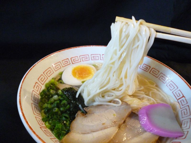
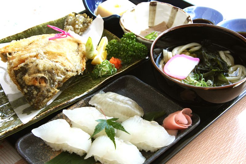
さんわ
野菜や煮干、豚骨、鶏がらなど17 種の食材を煮込んだスープを伯方の塩が引き立てる。
住所:今治市伯方町木浦甲1650-1
TEL:0897-72-1211
営業時間:
11:00-19:00 (水 17:00まで)
定休日:
不定休
料金:伯方の塩ラーメン 580円
せとうち茶屋大三島
大三島産・瀬戸田産のレモンからつくりあげたご当地ソフトクリーム。
住所:愛媛県今治市大三島町宮浦5119-2
TEL:0897-82-0195
営業時間:
9:00~17:00 [レストラン・汐の季]11:00~15:00
定休日:
年中無休
料金:しまなみレモンソフトクリーム 300円
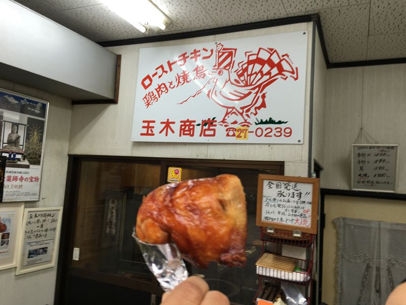
玉木商店
鹿児島産ハーブチキンをこんがりと焼き上げた肉厚の口―ストチキン。
住所:広島県尾道市瀬戸田町瀬戸田511
TEL:0845-27-0239
営業時間:
9:00~18:30
定休日:
不定休
料金:ローストチキン(手羽L)390円
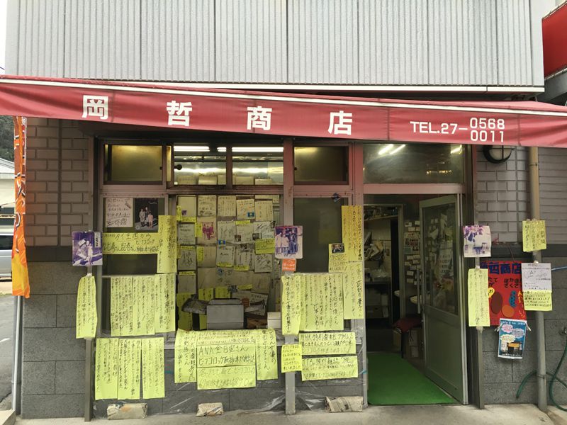
岡哲商店
気さくなおばあちゃんが揚げる少し甘めの優しい味のコロッケ。
住所:広島県尾道市瀬戸田町瀬戸田517−4
TEL:0845-27-0568
営業時間:
08:30~18:30頃(売り切れ次第終了)
定休日:
不定休
料金:コロッケ(1個)90円
道の駅 多々羅しまなみ公園
世界一の斜張橋である多々羅大橋のたもとにある道の駅。目の前に広がる瀬戸内海はもちろん、橋を下から望む絶好のビューボイント。特産品センターではレストランも併設されている。
住所:愛媛県今治市上浦町井口9180-2
TEL:0897-87-3866
営業時間:
9:00~17:00 [レストラン]10:00~16:00(店舗により異なる)
定休日:
年中無休
道の駅 伯方S・Cパーク マリンオアシスはかた
伯方・大島大橋のたもとにあり、ビーチや公園なども整備されている道の駅。物産品コーナーでは、伯方の塩を使った商品や地元産の野菜、瀬戸内海の海産物などが販売されている。
住所:愛媛県今治市伯方町叶浦甲1668-1
TEL:0897-72-3300
営業時間:
9:00~17:00 [レストラン]10:00~15:00
定休日:
年中無休
道の駅 しまなみの駅御島
大三島の観光拠点となる道の駅。館内には特産品や土産物がたくさん並ぶ。レンタサイクルやシャワー室やコインロッカーなどが整備され、サイクリストの休憩所として設備が充実している。
住所:愛媛県今治市大三島町宮浦3260
TEL:0897-82-0002
営業時間:
8:30~17:00
定休日:
年中無休
道の駅 よしうみいきいき館
来島海峡大橋の大島側たもとに位置する道の駅。七輪を囲んで味わう海鮮バーベキューは、目の前に広がる瀬戸内海を眺めながらのんびりと楽しむことができる。
住所:今治市吉海町名4520-2
TEL:0897-84-3710
営業時間:
9:00~17:00 [バーベキュー]10:00~16:00[レストラン]10:00~15:00
定休日:
元旦
料金:[レンタサイクル]電動アシスト自転車(大人)1,500円、その他自転車(大人)1,000円、その他自転車(小人)300円、保証料(大人)1,000円、保証料(小人)500円
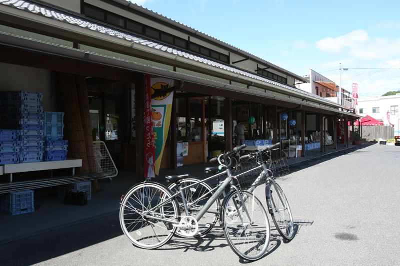
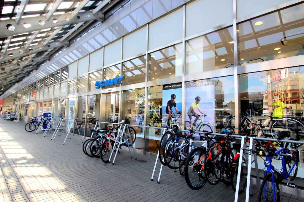
ジャイアントストア今治
住所:愛媛県今治市北宝来町1-729-8
TEL:0898-25-1175
営業時間:
9:00~19:00
定休日:
火曜日
料金:クロスバイク4,000円、ロードアルミ5,000円、ロードカーボン7,000円など(日帰り、保険料含む)
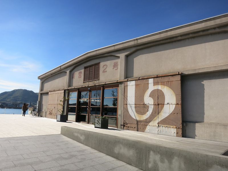
ONOMICHI U2
JR 尾道駅徒歩7 分ほどのところにあるサイクリスト向けの複合施設。宿泊施設のほか、サイクルスルーカウンターで自転車に乗ったまま購入できるカフェや、お酒落なレストラン、ショップがある。GIANTSTOREでは、自転車のプロスタッフがメンテナンスしたGIANT製のスポーツバイクレンタルも利用できる。
住所:広島県尾道市西御所町5−11
TEL:0848-21-0550
営業時間:
店舗により異なる
定休日:
店舗により異なる
ゲストハウス シクロの家
しまなみ海道の入り口、「今治」で自転車大好きな仲間が集まってできたゲストハウス(簡易宿泊施設)。キッチン・冷蔵庫・フリーパソコンなどが完備され、室内自転車置き場やメンテナンスルームもある。Cafe&Barは宿泊ゲストでなくても利用できる。
住所:愛媛県今治市北宝来町1-1-12
TEL:0898-35-4496
営業時間:
[チェックイン]15:00~21:00[チェックアウト]~10:00
料金:個室1名1泊3,300円~(税込)、ドミトリー1名1泊2,800円~(税込)
上浦レンタサイクルターミナル
住所:愛媛県今治市上浦町井口9180-2(道の駅 多々羅しまなみ公園)
TEL:0897-87-3855
営業時間:
9:00~17:00
定休日:
無休
料金:電動アシスト自転車 1,500円/6時間、普通自転車 1,000円/日、こども用 300円/日、保証料(大人)1,000円/台(小人)500円/台
大三島レンタサイクルターミナル
住所:今治市大三島町宮浦3260(道の駅 しまなみの駅御島)
TEL:0897-82-0002
営業時間:
8:30~17:00
定休日:
無休
料金:電動アシスト自転車 1,500円/6時間、普通自転車 1,000円/日、こども用 300円/日、保証料(大人)1,000円/台(小人)500円/台
伯方レンタサイクルターミナル
住所:愛媛県今治市伯方町叶浦甲1668-1(道の駅 伯方S・Cパーク)
TEL:0897-72-0018
営業時間:
9:00~17:00
定休日:
無休
料金:電動アシスト自転車 1,500円/6時間、普通自転車 1,000円/日、こども用 300円/日、保証料(大人)1,000円/台(小人)500円/台
宮窪レンタサイクルターミナル
住所:愛媛県今治市宮窪町宮窪2822-9(宮窪観光案内所)
TEL:0897-74-1074
営業時間:
9:00~17:00
定休日:
無休
料金:電動アシスト自転車 1,500円/6時間、普通自転車 1,000円/日、こども用 300円/日、保証料(大人)1,000円/台(小人)500円/台
吉海レンタサイクルターミナル
住所:愛媛県今治市吉海町名4520-2(道の駅 よしうみいきいき館)
TEL:0897-84-3233
営業時間:
9:00~17:00
定休日:
無休
料金:電動アシスト自転車 1,500円/6時間、普通自転車 1,000円/日、こども用 300円/日、保証料(大人)1,000円/台(小人)500円/台
中央レンタサイクルターミナル
住所:愛媛県今治市砂場町2-8-1(サイクリングターミナル サンライズ糸山)
TEL:0898-41-3196
営業時間:
[4月~9月]8:00~20:00[10月~3月]8:00~17:00
定休日:
無休
料金:[電動アシスト自転車]1,500円/6時間[タンデム自転車]1,200円/日[その他自転車(大人)]1,000円/日[その他自転車(小人)]300円/日[保証料(大人)]1,000円[保証料(小人)]500円
尾道港(駅前港湾駐車場)
住所:広島県尾道市東御所町地先
TEL:0848-22-5332
営業時間:
7:00~19:00
定休日:
無休
料金:電動アシスト自転車 1,500円/6時間以内、タンデム自転車(大人) 1,200円/日、その他自転車(大人) 1,000円/日 (小人) 300円/日、保証料(大人)1,000円/台 (小人)500円/台
尾道市民センターむかいしま
住所:広島県尾道市向島町5531-1
TEL:0848-44-0125
営業時間:
8:30~19:00
定休日:
無休
料金:電動アシスト自転車(大人) 1,500円/6時間以内、タンデム自転車(大人) 1,200円/日、その他自転車(大人) 1,000円/日 (小人) 300円/日、保証料(大人)1,000円/台 (小人)500円/台
土生港(尾道市営中央駐車場)
住所:尾道市因島土生町1899-31
TEL:0845-22-3362
営業時間:
8:30~19:00
定休日:
無休
料金:電動アシスト自転車(大人) 1,500円/6時間以内、タンデム自転車(大人) 1,200円/日、その他自転車(大人) 1,000円/日 (小人) 300円/日、保証料(大人)1,000円/台 (小人)500円/台
瀬戸田町観光案内所
住所:尾道市瀬戸田町沢200-5
TEL:0845-27-0051
営業時間:
9:00~17:00
定休日:
無休
料金:電動アシスト自転車(大人) 1,500円/6時間以内、タンデム自転車(大人) 1,200円/日、その他自転車(大人) 1,000円/日 (小人) 300円/日、保証料(大人)1,000円/台 (小人)500円/台
尾道市瀬戸田サンセットビーチ
住所:尾道市瀬戸田町垂水1506-15
TEL:0845-27-1100
営業時間:
9:00~17:00
定休日:
年末年始(12/29~1/3)
料金:電動アシスト自転車(大人) 1,500円/6時間以内、タンデム自転車(大人) 1,200円/日、その他自転車(大人) 1,000円/日 (小人) 300円/日、保証料(大人)1,000円/台 (小人)500円/台
県立今治病院
住所:愛媛県今治市石井町4丁目5-5
TEL:0898-32-7111
受付時間:
8:30~11:00
休診日:
土曜日、日曜日
今治市医師会市民病院
住所:愛媛県今治市別宮町7-1-40
TEL:0898-22-7611
受付時間:
9:00~12:30、14:00~17:30
休診日:
木曜日、日曜日、祝日、土曜日午後
みなと交流センターレンタサイクルターミナル
住所:愛媛県今治市片原町1-100-3
TEL:0898-35-5090
営業時間:
9:00~17:00
定休日:
無休
料金:クロスバイク1,000円/日、保証料(大人)1,000円/台(小人)500円/台
立石港務所
住所:愛媛県上島町生名1885-5
TEL:0897-76-2224
営業時間:
8:30~17:00
定休日:
無休
料金:クロスバイク 510円/日、電動アシスト自転車 820円/6時間、タンデム 510円/日(1人につき)、こども用 310円/日、チャイルドシート 無料、保証料 1,030円
岩城観光センター
住所:愛媛県上島町岩城1427-2
TEL:0897-75-3277
営業時間:
8:30~17:00
定休日:
10月第2日曜日、1/1~1/3
料金:クロスバイク 510円/日、電動アシスト自転車 820円/6時間、タンデム 510円/日(1人につき)、こども用 310円/日、チャイルドシート 無料、保証料 1,030円
[サイクルレスキュー]細河石油
住所:愛媛県今治市大三島町宮浦5656-2
TEL:0897-82-0066
営業時間:
7:00~19:30
定休日:
年末年始(12/29~1/3)
[サイクルレスキュー]おおしまタクシー
住所:愛媛県今治市吉海町幸新田105
TEL:0897-84-2629
営業時間:
24時間
定休日:
無休