


![]()
![]()
![]()
![]()
![]()
![]()
![]()
![]()

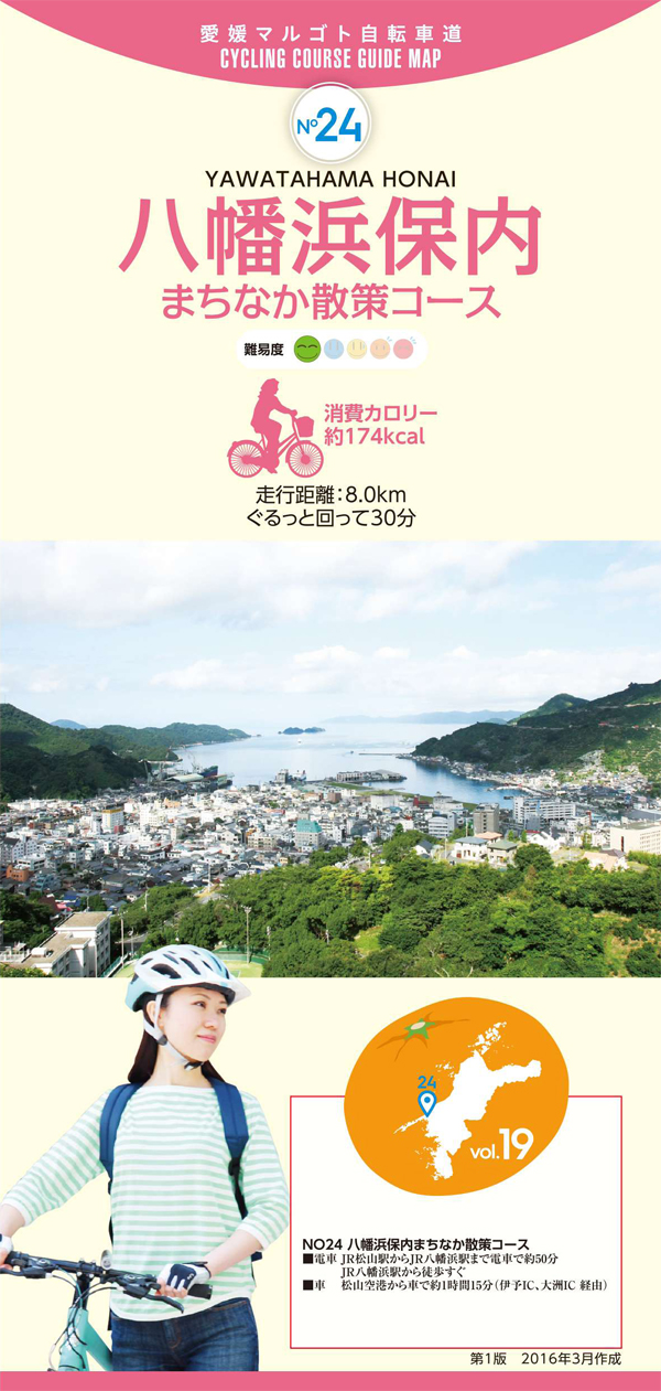
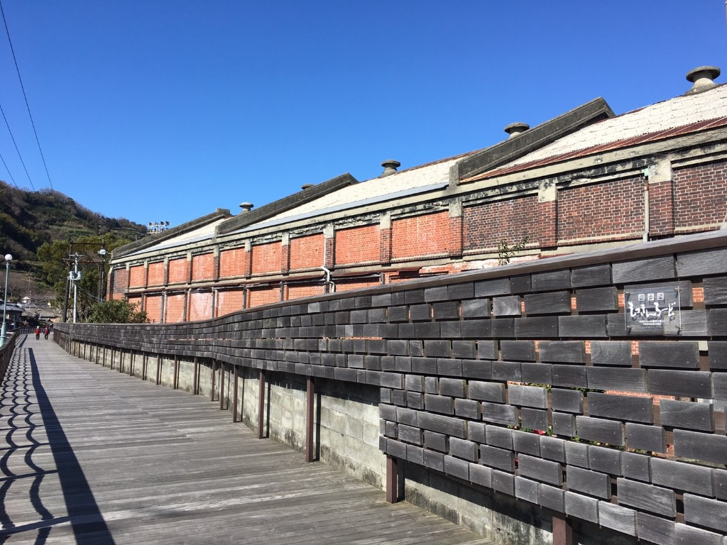
愛媛県で最初の銀行や紡績工場ができるなど、明治期の文明開化をリードした保内町から、四国一の規模を誇る魚市場を持つ八幡浜までの町並み散策コース。保内町の旧白石和太郎洋館や愛媛蚕種、内之浦公民館、赤レンガ倉庫などの歴史ある建物群、八幡浜市の道の駅みなっとまで、港町の風情を感じながらのんびりとしたライドが楽しめる。
This is a townscape walking course from Honai, which led civilization and enlightenment in the Meiji period, with the first bank and spinning factory being built in Ehime Prefecture to Yawatahama, which has the largest fish market in Shikoku. You can enjoy a leisurely ride while feeling the atmosphere of a port town, from historic buildings such as the former Shiraishi Wataro Western-style building in Honai Town, the Ehime Silkworm Brewing, Uchinoura Community Center, and the Red Brick Warehouse, to the roadside station Minato in Yawatahama City.
しまなみ海道を中心に全県域を誰もが自転車に親しみ、誰もが自転車を楽しめる「愛媛マルゴト自転車道」を展開することで、“愛媛がサイクリングパラダイス”となることを目指している。
マップ詳細へ※オンラインの地図上でサイクリングルートが閲覧できるウェブサイト「ルートラボ」が2020年3月末でサービス終了したため、「bikemap」に変更したことで、bikemap内の距離や高低差に誤差が生じている場合がありますが、ご理解ご了承の程、よろしくお願いします。

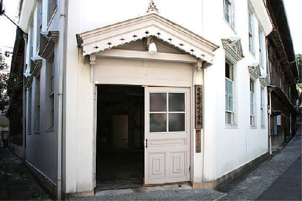
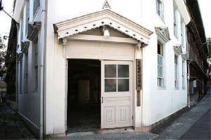
明治17年に建てられた木造3階建物は、玄関と窓にペディメント、羽目板張を使った美しい外観の洋風建築で蚕室のための赤レンガの防火壁が施されている。国の有形文化財に登録されている。
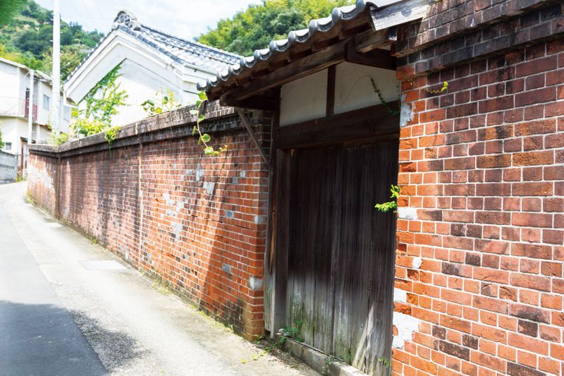
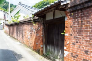
旧東洋紡績赤レンガ倉庫や旧白石和太郎洋館など、明治から昭和初期にかけての生活や産業の面影を色濃く残す建造物が立ち並んでいる。
蒸し上がったかまぼこを薄くのばして乾燥させ、さらに薄く削った保存グルメ・特産品品。ご飯にふりかけたりおにぎりにまぶしたり、お酒のつまみにもいい。
長崎ちゃんぽんのようなこってりスープではなく、鶏ガラ・カツオ・昆布などでダシを取ったあっさりスープのちゃんぽん。麺の上には肉野菜炒め。
八幡浜唯一のトロール船を持つ「昭和水産」から誕生したバーガー。サクッと揚げたヨリトフグを少しスパイシーなタルタル&カレーソースで。
「道の駅 八幡浜みなっと」内アゴラマルシェにあるカフェ。コーヒーハンター川島良彰氏プロデュースのコーヒーのほか、ランチもある。
「道の駅 八幡浜みなっと」内にあり、旬のフルーツや野菜、魚介、肉類まで八幡浜のグルメ・特産品材を豊富に集めた産直市。大きな石窯で焼くパンも人気。
八幡浜市内と松前町にある、テレビでも話題のベーカリー。並んででも買いたい名物の塩パンには、塩メロンパン、ソフト塩パンもある。
