コース・マップ検索
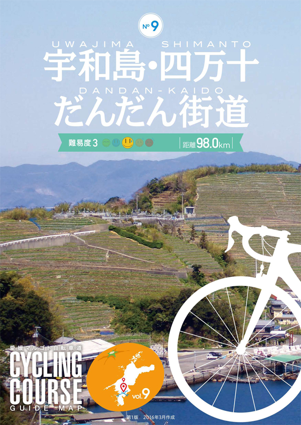
宇和島・四万十だんだん街道(蒋渕~日吉)
距離 Distance:
59.9km
獲得標高 上り Elevation Gain (Up):
711m
獲得標高 下り Elevation Gain (Down):
495m
最大標高差 Maximum elevation difference:
251m
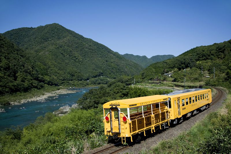
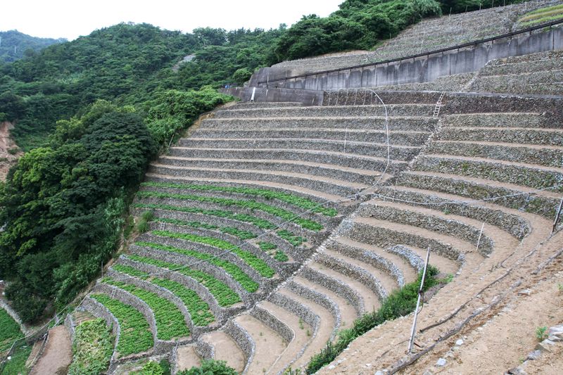
宇和海沿岸から清流・四万十川の源流へと走るコース沿線には、雄大な自然と美しい里山の風景が広がる。遊子水荷浦地区の段畑は「日本農村百景」にも選ばれている。予土線では自転車にカバーをかけずに列車内に持ち込める「サイクルトレイン四万十号」が運行されることもあるので、上手に活用することで行動範囲が大きく広がる。
Magnificent nature and beautiful satoyama scenery unfold along the course that runs from the Uwakai coast to the headwaters of the clear Shimanto River. The terraced fields in the Yuko Mizunaura district have been selected as one of the “100 Views of Japanese Rural Villages.” On the Yodo Line, the “Cycle Train Shimanto,” which can be brought into the train without putting a cover on a bicycle, is sometimes operated, so by making good use of it, the range of action expands greatly.
コース掲載マップ 愛媛マルゴト自転車道「宇和島・四万十だんだん街道」
しまなみ海道を中心に全県域を誰もが自転車に親しみ、誰もが自転車を楽しめる「愛媛マルゴト自転車道」を展開することで、“愛媛がサイクリングパラダイス”となることを目指している。
マップ詳細へ
オススメスポット ビュースポット いきもの・植物 グルメ ショッピング 道の駅 温泉 宿泊 病院 レンタサイクル 自転車販売店 サイクリングサポート トイレ その他
※オンラインの地図上でサイクリングルートが閲覧できるウェブサイト「ルートラボ」が2020年3月末でサービス終了したため、「bikemap」に変更したことで、bikemap内の距離や高低差に誤差が生じている場合がありますが、ご理解ご了承の程、よろしくお願いします。
コース周辺スポット
全て
オススメスポット
グルメ
道の駅
病院
レンタサイクル
自転車販売店
で絞り込む
遊子水荷浦の段畑
幅・高さとも1mほどの石垣がはるか山頂まで続く。国の重要文化的景観に選定。
住所:宇和島市遊子水荷浦
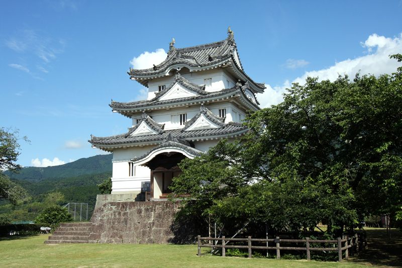
宇和島城
戦国時代に藤堂高虎によって築城。天守閣からは宇和島湾と字和島を一望できる。
住所:愛媛県宇和島市丸之内
TEL:0895-22-2832 (郷土館 0895-22-3904)
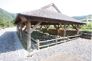
岩谷縄文遺跡
約3000年前の縄文時代後期の遺跡。環状列石や組石等の配石遺構を見学!
住所:北宇和郡鬼北町岩谷
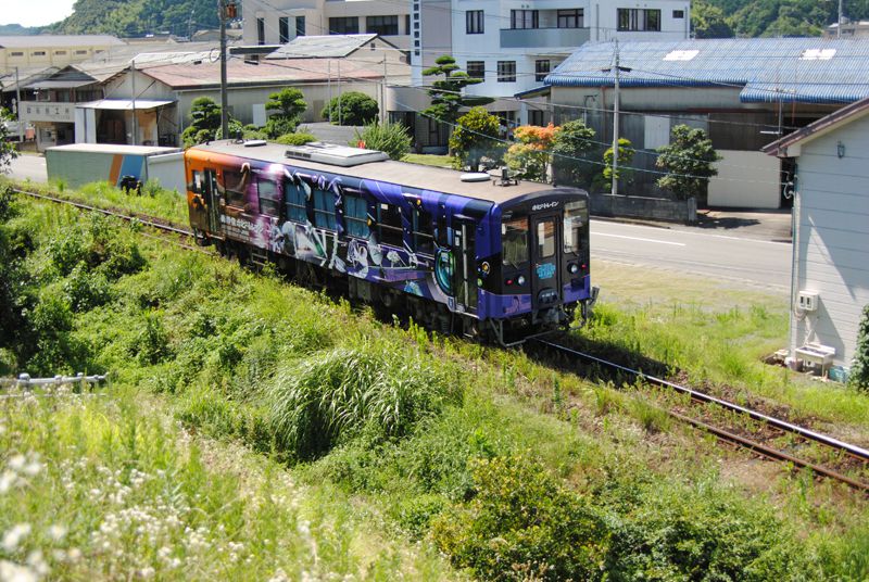
しまんトロッコ(予土線3兄弟)
元祖トロッコ列車「清流しまんと号」を水戸岡鋭治氏デザインにより平成25年10月リニューアル。四万十川の風景に映える山吹色のボディが特徴。
海洋堂ホビートレイン(予土線3兄弟)
フィギュアメーカー海洋堂のミュージアムがオープンした平成23年から運行。車内には海洋堂が制作したフィギュアを多数展示。
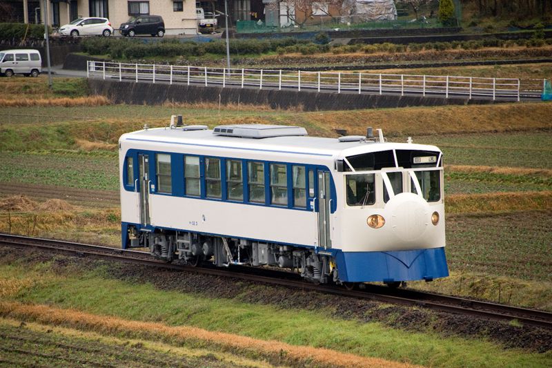
鉄道ホビートレイン(予土線3兄弟)
初代新幹線0系をイメージしたデザインで予土線を運行中。団子鼻も忠実に再現しているほか、実際に0系新幹線で使われていたシートも設置。
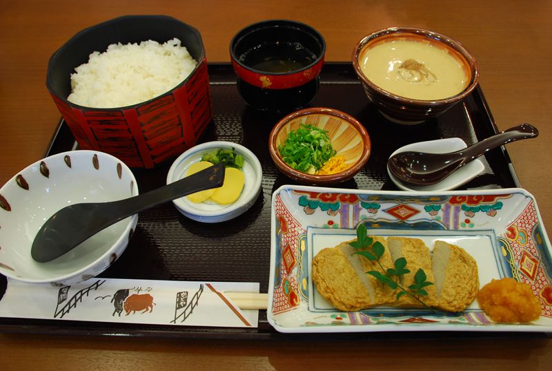
かどや(道の駅 きさいや広場)
とても手間がかかるため、今日では家庭で作られることが少なくなった宇和島に古くから伝わる魚と味噌を使った郷土料理。
住所:愛媛県宇和島市弁天町1丁目318-16
TEL:0895-22-3934
営業時間:
10:00~18:00
定休日:
木曜日
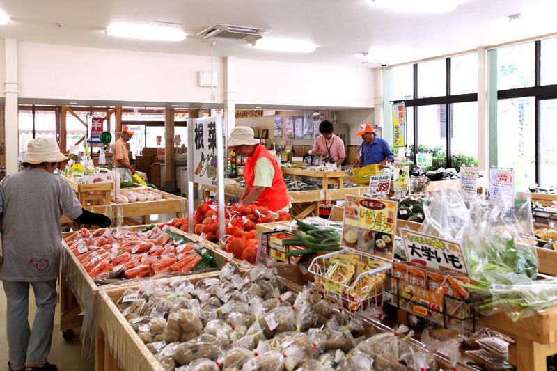
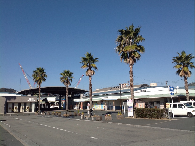
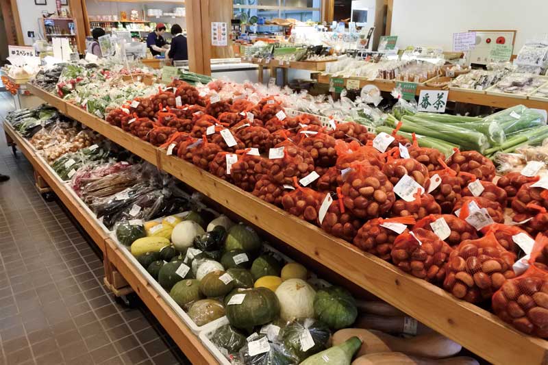
道の駅 みなとオアシスうわじま きさいや広場
宇和島市の中心にあり、港にも隣接し、利便性に優れた道の駅。伝統的祭礼「鬼牛」の展示及び、真珠生産を紹介する文化施設の他、新鮮な農産物・海産物や特産品が勢揃い。「宇和島鯛めし」を味わえる郷土レストランもある。
住所:愛媛県宇和島市弁天町1-318-16
TEL:0895-22-3934
営業時間:
9:00~18:00
定休日:
1/1は年頭休日
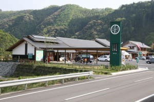
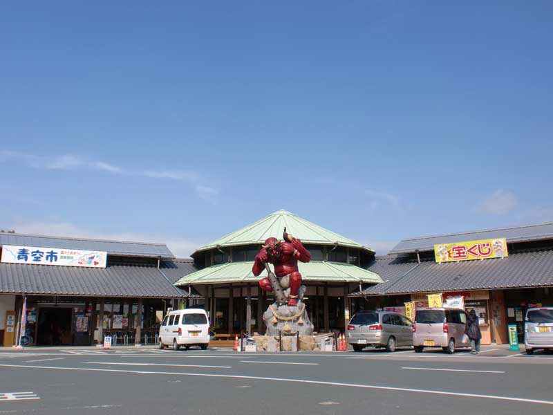
道の駅 森の三角ぼうし
5mの鬼のモニュメント「鬼王丸(おにおうまる)」が鎮座する。店内にも鬼商品や鬼王丸グッズが並び、お土産として人気。特産のきじ肉や柚子の加工品、どぶろくなどもある。地元の新鮮野菜や果物を販売する青空コーナーや、きじカレーやきじ釜飯(要予約)が味わえる軽食喫茶・彩り茶屋などが設けられている。
住所:愛媛県北宇和郡鬼北町永野市138-6
TEL:0895-45-3751
営業時間:
[特産品コーナー]8:00~18:00[レストラン]9:00~17:00(LO 16:30)※食事ものLO 14:30
定休日:
月曜(祝日の場合営業)、8月無休、年始(1/1)
道の駅 日吉夢産地
日吉夢産地の夢工房では、日吉地区の特産品を用いて、パンや焼き菓子・アイスクリームを製造・販売している。アイス(シャーベット)は、季節限定メニューがある。
住所:愛媛県北宇和郡鬼北町下鍵山54
TEL:0895-44-2340
営業時間:
店舗により異なる
定休日:
元旦[レストラン]火曜日
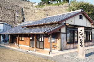
だんだん茶屋
遊子水荷浦の段畑近くにあるレストラン。段畑で採れたジャガイモの料理が自慢。
住所:愛媛県宇和島市遊子2323-3
TEL:0895-62-0091
営業時間:
9:30~16:30
定休日:
月曜日、木曜日
駅レンタカー四国
住所:愛媛県宇和島市錦町10-1(宇和島駅構内)
TEL:0895-25-2306
営業時間:
9:30~17:00
定休日:
無休
料金:1時間100円
宇和島市観光協会(九島周遊ポタリング)
住所:宇和島市弁天町1-318-16
TEL:0895-22-3934
営業時間:
9:00~18:00
定休日:
43101
料金:1日300円
市立宇和島病院
住所:愛媛県宇和島市御殿町1-1
TEL:0895-25-1111
受付時間:
8:30~12:00(急患の際の受診は24時間受付)
休診日:
土曜日、日曜日、祝日、年末年始、お盆(8/14、15)
ジェイコー(JCHO)宇和島病院
住所:愛媛県宇和島市賀古町2-1-37
TEL:0895-22-5616
受付時間:
8:15~12:00
休診日:
土曜日、日曜日、祝日、年末年始
宮脇輪業
住所:愛媛県宇和島市恵美須町1-3-7
TEL:0895-22-3035
営業時間:
8:00~19:00
定休日:
第2・4日曜日
観光情報センター(きさいや広場)
住所:愛媛県宇和島市弁天町1-318-16
TEL:0895-22-3934
営業時間:
9:00~18:00
定休日:
年始(1/1)
料金:ロード 1日2,000円、クロス 1日1,500円、普通自転車・電動自転車 1日500円、キッズ 1日300円
サイクルライフ イヌガイ
住所:愛媛県宇和島市新田町3-1-7
TEL:0895-24-3077
営業時間:
9:00~19:00
定休日:
水曜日
料金:[ロード]4時間まで2,000円、当日返却3,000円
九島の自然と文化を守る会
住所:愛媛県宇和島市本九島1742
TEL:090-2785-3857
営業時間:
8:00~18:00
定休日:
無休
料金:1日300円