


![]()
![]()
![]()
![]()
![]()
![]()
![]()
![]()

甲良町周辺の神社仏閣をめぐり、サイクルトレインで戻るルート。前半の湖東三山※最後の太郎坊宮ともに参道の階段が長いので、歩きやすい靴を推奨する。途中の道の駅では地元野菜のビュッフェやジェラートがいただける。疲れかけた後半には巨大飛び出し坊やが現れテンションが上がる。サイクルトレインは自転車をそのまま持ち込み可能なのが嬉しい。尼子駅で下車し、道の駅まで戻ろう
A route that goes around the shrines and temples around Kora-cho and returns by cycle train. Koto Sanzan in the first half ※Both of the last Tarobougū have long steps on the approach, so shoes that are easy to walk in are recommended. You can enjoy a local vegetable buffet and gelato at the roadside station along the way. In the second half, when they were almost exhausted, a giant jumping out boy appeared, and the tension rose. I'm happy that the bike can be brought in as is on the cycle train. Let's get off at Amago station and go back to the roadside station
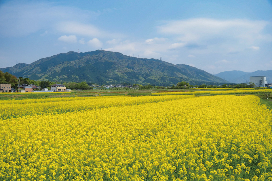
道の駅せせらぎの里こうらがある甲良町は、湖東エリアの中心からやや北に位置し、彦根市や近江八幡といった観光地にも近く、自転車で散策するのが楽しいエリア。このパンフレットでは、道の駅をスタート&ゴールとした、初心者から中・上級者も満足できる4ルートを提案している。神社仏閣巡りやダム巡り、彦根城周辺のグルメポタなど、甲良町起点のサイクリングを楽しもう。
マップ詳細へ※オンラインの地図上でサイクリングルートが閲覧できるウェブサイト「ルートラボ」が2020年3月末でサービス終了したため、「bikemap」に変更したことで、bikemap内の距離や高低差に誤差が生じている場合がありますが、ご理解ご了承の程、よろしくお願いします。
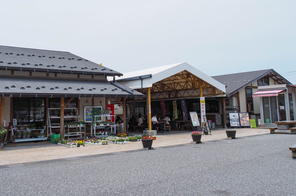
甲良町産の農産物や加工品を販売している。地域の食材を使ったテイクアウトの石窯ピザ専門店、クレープ店のほか無料のドッグランなどあり。観光案内所では周辺の観光情報も入手できる
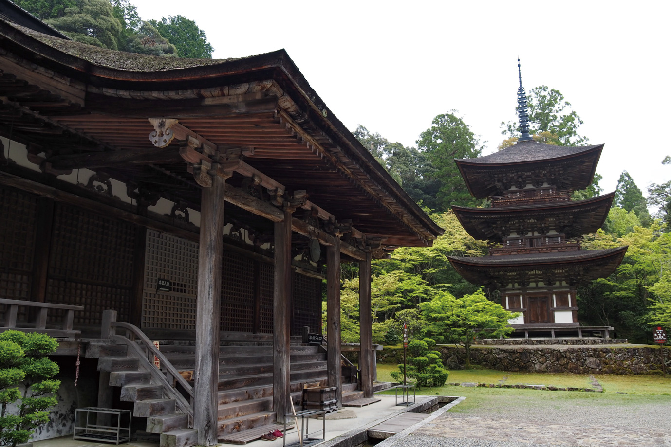
湖東三山のひとつに数えられる寺で、平安時代の承和元年に開創された。戦国時代に織田信長が焼き討ちしたが、兵火を免れた本堂、三重塔、二天門が今も当時の姿を残している。紅葉の名所としても有名
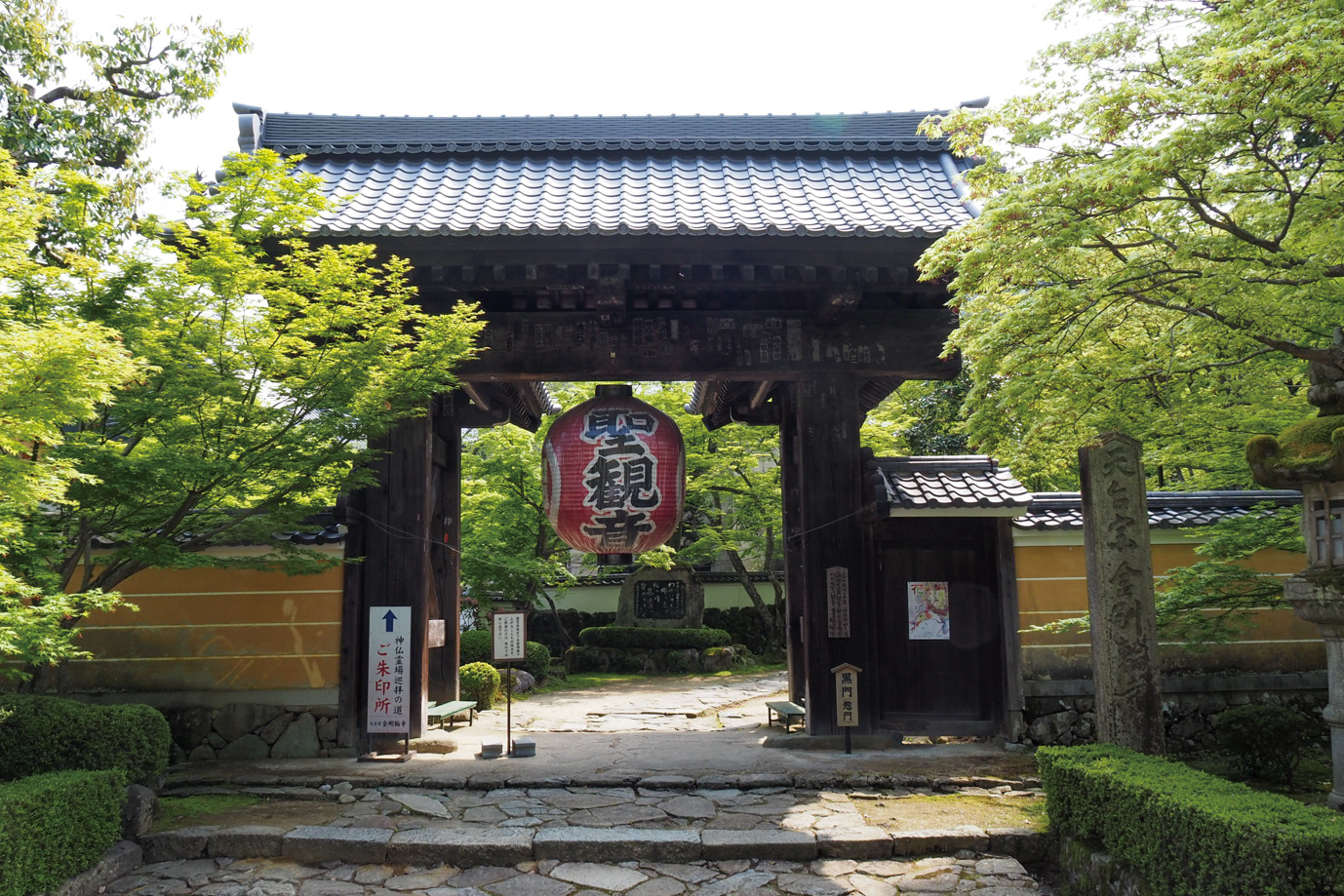
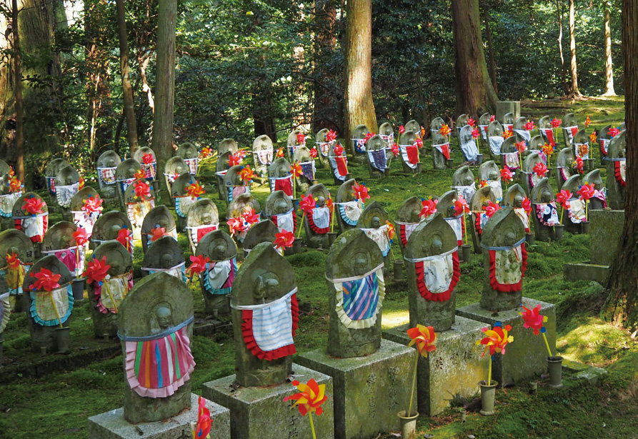
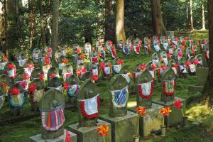
湖東三山まん中の寺。奈良時代の中頃、聖武天皇の勅願により行基が開山された。織田信長の焼き討ちを免れたのは本堂、三重塔、二天門だが、三重塔は荒廃が進み昭和49年に復元された。境内にはお地蔵様が多く千躰地蔵さまと呼ばれる
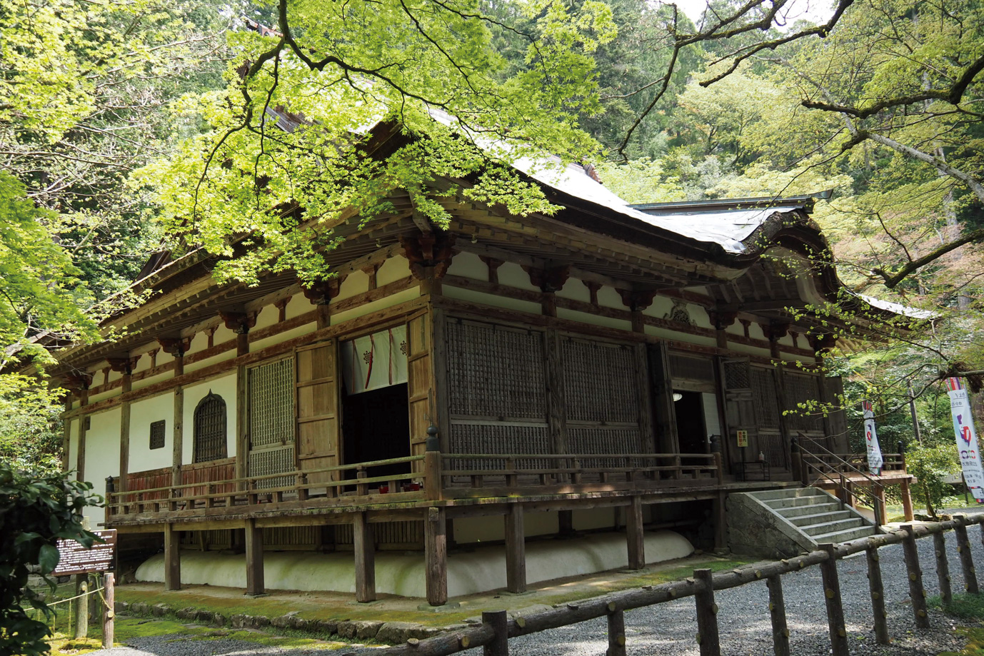
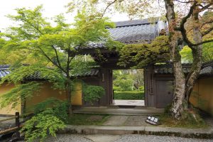
湖東三山の中で最も山深い場所にあり、近江の最古級寺院。推古14年に聖徳太子が渡来人のために創建させた。室町・戦国時代の兵火に壊滅的打撃をうけたが、江戸初期に現在の本堂、仁王門、山門等が再建された。百済寺庭園の遠望台からは、比叡山や琵琶湖が望める
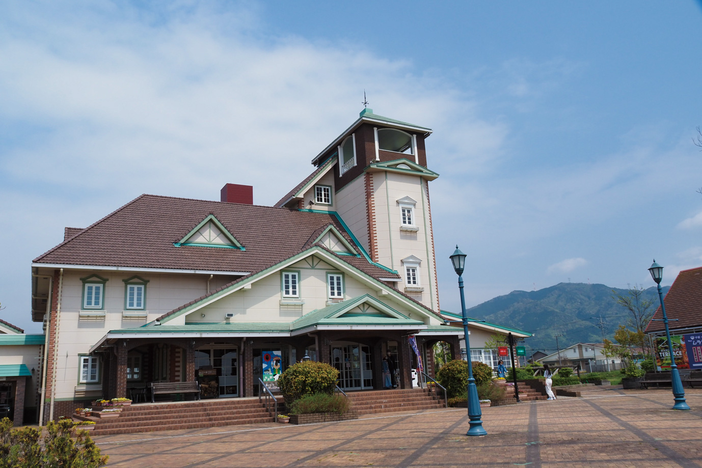
英国風の建物が可愛らしい道の駅。農産物の流通・加工、人的交流、観光などを総括した施設。フラワーアレンジメントの体験や、採れたて野菜を購入できる直売所も人気。フルーツ&ハーブ工房のイタリアンジェラートは並んでも食べたい
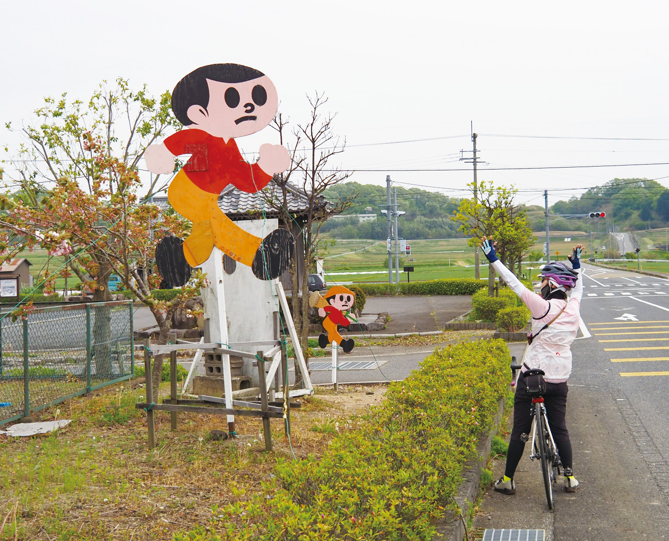
東近江市が発祥の飛び出し坊や・とび太くんは、近江の町を走るとよく目にする。そのとび太くんの約3倍サイズの巨大とび太くんが東近江原野に設置されている!世界最大の飛び出し坊やは一見の価値あり!?
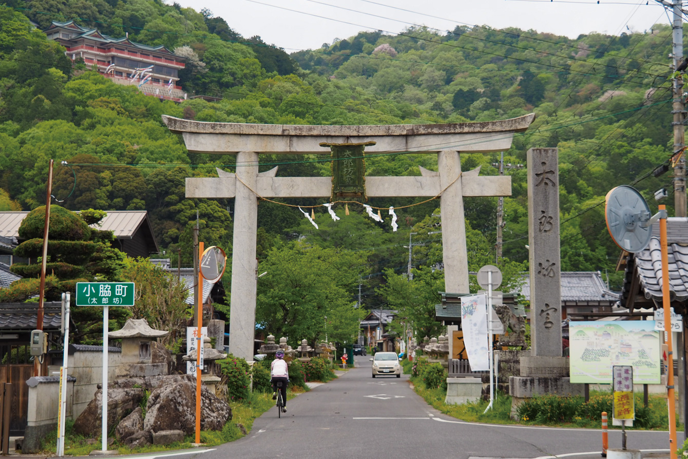
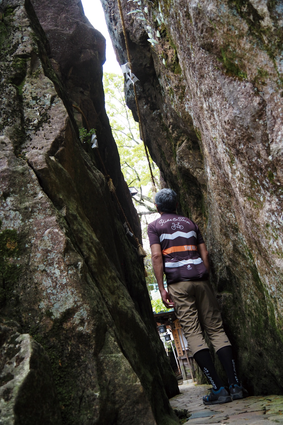
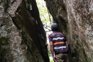
平地に突き出たような赤神山の中腹にある神社。太郎坊とは阿賀神社を守っていると言われていた天狗から付けられた愛称。地元では「太郎坊さん」と親しみを込めて呼ばれる。「勝利と幸福を授ける神様」とされ政治家、起業家、プロスポーツ選手なども御利益を仰ぎに来るとのこと。中腹まで約700mのヒルクライムするか下から階段で上るか迷うところ
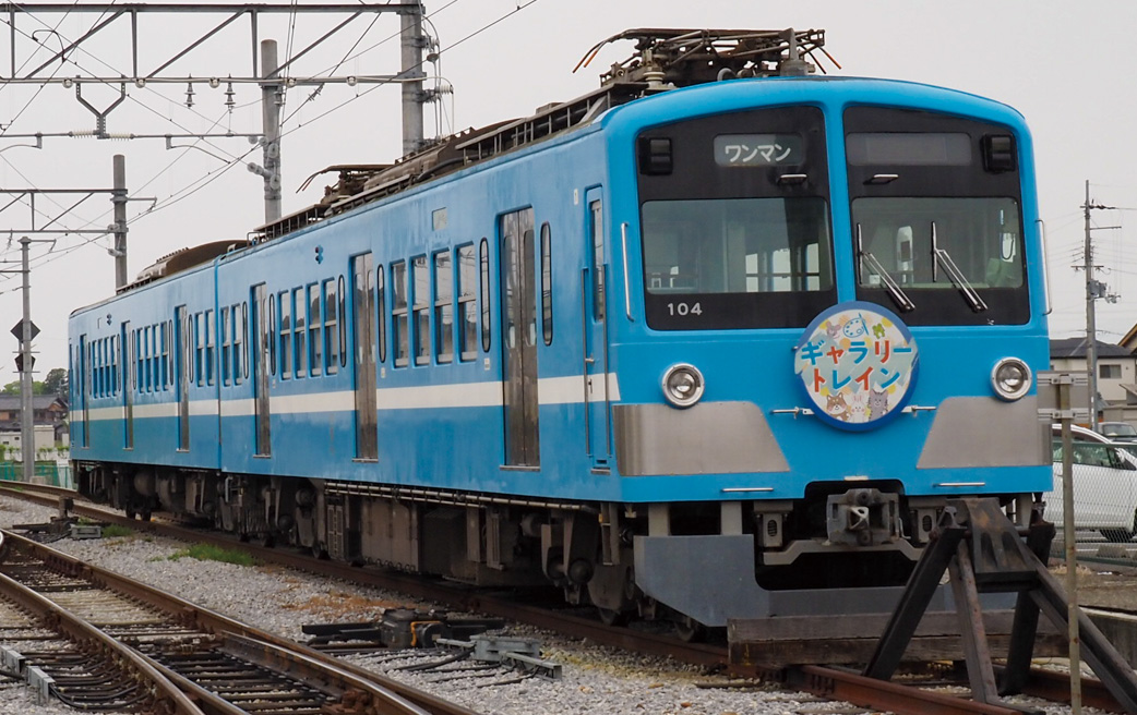
近江鉄道の米原駅~貴生川駅区間では、輪行袋を使わずに電車内へ自転車の持ち込みが可能。運賃のみで持ち込み料金は無料。彦根駅と八日市線(新八日市駅~近江八幡駅)の各駅では利用できないので注意
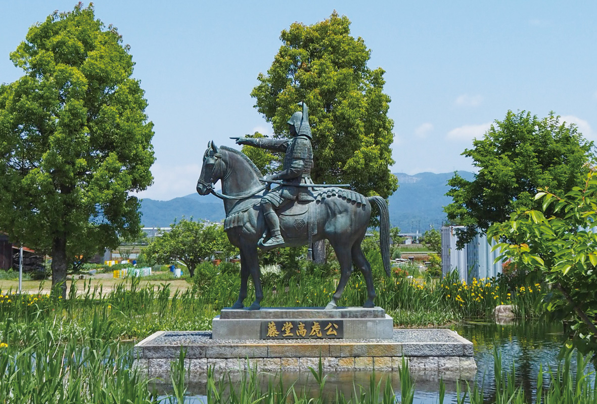
甲良町在士出身の戦国武将・藤堂高虎の像がある公園。関ヶ原の戦いに参戦し功績をあげた。築城技術にも優れていたため、江戸城の改築にも貢献したと伝わる。公園内には大阪城再建の時に使用されなかった「残念石」などが飾られている
