


![]()
![]()
![]()
![]()
![]()
![]()
![]()
![]()
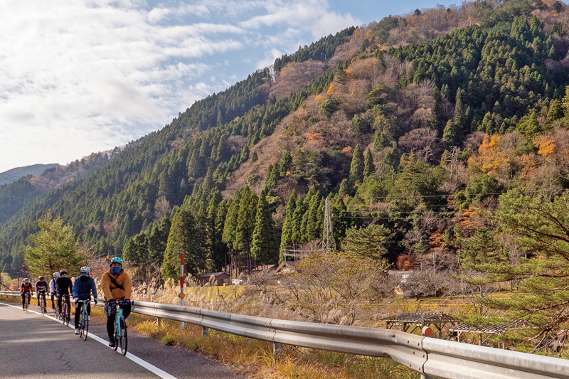


「若狭街道」は、鯖街道の中で最も多くの物資が運ばれた道である。この道を通って、若狭の海で水揚げされた鯖が、遠敷、熊川 を経由し、滋賀の朽木、難所・花折峠を越え、三千院で有名な大原を抜けて、京の都へと運ばれた。このコースでは、かつては塩 鯖を担いで運んだ約 77km の道のりを、京都から小浜を目指して走る。国道が中心となりつつも、時折現れる旧道が趣深い。特に 熊川宿以降は鯖街道の面影を良く感じさせ、まさに「THE 鯖街道」を体験できる。
The “Wakasa Kaido” is the road where the most supplies were transported in the Saba-kaido Road. Through this road, mackerel, which was landed in the sea of Wakasa, via Onshiki, and Kumagawa, crossed Shiga's Kutsuki, difficult place, Hanaori Pass, passed through Ohara famous for Sanzen-in Temple, and was transported to the capital of Kyoto. On this course, they used to carry salted mackerel and run for about 77 km from Kyoto to Kohama. While national highways take center stage, old roads that appear occasionally are interesting. In particular, after Kumagawa-juku, I was able to feel the vestiges of Saba-kaido, and truly experienced “THE Saba-kaido.”
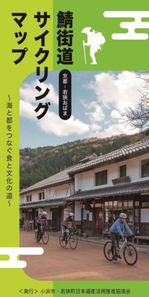
~海と都をつなぐ食と文化の道~
マップ詳細へ※オンラインの地図上でサイクリングルートが閲覧できるウェブサイト「ルートラボ」が2020年3月末でサービス終了したため、「bikemap」に変更したことで、bikemap内の距離や高低差に誤差が生じている場合がありますが、ご理解ご了承の程、よろしくお願いします。
のどかな農村風景の中にある直売所。地元産農産物の他、大原産中心のもち米を使った杵つきのお餅は、毎朝つきたてが用意される。大原特産の赤しそを使った紫蘇□は食べておきたい。
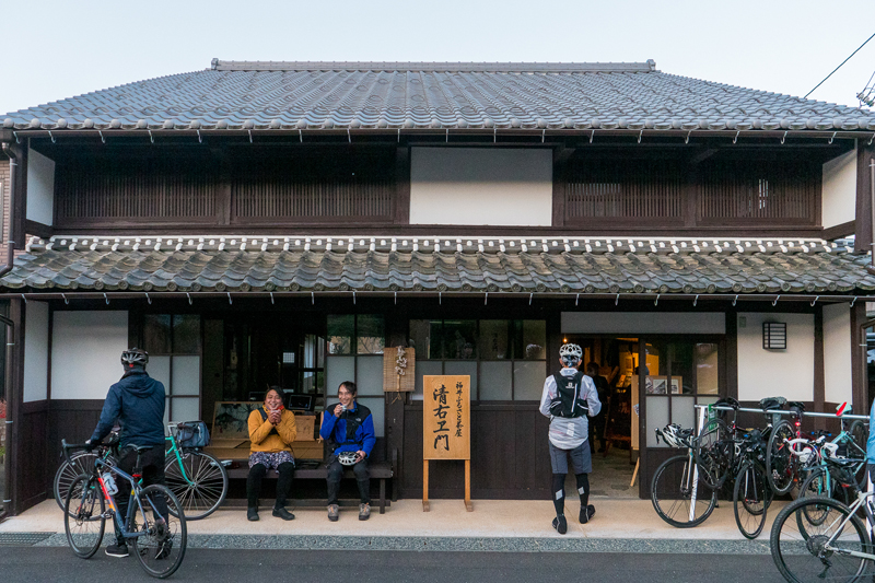
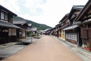
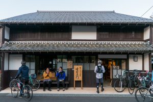
鯖街道の中でも最大の物流量を誇る「若狭街道」で、特に大きな宿場町だったのが熊川宿だ。国道より一本奥へと入れば、重要伝統的建造物群保存地区に選定されたレトロな町並みが現れる。現在は建物をリノベーションしたカフェやショップも並ぶ。道の駅が目印だ。
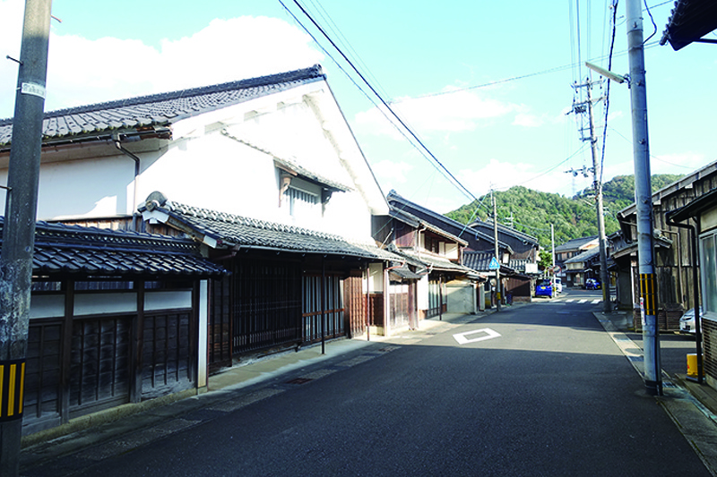
若狭街道と針畑越えの分岐となっている遠敷。かつては国府が置かれ、国分寺や若狭一の宮が鎮座する若狭の政治・経済の中心だった場所。今も江戸末期から明治にかけて建てられた重厚な建物が並び、街道情緒が色濃く残る。
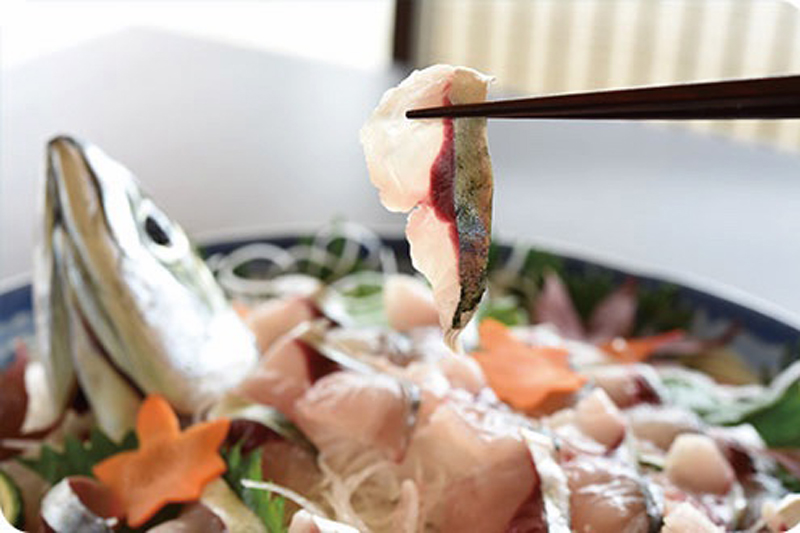
鯖街道の終点・京都の酒蔵の酒粕を鯖に、若狭・田烏の海で育ったブランド鯖。かつての一大産地の鯖を復活させるべく養殖に取り組んでいる。酒粕に含まれる豊富なアミノ酸によって、その味わいは深い旨みと甘さ、爽やかな酸味を持つ。新鮮な刺し身が絶品。食べられるお店は「小浜よっぱらいサバ 取り扱い店舗」で検索!
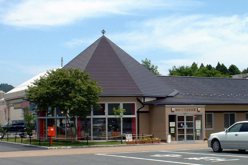
若狭小浜と京都を結ぶ鯖街道の中間地点にある道の駅。毎週日曜・祝日に開催する朝市が人気。物販の売店には、特産品の栃餅や鯖寿司、地場の野菜などが並びます。その他、レストランや無料休憩所などがある。
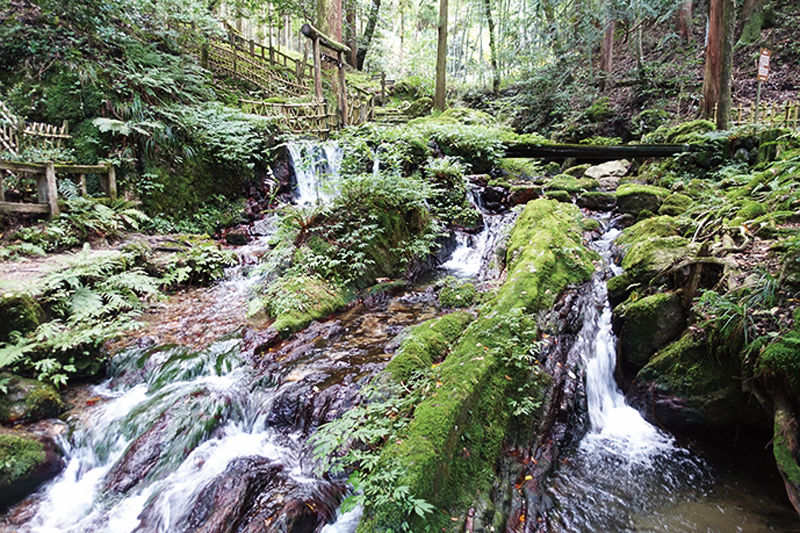
若狭町、天徳寺の境内にある岩間から湧き出る滝。夏でも水に付けておいた瓜が割れるほど冷たいことからその名が付いた。全国名水百選に選ばれており、この水を□みに来る人が常に絶えない。(水を持ち帰る場合は清掃協力金300円必要)
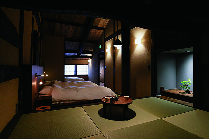
熊川宿の古民家をリノベーションした一棟貸しの体験型宿泊施設。建物は4つあり、それぞれ違ったスタイルの熊川ライフが楽しめ
る。地元食材を自分で調理するプランなど、まるで宿場町に住んでいるかのような時間を過ごせる宿だ。
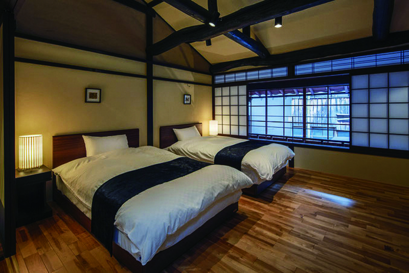
小浜の伝統的建物群保存地区を中心に、7つの伝統的な家屋をリノベーションした分散型ホテル。レンタサイクルや体験ツアーなども用意されており、まさに小浜暮らしを満喫できる。
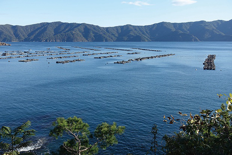
丹後半島と越前岬に囲まれた日本海側唯一の大規模リアス海岸。古くから天然の良港で豊富な海産物に恵まれている。特に18世紀後半からは多くの鯖が水揚げされた。大陸から最も都に近い港として、鯖街道を通じて様々な文化が行き来した。
街道沿いの築200年の古民家を改修して作られた、地域交流やまちづくり拠点施設。街道散策の休憩処の他、地域のガイドやイベントも行われている。
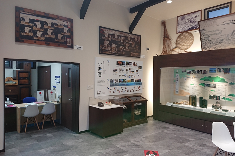
小浜市鯖街道ミュージアムは、日本遺産ガイダンス施設で、日本遺産に認定されている「鯖街道」をはじめとする小浜市の文化財や伝統芸能、祭礼等を紹介しています。小浜市の伝統芸能や祭礼を紹介する映像、トリックアートやフェノロジーカレンダー(祭礼行事や食の旬等を表した季節暦)等を展示。
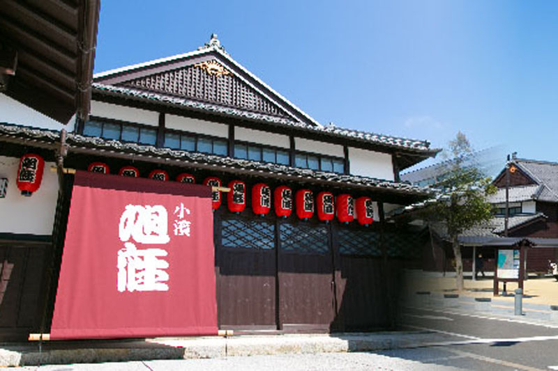
福井県内で唯一現存する明治期の芝居小屋「旭座」を移築復原。観光案内・物販、休憩施設等と併せ、小浜西組重伝建地区へのまち歩き観光拠点です。落語を含めた様々なイベントが定期的に実施されている。
