


![]()
![]()
![]()
![]()
![]()
![]()
![]()
![]()


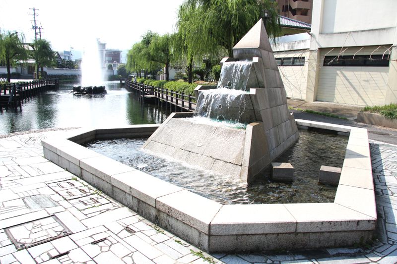
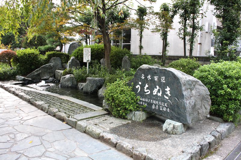


水の都・西条市の中心地を巡る。コース途中には「うちぬき」や疎水などの豊かな水系や、水に関係した史跡、旧陣屋町らしい町並み、歴史的建物などを見ることができる。アップダウンは非常に緩やかなので走行は楽だが、県道・市道は路肩が狭く、走行時には注意が必要。
Tour the center of Saijo, the city of water. In the middle of the course, you can see rich water systems such as “Uchinuki” and watersheds, historic sites related to water, townscapes typical of old Jinya Town, and historic buildings. The ups and downs are very gentle, so driving is easy, but the road shoulders are narrow on prefectural roads and city roads, so be careful when driving.
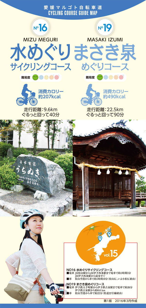
しまなみ海道を中心に全県域を誰もが自転車に親しみ、誰もが自転車を楽しめる「愛媛マルゴト自転車道」を展開することで、“愛媛がサイクリングパラダイス”となることを目指している。
マップ詳細へ※オンラインの地図上でサイクリングルートが閲覧できるウェブサイト「ルートラボ」が2020年3月末でサービス終了したため、「bikemap」に変更したことで、bikemap内の距離や高低差に誤差が生じている場合がありますが、ご理解ご了承の程、よろしくお願いします。

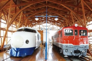
鉄道の文化や歴史に触れられるテーマパーク。特に人気の四国鉄道文化館には、初期型車両「0系新幹線」など貴重な鉄道車両を6両ほど展示する。


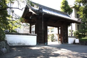
1604年に築かれた西条藩主・一柳家の陣屋の大手門や、石垣などが現存。陣屋跡には西条高校が建てられ、今や大手門は高校の正門となっている。
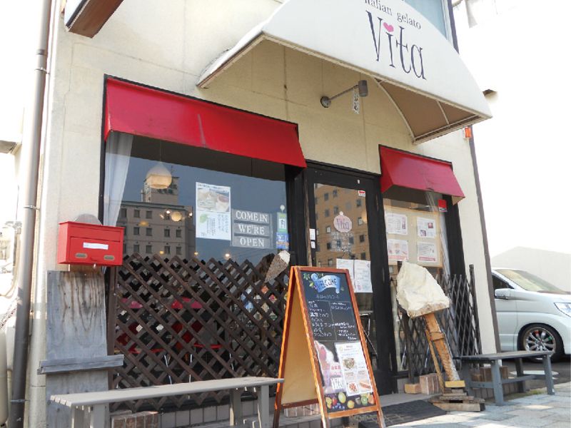
愛媛の名水と希少糖含有のシロップをたっぷり使った、自家製ジェラート専門店。約40種類以上のフレーバーの中には、西条産のミニトマトや甘夏、イチジクなどの珍しい味わいもそろう。
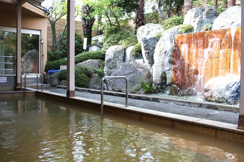
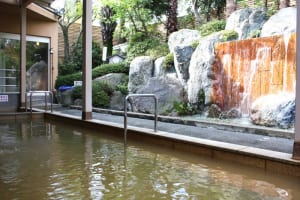
四国最大級の大浴場が自慢。グルメ・特産品塩泉が使用される大浴場は、保温効果が高く、熱の湯との別名も。ほかに露天風呂や漢方薬湯、サウナも完備。
