


![]()
![]()
![]()
![]()
![]()
![]()
![]()
![]()


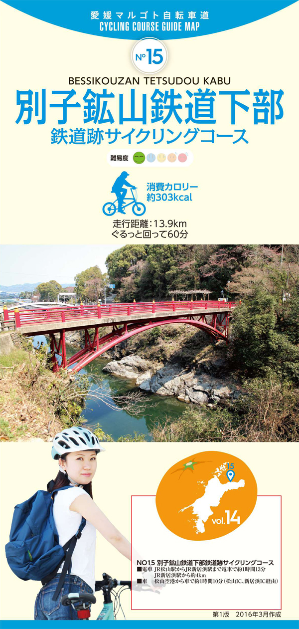
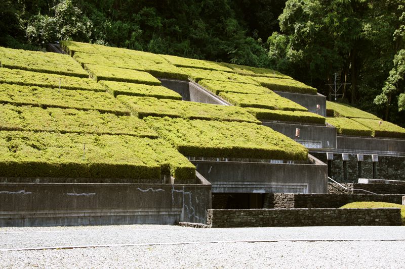
主に別子銅山から採掘された銅鉱石を精錬所や港湾へと輸送していた鉱山鉄道の路線跡を中心に巡るコース。ところどころに路線跡の遺構を見ることができる。国領川緑地公園沿いの土手沿いはサイクリングコースが整備されていて走りやすく、瀬戸内海向けて開けた景色は爽快だ。滝の宮公園から別子銅山記念館までは民家の間を緩やかな上り坂が続く。
This course mainly goes around the tracks of mining railways that transported copper ore mined from the Besshi Copper Mine to refineries and harbors. Remains of route ruins can be seen here and there. There is a cycling course along the bank along the Kokuryogawa Ryokuchi Park, making it easy to run, and the scenery that opens up towards the Seto Inland Sea is exhilarating. From Takinomiya Park to the Besshi Copper Mine Memorial Hall, a gentle uphill slope continues between private houses.
しまなみ海道を中心に全県域を誰もが自転車に親しみ、誰もが自転車を楽しめる「愛媛マルゴト自転車道」を展開することで、“愛媛がサイクリングパラダイス”となることを目指している。
マップ詳細へ※オンラインの地図上でサイクリングルートが閲覧できるウェブサイト「ルートラボ」が2020年3月末でサービス終了したため、「bikemap」に変更したことで、bikemap内の距離や高低差に誤差が生じている場合がありますが、ご理解ご了承の程、よろしくお願いします。
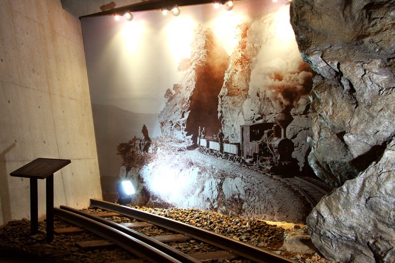
偉大な銅山の歴史や意義を後世に伝えるために記念館が設立された。

幕末・明治時代に別子銅山を守り、近代産業を支えた広瀬宰平の記念館。鉱山鉄道の開通を再現したジオラマや新居浜市の成り立ちなども学べる。
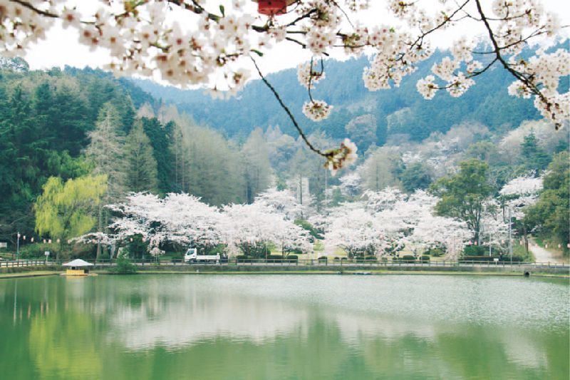
金子山の丘陵にある公園は、約1,500本の桜が咲く春の名所でもある。ウメの花がある日本庭園や花見広場など季節の花々が咲く園内を散策しよう。桜の身頃は3月下旬から4月上旬。

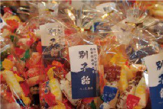
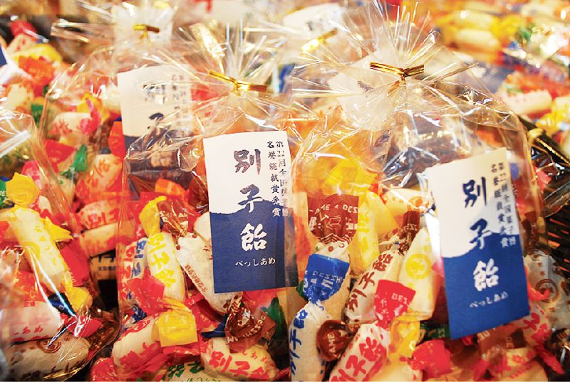
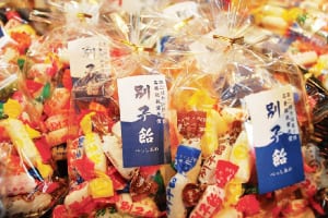
精選された水飴と練乳、上白糖を主原料に、明治元年の創業以来の製法を守り続けた、昔から変わらない伝統の飴。併設された工場では別子飴の製造工程を見学でき、職人技を見ることができる。

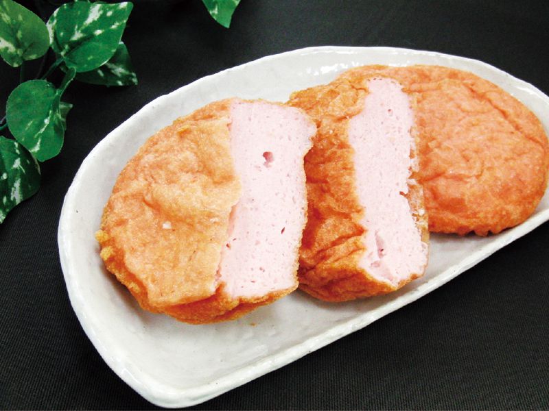
新鮮な海老と瀬戸内の魚、豆腐を練り合わせて揚げたえび天は、ふわふわのグルメ・特産品感が大人気。海老の風味が口いっぱいに広がる優しい味わい。
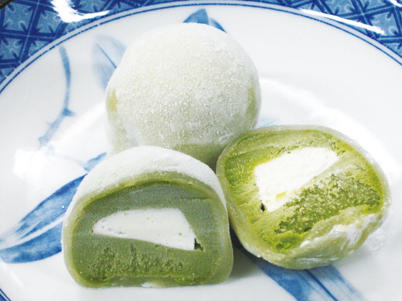
餅とあんこに宇治抹茶を加えた、抹茶を存分に堪能できる濃厚な大福。抹茶あんの真ん中に入る生クリームで、さらにまろやかな味わいに。
