


![]()
![]()
![]()
![]()
![]()
![]()
![]()
![]()


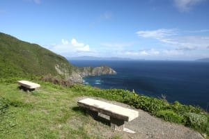

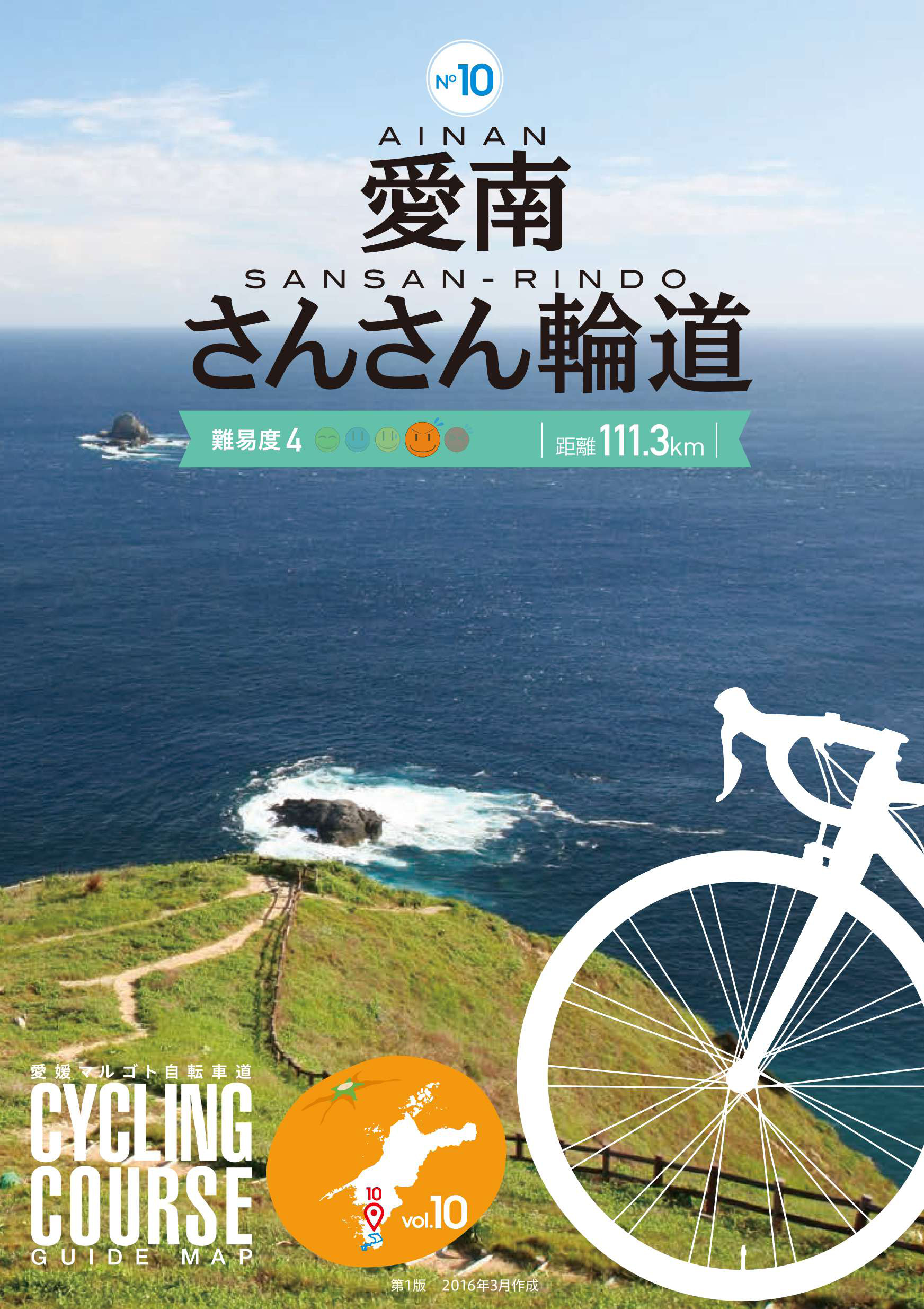
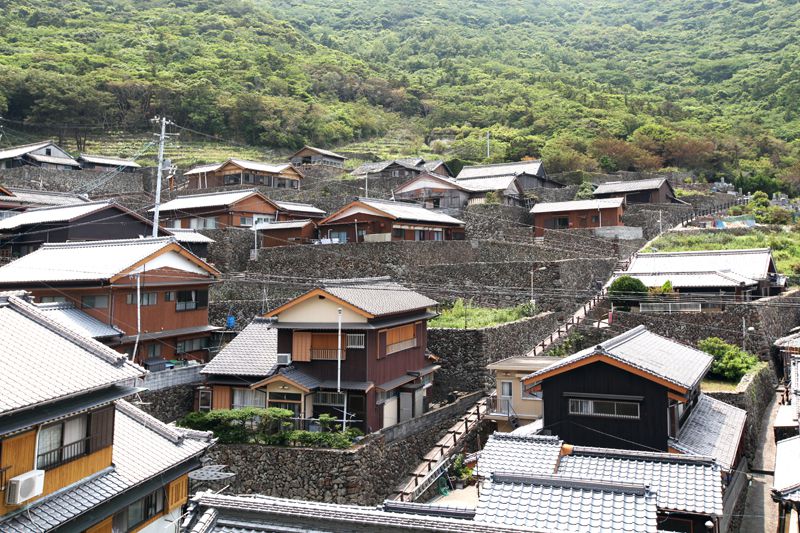
宇和海海中公園に面した美しいリアス式海岸に沿ったコースで、内泊・中泊・外泊といった漁業集落が見どころ。なかでも集落全体が人の手で積み上げられた高い石垣で囲まれた外泊地区の景観は見事。緑豊かなコースの途中では、野鳥や小動物と遭遇できる可能性も。自動車の交通量も少なく、のんびりとライドを楽しめるのも魅力。
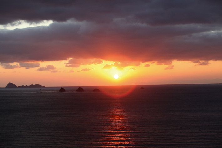
It is a course along the beautiful Rias-style coast facing Uwakai Marine Park, and the highlight is fishing settlements such as indoor, middle, and sleepovers. Above all, the scenery of the Sotomari district, which is surrounded by tall stone walls built up by hand, is spectacular. There is also a possibility that you will encounter wild birds and small animals along the course, which is rich in greenery. There is little car traffic, and it is also attractive that you can enjoy a leisurely ride.
しまなみ海道を中心に全県域を誰もが自転車に親しみ、誰もが自転車を楽しめる「愛媛マルゴト自転車道」を展開することで、“愛媛がサイクリングパラダイス”となることを目指している。
マップ詳細へ※オンラインの地図上でサイクリングルートが閲覧できるウェブサイト「ルートラボ」が2020年3月末でサービス終了したため、「bikemap」に変更したことで、bikemap内の距離や高低差に誤差が生じている場合がありますが、ご理解ご了承の程、よろしくお願いします。

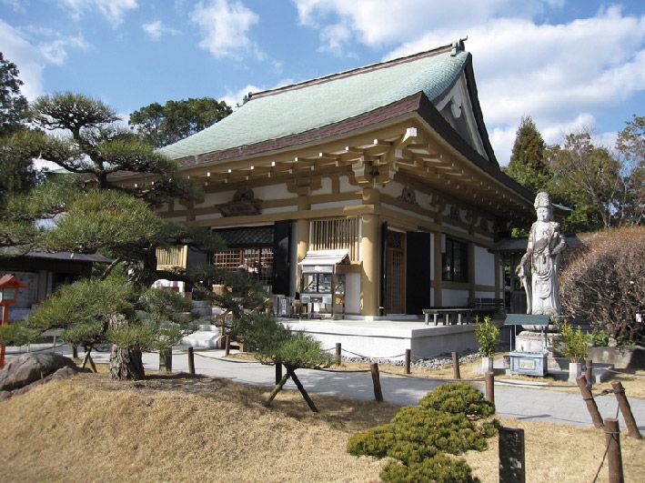
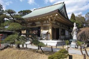
四国八十八箇所霊場の40番札所。かつて七堂伽藍を持ち四十の末寺を有するほど荘厳華麗を極め、日本4ヶ所の鎮守に数えられた。
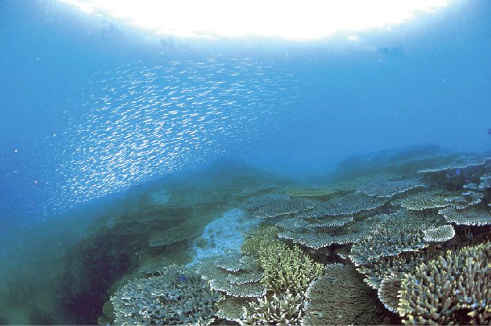
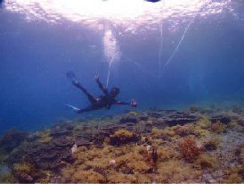
冬でも水温が15 度以下に下がることがない、熱帯魚やサンゴたちの楽園。色とりどりのサンゴの森を熱帯魚が泳ぐ様はまさに「海のお花畑」。澄みきった海は透明度が高く、周辺海域はスキューバダイビングのメッカとしても知られている。宇和海海中公園は、展望船「ガイヤナ」・「ユメカイナ」で、海の上から海中を散策できる。

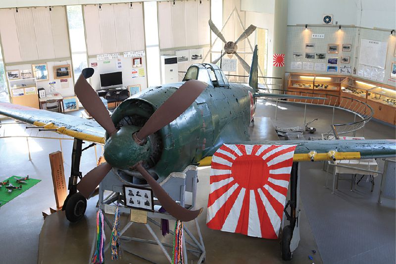
昭和54年久良湾の海底40mに34年問原型のまま沈んでいた紫電改が引き揚げられた。紫電改はゼ口戦に代わる新鋭機として終戦間近に開発され、海軍のもっとも優れた戦闘機と言われており、現存する、日本で唯一機。
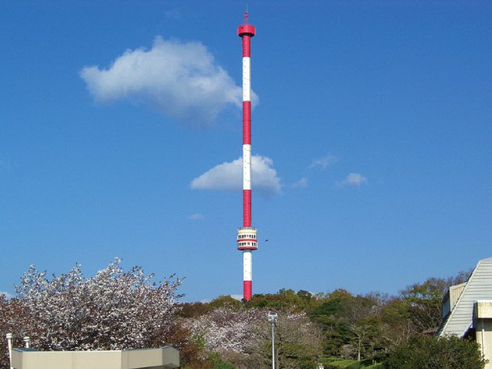
美しい海と青々とした山々を見渡すことができる展望タワー。展望室がゆるやかに360度回転しながら、地上107m、海抜260mの高さまで上昇。
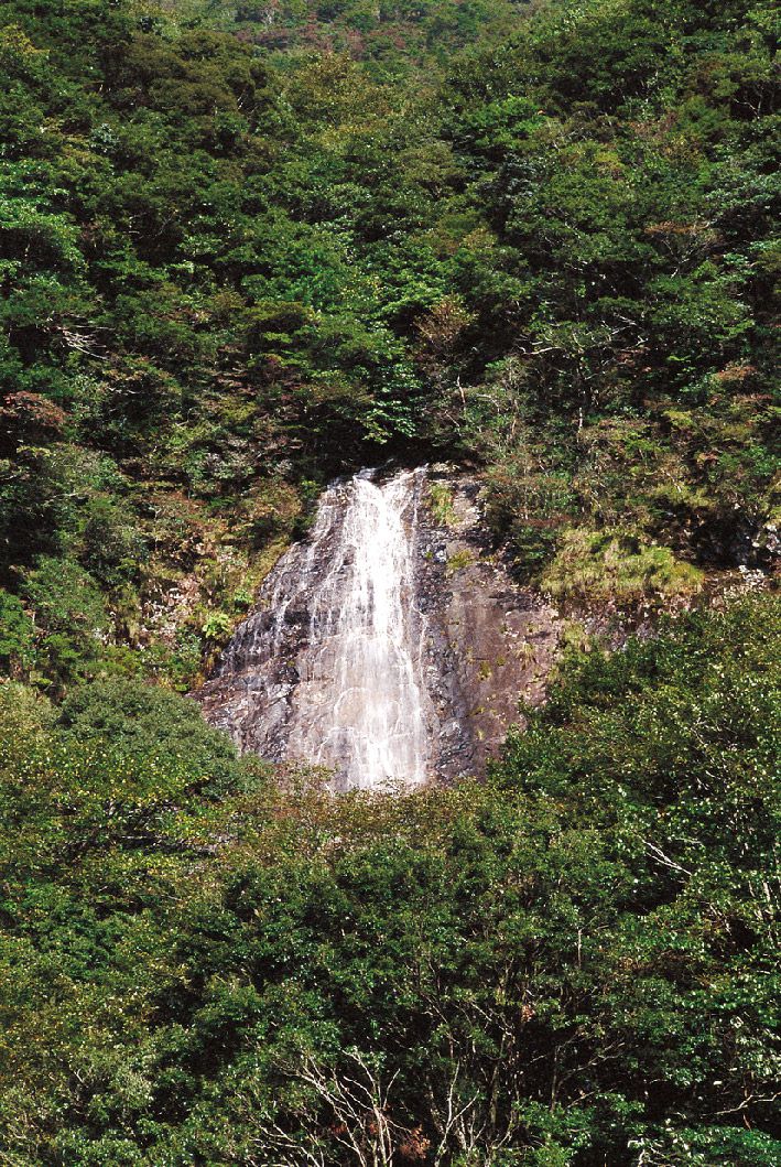
篠山の四季の写真や資料が揃っている「篠山自然学習館」の駐車場から山を見上げると「白滝」が見える。また、芝生広場等、一息つける休憩スペースもある。

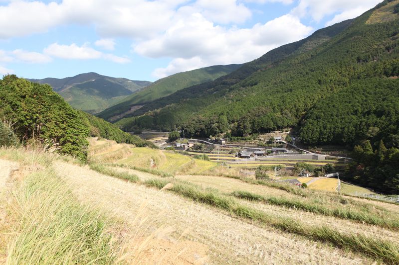
愛媛県と高知県の県境に位置し、古くから山岳信仰の霊地として知られる。標高1064.6mの頂上には篠山神社が鎮座している。山一面のアケボノツツジやシャクナゲの花は4月下旬~5月上旬が見頃。
シーウォーカーは専用のヘルメットを被るだけでお子様からお年寄りまで誰でも気軽に海中散歩を楽しむことができる。簡単な事前講習を受けたらいざ海中へ。顔は濡れないのでメガネをかけたままでOK。海中では、カラフルなサンゴや熱帯魚が沢山泳いでおり地上では味わえない絶景が広がっている。
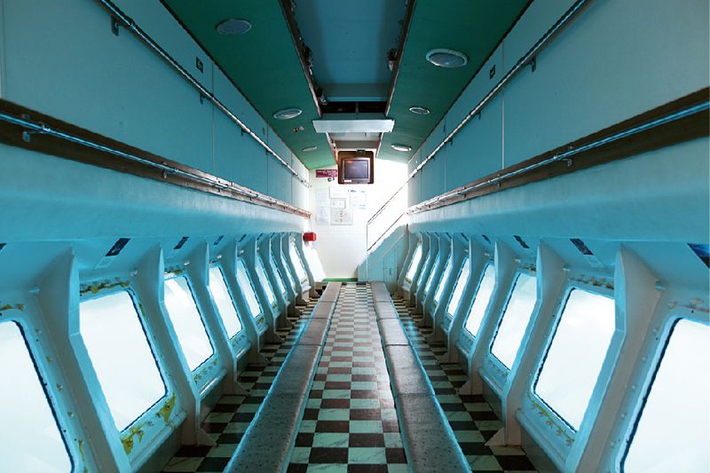
スキューバダイビングのメッカとしても有名な海の楽園を、海中展望船「ユメカイナ」と「ガイヤナ」で体感することができる。船体の中央展望室は水面下1.1mまで下がり、海中一面に広がる珊瑚の景色や魚が群れとなって泳いでいるところなど、幻想的な美しさに出会える。宇和海の温暖な海水と、澄み切った海が作り出した自然の神秘を体感できる。
石垣の里にある古民家風の建物の食事処兼観光案内所。朝獲れ魚介を使った日替わり定食や、刺身が付いただんだん定食(要予約)を味わおう。休憩所としても利用可。
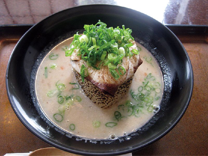
「愛なんうまいもんコンテスト2012」でグランプリに輝いたご当地グルメ。地元・久良のブリの焼身をすり鉢で下ろし、麦味噌で仕上げた温かいさつま汁は早くも人気。
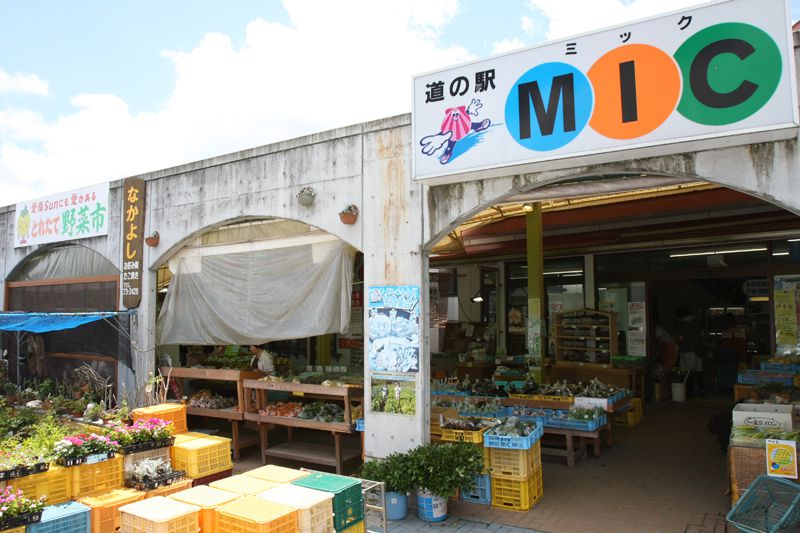
自然の恵みをたっぷり受けて育った愛南町の特産物・加工品だけなく、施設内にある愛南町観光協会では、愛南町の旬な観光情報を手に入れることができる。豊富で新鮮な柑橘類や、宇和海で獲れた魚介類のほかにも、ジュースやドレッシングなどここでしか買えないオリジナル商品も多数あるので、サイクリング途中の立ち寄り場所としても最適。
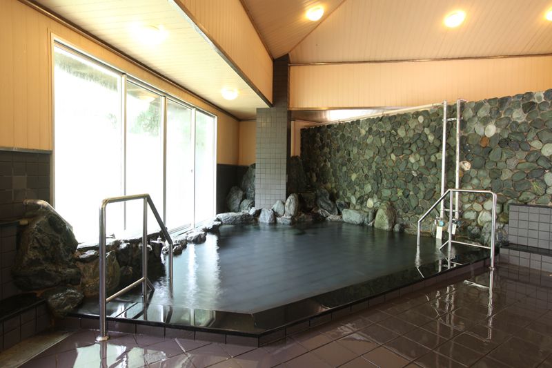
惠湯と有卦湯の2つの大浴場を備えた源泉かけ流しの温泉は、疲労回復や美肌効果があると人気。産直バイキングが楽しめるレストラン遊花亭などもぜひチェック!
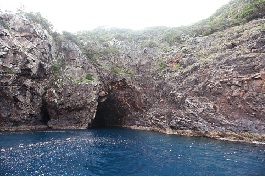
海岸の崖に波で浸食されてできた洞窟。海食崖の一部に断層や岩盤の割れ目など弱いところに波がくぼみを削ってできた深い洞窟。通称「鹿島のうど」と呼ばれる洞窟は、幅25m高さ20m奥行80mで大きな船が入ることができるため、神秘的な洞窟を遊覧船で探訪することができる。

愛南町の食材を使った大地の恵みの味がするパニーノ。多くの人においしく安全な食材を食べて欲しいと、オーナーみずから畑に出て、土作りからスタートし野菜などを栽培。媛っ子地鶏を使ったパニーノは、表面さっくり、中身はもちもちで旨味が凝縮している。
