


![]()
![]()
![]()
![]()
![]()
![]()
![]()
![]()
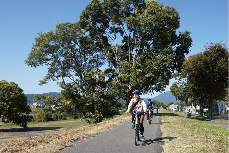


京都市の嵐山を起点とする全長180km の京奈和自転車道の中で、桂川・宇治川・木津川の三川が合流する地点までの桂川沿い20km の区間が「桂川サイクリングロード」だ。嵐山周辺をはじめとして京都の西エリアにある観光スポットへのアクセスが良いコースとなっている。市街地近くということもあり、歩行者や生活利用の人も多く道もやや細いため、スピードは抑えてゆっくりと楽しんでほしい。
The “Katsuragawa Cycling Road” is a 20 km section along the Katsura River to the point where the three rivers of the Katsura River, Uji River, and Kizu River meet in the 180km long Keinawa bicycle path starting from Arashiyama in Kyoto City. It is a course with good access to tourist spots in the western area of Kyoto, starting with the Arashiyama area. It is also close to the city area, and there are many pedestrians and people using it for daily use, and the road is slightly narrow, so I want you to keep your speed down and enjoy it slowly.
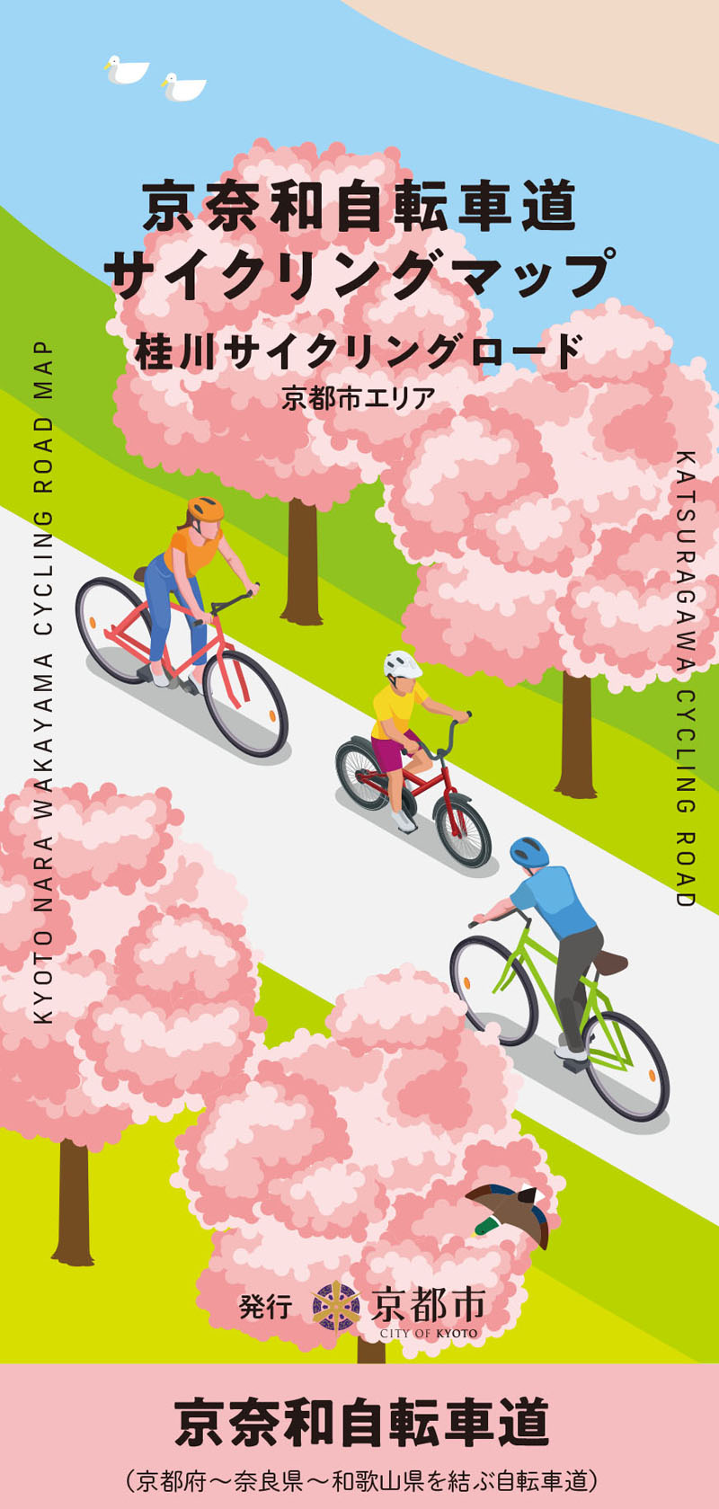
京奈和自転車道は京都市嵐山から奈良県を経て和歌山市の和歌山港までを結ぶ、全延長約180km の広域サイクリングルートです。京都市・京都府・奈良県・和歌山県が連携して整備を行ってきました。
京都市内においては、誘導ラインやフットサイン等の路面表示の設置や、案内看板のリニューアルが完了しました!
今後も広域サイクリングルートとしての魅力向上を図っていきます。
マップ詳細へ※オンラインの地図上でサイクリングルートが閲覧できるウェブサイト「ルートラボ」が2020年3月末でサービス終了したため、「bikemap」に変更したことで、bikemap内の距離や高低差に誤差が生じている場合がありますが、ご理解ご了承の程、よろしくお願いします。
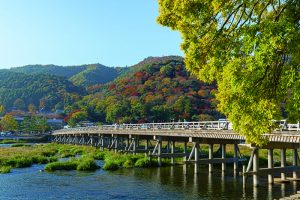
言わずと知れた京都を代表する観光エリア「嵐山」のアイコンとも言うべき橋。桂川サイクリングロードの起点からは目の前だ。ここから嵐山の各観光スポットまですぐにアクセスできる。渡月橋の名は,亀山上皇が橋の上を渡るように月が移動していく様を見て名付けた。人気エリアのため,混雑する場所では自転車は押して歩きたい。
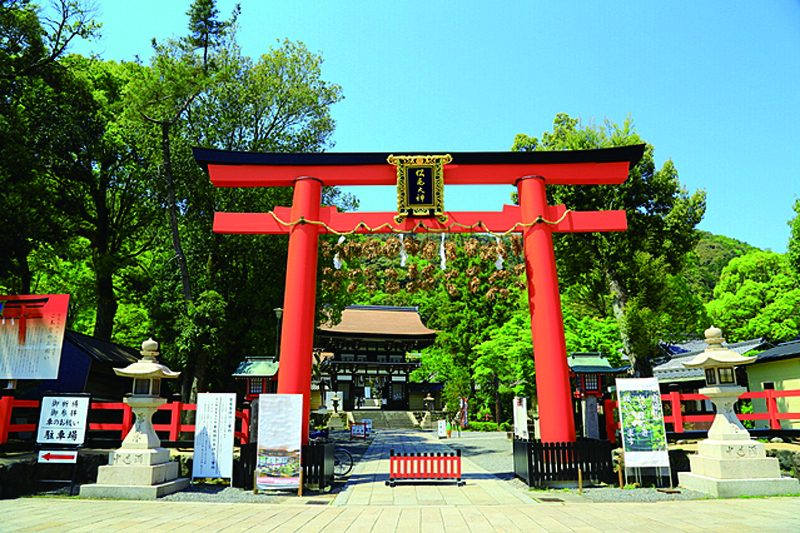
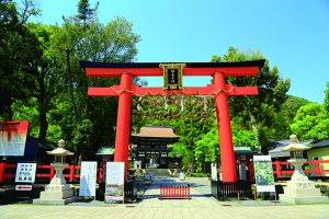
京に都が遷都する以前よりこの地に鎮座する古社で、嵐山からおよそ2km の位置にある。
お酒の神として酒造家の信奉厚く、神社内の湧水は、古代より酒造りに利用されてきた。今でも書道や茶道の水として持ち帰る人も。境内入り口にあるお酒の博物館は無料で入場可能。
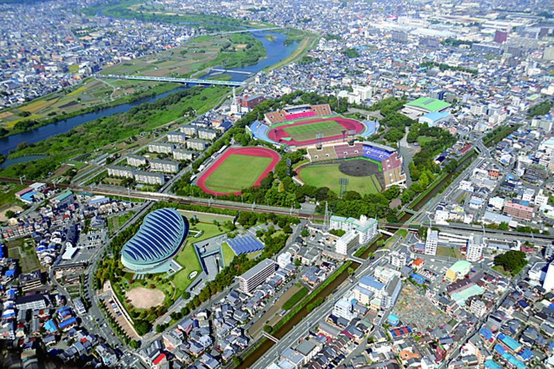
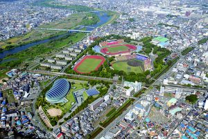
陸上競技場兼球技場、野球場、体育館、プール兼アイススケートリンク施設などで構成された総合運動公園。昭和21 年には第1回国民体育大会が開催されている場所だ。本格的なスポーツ競技以外にも、家族で気軽に楽しめる市民の憩いの場としても利用されている。ちなみに京極とは平安京エリアの内外の境界を表し、西京極とは西の端となる場所。
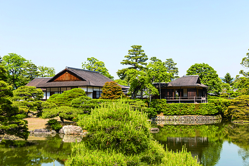
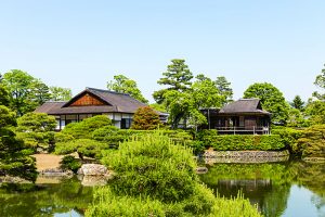
かつてドイツ人建築家ブルーノ・タウトによって「涙がでるほど美しい」と称された日本最高峰の庭園を持つ宮内庁施設。江戸時代に作られた約5.8 万m2 の庭園にはキリシタン灯篭などがあり興味深い。参観は基本的に事前予約制だが,当日申込みも先着順で受け付けている。
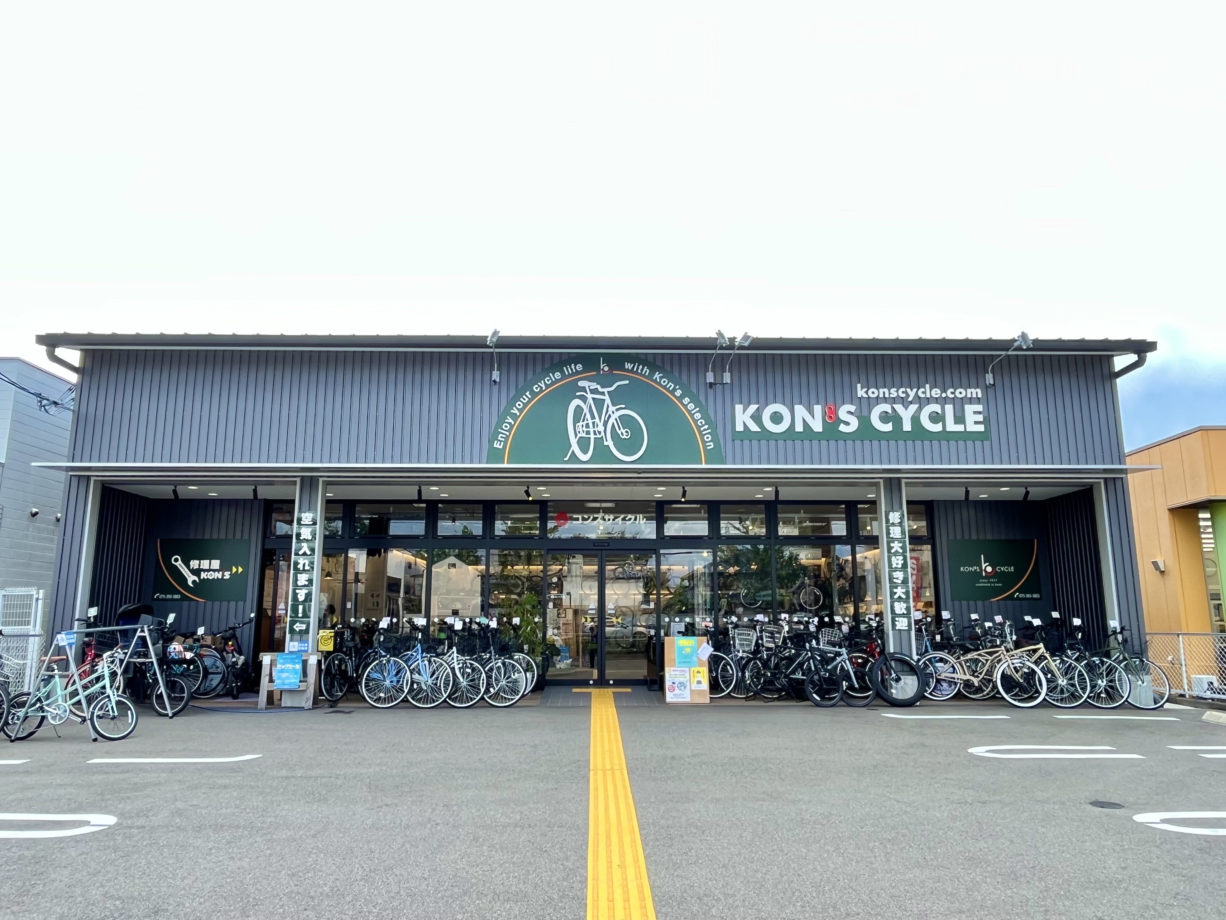
こどものファーストバイク、お母さんのこども乗せ電動アシスト自転車、お父さんの通勤スポーツバイク、おじいちゃんおばあちゃんの電動アシスト自転車「楽しい」 「新しい」を常にご提案。ナチュラルをコンセプトにした店舗にてゆっくり自転車をお選びいただけます。
もちろん修理もお任せください。
お気軽になんでもお問い合わせください。
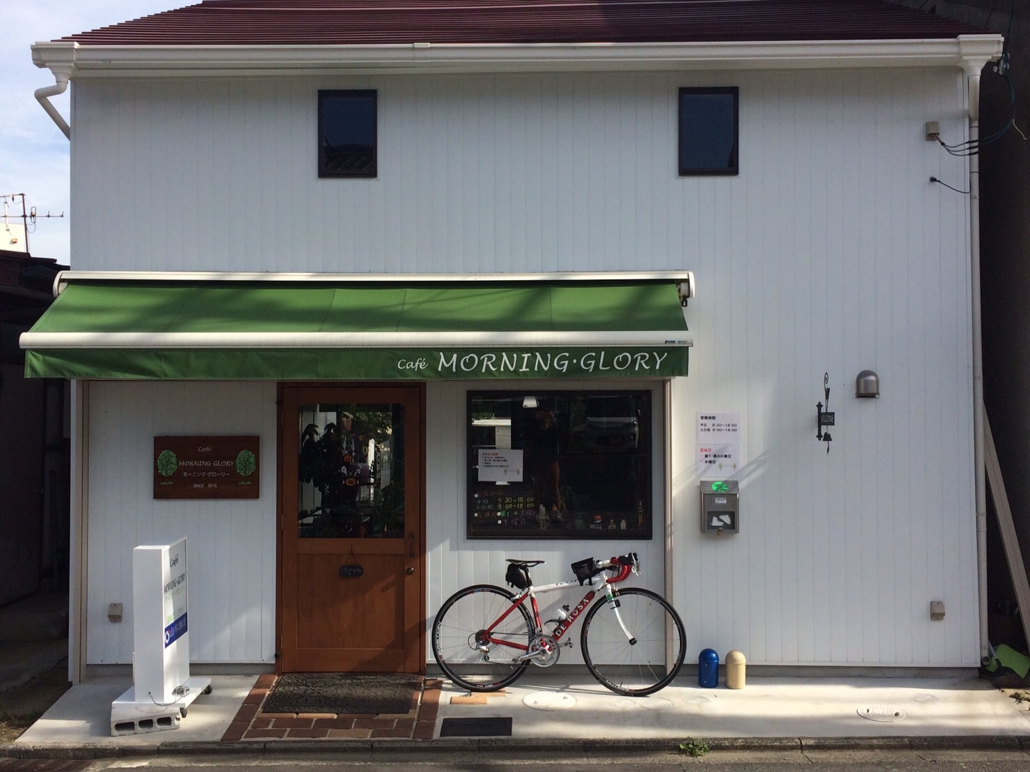
大阪から嵐山までを繋ぐ桂川サイクリングロード沿いのサイクリストにとってはとても立ち寄りやすい場所。趣味で集めた色とりどりのカップで美味しい手淹れ珈琲や季節ごとの自家製スイーツでちょっとした贅沢な時間をどうぞ。テラス席では喫煙、ペットOK。駐車場(5.6台)有り。サイクルラック完備。
※「給水」に関しては、店舗の混雑状況等により、利用できない場合があります。
