


![]()
![]()
![]()
![]()
![]()
![]()
![]()
![]()
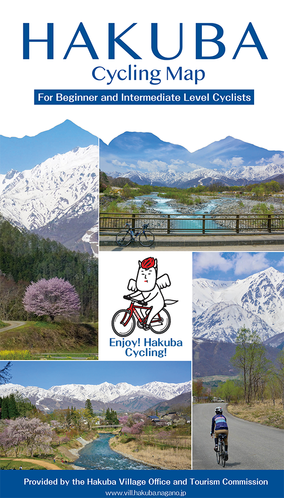
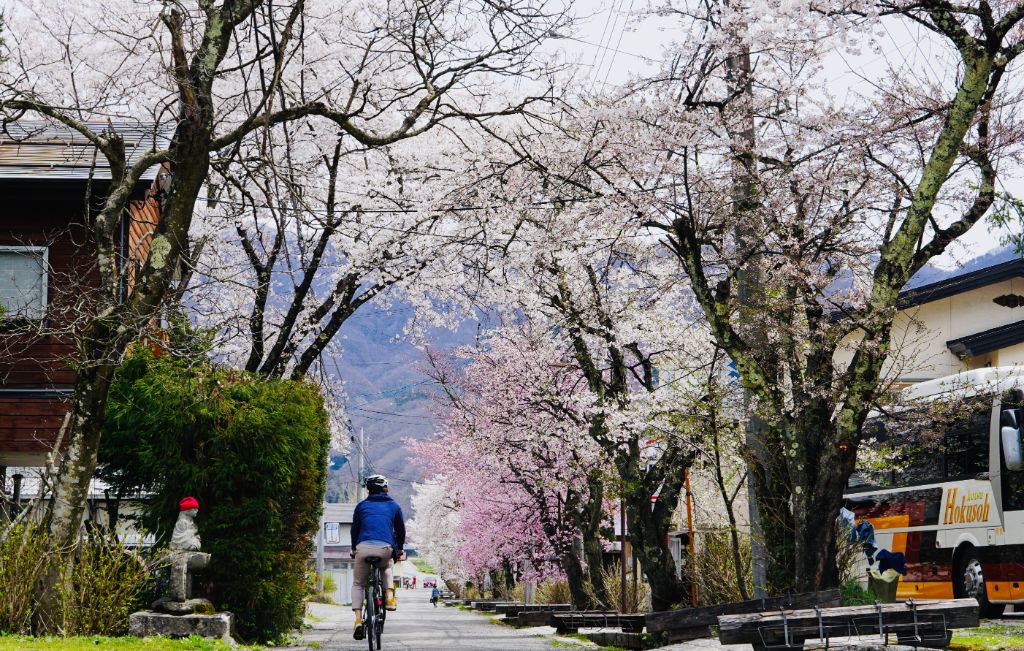
Set off from JR Hakuba station and ride along Matsukawa River Road. While taking in the view of the Northern Japan Alps spreading in front of you, ride up to the Hakuba Ohashi Bridge. Then go downhill a little bit until you pass through a short tunnel. After you pass the Hakuba Iwatake Mountain Resort, you will find the long uphills along the river so hang in there. The Ochikura Nature Park, which is free to enter, you can see white arum and skunk cabbage blooming from April to mid-May. At the end of the long, straight downhill, you will see the magnificent Tsugaike Panorama Bridge. Below the bridge are rice terraces along the traditional semi-natural area, which are quite beautiful. A coffee break at Tsugaike Kogen Resort will be refreshing. Go back a little bit on the same road and head toward JR Shinano Moriue station. When you go uphill at the Nodaira area, you’ll be welcomed by a beautiful cherry tree. As you head back to JR Hakuba station, enjoy the amazing scenery of Oide Park along the Hime river!
Set off from JR Hakuba Station and Ride along Matsukawa River Road. While taking in the view of the Northern Japan Alps spreading in front of you, ride up to the Hakuba Ohashi Bridge. Then go downhill a little bit until you pass through a short tunnel. After you pass the Hakuba Iwatake Mountain Resort, you will find the long uphills along the river so hang in there. The Ochikura Nature Park, which is free to enter, can you see white arum and skunk cabbage blooming from April to mid-May. At the end of the long, straight downhill, you will see the magnificent Tsugaike Panorama Bridge. Below the Bridge are rice terraces along the traditional semi-natural area, which are quite beautiful. A coffee break at Tsugaike Kogen Resort will be refreshing. Go back a little bit on the same road and head to JR Shinano Moriue Station. When you go uphill at the Nodaira area, you'll be surprised by a beautiful cherry tree. As you head back to JR Hakuba Station, enjoy the amazing scenery of Oide Park along the Hime River! For Japanese. Japanese is here.
※オンラインの地図上でサイクリングルートが閲覧できるウェブサイト「ルートラボ」が2020年3月末でサービス終了したため、「bikemap」に変更したことで、bikemap内の距離や高低差に誤差が生じている場合がありますが、ご理解ご了承の程、よろしくお願いします。
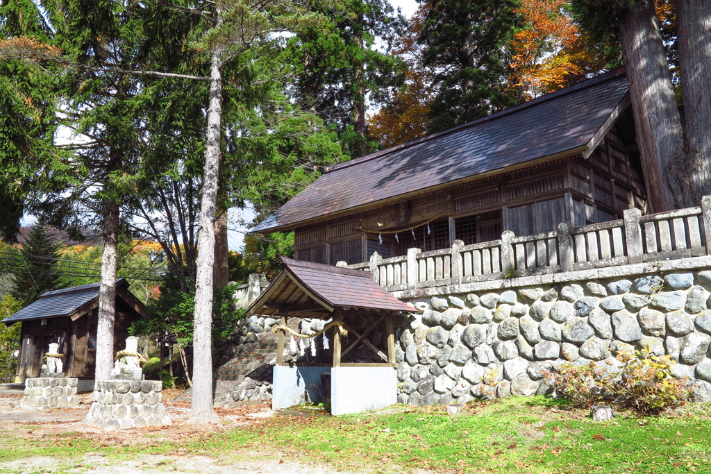
The construction of this shrine is unknown, but it is a Suwa shrine that is enshrined as a local deity in this area, and the large cedar tree is attractive.
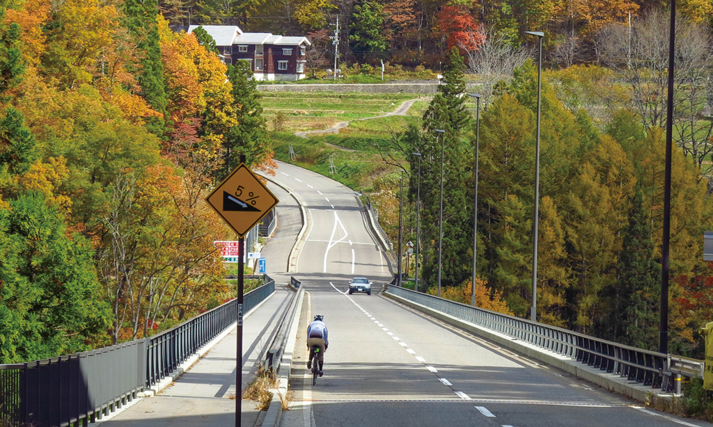
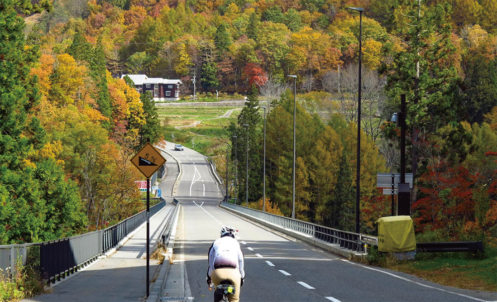
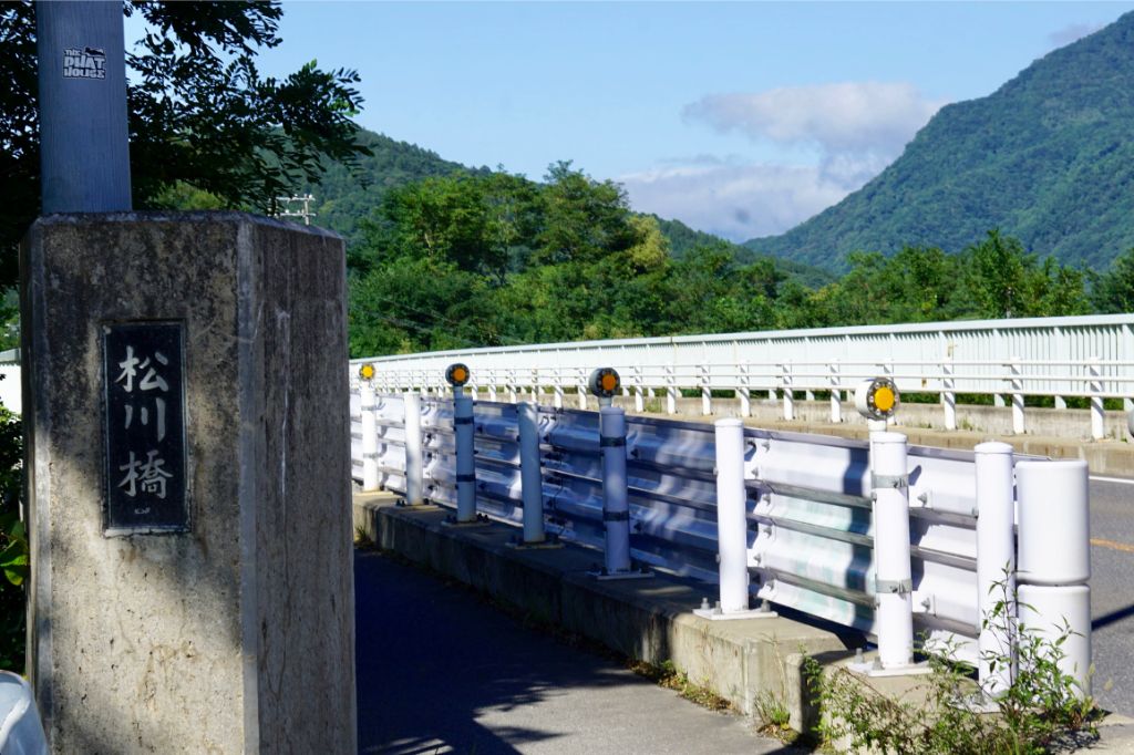
Tsugaike Panorama Bridge, which opened in 2013, stretches straight and feels good.Be careful of overspeeding!
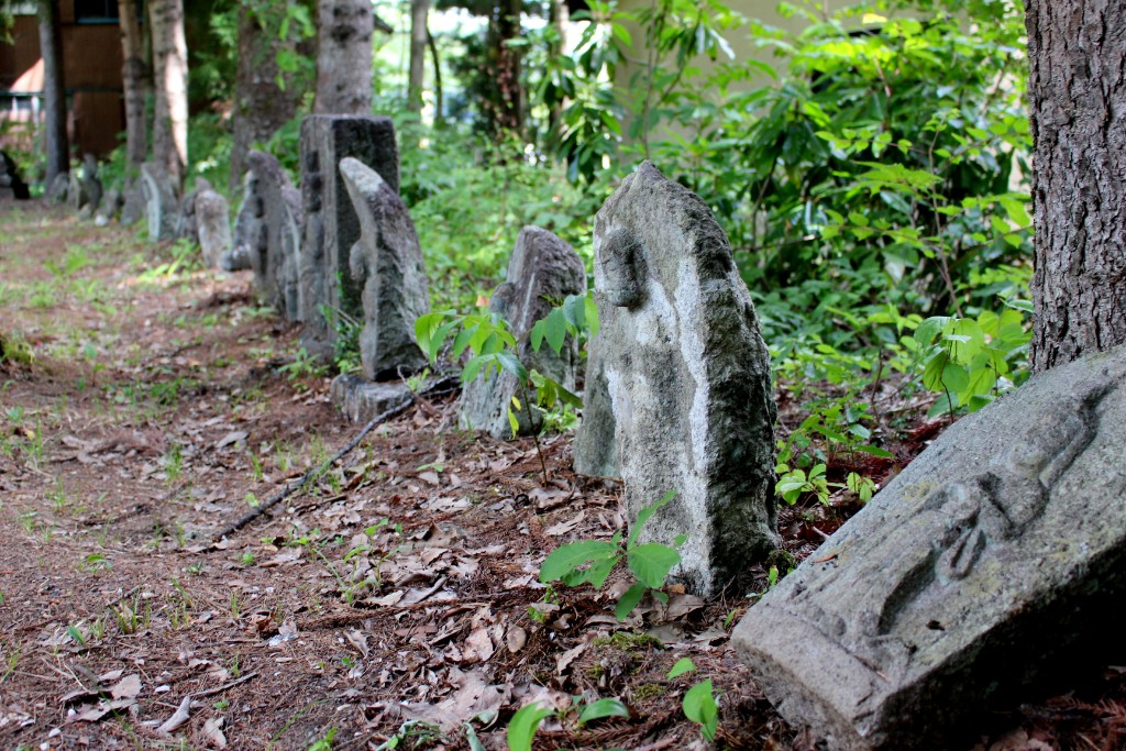
A group of stone Buddhist statues, there are about 190 stones. which has been designated a Cultural Property by Hakuba Village.
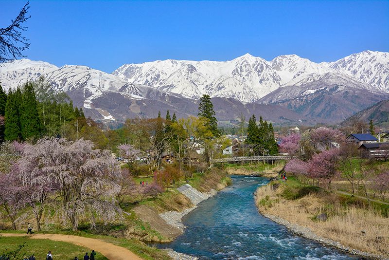
In the Oide area, you can see the thatched roof and the cool clear stream of Hime River with the magnificent Hakuba mountain range in the background.
The Oide Suspension Bridge over the Oide area is a pedestrian bridge where you can feel the wind of Hakuba.
The scenery of Hime River, Oide suspension bridge and Shirouma Sanzan is recommended as a spot for shooting and sketching.
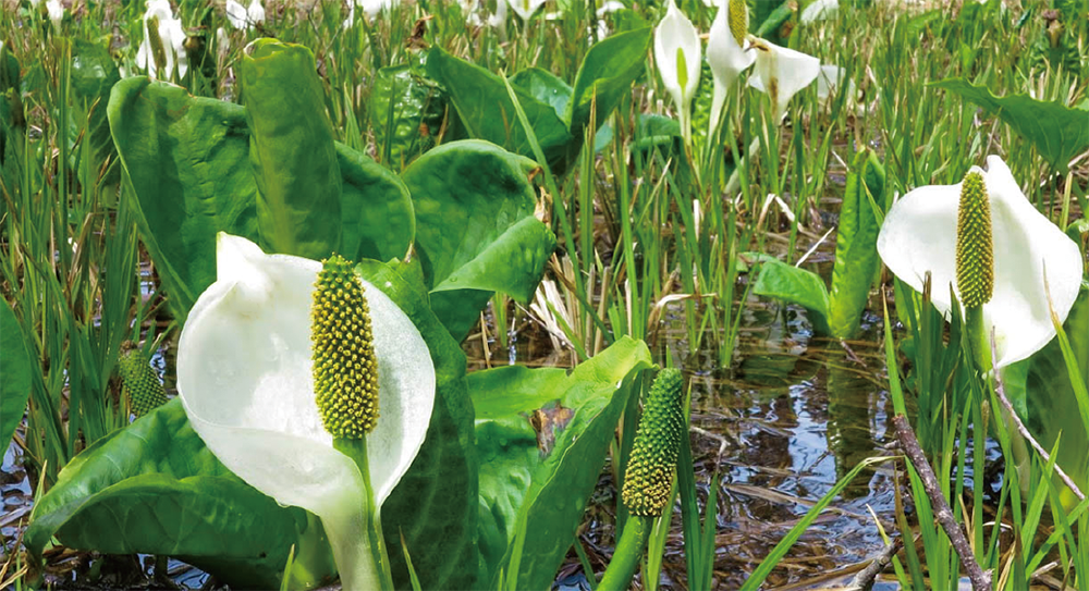
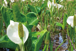
The Ochikura Nature Park located at the boarder of Hakuba Village and Otari Village, is a wetland with free admission. As you can go around it in 20 or 30 minutes, leave your bike and stroll around. Between April and May, white arum and skunk cabbage will be in bloom.
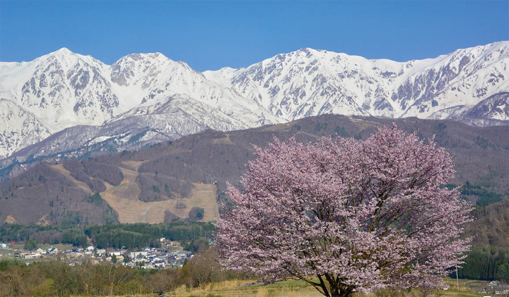
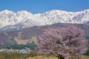
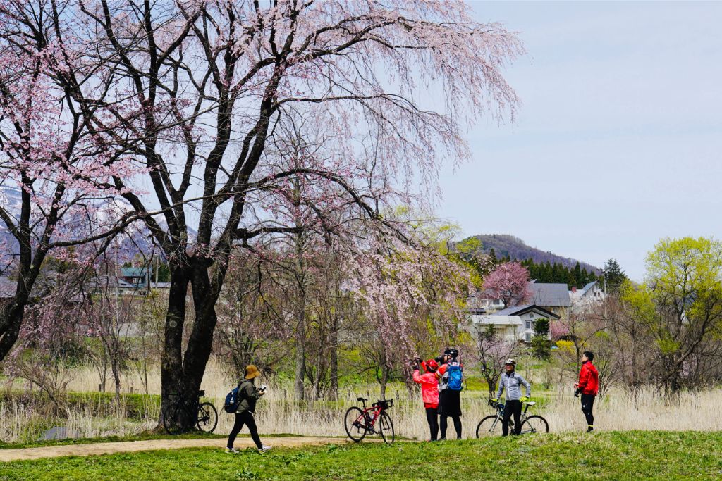
The single cherry tree in the Nodaira area attracts cameramen from all over Japan. It is breathtaking to see the cherry tree with the snow-capped Northern Alps in the background!
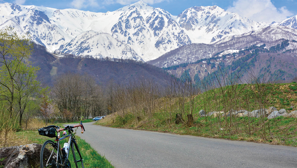
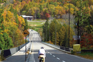
Matsukawa River Road is wide with few traffic, so it is easy to ride.
The magnificent Northern Alps spread out in front of you.
Matsukawa Bridge is a popular spot to take pictures, where you can see the magnificent and beautiful Northern Japan Alps.
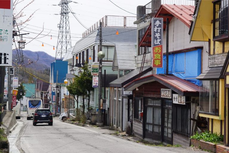
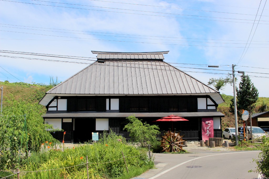
Tsugaike Kogen is a plateau in Otari Village, where the old-fashioned cityscape remains, and there are many places to eat and souvenir shops.
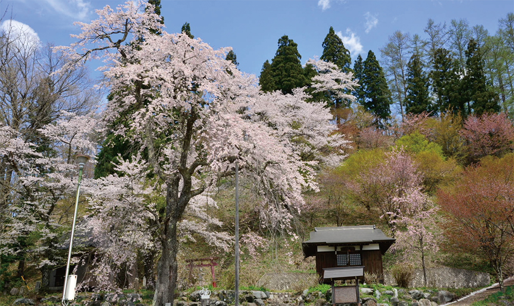
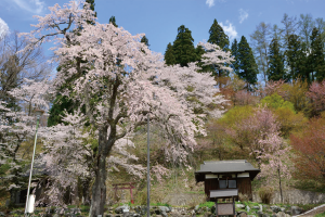
The weeping cherry at the foot of Mt Dengyo is called Tetsunen Cherry and is named after the man who planted it.
Oide Park is a park created in collaboration with local residents and Hakuba Village from 2002 to 5 years. From Observatory in the park, you can see the beautiful scenery of the Oide Suspension Bridge, the Northern Japan Alps, and the clear stream Hime River, which is a representative scenery of Hakuba Village!
You will enjoy cycling leisurely on beautiful roads. If you turn around, you can see the white mountains of the Alps.
