


![]()
![]()
![]()
![]()
![]()
![]()
![]()
![]()
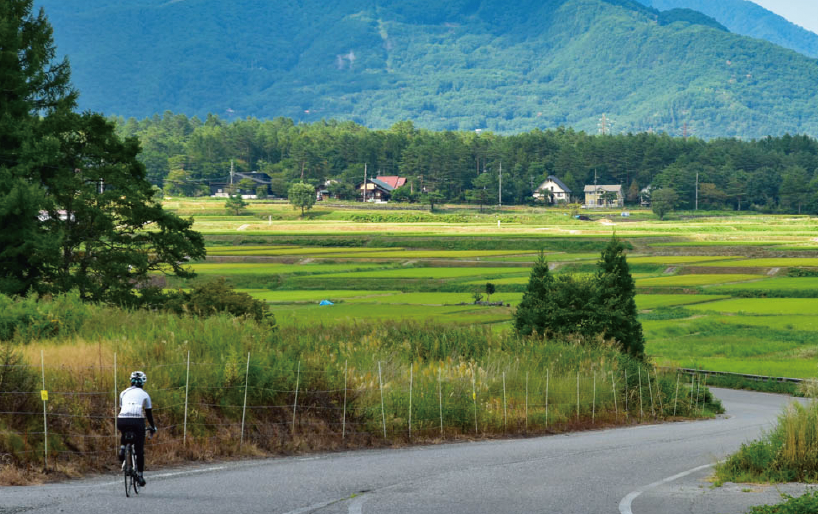
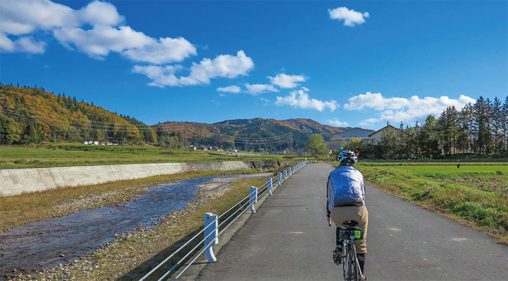
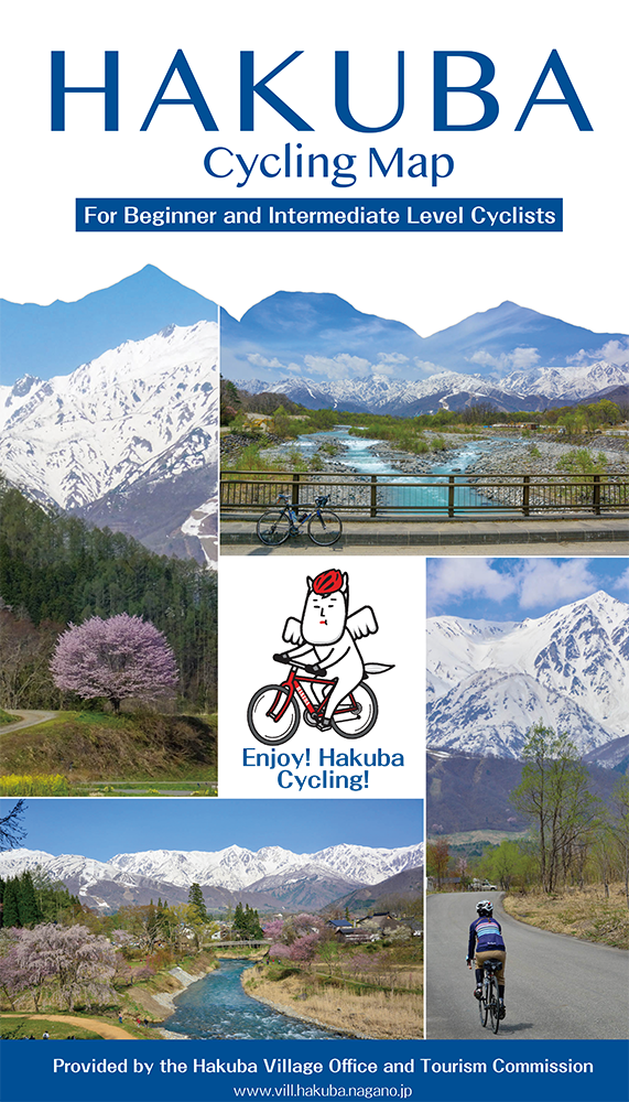
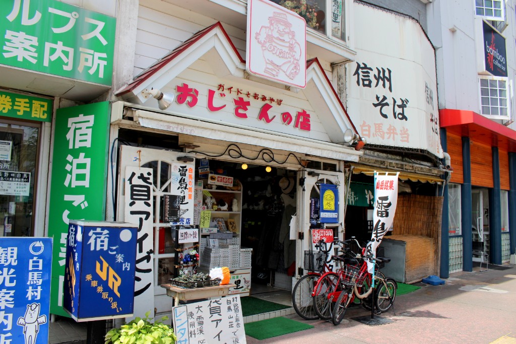
This route encompasses all of Hakuba’s most attractive sights and is suggested for beginner and intermediate level cyclists. As there are no sharp ascents, you won’t need to exert much energy while riding. If you start from JR Hakuba station, come across Hakuba Olympic Bridge. Then at Iimori Overpass, cross the national road and you will enter the Himekawa Cycling Road along the Hime river. With little traffic, it’s quite comfortable to ride along this stretch of road that goes through fields. There is more than enough to check out in the Sunsun Park Hakuba area as there are numerous stone monuments . At the Himekawa Genryu Shizen Tanshoen park, cross the national road and head back. Go along the narrow road in front of Minami Kamishiro station and you will find Teirinji Temple.
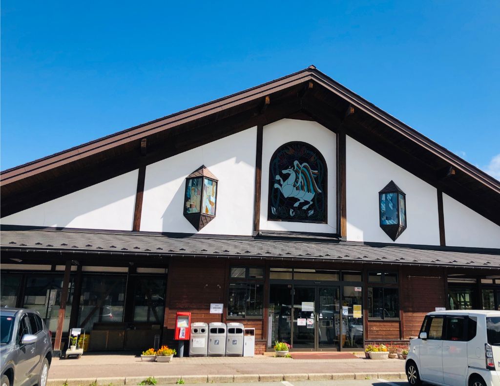
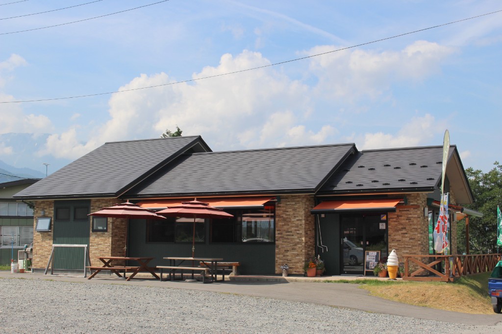
In this temple, you can enjoy Katakuri, or dog tooth violet, and cherry blossoms depending on the time of year. Then go back to the national road and take a break at Michino-eki Hakuba. Don’t miss a wide variety of Oyaki (Japanese dumpling with various fillings) and soft-serve ice cream with seasonal flavors. As the latter half of the course, ride along the Rinkan Route of Hakuba Goryu and head to the Hakuba Ski Jumping Stadium. Stroll
around the jump ramp and the downtown of Happo. From Hakuba Ohashi Bridge, slowly make your way down the Matsukawa River Road to get back to JR Hakuba Station.
This route encompasses all of Hakuba's most interesting sights and is considered for beginners and intermediate level cyclists. As there are no sharp ascents, you won't need to exert much energy while riding. If you start from JR Hakuba Station, come across Hakuba Olympic Bridge. Then at Iimori Overpass, cross the national road and you will enter the Himekawa Cycling Road along the Hime River. With little traffic, it's quite comfortable to ride along this stretch of road that goes through fields. THERE IS MORE THAN ENOUGH TO CHECK OUT IN THE SUNSUN PARK HAKUBA AREA AS THERE ARE WELL STONE ATTACHED. At the Himekawa Genryu Shizen Tanshoen Park, cross the national road and head back. Go along the narrow road in front of Minami Kamishiro Station and you will find Teirinji Temple. In this temple, you can enjoy Katakuri, or dog tooth violet, and cherry blossoms bloom on the time of year. Then go back to the national road and take a break at Michino-eki Hakuba. Don't miss a wide variety of Oyaki (Japanese dumpling with various fillings) and soft-serve ice cream with seasonal flavors. As the last half of the course, ride along the Rinkan Route of Hakuba Goryu and head to the Hakuba Ski Jumping Stadium. Stroll around the jump ramp and the downtown of Happo. From Hakuba Ohashi Bridge, slowly make your way down the Matsukawa River Road to get back to JR Hakuba Station. For Japanese. Japanese is here.
※オンラインの地図上でサイクリングルートが閲覧できるウェブサイト「ルートラボ」が2020年3月末でサービス終了したため、「bikemap」に変更したことで、bikemap内の距離や高低差に誤差が生じている場合がありますが、ご理解ご了承の程、よろしくお願いします。
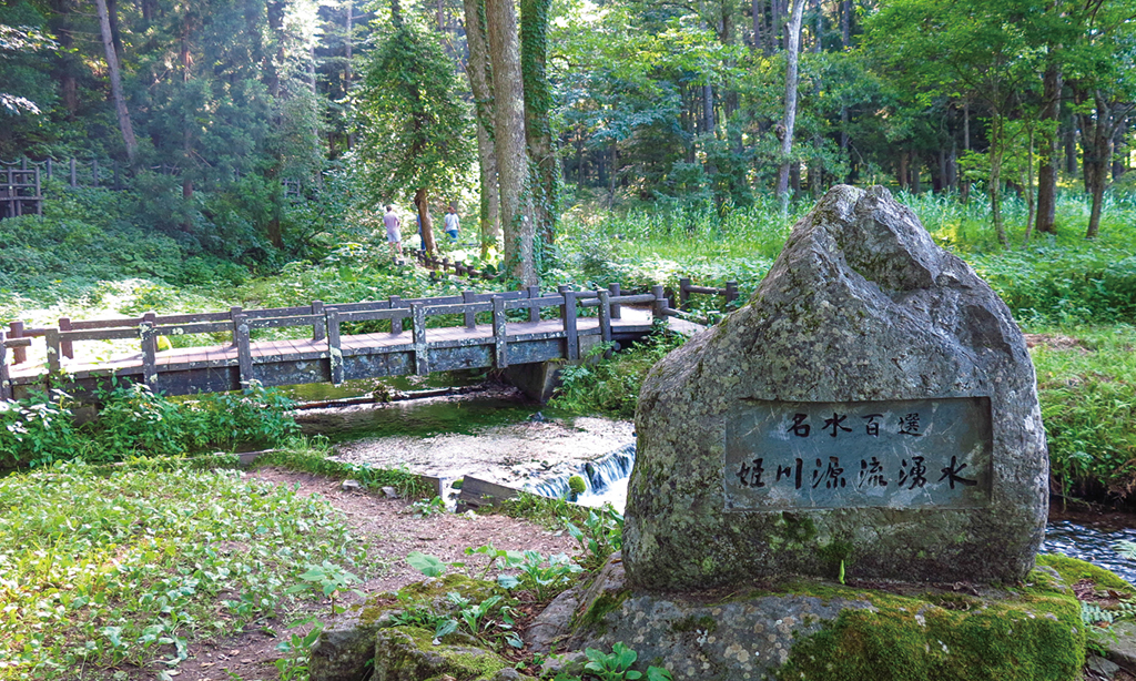
“Hime River Source” is a group of springs that is rarely located near national roads and private houses.
From the promenade, you can see a colony of Amur adonis, Baikamo (Ranunculus nipponensis), and Iwana(Chars) swimming in clean water up close.
“Oyomi Marsh” is a treasure trove of rare plants that you should definitely visit.
It is one of the 100 best waters in Japan, and bicycle riding is prohibited in the park.
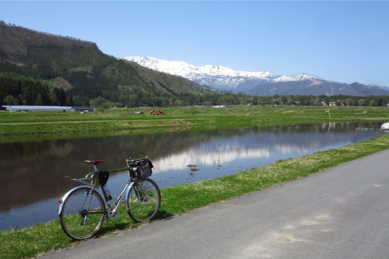
The Northern Japan Alps seen from Hakuba Olympic Bridge. The flowing water is beautiful.
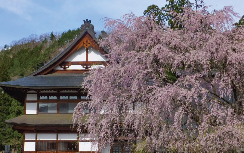
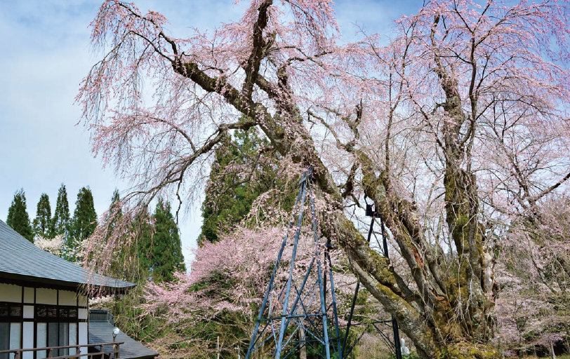
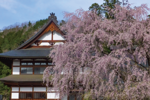
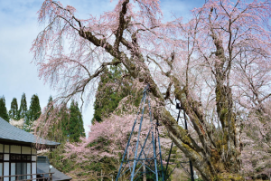
At Teirinji Temple, you can enjoy weeping cherry tree that is over 300 years old and flowers of dogtooth violet in spring.
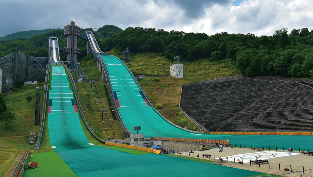
This is the Hakuba Ski Jumping Stadium that attracted attention from all over Japan at the Nagano Olympics.
The Olympic Gallery is located on the mezzanine floor of the Start Tower, where valuable materials and gold medals are displayed.
In addition, you can go up to the jumping platform by the observation elevator and experience the same scenery as the athletes.
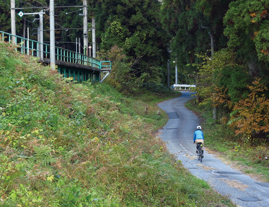
If you ride a bicycle in front of Minami-Kamishiro Station, avoiding the national highway, you can enjoy running in the woods, although the distance is short.
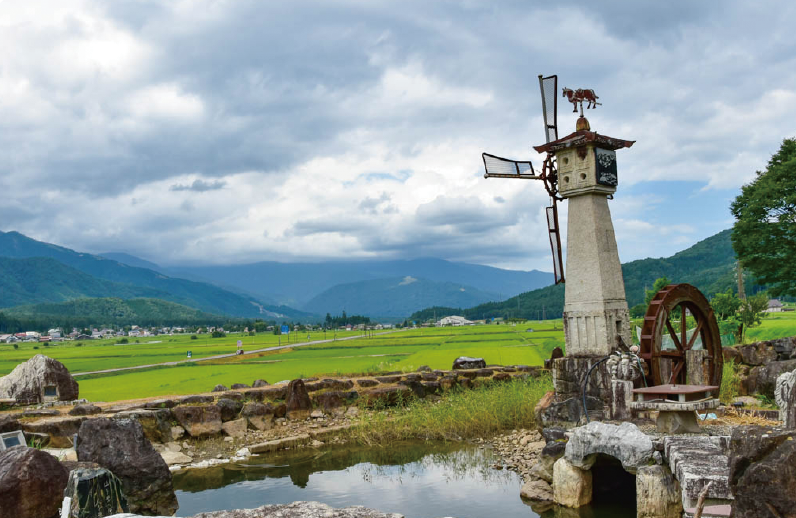
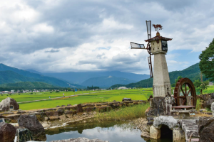
A stone windmill in the Olympic Memorial Stone Carving Park
Hime River has been designated as on of 100 Exquisite and Well- Conserved Waters, flows its source spring to Itoigawa City in Niigata Prefecture. This route takes you along part of the Himekawa Cycling Road, Which was constructed by Hakuba Village. As the track is quite wide with less traffic, riders can enjoy themselves there.
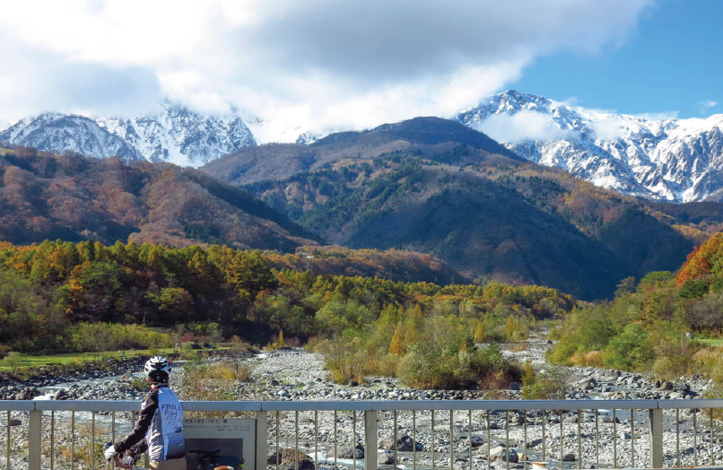
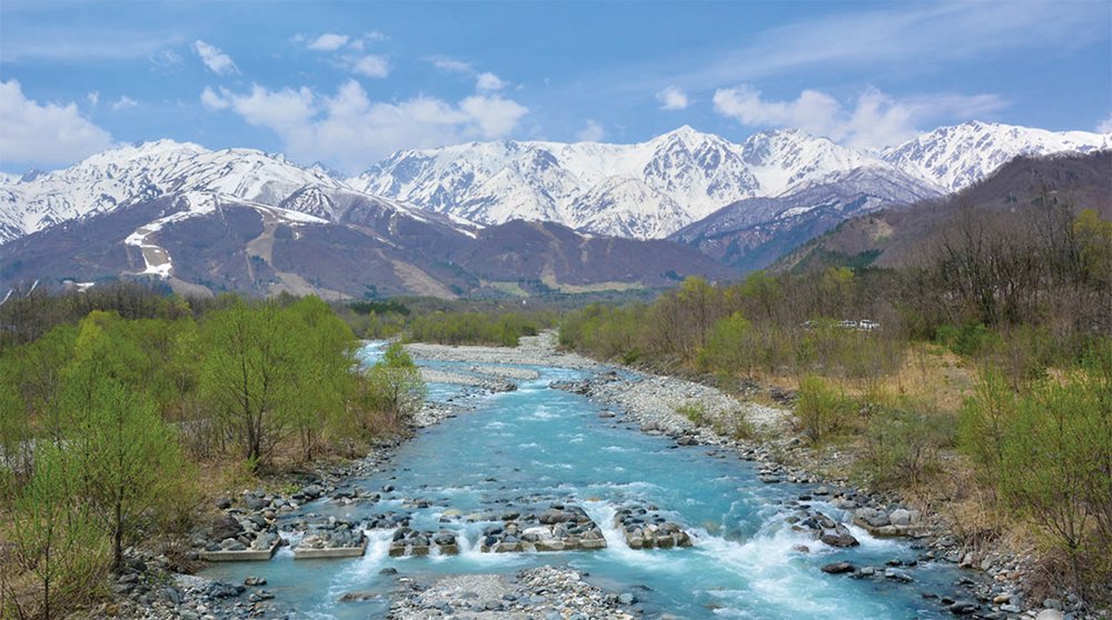
When viewing the Northern Japan Alps from the Hakuba Ohashi Bridge, you’ll witness overwhelming. pristine nature without any artificial objects or constructions.
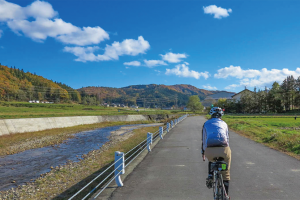
Matsukawa River Road is wide with few traffic, so it is easy to ride.
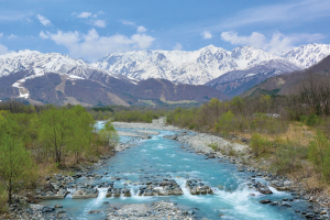
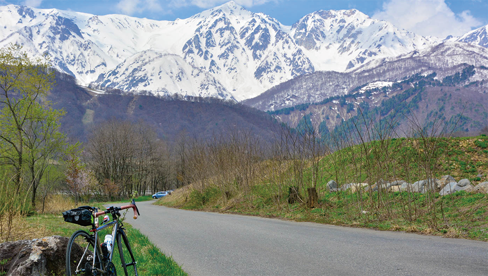
The magnificent Northern Alps spread out in front of you.
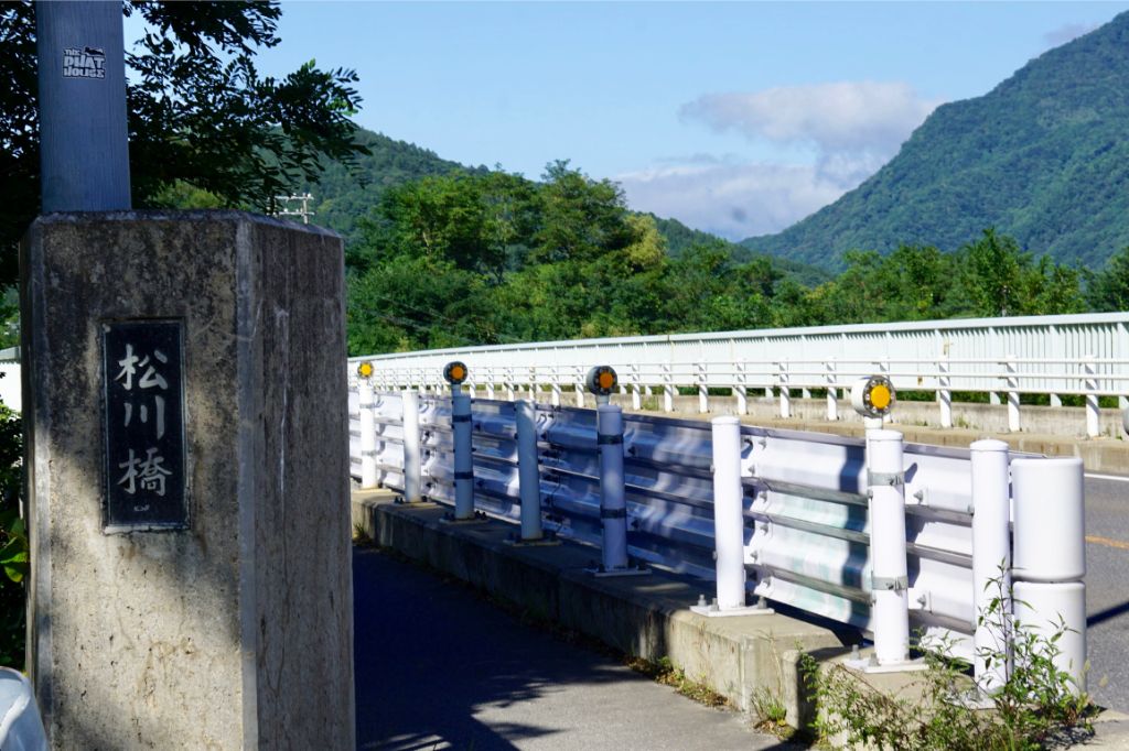
Matsukawa Bridge is a popular spot to take pictures, where you can see the magnificent and beautiful Northern Japan Alps.
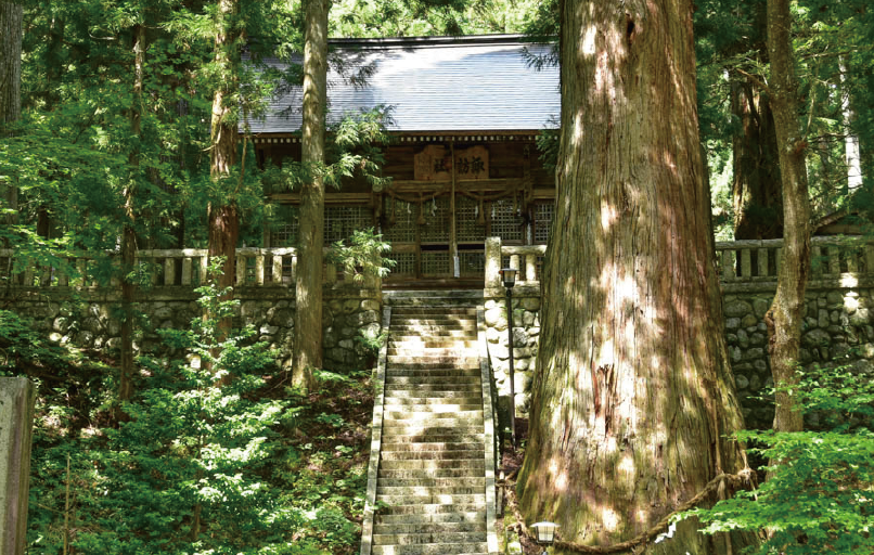
The big cedar in front of the main hall of Shimofurinomiya Hosono Suwa Shrine, which is estimates to be 1,000 years old, is 10 meters in diameter and 41 meters in heght.
You will find a secluded Torii gate in the back of the residential area. If you go up the steep gravel road, you will encounter the main shrine that is surrounded by cedar trees. Enshrined here is the Amaterasu Omikami deity, Which is supureme in Japanese myths.
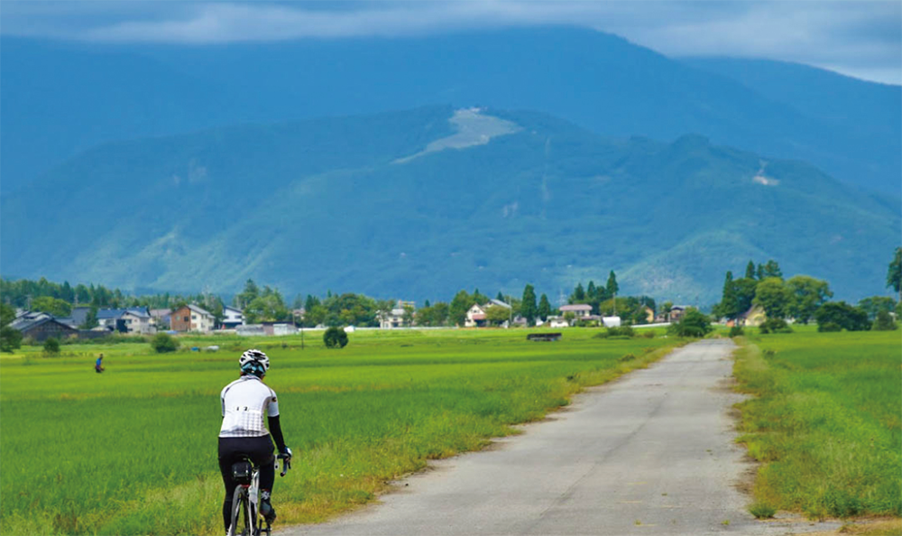
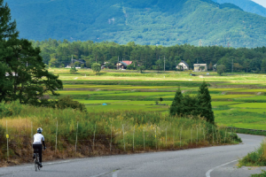
A straight road with a good view that runs straight through the fields.
A straight road with a good view that runs straight through the fields in Iimori.
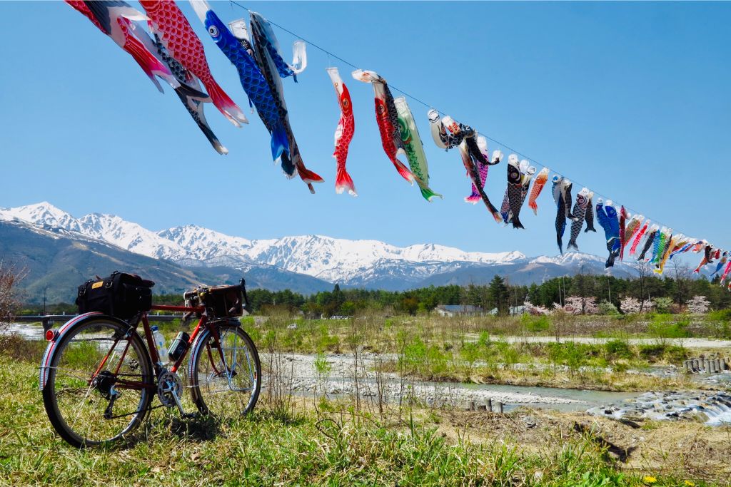
These are Koinobori(carp streamers)in Hirakawa River that can only be seen at this time of Golden Week(From late April to early May).
