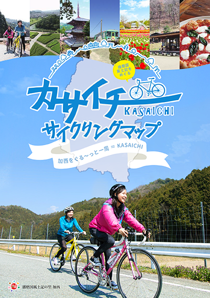
コース・マップ検索
加西三坂コース
距離 Distance:
38km
獲得標高 上り Elevation Gain (Up):
586m
獲得標高 下り Elevation Gain (Down):
596m
最大標高差 Maximum elevation difference:
268m
本格的なヒルクライムにチャレンジ!加西北部に広がる3つの峠を走破しよう
加西市の北部に広がる三つの坂(釜坂峠、船坂峠、遠坂峠)を走破するコース。
Take on the challenge of a full-scale hill climb! Let's run through the 3 mountain passes spread out in northern Kasai A course that runs through the three slopes (Kamasaka Pass, Funasaka Pass, and Tosaka Pass) spread out in the northern part of Kasai City . This is a course for advanced players who want to conquer the mountain pass and many people who visit it as training before the tournament with their goal. Warmed up on the hill on the way to Oaktown Kasai, first passed through "Kamasaka-toge" to Ichikawa-cho, then crossed "Funasaka-toge" into Taka-cho, and finally won "Tozaka-toge" and went back to Kasai City. You can also enjoy leisurely cycling while watching beautiful green mountains and clear streams running side by side with the course.
コース掲載マップ カサイチサイクリングマップ
オススメスポット ビュースポット いきもの・植物 グルメ ショッピング 道の駅 温泉 宿泊 病院 レンタサイクル 自転車販売店 サイクリングサポート トイレ その他
※オンラインの地図上でサイクリングルートが閲覧できるウェブサイト「ルートラボ」が2020年3月末でサービス終了したため、「bikemap」に変更したことで、bikemap内の距離や高低差に誤差が生じている場合がありますが、ご理解ご了承の程、よろしくお願いします。
コース周辺スポット
全て
オススメスポット
グルメ
温泉
宿泊
レンタサイクル
自転車販売店
トイレ
その他
で絞り込む
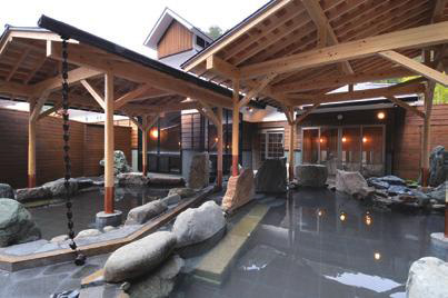
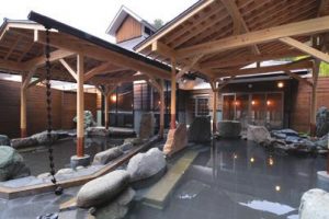
かさがた温泉せせらぎの湯
住所:兵庫県神崎郡市川町上牛尾半瀬2073-12
TEL:0790-27-1919
営業時間:
[ふところ館] 10:00~20:00(受付は19:00まで)
定休日:
毎月第1月曜日はメンテナンスのため場内全店休館(祝日の場合は営業)
料金:[ふところ館 入浴料] 大人(中学生以上) 700円 ※入湯税50円を含む、小人(5才~小学生) 300円
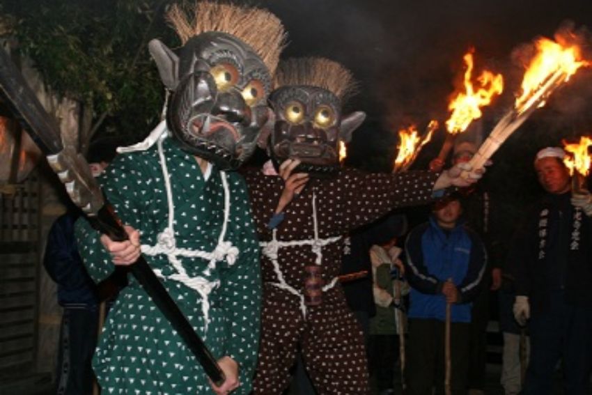
東光寺
毎年1月8日の夜、鬼会の儀式が行われる。(国の重要無形民俗文化財)
住所:兵庫県加西市上万願寺町392
TEL:0790-42-8823(観光案内所)
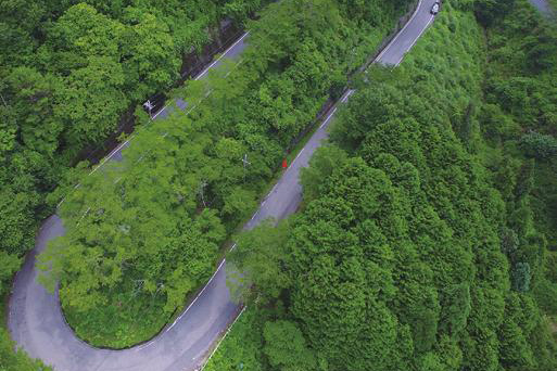
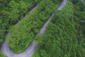
釜坂峠
農家レストラン 土一七日屋台(どいなかやたい)
住所:兵庫県加西市上万願寺町120
TEL:0790-44-0150
営業時間:
10:30~15:00
定休日:
水曜日
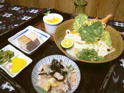
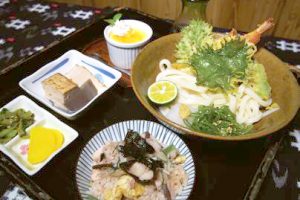
さたに食道
住所:兵庫県加西市佐谷町209
TEL:0790-44-1571
営業時間:
毎週火・水・木、毎月第1・第3土・日曜の 8:30~(L.O. 12:00)
定休日:
上記営業日以外
石部神社
住所:兵庫県加西市上野町69-2
TEL:0790-44-0046
うどん処 こはる蔵
住所:兵庫県加西市殿原町154-1
TEL:0790-44-2780
営業時間:
11:30~14:00 / 17:00~21:00
定休日:
木曜日
イオンサイクルショップ 加西北条店
住所:加西市北条町北条308-1(イオンモール加西北条)
TEL:0790-45-3500
営業時間:
9:00~23:00
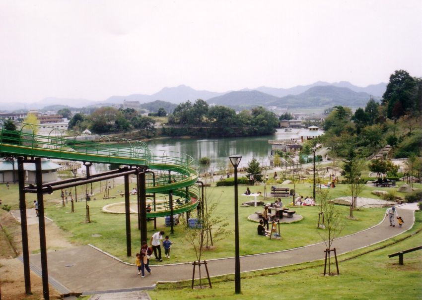
丸山総合公園
住所:兵庫県加西市北条町西高室
TEL:0790-35-8872
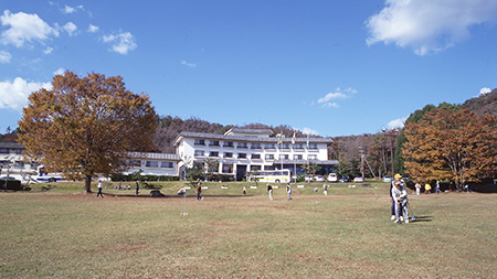
いこいの村はりま
住所:兵庫県加西市笹倉町823-1
TEL:0790-44-1750
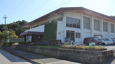
加西市勤労者体育センター
住所:兵庫県加西市玉野町1124
TEL:0790-47-1420
営業時間:
[レンタサイクル] 9:00~16:00
定休日:
水曜日
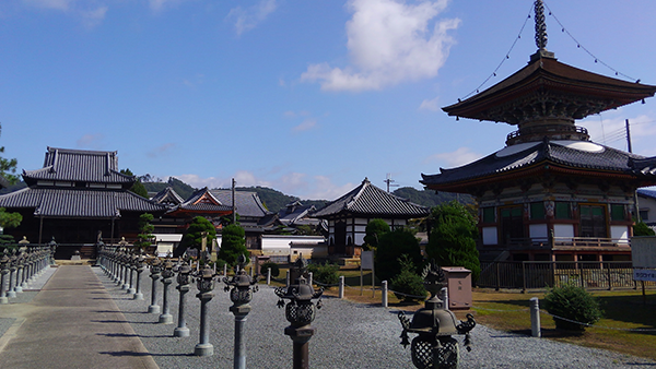
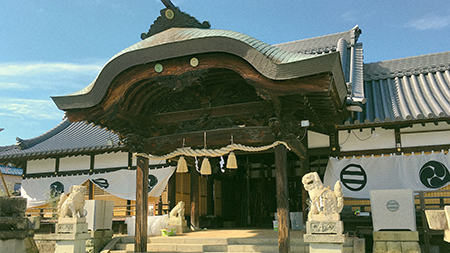
酒見寺(さがみじ)
住所:兵庫県加西市北条町北条1319
TEL:0790-42-0145
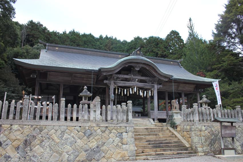
住吉神社
住所:兵庫県加西市北条町北条1318
TEL:0790-42-0423
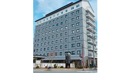
ホテルルートイン加西 北条の宿(ほうじょうのしゅく)
住所:兵庫県加西市北条町栗田7-7
TEL:050-5576-8100
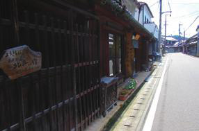
北条の宿(ほうじょうのしゅく)
創建約1300年の住吉神社や酒見寺の門前町、市場町を起源に江戸時代から在郷町として発展した町並み。
住所:兵庫県加西市北条町北条
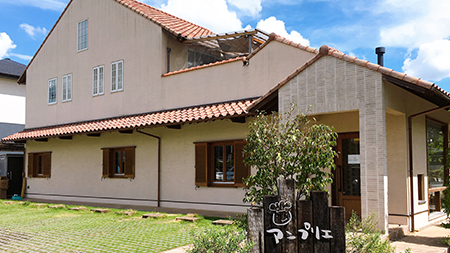
アンプリエ mishima
住所:兵庫県加西市北条町横尾1022-2
TEL:0790-43-8510
営業時間:
10:00〜19:30
定休日:
月曜日
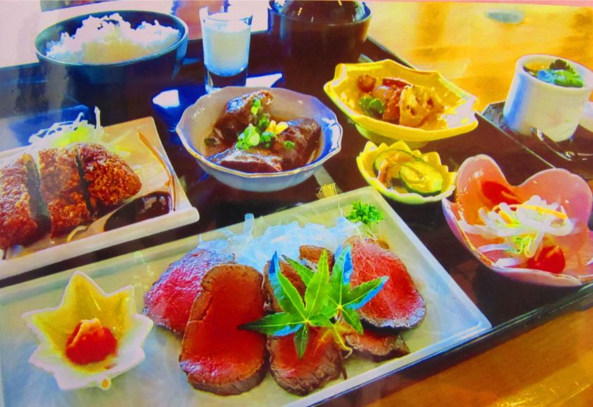
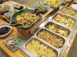
えぇもん王国
「安心な地元・加西のお米、朝獲り新鮮野菜や卵を使った手作りごはん」をテーマにした食事処「えぇもん王国」では、モーニング、ランチを楽しめる。加西市を中心とした「播磨のえぇもん」が大集結の農家直売所コーナーも要チェック。11時30分からスタートのランチバイキングには、オープン時間前にお客様が集まる人気ぶり。
住所:兵庫県加西市北条町横尾473-1
TEL:0790-42-1982
営業時間:
[モーニング] 8:30~11:00
定休日:
無休
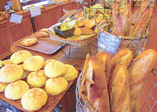
フレッシュベーカリー グリム
住所:兵庫県加西市北条町横尾463-1
TEL:0790-43-0811
営業時間:
[平日] 7:00~19:30 / [土日祝] 6:30~19:30
定休日:
水曜日
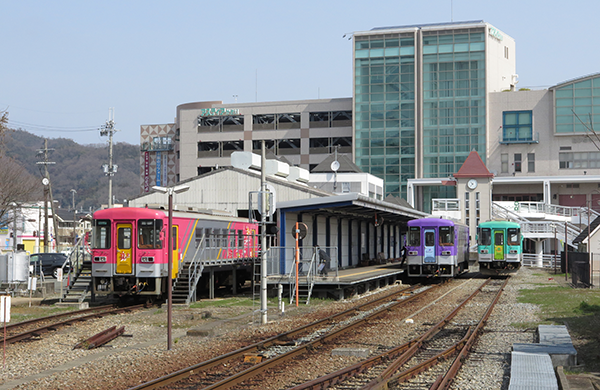
加西市観光案内所(北条町駅)
住所:兵庫県加西市北条町北条28-2
TEL:0790-42-8823
営業時間:
[観光案内] 8:30~17:30
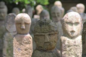
五百羅漢石仏
江戸時代初期に仏像が作られ、石仏は元々羅漢寺の南にある酒見寺にあり、寺の再興に伴う寺内整備や信仰・供養のために造立されたと考えられています。県指定文化財。
住所:兵庫県加西市北条町北条1293
TEL:0790-43-0580
営業時間:
9:00~17:00
定休日:
無休
料金:拝観料 200円
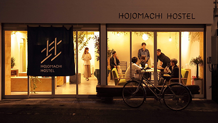
ゲストハウス HOJO MACHI HOSTEL
住所:兵庫県加西市北条町北条1098-15
TEL:0790-35-9216
なごみの里 山都
住所:兵庫県多可町八千代区大和1520-1
TEL:0795-38-0753
村岡自転車商会
住所:兵庫県加西市殿原町411-1
TEL:0790-44-0245
カーショップ タカハシ
住所:兵庫県加西市北条町西高室590-21
TEL:0790-42-2627
営業時間:
[平日] 9:00~20:00 / [日・祝]9:00~19:00
定休日:
木曜日
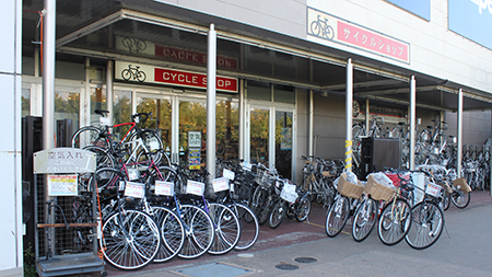
アリタサイクル
住所:兵庫県加西市北条町7-10
TEL:0790-42-0477
衣笠モーターサイクル
住所:兵庫県加西市北条町1060
TEL:0790-42-0401