


![]()
![]()
![]()
![]()
![]()
![]()
![]()
![]()
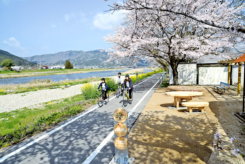

旭川に沿って勝山・久世・落合の地域を結ぶみちは、流域の自然と歴史を生かし、特別な日もふだんにも、地域のみんなで楽しんで使う、町の暮らしの今とこれからを豊かにするみんなの「かわのみち」です。「自転車」を「人に優しいモビリティー」として位置づけ、歩く人、ベビーカーや車椅子、乗り物に乗る人を含めて、川の魅力を楽しみながら行き交う、まちの新しい人の流れをつくるみちです。
The road that connects the Katsuyama, Kuze, and Ochiai regions along Asahikawa is everyone's “Kawamichi” that makes use of the nature and history of the watershed, is enjoyed and used by everyone in the community on special days, and enriches the present and future of the town's life. “Bicycles” are positioned as “human-friendly mobility,” and it is a path that creates a new flow of people in the town, including people walking, people riding strollers, wheelchairs, and vehicles while enjoying the appeal of the river.
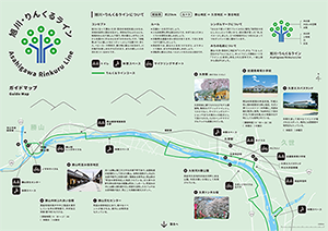
※オンラインの地図上でサイクリングルートが閲覧できるウェブサイト「ルートラボ」が2020年3月末でサービス終了したため、「bikemap」に変更したことで、bikemap内の距離や高低差に誤差が生じている場合がありますが、ご理解ご了承の程、よろしくお願いします。
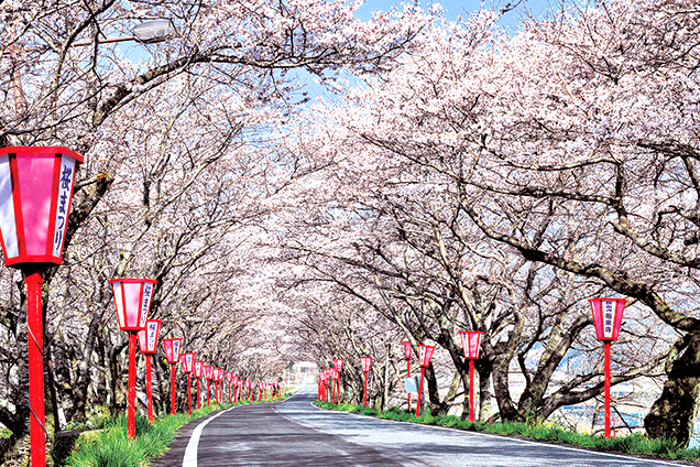
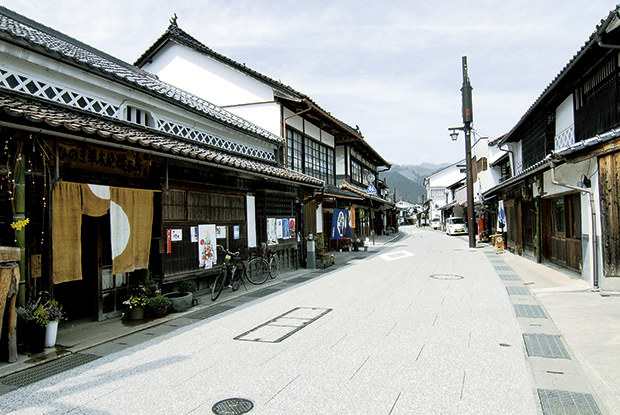
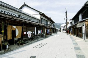
古くは勝山藩二万三千石の城下町であり、出雲街道の宿場町として栄えた勝山。当時の面影がしのばれる連子格子に白壁の続く情緒ある景色は、岡山県の「町並み保存地区」に指定されている。また家々の軒を飾る草木染の暖簾は町おこしの一つ。町並みの中には郷土資料館や古い民家を活用したカフェやお土産物屋が並び、見どころ満載の観光スポット。
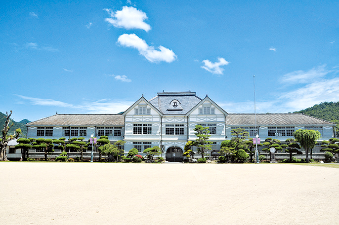
明治40年建築の木造校舎。平成11年に国の重要文化財に指定。モダン漂うシンメトリーの外観に、内部は檜を贅沢に使用。「ALWAYS三丁目の夕日」「火垂るの墓」など映画のロケ地としても使用されている。
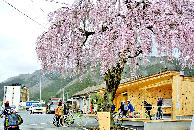
久世駅前に建てられたCLTモデル建築物。駅前のパブリックトイレとしてだけでなく、サイクリングステーションやまちの賑わいの起点として設けられた。CLTのベンチやサイクルラックも設置されている。
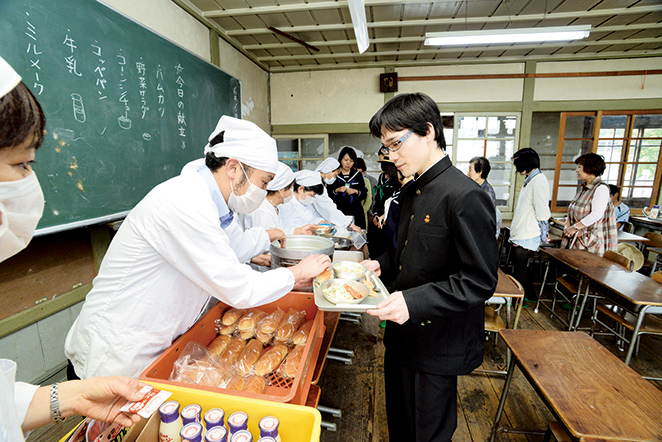
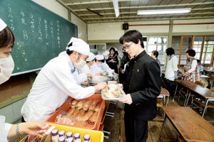
国指定重要文化財の旧遷喬尋常小学校内でなつかしい学校給食が楽しめる。要予約。申し込みは4日前まで。
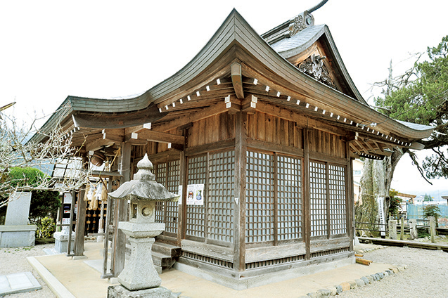
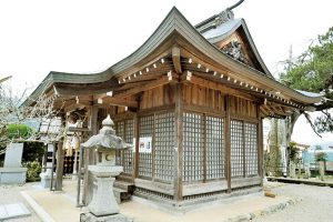
学問の神様、菅原道真公を祀る社。学業成就、子授け、安産の信仰が篤く、合格祈願祭には市内外から多くの参拝者が訪れている。御神木である伊吹ひばの木は推定樹齢が1000年の古木。県指定の文化財となっている。
町並み保存地区にあり、様々なイベントが催される。館内には喫茶店も入っている。
真庭地域の銘木や木工製品を展示している木の博物館で、木材加工体験(要予約)もできる。
