


![]()
![]()
![]()
![]()
![]()
![]()
![]()
![]()
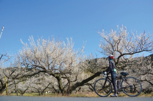


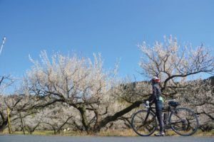

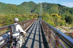
越生駅をスタートしてすぐに関東三大梅林で有名な越生梅林のあるエリアに入る。多くの梅がある中を抜けて、短いが峠道の雰囲気を味わえる松郷峠を越えると小川町、東秩父村となり、槻川に沿った県道を気持ちよく走って行ける。やや上り基調のピークの小谷野田峠を下ると荒川に出る。波久礼駅からは交通量が少ない県道82号線を辿り、長瀞へ。岩畳や荒川の雰囲気、軒を連ねるみやげもの店を見物した後はのどかな風景を楽しみながら秩父を目指そう。
As soon as you start Ogose Station, you will enter the area where the Ogose Plum Grove, famous for the three major plum groves in the Kanto region, is located. Passing through the middle where there are many plums, and crossing Matsugo-toge Pass, where you can enjoy the atmosphere of a mountain pass, it becomes Ogawa Town and Higashichichibu Village, and you can comfortably run along the prefectural road along the Tsukikawa River. If you go down Koyanoda Pass, which has a slightly upward trend peak, you will reach Arakawa River. From Hagure Station, follow Prefectural Route 82, where there is little traffic, to Nagatoro. After seeing the rocky pavement, the atmosphere of Arakawa River, and the many souvenir shops, let's head to Chichibu while enjoying the peaceful scenery.
埼玉県の西武、山、川、湖と自然の風景タップリの奥武蔵。山岳地帯には縦横無尽に繋がる林道、そして数え切れない程の峠があり、脚力や季節の風景に合わせたルートバリエーションは豊富に選ぶことが出来る。また、サイクリスト歓迎のお店も多くグルメライドとしても楽しめ、ビギナーからベテランまで満足の出来るエリアである。電車、車ともにアクセスがよく、毎週のように通うサイクルストも多い。
マップ詳細へ※オンラインの地図上でサイクリングルートが閲覧できるウェブサイト「ルートラボ」が2020年3月末でサービス終了したため、「bikemap」に変更したことで、bikemap内の距離や高低差に誤差が生じている場合がありますが、ご理解ご了承の程、よろしくお願いします。
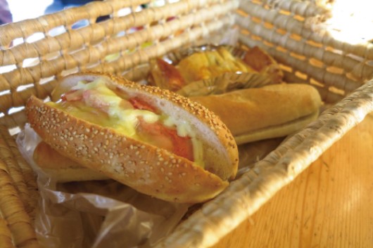
サイクリストには「聖地」のようなパン屋さん。常時35種類の惣菜パンを提供している。この店も自転車漫画に紹介され、遠くからサイクリストが集まる。
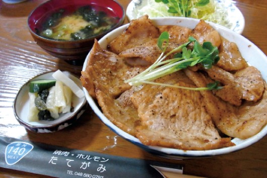
波久礼駅の真横にある店。焼肉屋だが、ランチで食べられる「炭焼き豚丼」がオススメ! サイズは小・並・大と揃っているのが嬉しい。特製みそダレが食欲をそそる!
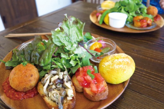
2017年にオープンしたオシャレなカフェ。オーナー夫婦も自転車に乗るの
でサイクリスト歓迎の店だ。料理はどれも美味しい! 隠れ家的お店。
越生梅林は関東三大梅林の1つ。太宰府より天満宮を分祀する際に梅を植えたのが起源とされる。梅林では毎年2 〜3月に「梅まつり」が行われ、多くの観光客で賑わう。越生梅林の外にも梅が植えられており、町全体が梅の香りにつつまれる。
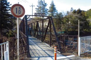
西平交差点には小さなトラス式鉄橋がある。橋には大正14年に竣工と記載されており、日本の近代土木遺産に選定されている。現在でも渡ることができるので立ち寄ってみよう。
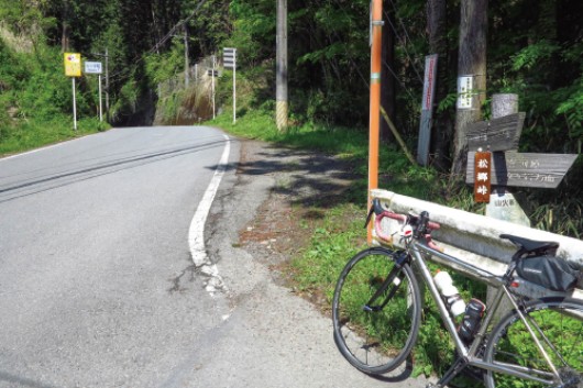
ときがわ町と小川町を結ぶ県道にある峠。自転車漫画にも登場したので、
聖地的に訪れる人も多い。傾斜が比較的緩やかで、坂道に慣れて無くても大丈夫!
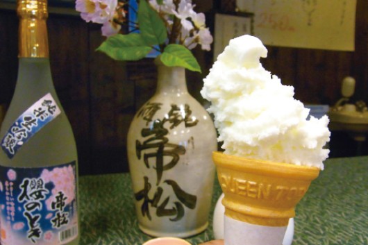
小川町の名門地酒蔵「帝松」では、大吟醸ソフトクリームを食べられる。ノンアルコールなので自転車でも安心だ。
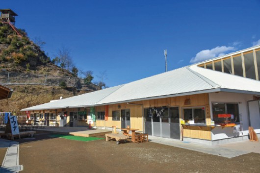
2016年にオープンした比較的新しい道の駅。ユネスコ無形文化遺産にも登録された「細川紙」の体験コーナーやフードコートがあり、地元のグルメを味わえる。
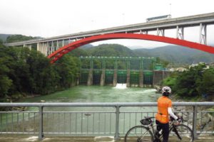
幅100メートルほどの荒川を堰き止めたダム。折原橋から眺めると緑色の6門の巨大なローラーゲートと、皆野寄居(みなのよりい)バイパスの赤い橋脚とのコントラストが美しい。
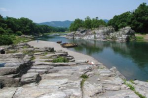
に見えるので岩畳と呼ばれ、国の名勝・天然記念物に指定されている。この隆起した岩は関東から九州まで貫く中央構造線の一部といわている。ライン下りやカヌー・ラフティングも楽しめる。
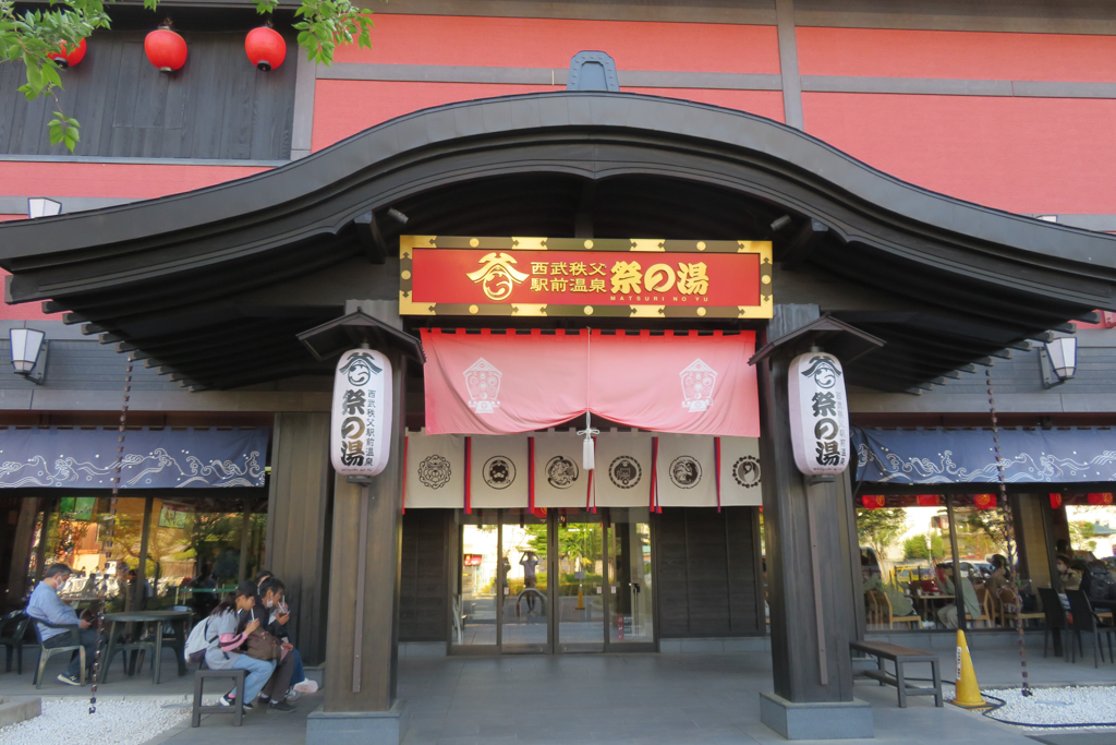
“祭”をコンセプトにした複合型温泉施設。4つの露天風呂と高濃度人工炭酸泉などの豊富な種類が自慢の温泉エリアや、秩父グルメが楽しめるフードコート、秩父の特産品が並ぶ物販エリアもある。
