


![]()
![]()
![]()
![]()
![]()
![]()
![]()
![]()


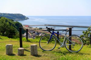

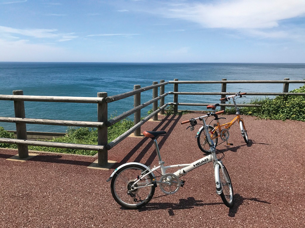
旧国鉄北陸本線の線路跡地を利用した、国道8号に沿って走る自転車と歩行者の専用道路です。
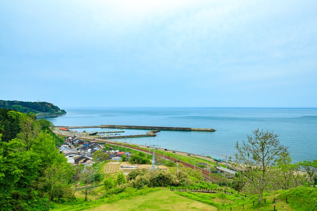
海沿いを走るルートからは、日本海の美しい風景を楽しむことができ、条件が良ければ佐渡島や能登半島も望むことができます。
途中、海の幸などの食を満喫できるスポットがあり、ライドとグルメを同時に楽しめるコースです。
It is a dedicated road for bicycles and pedestrians running along National Route 8, using the former JNR Hokuriku Main Line track site.
From the route that runs along the sea, you can enjoy the beautiful scenery of the Sea of Japan, and if conditions are good, you can also see Sado Island and the Noto Peninsula.
Along the way, there are spots where you can enjoy food such as seafood, etc., and this is a course where you can enjoy riding and gourmet food at the same time.
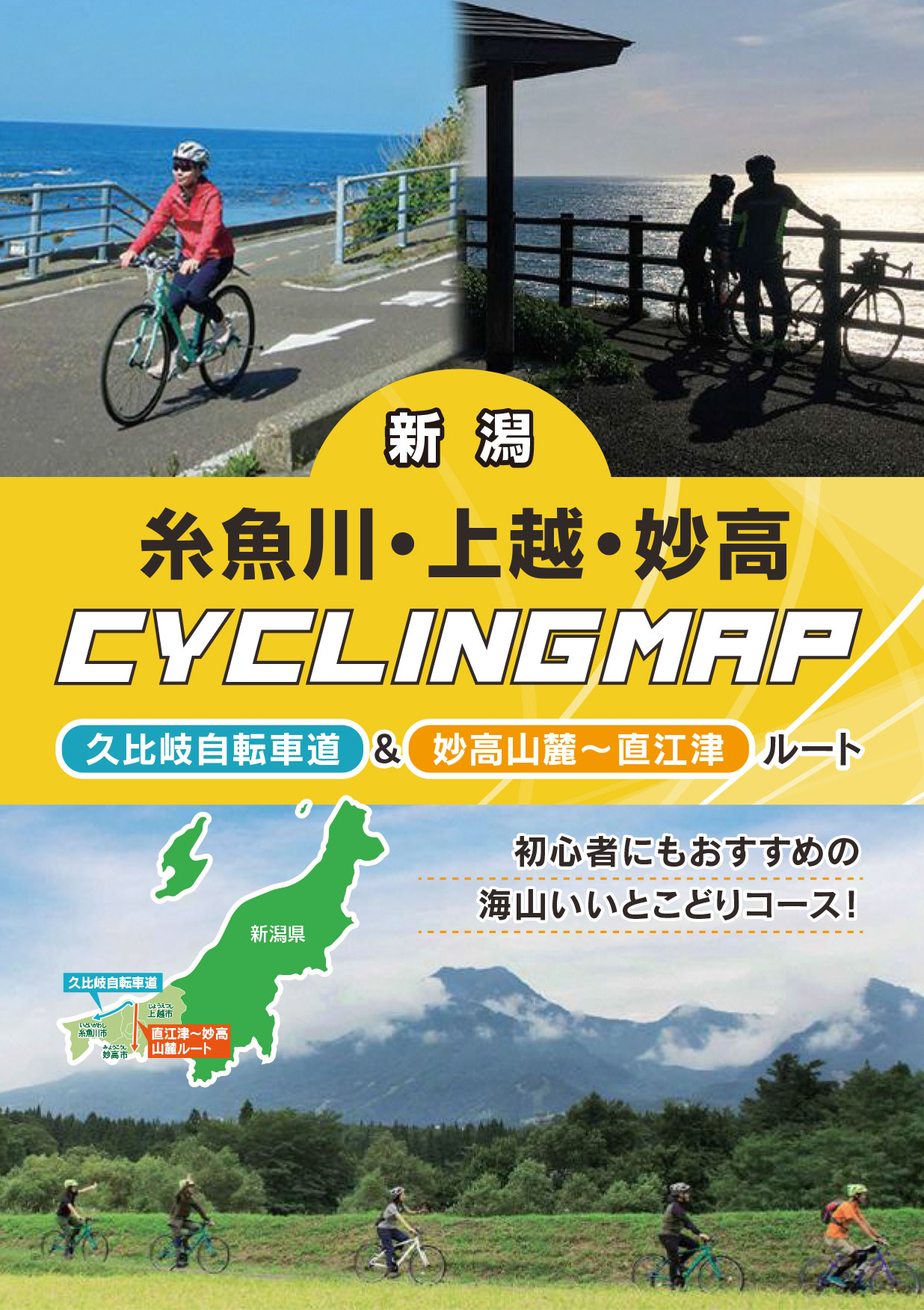
初心者にもおすすめの海山いいとこどりコース!
マップ詳細へ※オンラインの地図上でサイクリングルートが閲覧できるウェブサイト「ルートラボ」が2020年3月末でサービス終了したため、「bikemap」に変更したことで、bikemap内の距離や高低差に誤差が生じている場合がありますが、ご理解ご了承の程、よろしくお願いします。
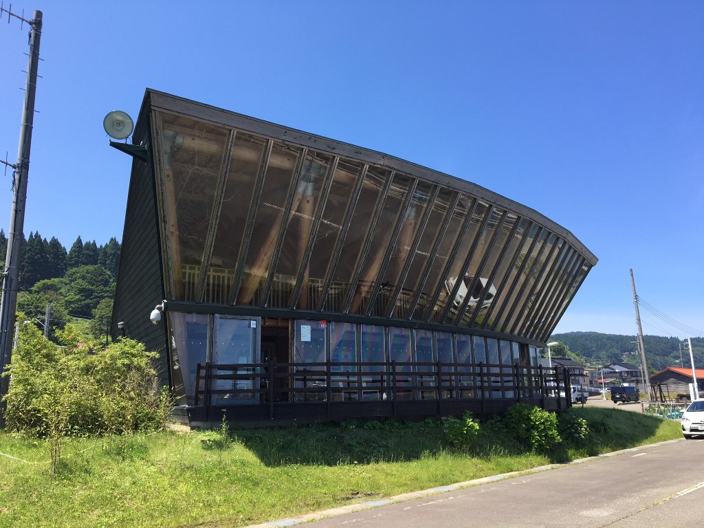
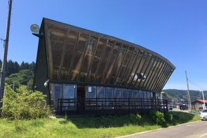
有間川漁港の休憩施設。独特のデザインの建物が特徴です。
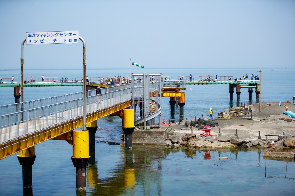
釣竿の貸し出しがあり、気軽に海釣りが楽しめます。
日本海が一望できる公園。市内最大の大型複合遊具、小型複合遊具、ロープウェイ、ブランコ、シーソー、スプリング遊具やバーベキューエリアが設置されています。
また、無料で利用できる県内最大級のドッグランもあります。
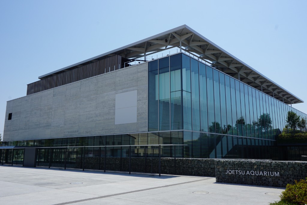
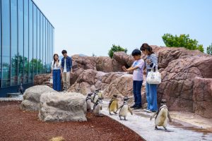
平成30年6月26日、水族館「うみがたり」が誕生。雄大な日本海を一望できる最上階は、新しい絶景スポットです。また、バンドウイルカたちの身体能力がいかんなく発揮されるパフォーマンスを見ることができるほか、愛らしい仕草が人気のシロイルカにも出会えます。上越沖の海底地形を再現し、自然の光が差込む大水槽には、大小様々な魚たちがくらしていて、訪れた季節や天候によって新しい発見があるはず。360度足元まで透明なアクリルガラスのトンネルでは、海の中を歩いているような体験ができます。保育数世界一を誇るマゼランペンギンのエリアは、野生種の一大繁殖地であるアルゼンチン共和国の自然環境を再現し、約120羽のペンギンたちを圧倒的な近さで楽しむことができます。よちよち歩く姿は可愛くて目がはなせません。
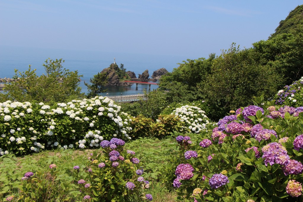
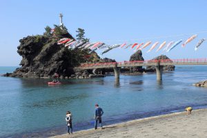
大きな岩礁に紅い曙橋が架かり、島を装う松の緑と白い灯台が日本海と大空に映える絶景スポット。
日本海の雄大な水平線を海から眺めることができます。全国でも珍しい、海の神様を祀る厳島神社にお参りをして、「恋する灯台」の夕焼けを大切な人と眺めよう!
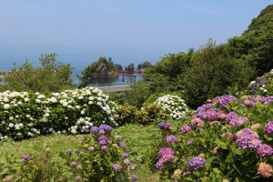
約1000㎡の園内に約1200株35種類のアジサイが植えられています。色とりどりの花の向こうに、弁天岩と日本海を見わたす絶好のロケーション!6月中旬が見頃。
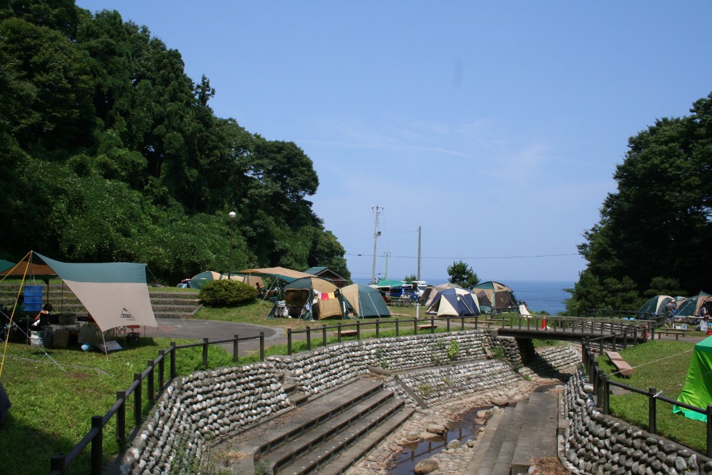
日本海が見えるキャンプ場。緑の立木に囲まれ、28区画のテントサイト、炊事棟、ファイヤーサークル完備。キャンプツーリングにオススメ!6月頃には蛍に出会えるかも。
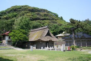
本殿は室町時代の特色を残す国指定重要文化財。社叢となる尾山とその森に生息するヒメハルゼミが、国天然記念物に指定されています。
毎年4月24日の春季大祭には、国指定重要無形文化財の舞楽が奉納されます。
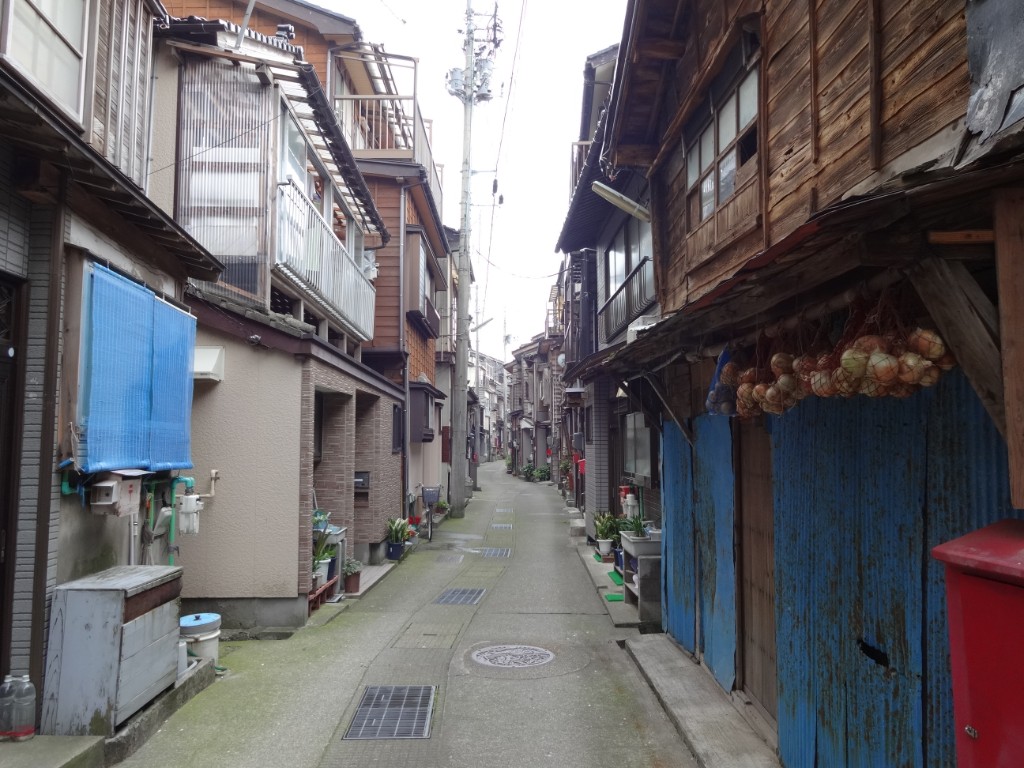
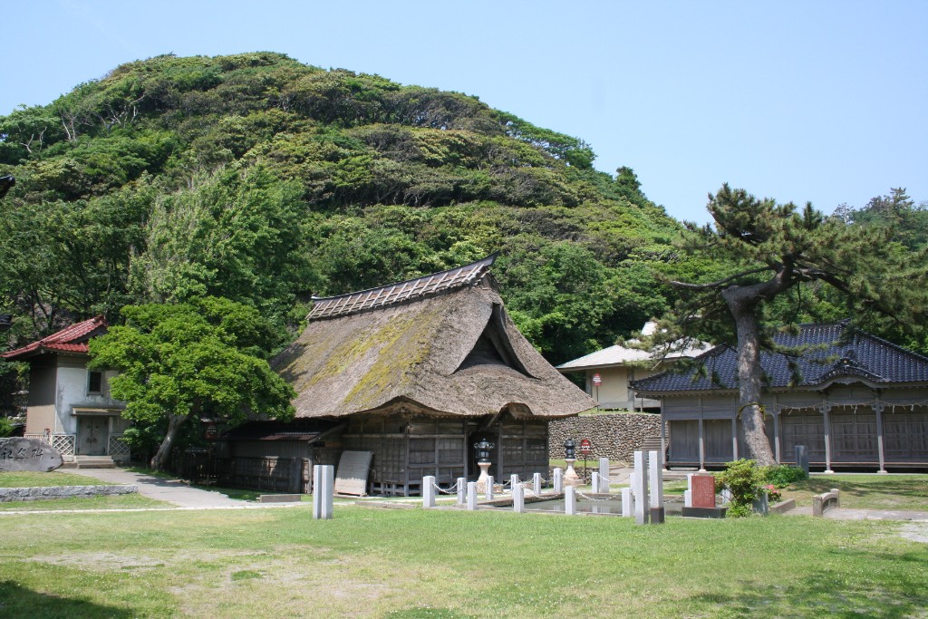
古くから漁業が盛んな筒石地区。山々と海岸線の間のわずかな平地に家があるため、木造家屋の多くは間口が狭く、3階建ての住宅が続きます。昔は壁を隣の家と共有していました。
漁港に隣接 海の幸ならおまかせ
鮮魚市場から宿泊施設までそろう
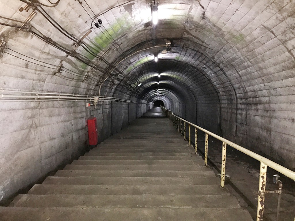
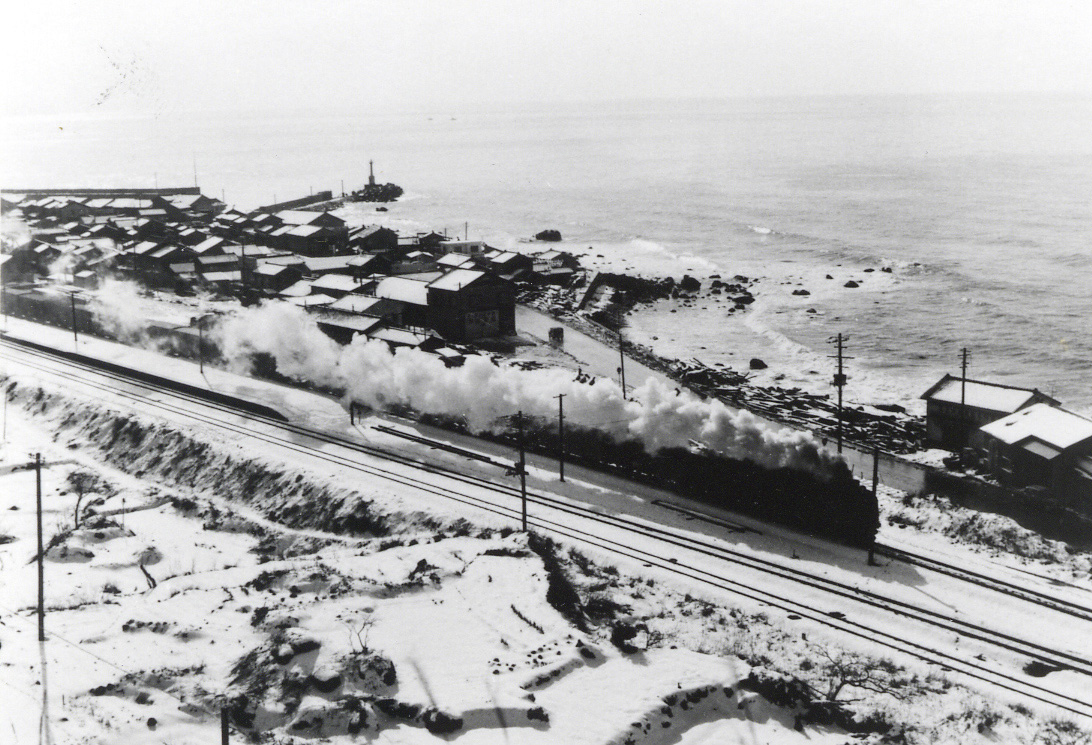
えちごトキめき鉄道 日本海ひすいラインは現在、海岸線から離れた場所を通っていますが、昔は海岸の近くに線路がありました。久比岐自転車道はその路線跡地を利用しています。
久比岐自転車道にあるトンネルや橋の一部には当時のままのレンガが使われていて、そのおもかげを感じることができます。また、その頃は電車ではなく蒸気機関車(SL)が走っていました。SLが走っていることを想像して走るのも面白いかもしれません。
