


![]()
![]()
![]()
![]()
![]()
![]()
![]()
![]()
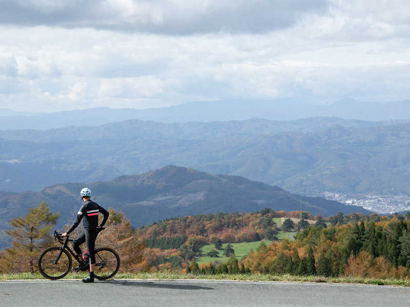
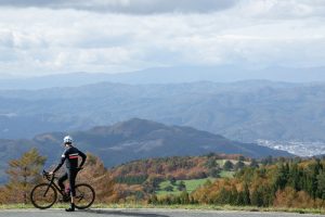
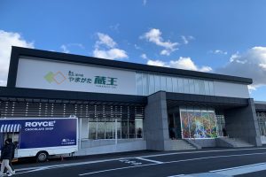
令和5年12月にオープンしたばかりの道の駅「やまがた蔵王」を主な発着点として、蔵王温泉街まで登って下るルート(約33km)に加え、途中から宮城県境までの「蔵王エコーライン」を登るルート(約14km)です。
標高差は約1,400mにもなります。坂道とカーブの連続で、時間を競って!獲得標高を競って!とまさに上級者好みのヒルクライムルートです。
ですが、素人の方でも電動自転車を使えば安心して登ることが出来ますし、ルート沿線の休憩施設で休みながらゆっくりと楽しむこともできます。
With the roadside station “Yamagata Zao,” which just opened in December 2020, as the main departure and arrival point, it is a route (about 14 km) that climbs and descends to the Zao Onsen district, as well as a route (about 14 km) that climbs the “Zao Echo Line” from the middle to the Miyagi prefectural border.
The elevation difference is approximately 1,400m. Race for time on a series of slopes and curves! Compete for elevation! It really is a hill climb route that advanced riders like.
However, even amateurs can climb with peace of mind if they use an electric bicycle, and they can also enjoy leisurely while resting at rest facilities along the route.
※オンラインの地図上でサイクリングルートが閲覧できるウェブサイト「ルートラボ」が2020年3月末でサービス終了したため、「bikemap」に変更したことで、bikemap内の距離や高低差に誤差が生じている場合がありますが、ご理解ご了承の程、よろしくお願いします。
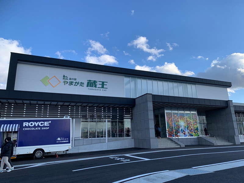
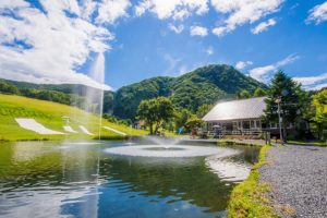
東北屈指の観光地である「蔵王」の登り口に位置する、道の駅「やまがた蔵王」。山形のまだ知られていない魅力をたくさん発信。いつも自然と人々が集う空間にすることで「新たなビジネスを創造する」新しい道の駅を目指しています。
観光客、地域住民、道路利用者など、さまざまな交流が生まれるよう、多彩なジャンルのイベントが開催される大空間の樹氷ホール、手ぶらで芋煮会などを楽しめる芋煮広場、高速バスや路線バスの待合所、無料のパークアンドライド駐車場などを備えた複合的施設です。
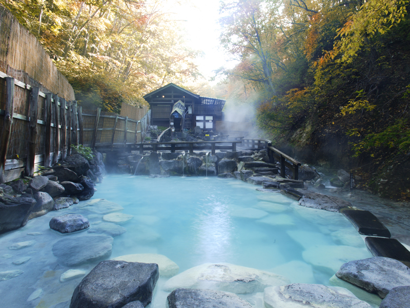
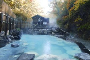
蔵王温泉は開湯1900年、日本屈指の古湯です。
湯量が豊富で強酸性の硫黄泉が特徴の蔵王温泉では、温泉街のそこかしこに湯気が立ち上り、多くの旅館やホテルが建ち並び、野趣あふれる大露天風呂も有名です。
硫黄泉には表皮の殺菌作用や皮膚を強くする作用があり、「美肌の湯」「美人づくりの湯」とも呼ばれます。
そんな名湯を気軽に楽しめるのが、蔵王温泉共同浴場。「上湯」「下湯」「川原湯」という3つの共同浴場は、それぞれが徒歩3分圏内という近さなので、湯めぐりするのにも便利です。
蔵王エコーライン沿いにある、ジンギスカンが好評のレストハウス。
パーティー・宴会も出来る!ご予約で2階和室貸切も。
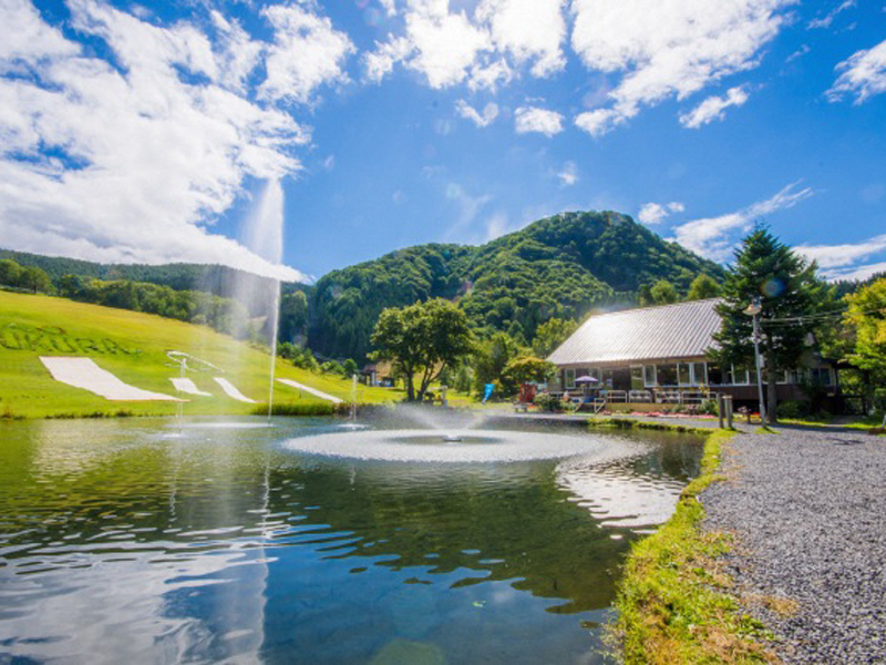
釣ってその場で食べられる釣り堀も人気。
湧き水をそのまま引いてきたにじますつかみ取りコーナー。
足湯ならぬ“足水”でひんやり!
山だけどビーチバレーボール場、バドミントン・ポール他あります!
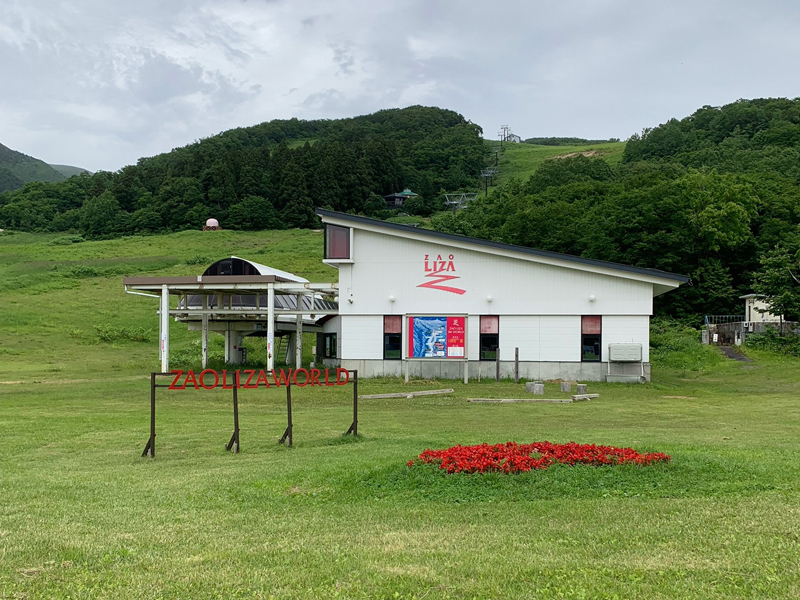
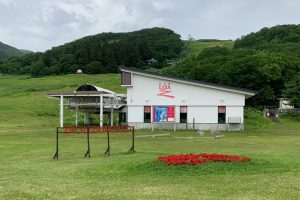
蔵王ライザワールドのライザレストランは、石窯で焼いた本格ピッツァをはじめ多彩なメニューで人気のスポット!ライザウッディロッジは、コテージ風ロッジで全室ミニキッチン・バス・トイレ付き、FREE Wi-Fiありの究極のくつろぎスペースです。サイクリング後はコテージに泊まってリフレッシュしてはいかがでしょう。ちょっと足をのばして、蔵王刈田リフトを使って神秘的なお釜の散策も楽しめます。
