


![]()
![]()
![]()
![]()
![]()
![]()
![]()
![]()
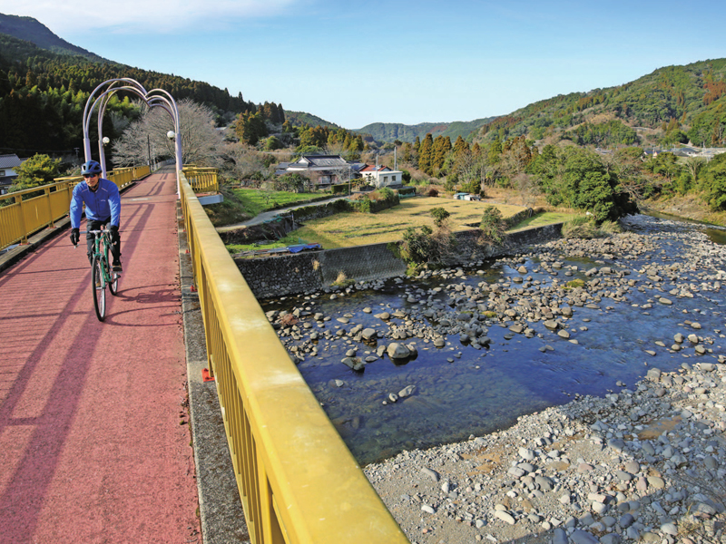
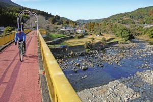
石積みの棚田風景が広がるのどかな山間部を走るルート。起点の「道の駅大野温泉」から「道の駅芦北でこぽん」までは、比較的緩やかな川沿いの道が続き、澄んだ空気の中をのんびりと走ることができる。最大の難所、古石地区から久木野地区へと抜ける峠には、勾配10%以上の激坂が脚自慢たちの挑戦を待ち受ける。久木野地区は寒川水源や美しい棚田が広がるエリアだ。そのあとはJR山野線の廃線跡を利用して作られた「日本一長~い運動場」という全長14km の自転車歩行者道を、一気に水俣駅まで下る。沿道には綺麗なトイレや水飲み場も整備されており快適だが、スピードの出し過ぎには気をつけて。
A route that runs through an idyllic mountainous area with a view of masonry rice terraces. From the starting point “Roadside Station Ono Onsen” to “Roadside Station Ashikita Dekopon,” a relatively gentle riverside road continues, and you can run leisurely in the clear air. At the mountain pass that passes from the Furuishi district to the Kugino district, the biggest difficulty, a steep slope with a slope of 10% or more awaits the challenge of those proud of their legs. The Kugino area is an area with Samukawa water sources and beautiful rice terraces. After that, go down to Minamata Station all at once on a 14-kilometer long bicycle and pedestrian path called the “longest playground in Japan,” which was built using the abandoned tracks of the JR Yamano Line. There are clean toilets and drinking fountains along the road, so it's comfortable, but be careful not to go too fast.
九州の真ん中、熊本県南部の八代海に面した【八代、水俣・芦北地域】は、西側には海を挟んで天草の島々が広がり、東側には九州山地が連なる。その山地を縫って日本三大急流・球磨川が流れており、海、山、そして川と三拍子揃ったエリアだ。
歴史と個性豊かな数々の温泉や、海の幸や川の恵、また山には特産の柑橘類が実り、和牛も美味しい。風光明媚な海岸線には白いビーチや岬からの絶景。そんな風景を眺めながら利用できるサイクルトレインだって君が来るのを待っている。
さあ、サイクリングでこのエリアを全部まとめて楽しんでしまおう!
マップ詳細へ※オンラインの地図上でサイクリングルートが閲覧できるウェブサイト「ルートラボ」が2020年3月末でサービス終了したため、「bikemap」に変更したことで、bikemap内の距離や高低差に誤差が生じている場合がありますが、ご理解ご了承の程、よろしくお願いします。

水俣湾を埋め立てて作られた41.4 ヘクタールの広さを持つ花と緑に包まれた公園。恋路島を望む親水護岸や各種スポーツ施設がある他、竹林園や熊本県環境センター、水俣病資料館が隣接する。パーク入り口の「道の駅みなまた」に、レストランや物産館、また、春、秋には800 種5,000 株が咲くバラ園があるなど見どころが多い。
標高333m の中尾山頂上付近に位置する見晴らしの良い公園。展望台からは水俣市街や八代海が一望できる。また園内には1500 本の梅林や、桜並木、また秋には5 万本のコスモスが咲き誇るなど、四季折々の花が楽しめるスポットだ。
