![]()
![]()
![]()
![]()
![]()
![]()
![]()
![]()


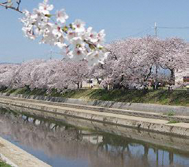

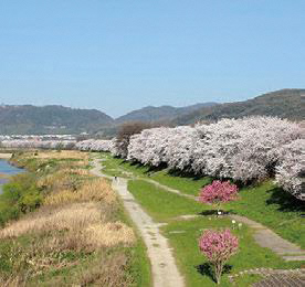
国宝石清水八幡宮の門前町から、流れ橋と上津屋の茶園を望み、今は失われた湖沼、巨椋池の跡地を走るコース。コースの一部である東高野街道では、風情ある街並みを感じられ、流れ橋と上津屋の茶園では、昔ながらの風景にどこか懐かしさを感じるかもしれない。巨椋池跡の広大な平地は、今は農業用地だが、東一口の集落にはかつての漁村の面影が残る。また、桜の季節には前川堤や背割堤の桜並木が見逃せない。
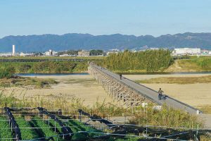
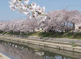
This course overlooks Nagarehashi Bridge and Kozuya tea garden from the gate town of Shimizu Hachimangu Shrine, and runs on the site of Ogura Pond, a lake that has now been lost. On the Higashikoya Kaido, which is part of the course, you can feel the tasteful cityscape, and at Nagarehashi and Kozuya's tea garden, you may feel nostalgic about the old-fashioned scenery. The vast flatland at the ruins of Ogura Pond is now agricultural land, but remnants of a former fishing village remain in the village of Higashiguchi. Also, during the cherry blossom season, you can't miss the rows of cherry blossom trees along the Maekawa River Bank and Sewaritei.
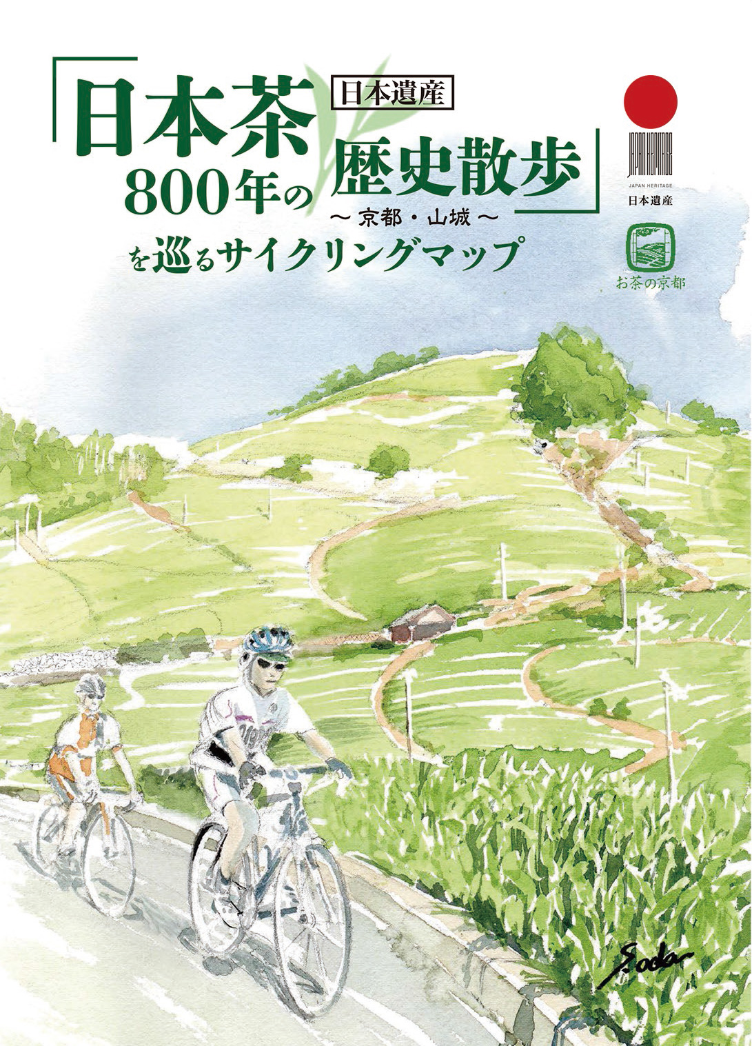
お茶のふるさと「山城」は、13世紀に栄西禅師が宋から伝えた茶の栽培法を、明恵上人が宇治にもたらして以来、約800年にわたって製茶技術の工夫と品質の向上・生産の拡大によって日本の茶文化を支えてきました。そして、独特で美しい茶畑、茶問屋、茶まつりなどの代表例が優良な状態で揃って残っている日本で唯一の場所です。この一連の物語(ストーリー)が日本遺産「日本茶800年の歴史散歩」~京都・山城~として認定されました。
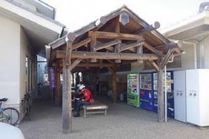
マップ詳細へ※オンラインの地図上でサイクリングルートが閲覧できるウェブサイト「ルートラボ」が2020年3月末でサービス終了したため、「bikemap」に変更したことで、bikemap内の距離や高低差に誤差が生じている場合がありますが、ご理解ご了承の程、よろしくお願いします。
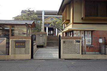
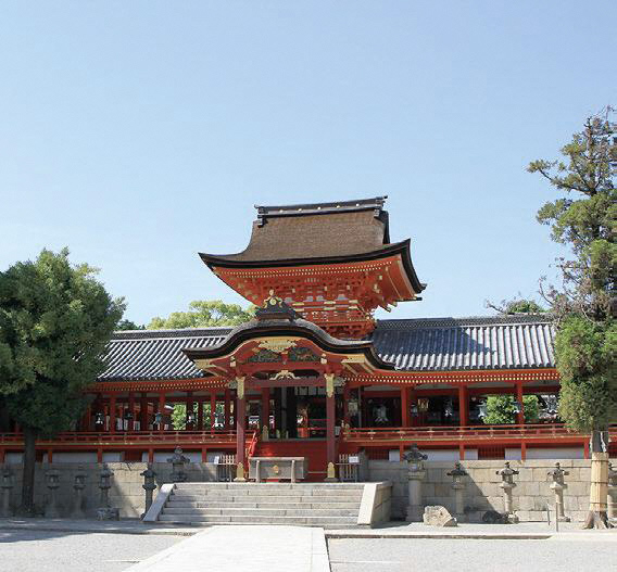
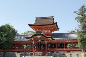
伊勢神宮に次ぐ国家第二の宗廟と称され、日本三大八幡宮その一つ。平成28年2月国宝に指定される。平成22年、26年の過去2回マウンテンバイクで山頂の本殿から石段を駆け下りるダウンヒルレースが開催された。
寛永期の文人松花堂昭乗ゆかりの地。昭乗が使用していた絵具箱をヒントに老舗料亭の創始者が松花堂弁当を発案。ここでは、本場の松花堂弁当が味わえる。
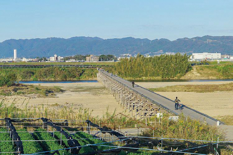
正式名は「上津屋橋」。全長356.5m、日本最長級の木造橋。川の水かさが増すと橋板が浮き上がって流れることから「流れ橋」と呼ばれる。テレビや映画の撮影にしばしば利用される。2016年3月下旬、改修を終えて再開通。
東一口の前川(巨椋池排水幹線)堤の両岸のソメイヨシノ並木。200本以上の満開は壮観。京都の自然200選(歴史的自然環境部門)選定。地元の「前川桜並木愛護会」により手入れされている。