コース・マップ検索
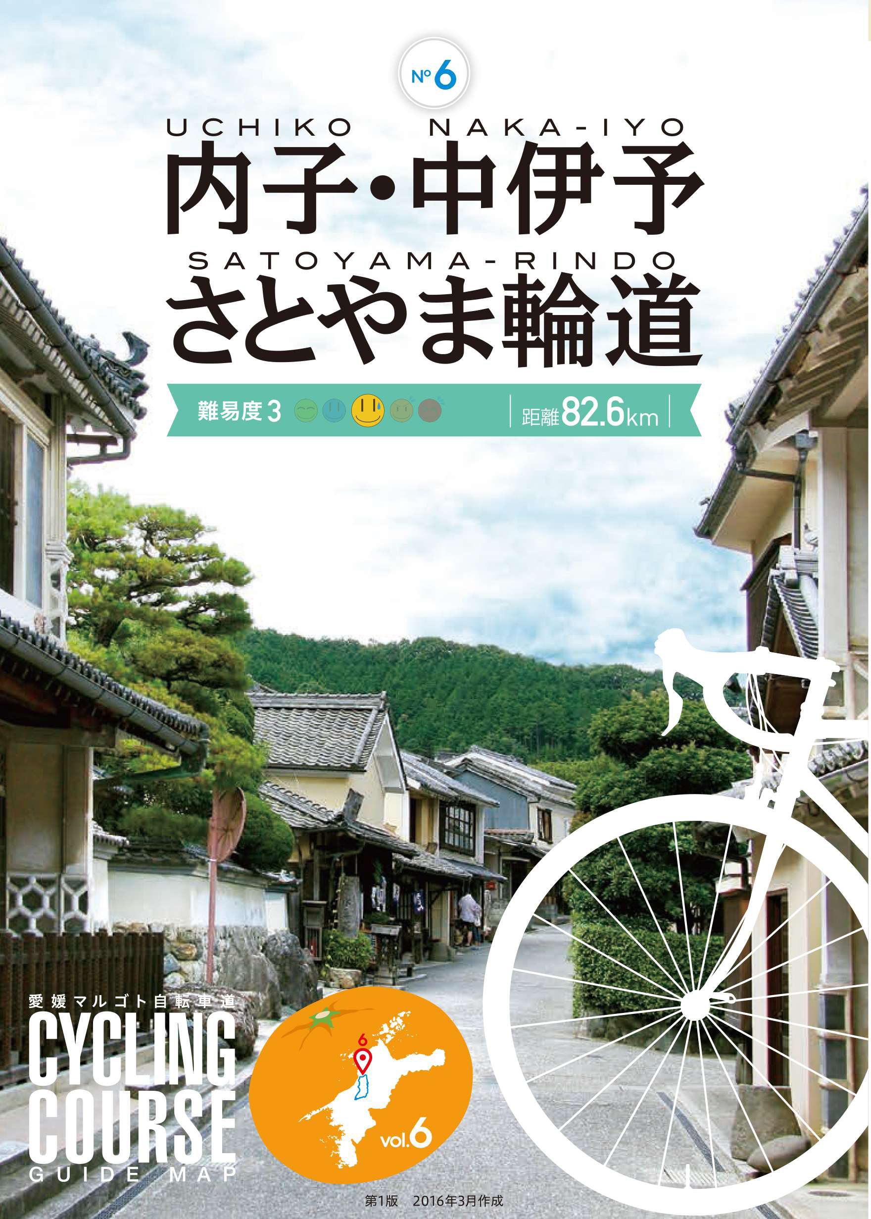
内子・中伊予さとやま輪道
距離 Distance:
82.6km
獲得標高 上り Elevation Gain (Up):
924m
獲得標高 下り Elevation Gain (Down):
907m
最大標高差 Maximum elevation difference:
445m
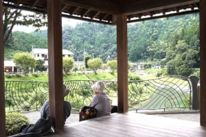
国道などは歩行者自転車道が整備され、交通量も少ないので走りやすくなっている。コース途中には「道の駅クラフトの里」や「道の駅からり」、「道の駅ひろた峡の館」など、それぞれ特徴のある道の駅が点在している。中山までは上りが続き、内子までは下り、そこから広田まで上り、また下るという、大きな波でアップダウンが繰り返す。
National highways and the like are equipped with pedestrian bicycle paths, and traffic volume is low, making it easier to drive. Roadside stations with their own characteristics are scattered along the way, such as “Roadside Station Craft Village,” “Roadside Station Street Station,” and “Roadside Station Hirota Gorge House.” The ascent continues to Nakayama, descends to Uchiko, then goes up and down from there to Hirota, and then goes down again and again, and the ups and downs are repeated.
コース掲載マップ 愛媛マルゴト自転車道「内子・中伊予さとやま輪道」
しまなみ海道を中心に全県域を誰もが自転車に親しみ、誰もが自転車を楽しめる「愛媛マルゴト自転車道」を展開することで、“愛媛がサイクリングパラダイス”となることを目指している。
マップ詳細へ
オススメスポット ビュースポット いきもの・植物 グルメ ショッピング 道の駅 温泉 宿泊 病院 レンタサイクル 自転車販売店 サイクリングサポート トイレ その他
※オンラインの地図上でサイクリングルートが閲覧できるウェブサイト「ルートラボ」が2020年3月末でサービス終了したため、「bikemap」に変更したことで、bikemap内の距離や高低差に誤差が生じている場合がありますが、ご理解ご了承の程、よろしくお願いします。
コース周辺スポット
全て
オススメスポット
グルメ
道の駅
温泉
病院
レンタサイクル
で絞り込む
砥部衝上断層
古い地層が新しい地層の上に重なった珍しい逆断層。1200万年~1400万年前の地殻変動によってできたものといわれる国の天然記念物。
住所:伊予郡砥部町岩谷口450
陶板の道
坂村真記念館から陶租ケ丘、砥部町陶芸創作館まで続く散策路。町内の陶士が絵付けした約580枚の砥部焼の陶板が至る所に埋め込まれていて、アートな気分を味わえる。
住所:伊予郡砥部町大南874先
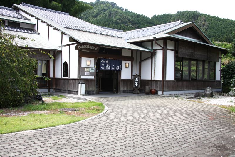
クラフトの里
中山町特産のそばを打ちや木工クラフトなど多彩な体験ができる施設。木工工芸品や地元のフルーツや野菜で作るシャーベットの販売なども楽しみに訪れたい。
住所:愛媛県伊予市中山町中山子271
TEL:089-968-0756
営業時間:
施設により異なる
定休日:
月曜日(祝日の場合は翌日)、年始(1/1~1/4)
料金:施設により異なる
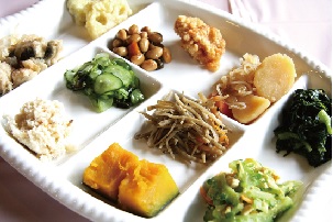
遊栗館
栗の里公園内にあるレストラン。地元特産の栗をはじめ新鮮な野菜を中心に常時20種以上が楽しめる季節料理のバイキングがヘルシーと評判。
住所:愛媛県伊予市中山町中山戌696
TEL:089-967-0108
営業時間:
10:00~16:00(お食事タイム11:00~15:00)
定休日:
木曜日(祝日の場合は翌日)
料金:[ランチバイキング]大人1,296円、小学生864円、3歳以上432円、3歳未満無料
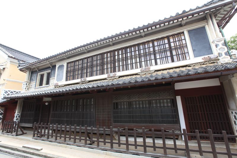
八日市・護国の町並み
江戸末期から明治、大正時代にかけて建てられた古い家屋80軒以上が、南北約600mに渡って軒を連ねる。国の重要伝統的建造物群保存地区に選定されている。
住所:愛媛県喜多郡内子町内子
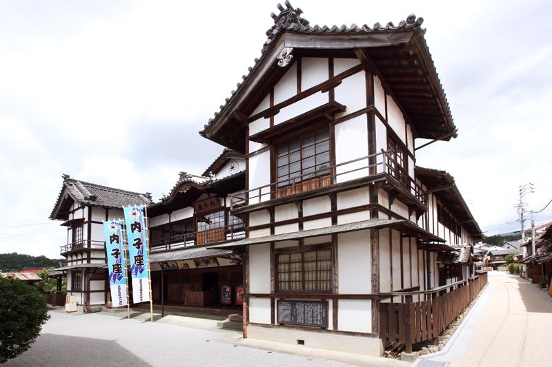
内子座
大正5(1916)年に建てられた最大650人収容可能な木造2階建て瓦葺入母屋作りの劇場。催し物がない日には、内部や舞台裏の様子などを見学することもできる。
住所:愛媛県喜多郡内子町内子2102
TEL:0893-44-2840
営業時間:
9:00~16:30
定休日:
年末年始(12/29~1/2)
料金:大人400円、小・中学生200円、幼児無料
森と谷間の村大瀬成留屋ミュージアム
江戸時代に手漉き和紙などで栄えた大瀬の成留屋地区は、出格子窓の旧家が立ち並ぶ風情あるエリア。休憩所も多数あるのでのんびり散策してみよう。
住所:喜多郡内子町大瀬中央
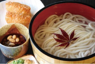
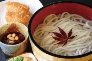
なみへいうどん
小田地方に伝わる郷土料理でコシがある食感と滑らかなのどこしが特徴。「祝事や来客のもてなし、家族だんらんの食卓で、酒を酌み交わしながら賑やかに味わってきた歴史を持つ。
住所:愛媛県喜多郡内子町中田渡61
TEL:0892-52-3883
営業時間:
11:00~14:00
定休日:
金曜日(祝日は営業)、年末年始(12/30~1/4)
料金:たらいうどん 380円
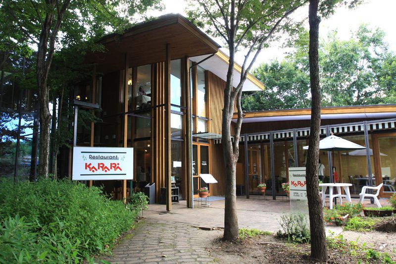
道の駅 内子フレッシュパークからり
農家から毎朝持ち込まれる鮮度抜群の野菜が並ぶ直売所。構内には、旬の野菜や果物を使って毎日売り場で作られているアイスやシャーベットの販売所もあり、愛媛県名産の「もち麦」や珍しい「じゃばら」という柑橘など、その季節ならではの食材を使って製造するので、何度行っても違う味が楽しめる。また、からりオリジナルのソーセージやハムなどはお土産に最適で、ここでしか食ぺられない物や手に入らない物も多数あり、何度訪れても楽しめるスポットとなっている。
住所:愛媛県喜多郡内子町内子2452
TEL:0893-43-1122
営業時間:
9:00~17:00(店舗により異なる)
定休日:
年末年始(1/1~1/3)、店舗により異なる
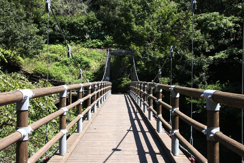
道の駅 ひろた 峡の館
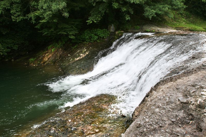
名産の自然薯をはじめ新鮮な野菜や果物、手作りの加工品などがズラリと並ぶ。敷地内には木造橋が架かっており、橋の下を流れる玉谷川の自然もぜひ楽しみたい。
住所:愛媛県伊予郡砥部町総津162-1
TEL:089-969-2070
営業時間:
[4月~10月]8:00~18:00[11月~3月]8:00~17:00
定休日:
年末年始(12/31~1/3)
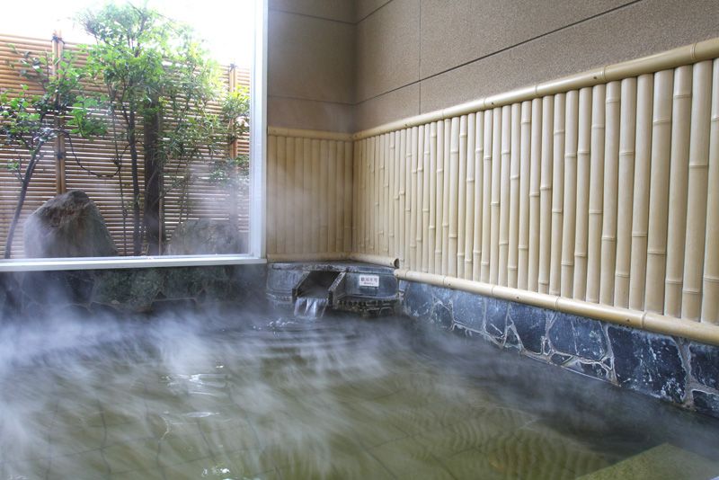
いよ温泉
伊予商店街沿いに位置し、すべすべとして滑らかな「美人の湯」として知られている天然温泉。地下1000mから湧き出る黄金色に輝く神秘的な湯は、多くの効能と高い温浴効果を持ち、湯上り後はいつまでも体がポカポカするのが特徴。リーズナブルな料金で利用できる家族風呂は、源泉かけ流しとなっており、アットホームな雰囲気の中、温泉を楽しめる。
住所:愛媛県伊予市灘町16(いよプリンスホテル)
TEL:089-982-7777
営業時間:
9:00~23:00(札止めは22:30)
定休日:
年2回(不定期)
料金:大人450円、子供250円、[家族風呂]大人550円、子供250円
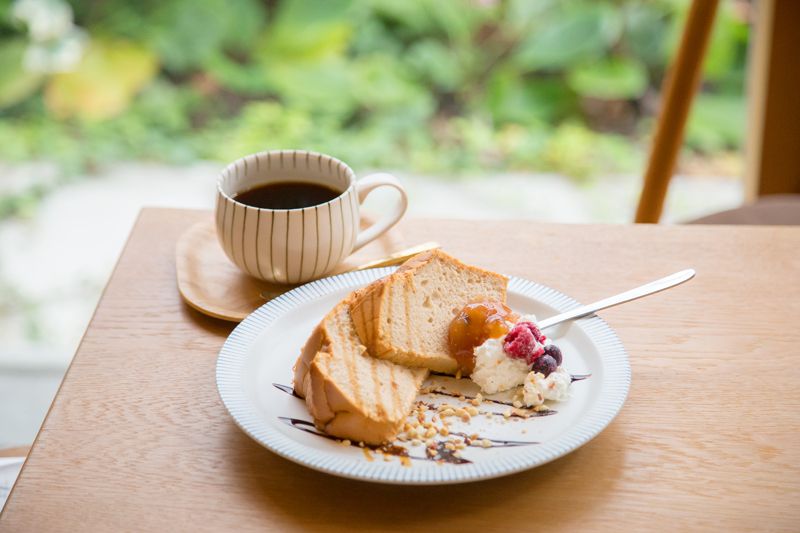
トークギャラリー紫音
砥部焼ギャラリー。鑑賞がてら、カフェもできるお店。織細であっさりとした味わいの手作りシフォンケーキが美味。
住所:伊予郡砥部町五本松885-13
TEL:089-962-7674
営業時間:
10:00~18:00
定休日:
火曜日、第3水曜日
料金:シフォンケーキ 200円+ドリンク代
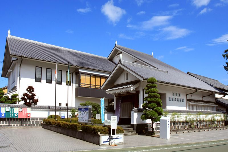
砥部焼伝統産業会館
砥部焼の歴史的資料を始め、製造過程を説明したパネルなどで砥部焼の歴史を学ぶことができる。2階フロアでは企画展が年8回ほど開催されている。
住所:愛媛県伊予郡砥部町大南335
TEL:089-962-6600
営業時間:
9:00~17:00
定休日:
月曜日(祝祭日の場合は翌日)、年末年始(12/29~1/1)
料金:[入館料]大人300円、高校生・大学生200円、小学生・中学生100円、65歳以上200円
旅里庵
住所:愛媛県喜多郡内子町内子324(JR内子駅構内)
TEL:0893-43-1450
営業時間:
9:30~17:00
定休日:
年末年始5日間
料金:350円(普通自転車350円(2時間)、延長(1時間毎)200円)
平成脳神経外科病院
住所:愛媛県松山市北井門2-7-28
TEL:089-905-0011
受付時間:
8:30~17:00
休診日:
日曜日、祝日
加戸病院
住所:愛媛県喜多郡内子町内子771
TEL:0893-44-5500
受付時間:
9:00~12:00、14:00~17:00
休診日:
土曜日午後、日曜日、祝日
内子まちの駅Nanze
住所:愛媛県喜多郡内子町内子2023
TEL:0893-44-6440
営業時間:
10:00~17:00
定休日:
木曜日
料金:2時間まで350円、2時間以上500円
町並駐車場
住所:愛媛県喜多郡内子町城廻
TEL:0893-44-5347
営業時間:
9:00~17:00
定休日:
無休
料金:2時間まで350円、2時間以上500円
砥部焼観光センター炎の里
住所:愛媛県伊予郡砥部町千足359
TEL:089-962-2070
営業時間:
8:30~18:00
料金:1回300円