コース・マップ検索
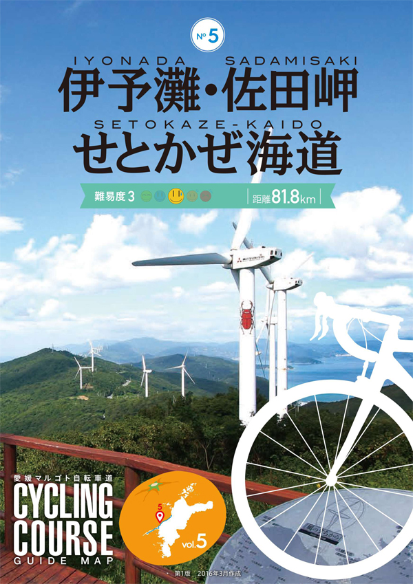
伊予灘・佐田岬せとかぜ海道
距離 Distance:
81.8km
獲得標高 上り Elevation Gain (Up):
1026m
獲得標高 下り Elevation Gain (Down):
1026m
最大標高差 Maximum elevation difference:
251m
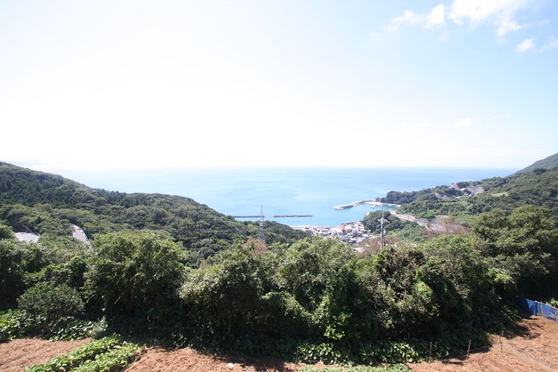
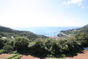
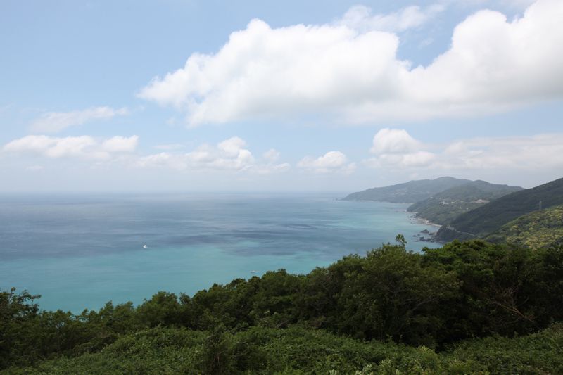
コース前半の海岸線は比較的アップダウンが少ないが、後半の佐田岬・メロディーラインは起伏が激しいので体力が必要。夕やけこやけラインからは穏やかな伊予灘の青い海と、沿道を彩る早春の水仙から菜の花、芙蓉など四季折々の花が楽しめ、メロディーラインからは青さの違う伊予灘と宇和海の二つの海を同時に眺めることができる。
The coastline in the first half of the course has relatively few ups and downs, but the Cape Sadamisaki Melody Line in the second half has severe undulations, so physical strength is required. From the Yuyake Koyake Line, you can enjoy the calm blue sea of the Iyo Sea and seasonal flowers such as early spring daffodils, rapeseed flowers, and hibiscus that adorn the roadside, and from the melody line, you can simultaneously see the two seas of Iyo Sea and Uwa Sea, which have different shades of blue.
コース掲載マップ 愛媛マルゴト自転車道「伊予灘・佐田岬せとかぜ海道」
しまなみ海道を中心に全県域を誰もが自転車に親しみ、誰もが自転車を楽しめる「愛媛マルゴト自転車道」を展開することで、“愛媛がサイクリングパラダイス”となることを目指している。
マップ詳細へ
オススメスポット ビュースポット いきもの・植物 グルメ ショッピング 道の駅 温泉 宿泊 病院 レンタサイクル 自転車販売店 サイクリングサポート トイレ その他
※オンラインの地図上でサイクリングルートが閲覧できるウェブサイト「ルートラボ」が2020年3月末でサービス終了したため、「bikemap」に変更したことで、bikemap内の距離や高低差に誤差が生じている場合がありますが、ご理解ご了承の程、よろしくお願いします。
コース周辺スポット
全て
オススメスポット
ビュースポット
グルメ
道の駅
温泉
病院
レンタサイクル
サイクリングサポート
トイレ
で絞り込む
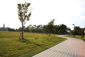
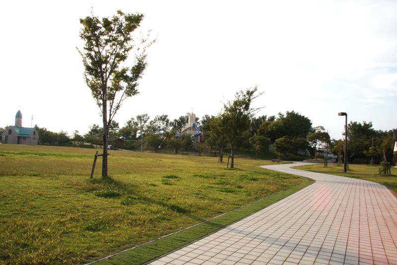
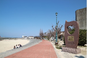
伊予市しおさい公園
スポーツと憩いの場を兼ねた備えた総合公園。体育館を始め施設が充実。
住所:愛媛県伊予市森91-1
TEL:089-982-2367
営業時間:
[開園時間]8:30~21:30
定休日:
月曜日(祝日もしくは振替休日の場合は翌日)、年末年始(12/28~1/4)
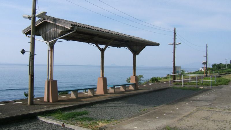
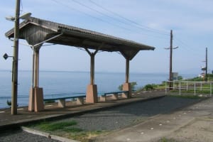
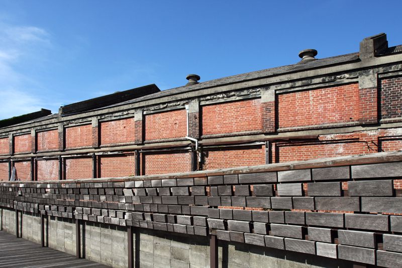
JR下灘駅
日本で一番海に近かったとされる駅。ホームから瀬戸内海が一面に広がる。
住所:愛媛県伊予市双海町大久保
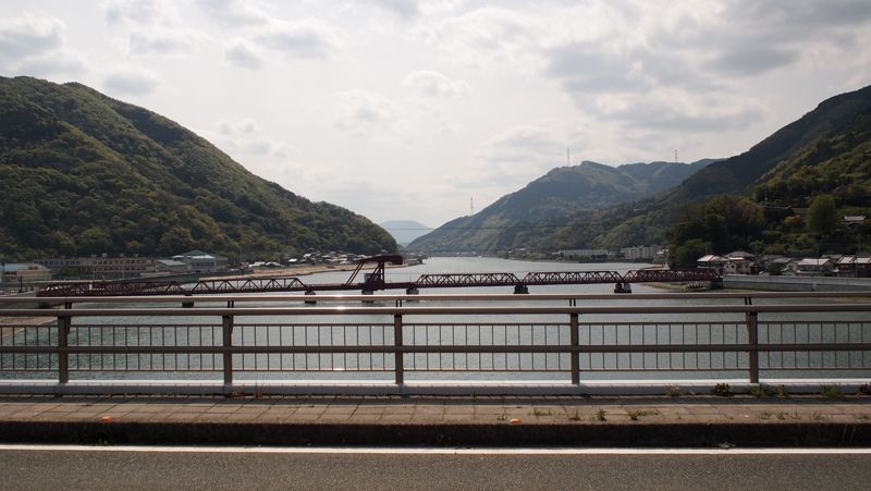
肱川あらし展望公園
長浜大橋や、霧が川面を滑るように吹き出す肱川嵐を展望できる公園。
住所:愛媛県大洲市長浜甲785
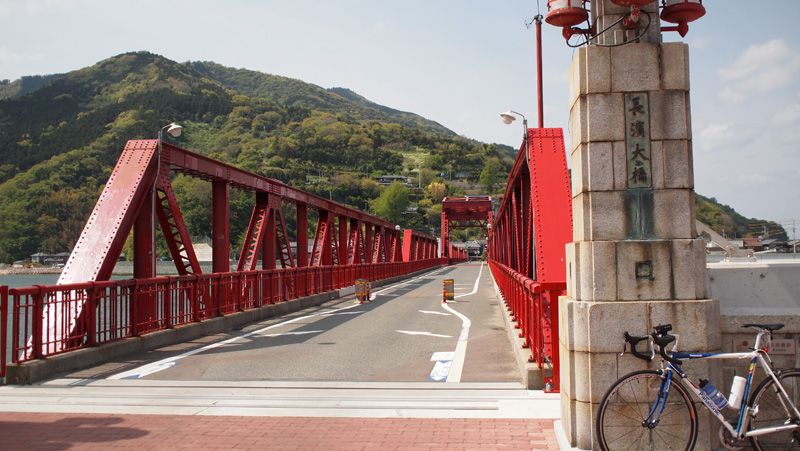
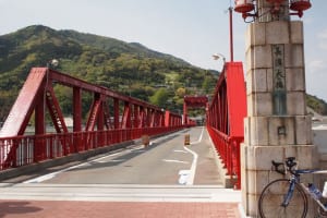
新長浜大橋
気象現象の肱川嵐で有名な肱川の河口に架かる。国の登録有形文化財に指定。
住所:愛媛県大洲市長浜沖浦
明治の町並み・もっきんろーど
昔は運河だった宮内川沿いにある、木琴のように歩くと音がする遊歩道。
住所:八幡浜市保内町川之石(宮内川沿い)
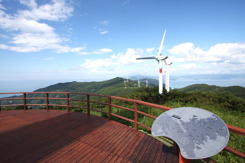
せと風の丘パーク
公園内には実物大の羽が横たえて展示されており、展望スペースからは、東西に延びる風車群を一望することができる。「海に囲まれた細長い半島の山頂部に連なる巨大な風車群」という景色は、とてもきれい。
住所:西宇和郡伊方町川之浜
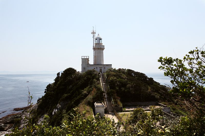
佐田岬灯台
日本一長い佐田岬半島先端に立つ灯台。晴れた日には豊予海峡を隔てて九州が遠望できます。
住所:愛媛県西宇和郡伊方町正野
朝日共販しらすパーク
目の前の海で水揚げされた鮮度バツグンの採れたてシラスを使った丼。
住所:西宇和郡伊方町川之浜652-1
TEL:0894-53-0776
営業時間:
10:00~15:00(LO 14:30)
定休日:
火曜日
料金:釜揚げしらす丼 700円
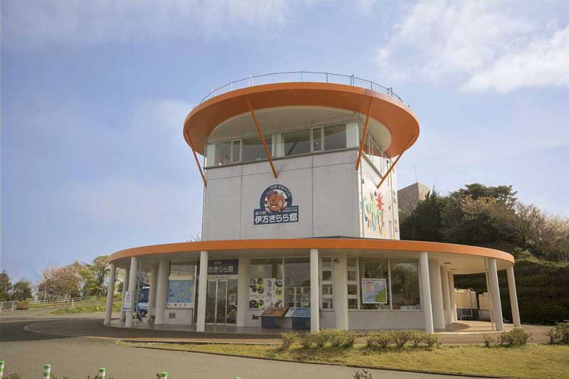
道の駅 伊方きらら館
特産品売り場では、地元特産品を中心に品揃え。ほぼ年間通して柑橘を取り扱う。柑橘・海産加工品も多い。人気の「ふれあい水槽」は魚にエサやりができる(※数量限定、有料)。映像で海の中を体験できるアクアリウムや、お子様づれにやさしい休憩室がある。展望台では宇和海と瀬戸内海が一望できる。
住所:愛媛県西宇和郡伊方町九町越3−179-1
TEL:0894-39-0230
営業時間:
9:00~17:30
定休日:
なし ※年末年始は時間短縮にて営業[12/31]9:00~15:00[1/1]12:00~17:30
長浜大橋
天秤式に開閉する跳開式の可動橋で、日本では現存最古の道路開閉橋。
住所:愛媛県大洲市長浜
営業時間:
[開閉期間]毎週日曜日13:00より開閉[ライトアップ期間]7/1~8/31 19:30~21:00
定休日:
期間中無休
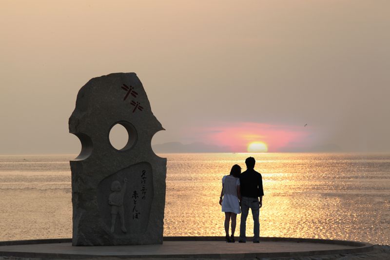
道の駅 ふたみ(ふたみシーサイド公園)
「沈む夕日が立ち止まる町」をキャッチフレーズに、伊予灘に沈む夕日をテーマに整備された道の駅で、特産品や実演販売コーナー、レストランなどが完備されている。「恋人の聖地」に認定されてからはさらに注目を集めている。夏は海水浴所になり年間通しても多くの人が集う。夕日を愛でる海岸線沿いのドライブを楽しみながら、立寄るスポットとしても絶好のロケーション。
住所:愛媛県伊予市双海町高岸甲2326
TEL:089-986-0522
営業時間:
店舗により異なる
定休日:
年末年始、[鮮魚]火曜日[レストラン・市場]月曜日[他]無休
料金:[夕焼けソフトクリーム]濃厚なバニラ味に、特産のみかん風味が加わり、さわやかで甘すぎず、男性にも人気。300円
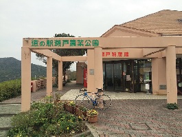
道の駅 瀬戸農業公園
日本で一番細長い佐田岬半島を横断する国道(佐田岬メロディーライン)沿いの道の駅。潮風が心地良く吹き抜ける広場からは、風光明媚な眺望をパノラマで見渡せ、雄大な瀬戸内海と宇和島を一望することができる。また、隣接している「レストラン風車」では、周辺の海岸で獲れた新鮮な魚介類をふんだんに使用した料理に舌鼓を打てるドライブの中継地点や休憩地点としても最適のスポット。
住所:愛媛県西宇和郡伊方町塩成乙293
TEL:0894-57-2321
営業時間:
9:30~17:30
定休日:
1/1
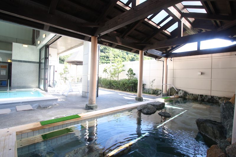
亀ヶ池温泉
地下1,500mから湧き出る天然温泉で疲れを癒そう。明るく開放的な空間の大浴場や岩盤浴もそろう。
住所:愛媛県西宇和郡伊方町二見1289
TEL:0894-39-1160
営業時間:
10:00~21:00[12/31~1/3]10:00~19:00
定休日:
毎月第4木曜日(但し同日が祝祭日の場合は翌日)
料金:大人600円、小人(小学生以下)300円、幼児(3歳未満)無料、高齢者(65歳以上)500円
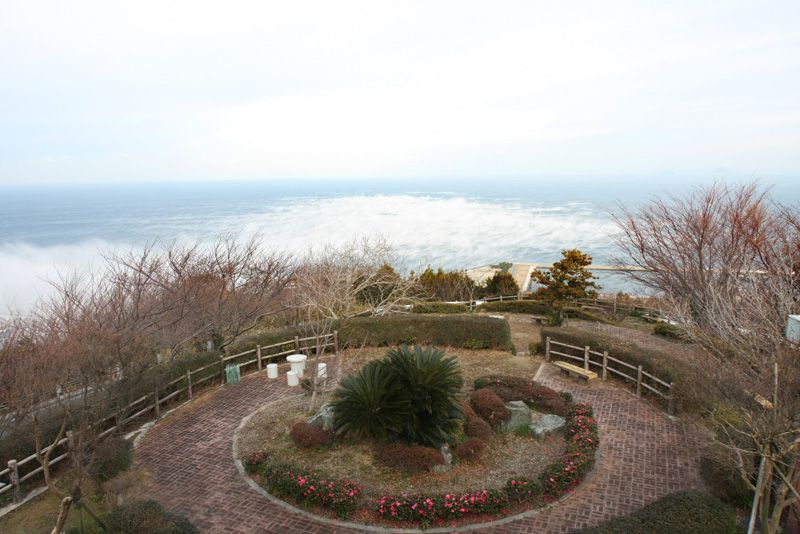
大久展望台
佐田岬メロディライン沿いにある宇和島が一望できる白亜の展望台。
住所:西宇和郡伊方町大久字大成2370-1
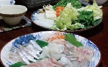
民宿みちもと
生まれたばかりのご当地グルメ。新鮮な地魚たちを「しゃぶしゃぶ」する贅沢グルメ。
住所:愛媛県西宇和郡伊方町二見乙973鳥津
TEL:0894-39-0036
営業時間:
11:30~14:00、17:00~23:00(要予約)
定休日:
無休
料金:海鮮活しゃぶコース(1人前)3,500円
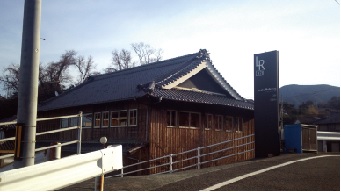
Ledru Rollin378
海が見える雑貨&カフェ。テイクアウトもできる焼菓子もたくさんある。
住所:愛媛県伊予市双海町高岸甲1227-1
TEL:089-986-0358
営業時間:
10:00~17:00(LO16:00)
定休日:
不定休
瀬戸アグリトピア
宇和海を望む大自然の中、農漁村の体験を通して都市と農村の交流を行う施設。交流センターのほかに宿泊できる多様なログハウスが10棟ある。
住所:愛媛県西宇和郡伊方町大久2465-1
TEL:0894-53-0002
営業時間:
6:00~22:00
定休日:
年中無休
料金:4時間まで500円、当日返却800円、保証料1,000円
渡辺病院
住所:愛媛県松山市空港通7-13-3
TEL:089-973-0111
受付時間:
9:00~12:30、13:30~18:30[土曜日]9:00~13:00(科によって異なる)
休診日:
日曜日、土曜日午後
市立八幡浜総合病院
住所:愛媛県八幡浜市大平1-638
TEL:0894-22-3211
受付時間:
8:30~11:00
休診日:
土曜日、日曜日
佐田岬はなはな
住所:愛媛県西宇和郡伊方町三崎1700-11
TEL:0894-21-1730
営業時間:
9:00~17:30
定休日:
1/1~1/3
料金:[レンタサイクル]4時間まで500円、当日返却800円、保証料1,000円
JA愛媛たいき長浜セルフSS
住所:愛媛県大洲市長浜黒田甲617-2
TEL:0893-52-1366
営業時間:
9:00~17:00
定休日:
無休
料金:3時間500円、第3土曜日のみ5時間500円
合同会社岸本石油
住所:愛媛県大洲市長浜甲670-1
TEL:0893-52-0072
営業時間:
9:00~17:00
定休日:
無休
料金:3時間500円、第3土曜日のみ5時間500円
有限会社池内石油店
住所:愛媛県大洲市長浜甲169-1
TEL:0893-52-0448
営業時間:
9:00~17:00
定休日:
日曜日
料金:3時間500円、第3土曜日のみ5時間500円
矢野ガス株式会社リバーサイド長浜給油所
住所:愛媛県大洲市長浜町上老松6-1
TEL:0893-52-0420
営業時間:
9:00~17:00
定休日:
無休
料金:3時間500円、第3土曜日のみ5時間500円