


![]()
![]()
![]()
![]()
![]()
![]()
![]()
![]()


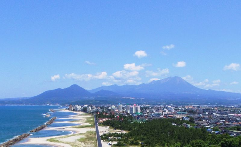

「日本夕陽百選」宍道湖畔の松江しんじ湖温泉駅から、平成30(2018)年に開山1300年を迎える大山を結ぶルート。松江しんじ湖温泉駅から中海を経由して山陰の名湯、皆生温泉付近にかけては高低差が少なく、湖畔の風景や白砂青松の日本海が楽しめます。大山山麓では自然を感じながらのヒルクライム・ダウンヒルを体験することもできます。休憩スポットとして、鳥取県内には「サイクルポート」や「サイクルカフェ」、島根県内には「ご縁サイクルステーション」などの施設があります。
“Japan's Top 100 Sunsets” This route connects Matsue Shinjiko Onsen Station on the shores of Lake Shinji to Mt. Oyama, which celebrated 1300 years since its founding in Heisei 30 (2018). There is little difference in elevation from Matsue Shinjiko Onsen Station via Nakaumi to the vicinity of Kaike Onsen, a famous hot spring in Sanin, and you can enjoy lakeside scenery and the white sand and blue sea of Japan. At the foot of Mt. Daisen, you can also experience hill climbing and downhill while feeling nature. As resting spots, there are facilities such as “cycle ports” and “cycle cafes” in Tottori prefecture, and “go cycle stations” in Shimane prefecture.
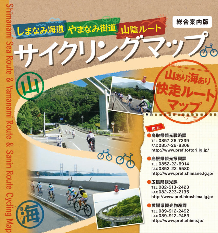
※オンラインの地図上でサイクリングルートが閲覧できるウェブサイト「ルートラボ」が2020年3月末でサービス終了したため、「bikemap」に変更したことで、bikemap内の距離や高低差に誤差が生じている場合がありますが、ご理解ご了承の程、よろしくお願いします。
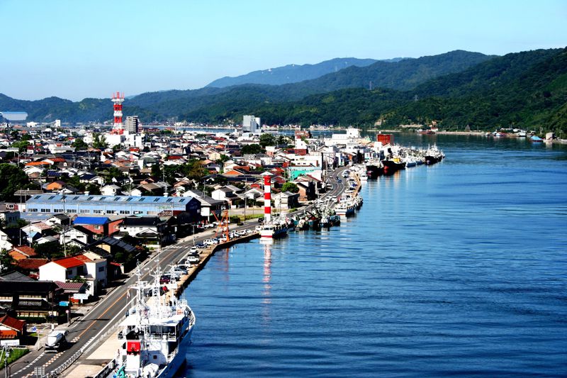
境港は国内有数の漁港を持つ“さかなの街”。漁獲高日本一の生クロマグロ、カニのほか、さまざまな種類が水揚げされ、市内の直売施設では新鮮な魚介類を購入できます。“妖怪の街”としても知られており、JR境港駅から駅前通りを歩くと、懐かしい妖怪たちが次々に出現。境港出身の漫画家水木しげる氏の代表作「ゲゲゲの鬼太郎」に登場する鬼太郎、ねずみ男、目玉おやじなどの妖怪ブロンズ像が訪れる人を歓迎してくれます。

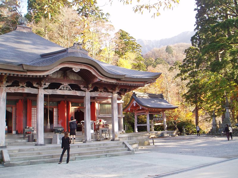
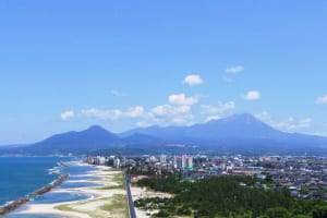
大山寺は、中国地方最高峰大山(だいせん)の北面中腹に位置する山林寺院で、奈良時代に創建され、鎌倉・室町時代には高野山金剛峰寺や比叡山延暦寺とならぶ大寺として隆盛を誇りました。大山寺の開山は養老2年(718)のことと伝えられており、平成30年(2018)には開山1300年を迎えます。
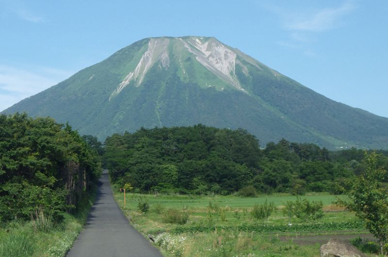
明治時代まで山岳仏教の霊場として入山が禁止されていた大山には、今も手つかずの大自然が残っている。登山や森林浴、自然観察スポットとしても人気が高く、平成28年度に大山山岳地域が日本遺産に認定された。
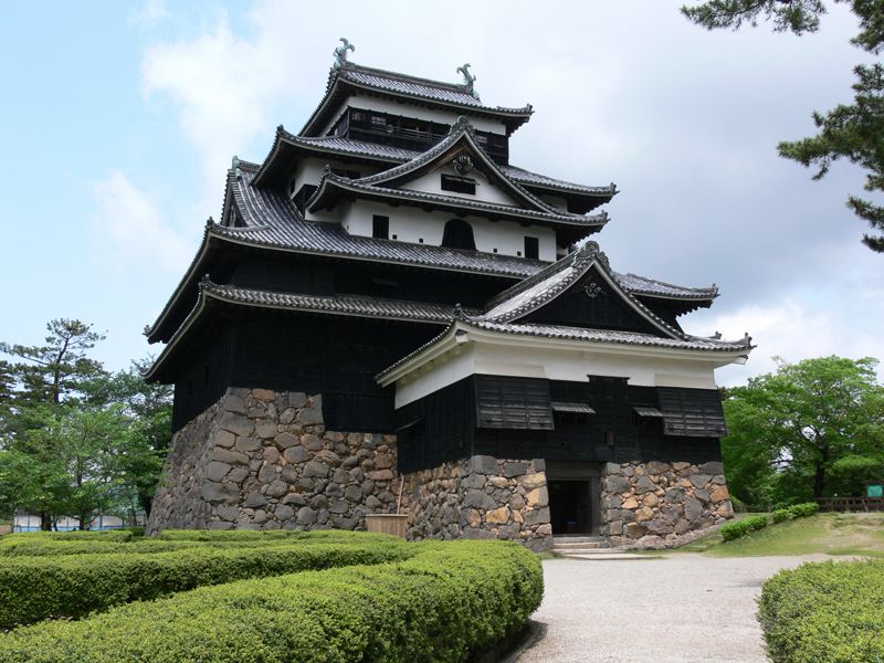
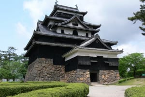
城下町松江のシンボル。千鳥が羽を広げたように見える入母屋破風(いりおもやはふ)の屋根が見事なことから、「千鳥城」とも呼ばれる。全国で現存する12天守の一つで、山陰地方で唯一現存する天守閣。平成27年7月に国宝に指定された。
日本海に面した温泉郷で、豊富な湯量を誇っています。ナトリウム・カルシウム塩化物泉で主な効能は神経痛、リウマチ、慢性皮膚病、慢性婦人病など。近年の調査で優れた美肌効果が判明し、女性にとってもうれしい「ホカホカ、ツルツルの健康と美肌をつくる」温泉として注目されています。また、皆生温泉は「国内トライアスロン発祥の地」。毎年7月には「全国トライアスロン皆生大会」を開催しています。
