コース・マップ検索
岩岳コース
距離 Distance:
10.1km
獲得標高 上り Elevation Gain (Up):
128m
獲得標高 下り Elevation Gain (Down):
129m
最大標高差 Maximum elevation difference:
106m
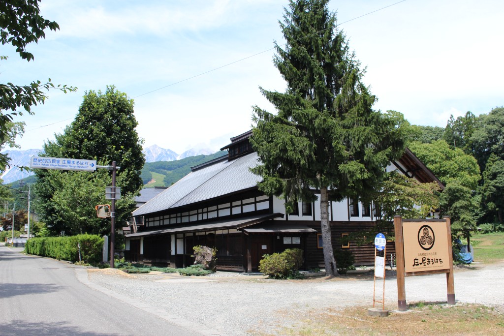
MTBコースがある岩岳から始まるコースは、白馬大橋、大出公園、松川大橋と白馬村の絶景スポットを周るコース。途中の新田地区の民宿街や観音原石仏群などでは歴史を感じられる。
The course, which starts at Iwatake, where the MTB course is located, is a course that goes around scenic spots in Hakuba Bridge, Oide Park, Matsukawa Ohashi, and Hakuba Village. Along the way, you can feel the history at the guest house district in the Shinden district and the Kannon Genseki Buddha Group.
コース掲載マップ 岩岳コース
オススメスポット ビュースポット いきもの・植物 グルメ ショッピング 道の駅 温泉 宿泊 病院 レンタサイクル 自転車販売店 サイクリングサポート トイレ その他
※オンラインの地図上でサイクリングルートが閲覧できるウェブサイト「ルートラボ」が2020年3月末でサービス終了したため、「bikemap」に変更したことで、bikemap内の距離や高低差に誤差が生じている場合がありますが、ご理解ご了承の程、よろしくお願いします。
コース周辺スポット
全て
オススメスポット
ビュースポット
病院
レンタサイクル
サイクリングサポート
で絞り込む
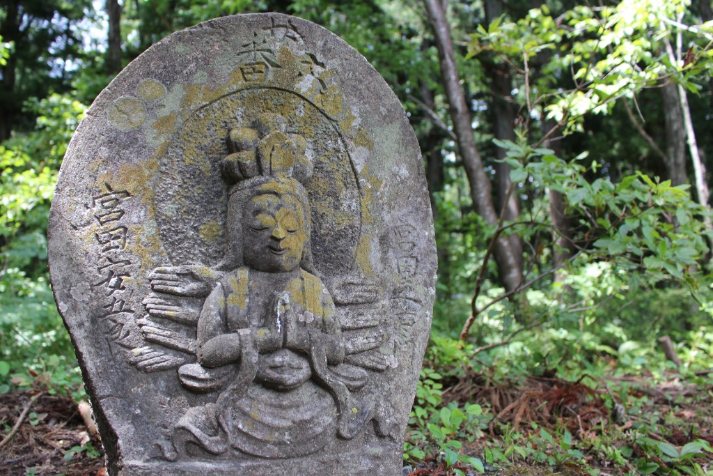
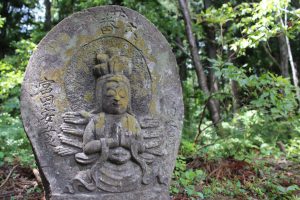
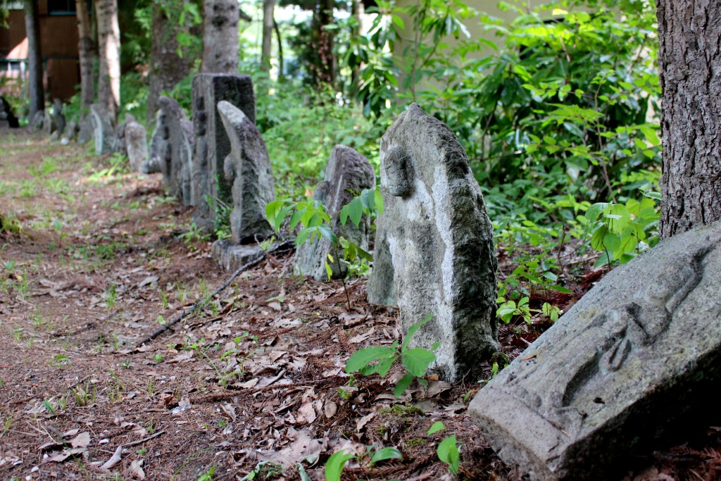
観音原石仏群
西国三十三番・坂東三十三番・秩父三十四番、それに馬頭観音など計187体もの観音が揃う石仏群。木漏れ日を浴びて小径は過去にタイムスリップ。12ポイントより150m進んだ所。
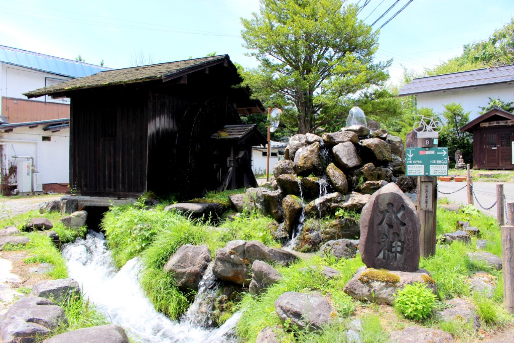
新田水車小屋
水車の音を聞きながら、春の桜並木の中をゆっくりと歩いてみるのも気持ちいいでしょう。
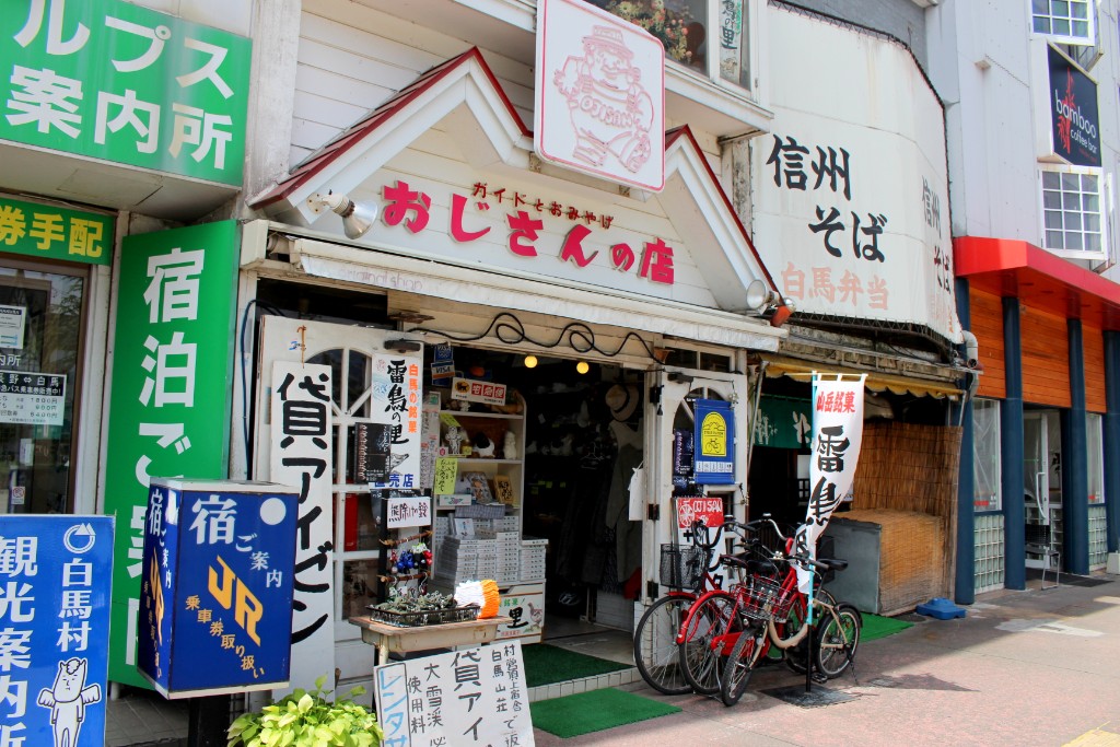
おじさんの店
住所:長野県北安曇郡白馬村大字北城6140-1
TEL:0261-72-2129
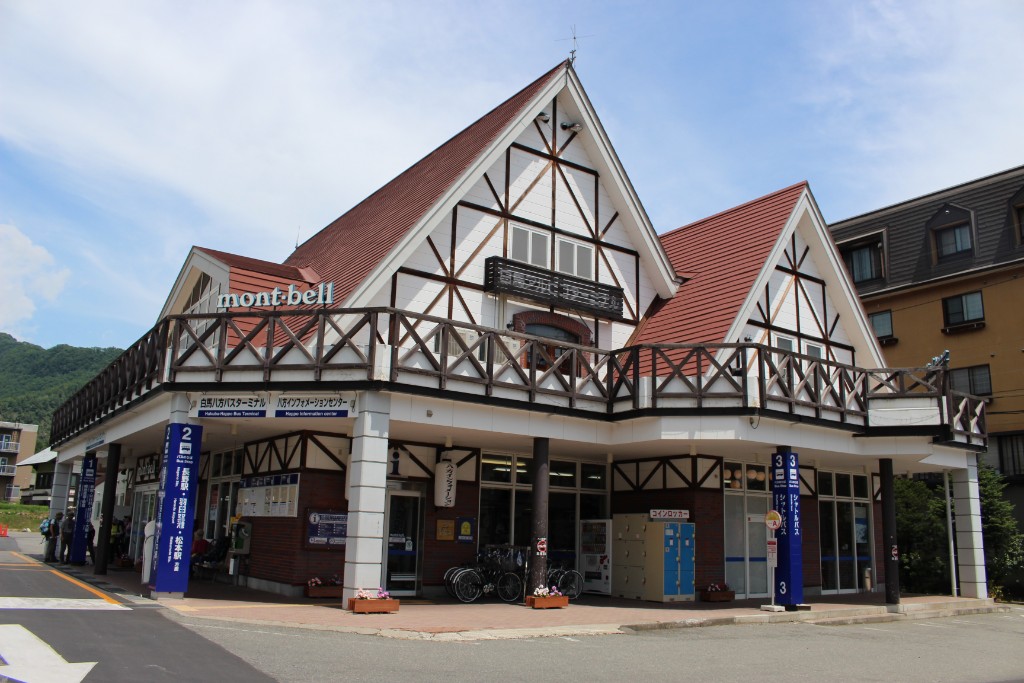
八方インフォメーションセンター
住所:長野県北安曇郡白馬村大字北城5734-1
TEL:0261-72-3066
営業時間:
[夏季]6:00~18:00(3月26日〜12月中旬)
定休日:
無休
料金:[レンタサイクル]タウン・子供用自転車 450円(1時間)、1,600円(1日)
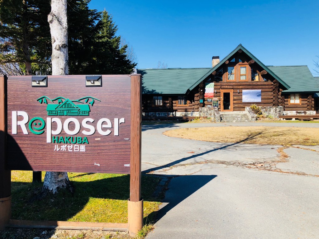
ルポゼ白馬
住所:長野県北安曇郡白馬村大字北城3030-1
TEL:0261-85-2822
営業時間:
[レストラン]11:30~14:30
定休日:
[レストラン・カフェ]火曜日
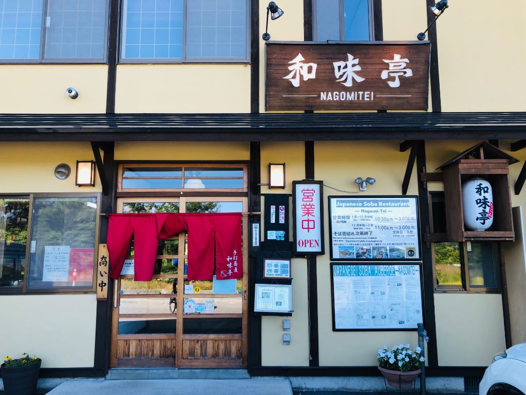
和味亭
住所:長野県北安曇郡白馬村北城3140
TEL:0261-72-7797
営業時間:
[3~12月中旬]10:30~15:00
定休日:
不定休
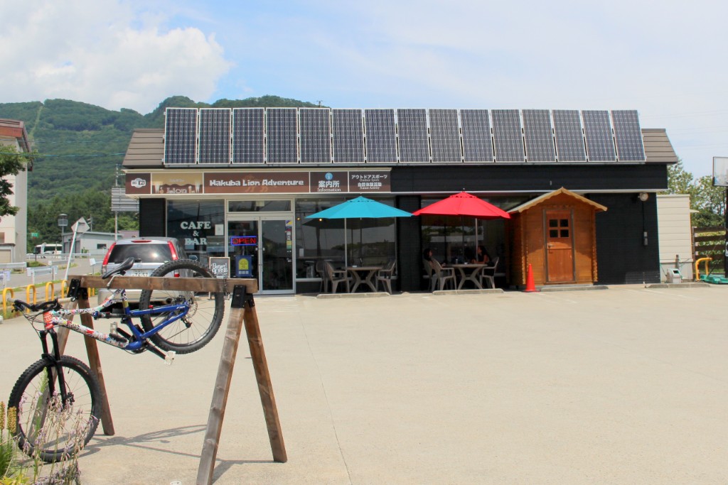
ライオンcafé
住所:長野県北安曇郡白馬村北城5746-3
TEL:0261-72-3860
営業時間:
8:00~17:00
定休日:
水曜日
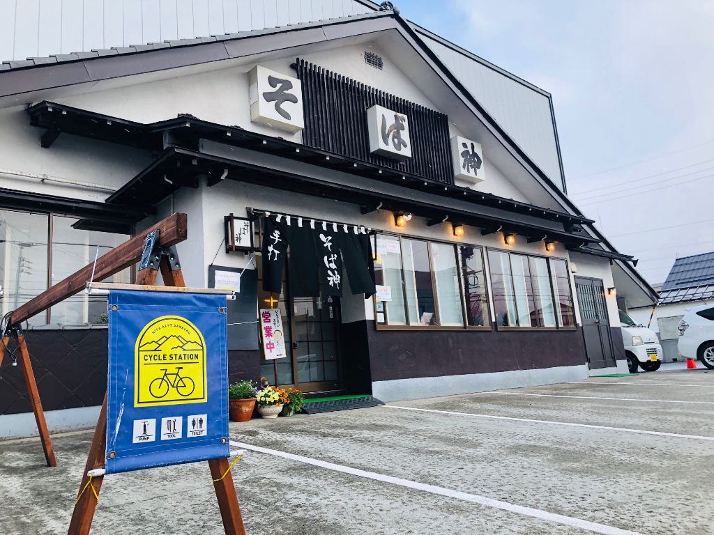
そば神白馬店
住所:長野県北安曇郡白馬村大字北城白馬町2126-2
TEL:0261-72-2055
営業時間:
11:00~15:00
定休日:
木曜日
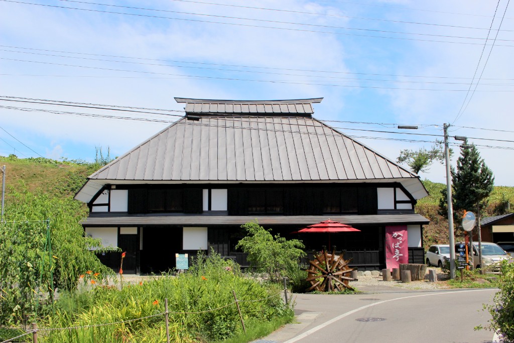
古民家カフェ かっぱ亭
住所:長野県北安曇郡白馬村大字北城大出
TEL:080-3391-7718
営業時間:
5月~10月 11:00~16:00
定休日:
火曜日、水曜日(臨時休業あり)
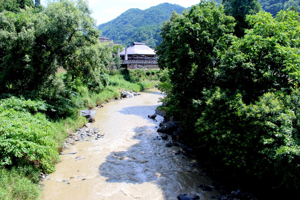
大出吊橋
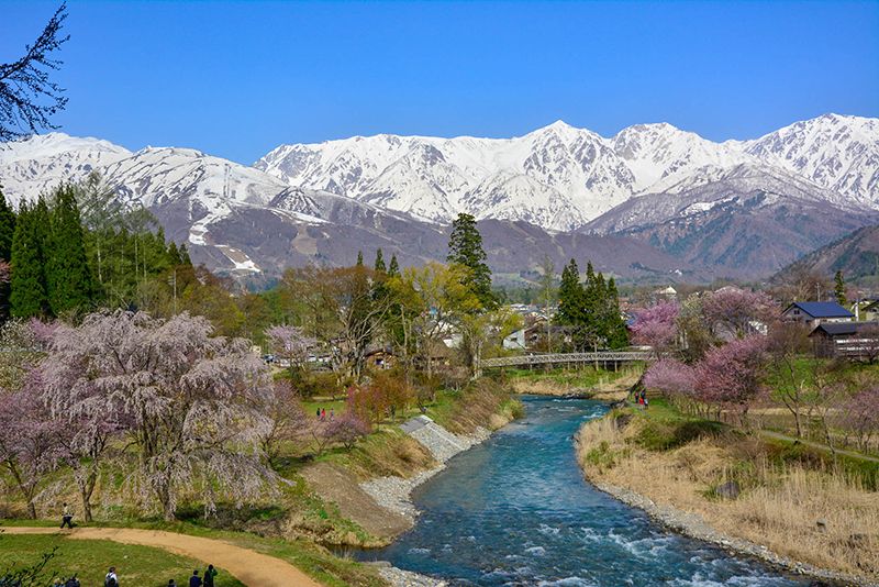
雄大な白馬連峰を背に茅葺き屋根と涼しげな姫川の清流。田舎情緒あふれる大出地区は白馬の里山風景を代表するスポットです。そこに架かる大出吊橋は、歩行者用の橋で白馬の風を感じながら歩く人々にはとっておきの場所です。姫川と吊橋とそして白馬三山の景色は、撮影やスケッチのスポットとしてもおすすめです。橋の近くには、古徑庵(こけいあん)と呼ばれる、茅葺き屋根の小屋があります。もとは江戸時代後期に建てられたもので、古人の残した文化遺産を保存しようと平成10年に復元したものです。中には情緒漂う囲炉裏と、写真や資料が置かれ、古人の生活を感じられる空間です。
白馬岩岳ゆり園&マウンテンビュー
50余種50万株のゆりが咲き誇る白馬村最大級の花畑。標高1,289mの山頂エリアには3,000m級の白馬アルプスの絶景と360°の大パノラマ。森林浴を楽しむ「ねずこの森~ビュー自然探勝路」が整備されています。
TEL:0261-72-2474
営業時間:
[春]( 4/28~5/6、5月・6月毎週土日)8:30~17:00
料金:[ゴンドラリフト往復(夏季ゆり園入園料含む)]大人1,800円、小児1,000円、ペット600円(1頭につき)
切久保石仏群
木を取り囲むように大小、新旧7基の石仏群が建っています。魔除けの御利益が信じられたという庚申塚です。
広進堂
サービスショップ360°
住所:長野県北安曇郡白馬村北城向原12086
TEL:0261-72-4669
横沢医院
住所:長野県北安曇郡白馬村大字北城9715-2
TEL:2061-72-2008
栗田医院
住所:北安曇郡白馬村大字北城5986
TEL:2061-72-2428
SPICY岩岳ゴンドラ店
住所:長野県北安曇郡白馬村北城 岩岳スキー場内
TEL:0261-72-2479
営業時間:
8:00~17:00(通年営業。夏季は岩岳ゴンドラに準ずる)
フルマークス白馬店
住所:長野県北安曇野白馬村北城5595-11
TEL:0261-72-7344
営業時間:
12:00~20:00
定休日:
[4月~11月]水曜日
栂池高原観光協会
TEL:0261-83-2515
営業時間:
8:30~17:00
ゴンドラリフト栂池高原駅
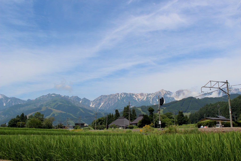
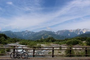
白馬大橋
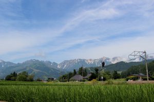
日本の道百選のひとつ。ここから望む白馬連峰と清流の調和が素晴らしい。近くに露天風呂やキャンプサイトもあります。