


![]()
![]()
![]()
![]()
![]()
![]()
![]()
![]()
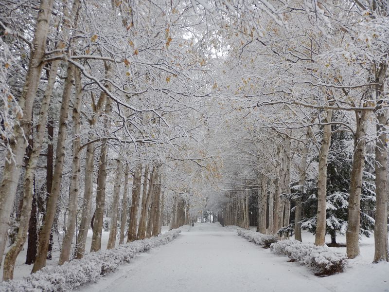
冬もマウンテンバイクで遊ぼう。除雪が入っていて、冬でも走りやすいコースです。林業試験場北支場のシラカバ並木の雪道は、雪の降り始めの頃しか走れませんが、木漏れ日指す雪のトンネルを抜けるような感じが心地よいです。帰りは道の駅なかがわに立ち寄って、温かい飲み物でほっと一息。
Let's enjoy mountain biking in the winter too. Snow is removed, and the course is easy to run even in winter. You can only run on the snowy road lined with birch trees at the North Branch of the Forestry Experiment Station when it starts snowing, but the feeling of going through a snowy tunnel pointing through the trees is comfortable. On the way back, I stopped by Roadside Station Nakagawa and took a break with a warm drink.
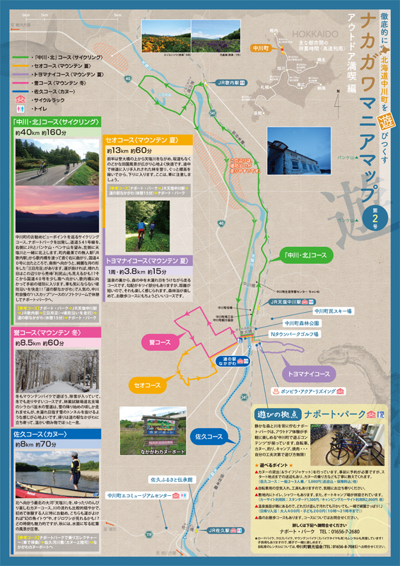
※オンラインの地図上でサイクリングルートが閲覧できるウェブサイト「ルートラボ」が2020年3月末でサービス終了したため、「bikemap」に変更したことで、bikemap内の距離や高低差に誤差が生じている場合がありますが、ご理解ご了承の程、よろしくお願いします。
静かな森と川を背に佇むナポート・パークは、アウトドア体験が手軽に楽しめる“中川町で遊ぶコンテンツ”が揃っています。自転車、カヌー、釣り、キャンプ、焼肉・・・自分の工夫次第で遊び方無限!
キャンプ場に隣接している公共温泉施設。キャンプ場に泊まっている人も、朝早くから温泉に入れるので嬉しい。室内用の自転車スタンドの貸し出しや空気入れも用意しています。
