


![]()
![]()
![]()
![]()
![]()
![]()
![]()
![]()


1周ルートに似ているが、途中列車移動するオプション付きだ。道の駅をスタートし上総一ノ宮駅から細い路地を南下していく。千葉の県木イヌマキを使った生垣が続く路地を走り日在海岸から大原自転車道に入る。遮るものが無い海の真横を走る自転車道は他には無い開放感を感じられる。大原駅からいすみ鉄道に乗車し、約1時間の列車旅気分を楽しみ東総元駅で下車。大多喜町で城下町らしい風情が残る町並みを散策。最後に緩やかな坂を上れば道の駅に到着だ
It's similar to a one-lap route, but it comes with an option to travel by train along the way. Start at the roadside station and go south through a narrow alley from Kazusa-Ichinomiya Station. Run along an alley with hedges made from Chiba's prefectural tree, Inumaki, and enter the Ohara bicycle path from the coast on the day. You can feel a sense of openness like no other on the unobstructed bicycle path that runs right beside the ocean. Take the Isumi Railway from Ohara Station, enjoy the feeling of a train trip of about 1 hour, and get off at Higashisamoto Station. Stroll through the streets of Otaki Town where the atmosphere typical of a castle town remains. If you go up a gentle slope at the end, you'll arrive at the roadside station
千葉県睦沢町は房総半島の中央部からやや東南にあり、比較的平坦な土地となっている。町内には駅がないので道の駅を起点とするのが良いだろう。道の駅むつざわには、レンタサイクルもありフラッと立ち寄ってサイクリングを楽しむこともできる。日帰り温泉施設も併設しているのが嬉しい。中・上級者は足を伸ばして九十九里の海を楽しみつつ、いすみ市・大多喜町をグルッと1周すると充分に満足できるはずだ!
マップ詳細へ※オンラインの地図上でサイクリングルートが閲覧できるウェブサイト「ルートラボ」が2020年3月末でサービス終了したため、「bikemap」に変更したことで、bikemap内の距離や高低差に誤差が生じている場合がありますが、ご理解ご了承の程、よろしくお願いします。

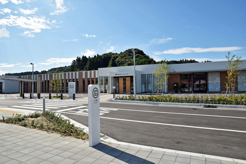
2019年にオープンした道の駅。周辺地域の魅力を発信する取り組みを行っている。産直所・イタリアンレストラン・温泉・ドッグラン・レンタサイクルなど盛りだくさん
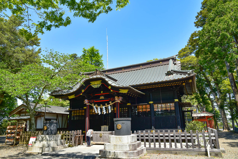
関東屈指のパワースポットとして女性に人気の神社。縁結び・子授け・安産などに御利益があるといわれる。黒漆塗り権現造りの社殿は珍しい。一周無事に走りきれるようお参りして、先に進もう!
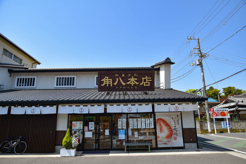
江戸時代中期から続く老舗和菓子屋。朝7時から営業しているので補給食を購入しておこう。人気の「みかん大福」はジューシーなみかんが丸ごと入っているので水分補給にもなる!?
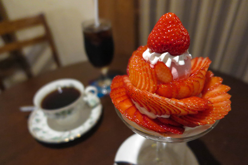
古民家をリノベーションした店内は落ち着いた雰囲気。期間限定の季節のフルーツパフェは、苺・桃・シャインマスカットなど旬の時期により変化するので要チェック。珈琲はネルドリップで丁寧に淹れるこだわり
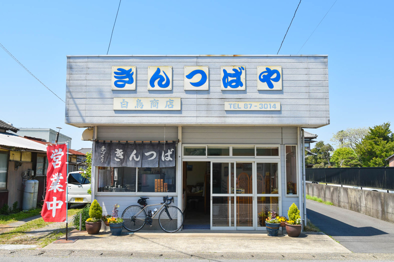
小ぶりの今川焼きという感じだが、この地域では「きんつば」と呼ばれる。1つ100円と手頃で通るたびに買いたくなる魅力がある。きんつばの販売は10月~6月中旬まで。夏期はかき氷の販売になるので注意!

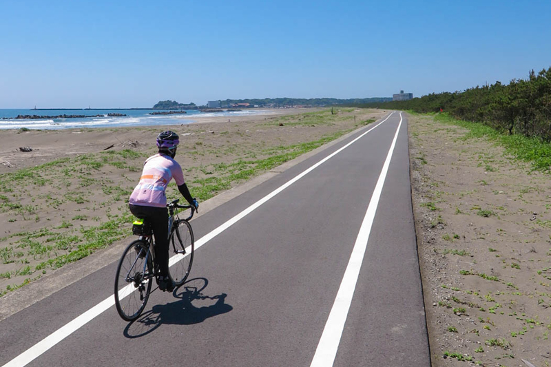
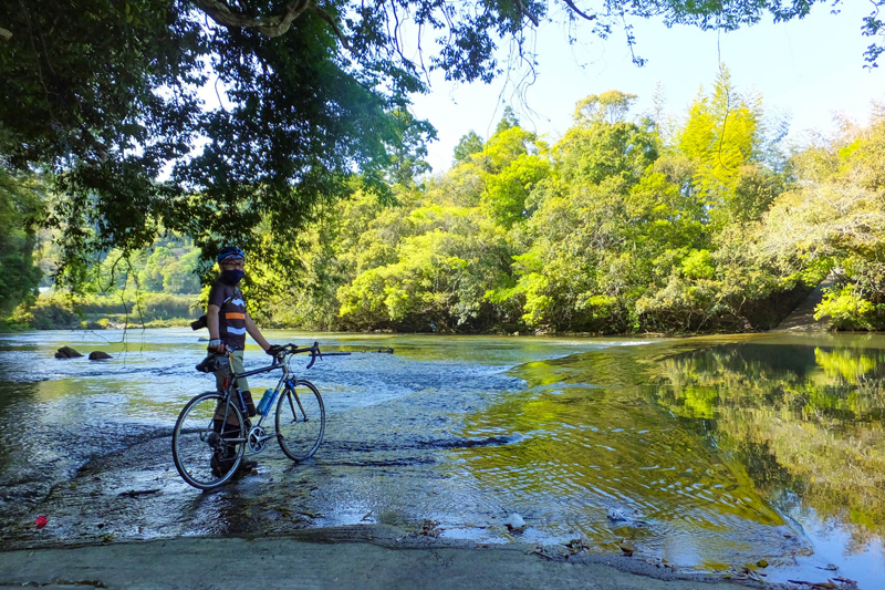
夷隅川を渡り日在海岸沿いに走る大原自転車道は、真横に海が続く爽快な自転車道という雰囲気。ただし砂に覆われている場合もあるので、その区間は安全第一で押し歩きで通過しよう
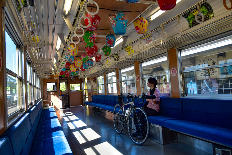
車内に自転車をそのまま持ち込めるのが魅力的!乗車の際には「自転車・手荷物手回り券」を購入する。通勤時間時や混雑時は乗せられない場合があるので要確認

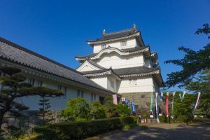
徳川四天王の一人として知られる本多忠勝が初代藩主。本丸跡に城郭様式で建てられた博物館には刀や鎧などが展示されている。城の窓から大多喜の町並みが一望できる

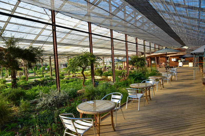
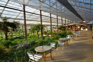
全天候型室内ガラスハウスのハーブ園。入園無料。ハーブカフェレストランでは園内産フレッシュハーブを使った料理やお茶が楽しめる。ガーデンショップでハーブティーやドライハーブなどをお土産で購入しよう
ギャラリー&ショップ併設の一軒家カフェ。ランチは月ごとに代わる「本日のごはん」のみ。併設のギャラリーには冬季や雑貨など、こだわりの品が並ぶ。営業は不定休なのでInstaramで要確認!
