


![]()
![]()
![]()
![]()
![]()
![]()
![]()
![]()

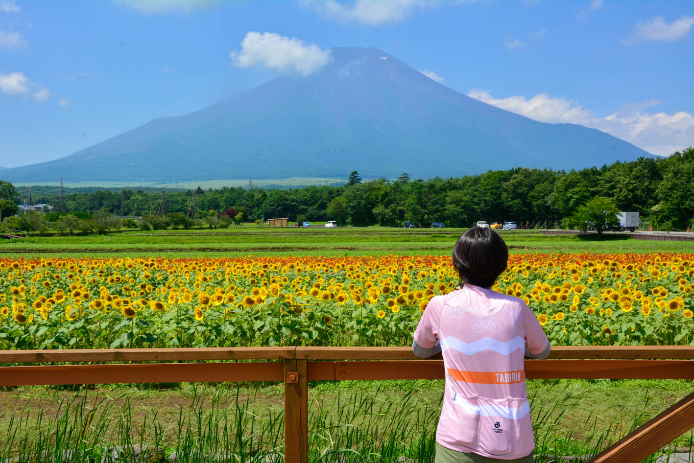


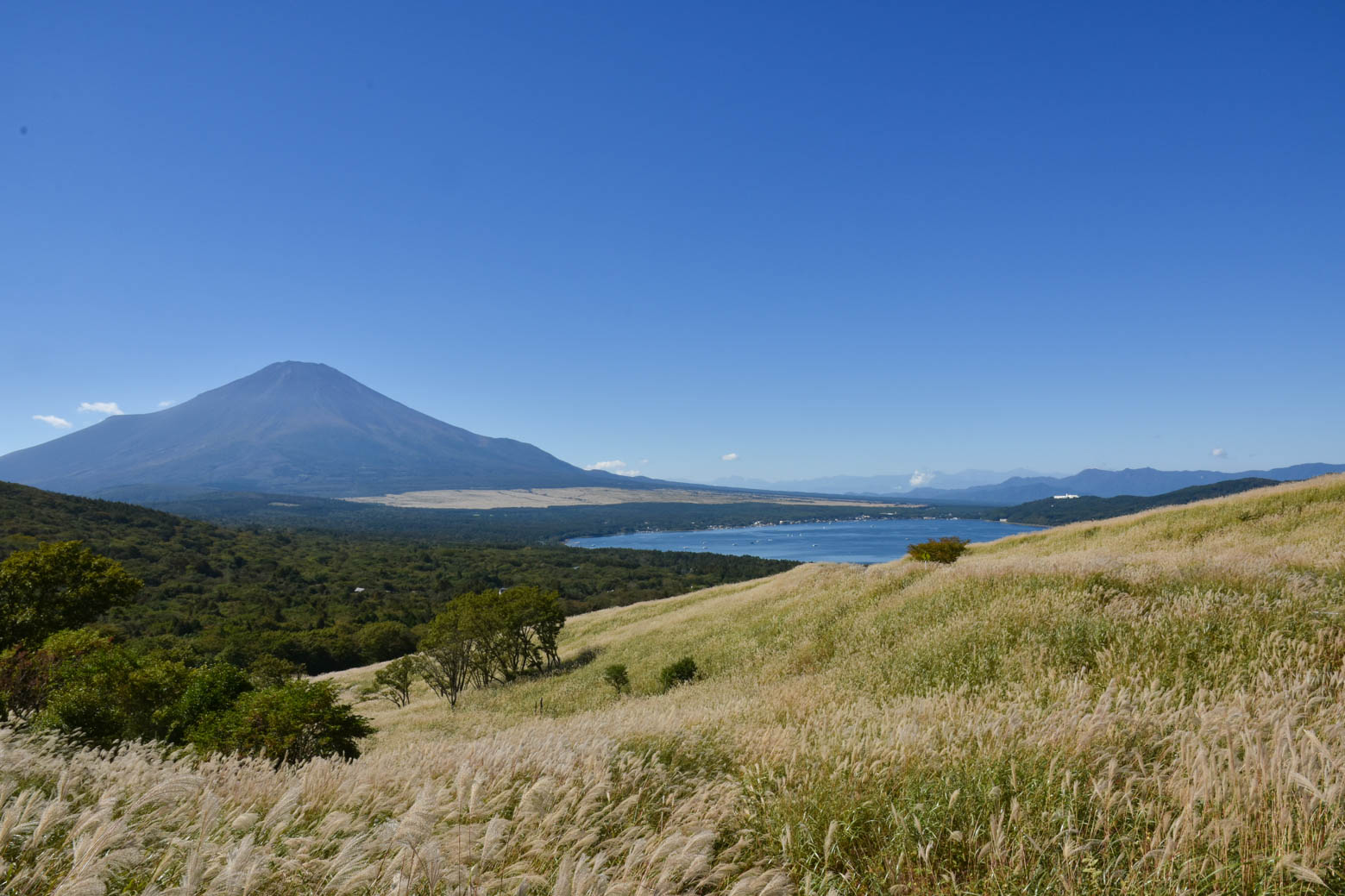
富士山駅をスタートして、まずは忍野八海や花の都公園で観光気分を味わい山中湖へ。脚も暖まってきたら、いよいよ峠道に突入!緩やかな斜度を上っていくと、山中湖と富士山のコラボレーションが素晴らしいパノラマ台に到着。その先には県境の三国峠。ここから一気に急降下する。
明神峠は坂の途中にあるので見過ごさないように。本ルートは国際スポーツ大会でのルートの逆周りを推奨しているが、選手が上る際は斜度20%という箇所もある激坂ポイントだ! 選手気分を味わいたい人は、逆周りを走るのもアリだろう。本ルートは山中湖エリアを過ぎると須走地区までコンビニなどが無いので補給はしっかり用意しておこう。ラストは籠坂峠を越え山中湖へ。そのまま富士山駅に向かいゴールとなる
Start at Fujisan Station and first enjoy the feeling of sightseeing at Oshino Hakkai or Flower Park, then head to Lake Yamanaka. Once your legs have warmed up, it's time to rush into the mountain pass! As you go up the gentle slope, you will arrive at a panoramic platform where the collaboration between Lake Yamanaka and Mt. Fuji is wonderful. Beyond that is Mikuni Pass on the prefectural border. It descends rapidly from here all at once.
Myojin Pass is in the middle of the hill, so don't overlook it. This route is recommended to go around the opposite direction of the route at international sports competitions, but when athletes climb, it's a steep slope of 20%! If you want to feel like an athlete, it would be a good idea to run in reverse. If you go past the Yamanakako area on this route, there are no convenience stores until the Subashiri area, so be sure to prepare supplies. Finally, cross Kagosaka-toge Pass and go to Lake Yamanaka. Head straight to Fujisan Station and get to the goal
神奈川県相模原市の青山交差点から山梨県山中湖村につづく国道413号の事を「道志みち」という。神奈川県のエリアは約14キロほど。道志村を通る国道沿いには清流・道志川が流れ、キャンプ場が30以上もあり「キャンプ場の聖地」とも呼ばれる自然豊かな場所だ。
もともと多くのサイクリストが訪れる人気の場所ではあったが、ここ数年は国際スポーツ大会の影響でさらに増えている。道志村ではサイクルサポートステーションを数多く設置し、サイクリストが安心快適に楽しめるサポートもしてくれている。世界トップクラスの自転車競技選手が走るルートを体感するために、ぜひ道志みちを訪れてみよう!
マップ詳細へ※オンラインの地図上でサイクリングルートが閲覧できるウェブサイト「ルートラボ」が2020年3月末でサービス終了したため、「bikemap」に変更したことで、bikemap内の距離や高低差に誤差が生じている場合がありますが、ご理解ご了承の程、よろしくお願いします。
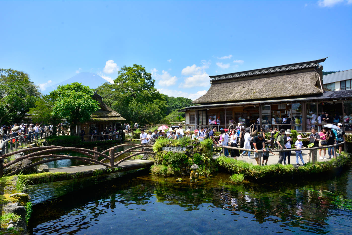
富士山の伏流水を水源とする湧水池。国の天然記念物、富士山世界文化遺産、全国名水百選にも選ばれている。池の底までハッキリ見える透明度は一見の価値ありだ!

公園入口の花畑・農園エリアは30万平方メートルの敷地に四季折々の花が咲き、富士山とのコラボレーションが無料で楽しめる。有料エリアでは明神の滝・全天候型温室フローラルドームふららなどがあり、さらに楽しめる
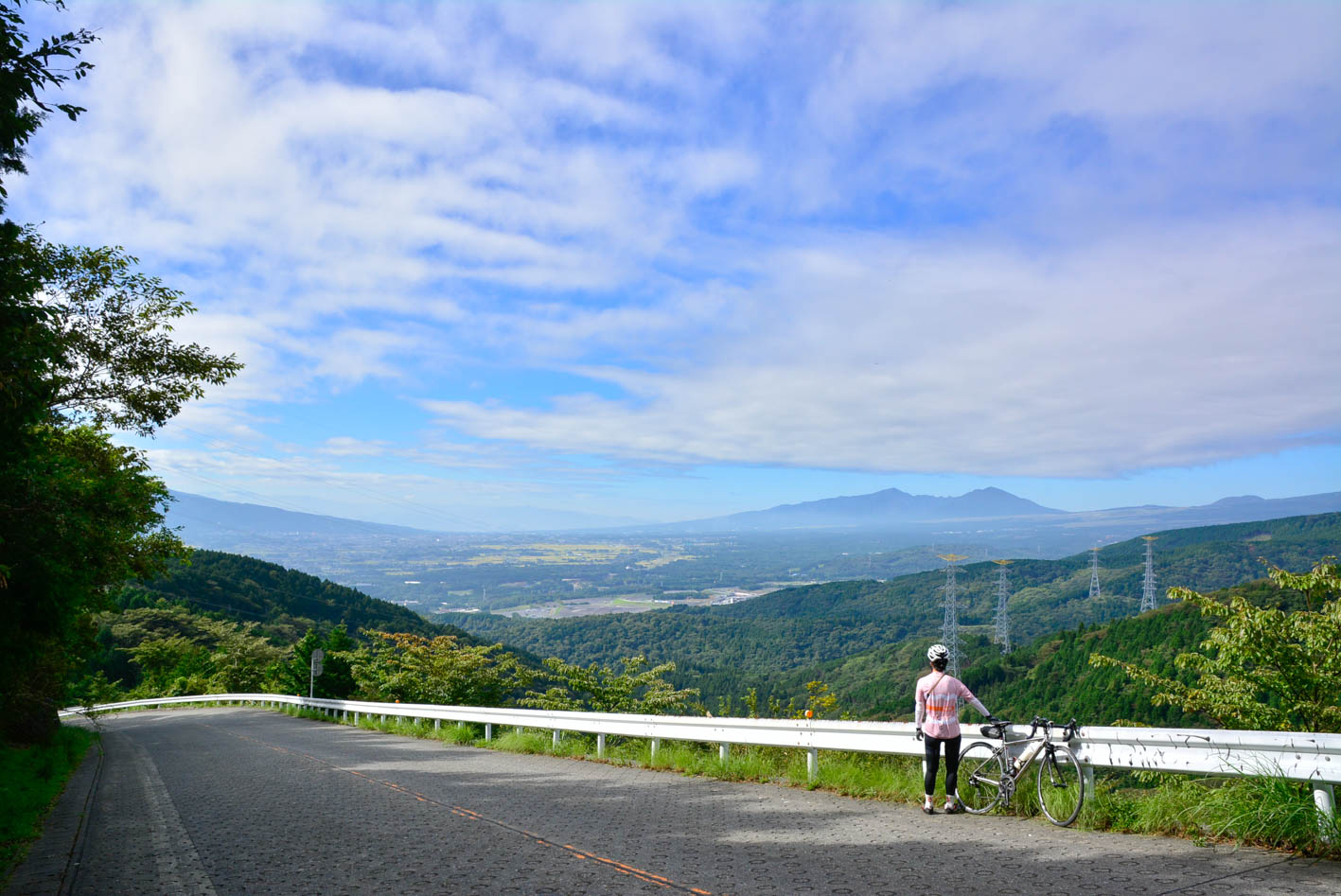
真空コンクリート舗装の区間には斜度18%の看板があり、普通に立っているのも大変な坂だ。国際スポーツ大会では本ルートとは逆周りになるので、選手達はこの激坂を走って上ることになる。そう考えながら坂を下ると選手の凄さを実感できる
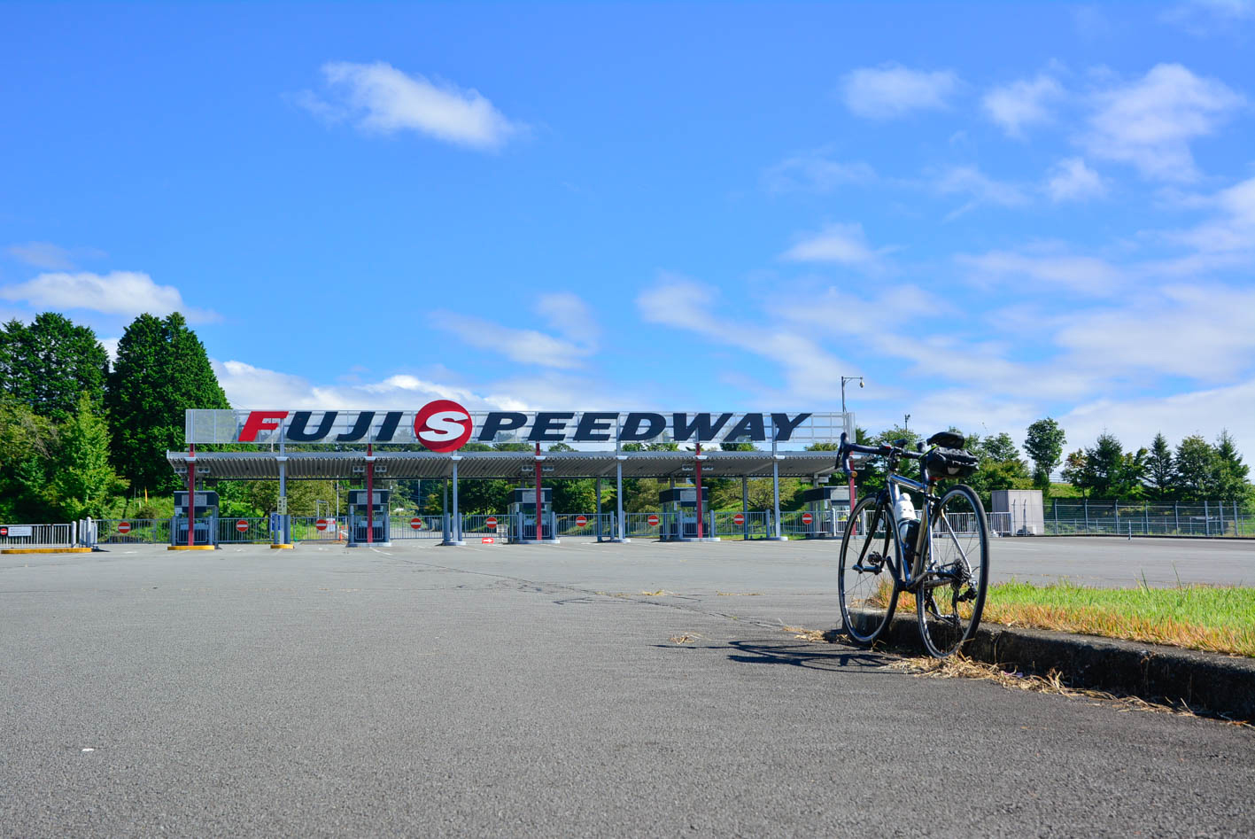
富士山の麓に位置する国際サーキットです。FIA世界耐久選手権(WEC)を始めとする国際レースから自転車レース、マラソン大会など、様々なイベントを実施しています。また、2017年7月にオープンした富士ジュラシックウェイでは、動く恐竜を見ることができ、子供~大人まで楽しめる施設となっています。

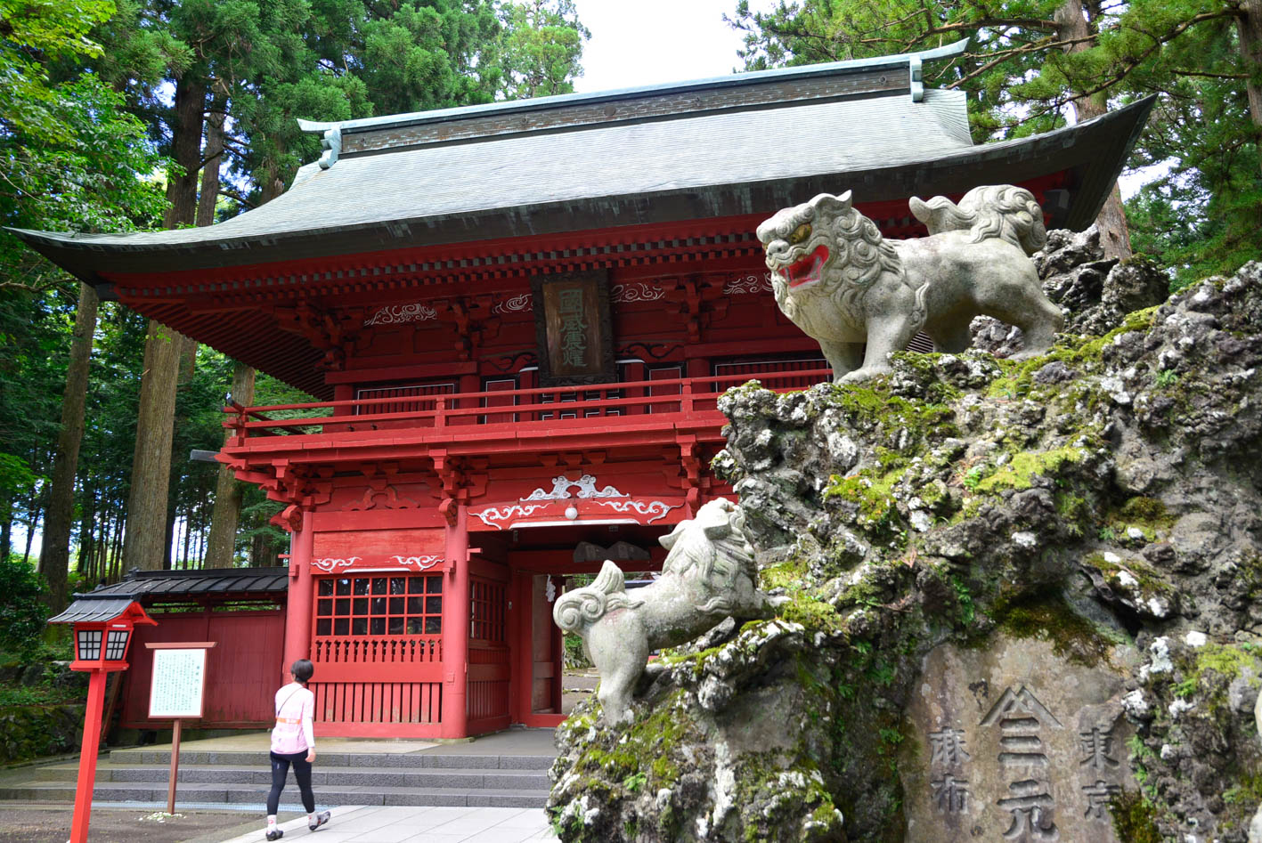
延暦大噴火の際に国司・郡司により富士山の噴火を鎮める祭祓が行われた。その鎮火祭の跡地に社殿を造営したと伝えられる。入口の「富士塚の狛犬」は獅子の子落としを表現している
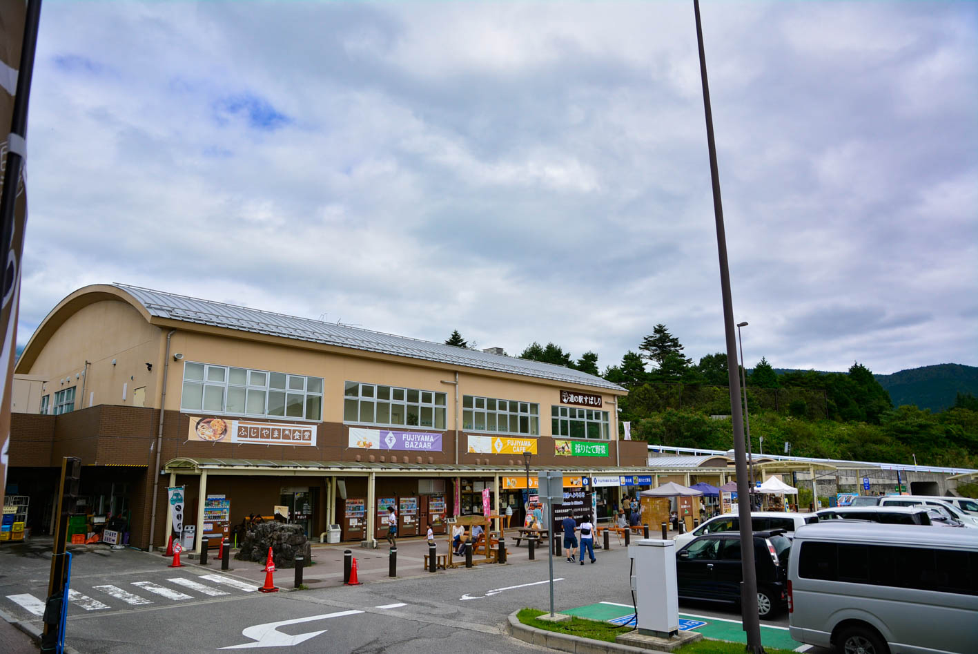
1階はお土産品やソフトクリームが買える売店があり、2階にはふじやま食堂がある。2階テラス席の奥には足湯があり、富士山を眺めながらくつろげる
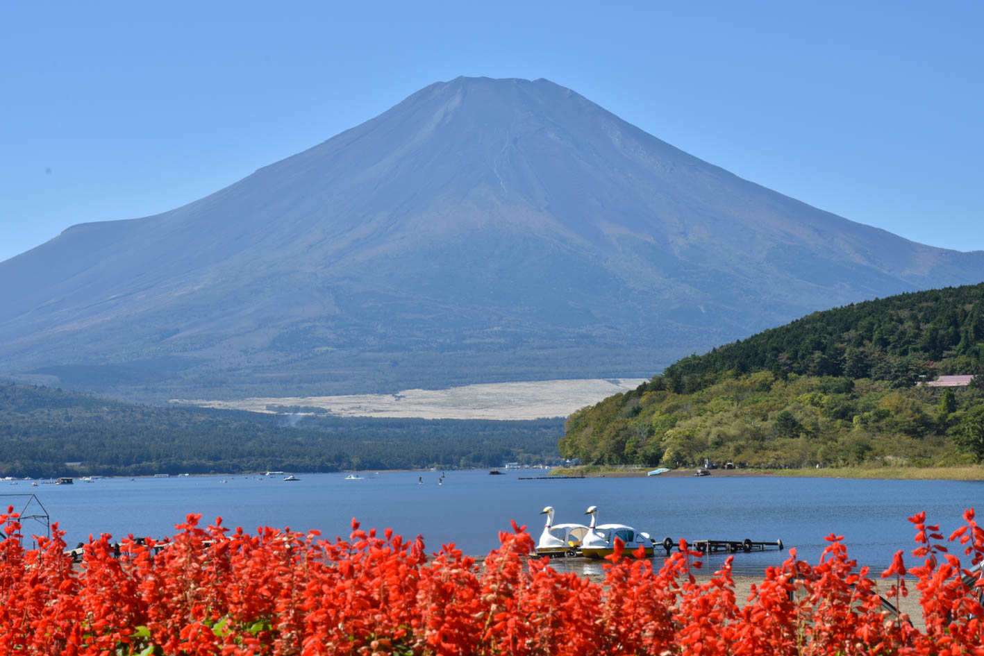
富士五湖の中で最大の面積で、最も標高が高い位置にある湖。昔は形が牛に似ていると「臥牛湖」と呼ばれたが、最近では「クジラ」と言われる。湖畔には眺望スポットが多いため、カメラマンにも人気が高い。風が弱く湖面が穏やかになると美しい逆さ富士も見ることができる
