


![]()
![]()
![]()
![]()
![]()
![]()
![]()
![]()

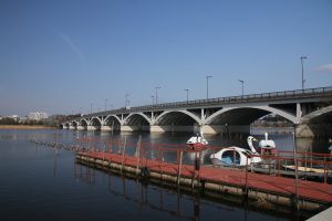
一般県道我孫子流山自転車道線は、千葉県我孫子市から柏市までの約20kmの自転車道です。
通称「手賀沼自転車道」と呼ばれています。
計画延長30.8kmのうち、約20km分を掲載。
より詳細な情報を掲載したい自治体の方はこちら
The general prefectural road Abiko Nagareyama bicycle path line is a bicycle path approximately 20 km from Abiko City to Kashiwa City in Chiba Prefecture. It is commonly known as the "Teganuma Bicycle Path." Of the 30.8 km planned extension, approximately 20 km is posted. For local governments that would like to post more detailed information, click here
※オンラインの地図上でサイクリングルートが閲覧できるウェブサイト「ルートラボ」が2020年3月末でサービス終了したため、「bikemap」に変更したことで、bikemap内の距離や高低差に誤差が生じている場合がありますが、ご理解ご了承の程、よろしくお願いします。
