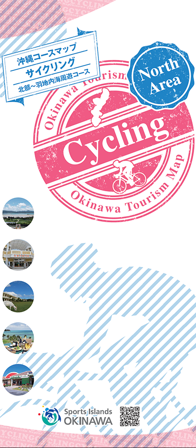
コース・マップ検索
本部・羽地周遊コース
距離 Distance:
50.4km
獲得標高 上り Elevation Gain (Up):
371m
獲得標高 下り Elevation Gain (Down):
376m
最大標高差 Maximum elevation difference:
76m
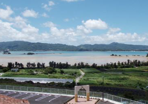
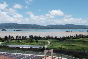
沖縄本島北部にある「やんばるエリア」のサイクリングコース。「沖縄の松島」と称される「羽地内海」を中心に、名護市、本部町、今帰仁村を巡り、「ワルミ大橋」や「古宇利大橋」といった絶景ポイントから眺めるオーシャンビューは、他では味わえない感動を与えてくれます。
A cycling course in the “Yanbaru Area” in the northern part of the main island of Okinawa. Centering on the “Haneji Inland Sea,” called “Matsushima in Okinawa,” the ocean view that you can see from spectacular points such as the “Warumi Bridge” and “Kouri Bridge” gives you an impression that cannot be experienced anywhere else.
コース掲載マップ 沖縄コースマップサイクリング 北部~羽地内海周遊コース
オススメスポット ビュースポット いきもの・植物 グルメ ショッピング 道の駅 温泉 宿泊 病院 レンタサイクル 自転車販売店 サイクリングサポート トイレ その他
※オンラインの地図上でサイクリングルートが閲覧できるウェブサイト「ルートラボ」が2020年3月末でサービス終了したため、「bikemap」に変更したことで、bikemap内の距離や高低差に誤差が生じている場合がありますが、ご理解ご了承の程、よろしくお願いします。
コース周辺スポット
全て
オススメスポット
ビュースポット
グルメ
ショッピング
道の駅
温泉
宿泊
病院
レンタサイクル
トイレ
その他
で絞り込む
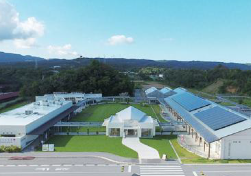
なごアグリパーク
住所:沖縄県名護市名護4607-1
TEL:0980-43-6010
営業時間:
10:00~18:00
定休日:
日曜日、月曜日(加工支援施設)、年中無休(その他施設)
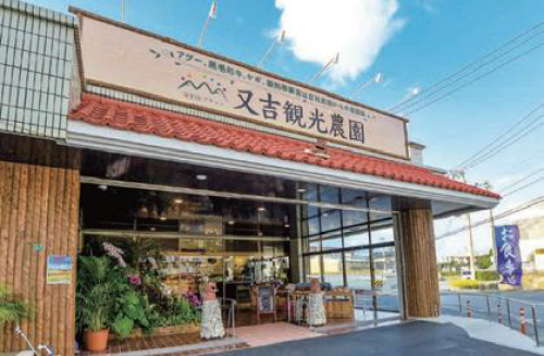
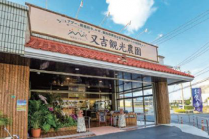
又吉観光農園
住所:沖縄県名護市大北1-23-1
TEL:0980-43-5535
営業時間:
11:00~22:00
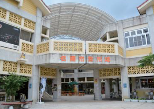
名護市営市場
住所:沖縄県名護市城1-4-11
TEL:0980-53-1212(名護市役所)
営業時間:
店舗により異なる
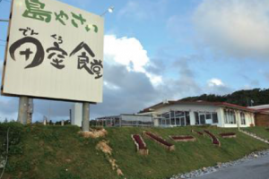
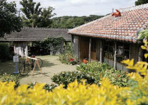
古民家café 喜色
住所:沖縄県名護市饒平名19
TEL:0980-52-8126
営業時間:
11:00~19:00
定休日:
月曜日
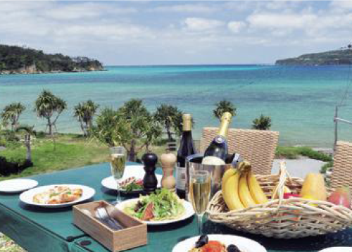
美らテラス
住所:沖縄県名護市字済井出大堂1311
TEL:0980-52-8082
営業時間:
11:00~18:00(夏季10:30~)
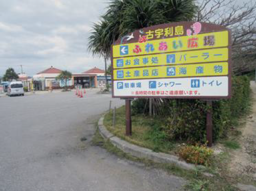
古宇利ふれあい広場
住所:沖縄県国頭郡今帰仁村古宇利323
TEL:0980-56-5574
営業時間:
9:00~18:00
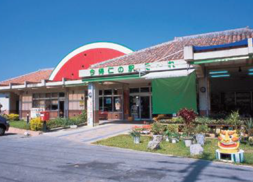
今帰仁の駅そーれ
住所:沖縄県今帰仁村字玉城157
TEL:0980-56-4940
営業時間:
9:00~18:00
今帰仁あいあいファーム
住所:沖縄県国頭郡今帰仁村湧川369
TEL:0980-51-5111
営業時間:
11:00~15:00
田空の駅ハーソー公園
住所:沖縄県国頭郡本部町具志堅1334
TEL:0980-48-3835
営業時間:
10:00~18:00
定休日:
火曜日
もとぶ浜の駅
住所:沖縄県国頭郡本部町崎本部671-1
TEL:0980-51-6536
営業時間:
9:00~18:00
屋我地支所
住所:沖縄県名護市字饒平名1177-1
TEL:0980-52-8101
営業時間:
8:30~17:15
定休日:
土曜日、日曜日、祝日、6/23、12/29~1/3
お菓子のEBISU為又店
住所:沖縄県名護市宮里1499
TEL:0980-52-2145
営業時間:
10:00~20:00
羽地の駅
住所:沖縄県名護市字真喜屋763-1
TEL:0980-58-2437
営業時間:
9:00~19:00
カフェ エニシ
住所:沖縄県名護市大東1-11-11
TEL:0980-43-0533
営業時間:
11:30~22:00
ホテルルートイン名護
住所:沖縄県名護市東江5-11-3
TEL:0980-54-8511
ホテルリゾネックス名護
住所:沖縄県名護市字山入端247-1
TEL:0980-53-8021
営業時間:
9:00~18:00
ホテルゆがふいん沖縄
住所:沖縄県名護市宮里453-1
TEL:0980-53-0031
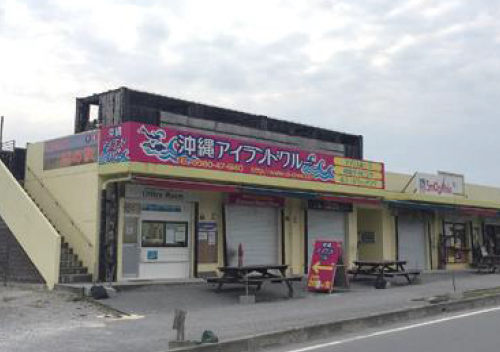
リカリカワルミ
住所:沖縄県国頭郡今帰仁村字天底1124-5
TEL:0980-56-1223
営業時間:
[直売所]9:00~18:00、[レストラン]11:00~18:00(L.O.17:00)
定休日:
第1水曜日(ただし、1月、5月、8月は除く)
海辺のCaféかぬたん
住所:沖縄県国頭郡本部町具志堅632-1
TEL:0980-48-4771
営業時間:
11:00~16:00
あっちゃんの塩工房
住所:沖縄県国頭郡本部町備瀬1779-1
TEL:0980-51-7555
営業時間:
10:00~18:00
定休日:
水曜日
もとぶかりゆし市場
住所:沖縄県国頭郡本部町大浜881-1
TEL:0980-43-0280
営業時間:
9:00~19:00
ドライブインレストランハワイ
住所:沖縄県本部町字崎本部4578
TEL:0980-47-2927
営業時間:
11:00~21:00
定休日:
木曜日
名護市役所
住所:沖縄県名護市港1-1-1
TEL:0980-53-1212
北部地区医師会病院
住所:沖縄県名護市字宇茂佐1712-3
TEL:0980-54-1111
受付時間:
[月曜日~金曜日]8:30~11:00、13:30~16:00
[土曜日8:30~11:00
休診日:
土曜日午後、日曜日、祝祭日
県立北部病院
住所:沖縄県名護市大中2-12-3
TEL:0980-52-2719
受付時間:
[初診受付時間(平日)]8:30~11:00[再診受付時間(平日)]8:30~14:00
休診日:
土曜日、日曜日、祝祭日