![]()
![]()
![]()
![]()
![]()
![]()
![]()
![]()
京都から大津へ向かうルートの一つで、逢坂の関(大関越え)に対し小関越えと呼ばれ、山科から三井寺に至るルート。琵琶湖の水量を調節するために造られた南郷洗堰まで南下、折り返して湖岸道路沿いに守山を目指す。峠を越えてからは琵琶湖を左に眺めながらの走行となり景色もよく気持ちいい。
It is one of the routes from Kyoto to Otsu, and it is called Koseki crossing (crossing the Ozeki) in Osaka, and it is a route that goes from Yamashina to Mii-dera Temple. Go south to the Nango-arai dam, which was built to control the amount of water in Lake Biwa, then turn back and aim for Moriyama along the lakeshore road. After crossing the mountain pass, I was driving while looking at Lake Biwa to the left, and the scenery was nice and comfortable.
※オンラインの地図上でサイクリングルートが閲覧できるウェブサイト「ルートラボ」が2020年3月末でサービス終了したため、「bikemap」に変更したことで、bikemap内の距離や高低差に誤差が生じている場合がありますが、ご理解ご了承の程、よろしくお願いします。
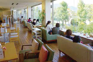
大きな窓からのレイクビューが人気のカフェ。ウッディーなインテリアがおしゃれで、ゆったりと琵琶湖を眺めながら、旬の地元野菜を使った週替わりのヘルシーランチをお楽しみいただけます。
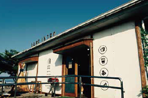
琵琶湖に張り出した烏丸半島の中心に佇むカフェ。大自然を眺めながらの休息は他では味わえないひと時を過ごせます。サイクルスタンドや基本工具を揃えていてサイクリストのサポートは万全です。
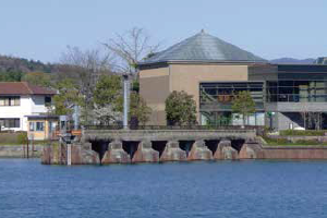
明治期に築造された琵琶湖や下流河川の水量調整施設。土木遺産に認定されていて、隣接のアクア琵琶でその役割を学べます。向かいの南郷水産センターではアユやマスの塩焼も楽しめます。
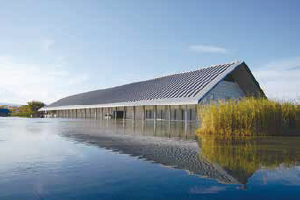
比叡・比良山を仰ぐ、琵琶湖のほとりに佇む佐川美術館。水庭を建物を取り囲むように配置したその姿は「水に浮かぶ美術館」とも称されています。

無料駐車場が朝7時30分から利用できるなど、サイクリストの発着地としてオススメです。サイクリングの後は、琵琶湖を眺めながらおいしいスイーツやグルメが楽しめるほか、その他施設も充実し、1日中楽しめる施設ですので是非ご利用ください。