![]()
![]()
![]()
![]()
![]()
![]()
![]()
![]()
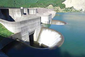
旧東海道を草津~水口~土山と辿り、後半はダムを巡って守山へ戻るルート。滋賀県のダムカードの大半をゲットできる。距離もアップダウンもそれなりにあるが、季節によっては夕陽のびわ湖を見ることもできる。近江鉄道のサイクルトレインを利用することでショートカットも可能。
Follow the old Tokaido from Kusatsu to Mizuguchi to Tsuchiyama, and the second half is a route that goes around the dam and returns to Moriyama. You can get most of the Shiga Prefecture dam cards. The distance and ups and downs are reasonable, but depending on the season, you can also see Lake Biwa at sunset. Shortcuts are also possible by using the Omi Railway cycle train.
※オンラインの地図上でサイクリングルートが閲覧できるウェブサイト「ルートラボ」が2020年3月末でサービス終了したため、「bikemap」に変更したことで、bikemap内の距離や高低差に誤差が生じている場合がありますが、ご理解ご了承の程、よろしくお願いします。
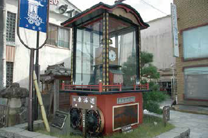
水口宿は東海道五十三次の50番目の宿場。最盛期には40余りの旅宿と本陣で賑わいました。この三筋に水口祭の曳山を模した、からくり時計が設置されていて、午前9時・正午・午後3時・午後6時に動く仕掛けは一見の価値あり。
ダム湖畔にある青土ダムエコーバレイでは、キャンプや釣り堀などで自然を満喫。ログハウス風のコテージでは喫茶・軽食で休憩もできます。ここから鮎河地区まで続く桜並木は壮観のひと言です。
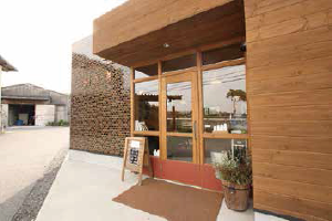
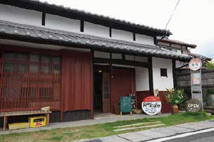
風情ある日野商人の町並みに佇むレトロなカフェ。古民家を改装した店内はとても落ち着きがあり、地元食材で作るランチが人気。休憩がてら、焼き菓子とコーヒーなどで、ほっと一息できます。
自社牧場の搾りたてミルクを使用したジェラートやチーズ等の乳製品を販売しています。牧場チーズを使用したランチや体験型のメニューの充実しています。

無料駐車場が朝7時30分から利用できるなど、サイクリストの発着地としてオススメです。サイクリングの後は、琵琶湖を眺めながらおいしいスイーツやグルメが楽しめるほか、その他施設も充実し、1日中楽しめる施設ですので是非ご利用ください。