


![]()
![]()
![]()
![]()
![]()
![]()
![]()
![]()
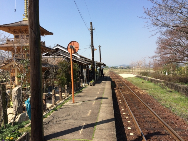
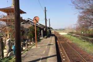
兵庫県加西市北条町駅~小野市粟生駅を結ぶローカル線「北条鉄道」が走るまち・加西市の南部を線路沿いに走るコース。一両編成のディーゼル列車に、田んぼ、青空、赤い鉄橋…など、”撮り鉄”ならずとも、撮影したくなるナイスな風景があちこちに!法華口駅構内の「駅舎工房 Mon Favori」をはじめ、ランチバイキングが人気の「えぇもん王国」、ナポリピッツァの「IL BI-NARIO DI ORO」やおふくろの味の「カフェ☆えん」など、素敵なグルメ処も満載。癒しの風景や絶品料理に拍手かっさい!な加西サイクリングへぜひ。加西市発行のサイクリングマップ「カサイチ」もチェックしてみて。
カサイチサイクリングマップのURLはこちら
This course runs along the southern part of Kasai City, the town where the local line "Hojo Railway," which connects Hojocho Station in Kasai City, Hyogo Prefecture to Ao Station in Ono City, runs. The one-car diesel train, rice fields, blue skies, red iron bridges... there are nice scenes all over the place that you'll want to take pictures even if you're not a "shooting iron"! Starting with "Station Building Workshop Mon Favori" inside Hokkeguchi Station, there are also plenty of wonderful gourmet places, such as "Eemon Kingdom," which has a popular lunch buffet, "IL BI-NARIO DI ORO" Neapolitan pizza, and "Cafe ☆ EN," which has a mother's flavor. I applaud the healing scenery and exquisite food! Be sure to go to Kasai Cycling. Also check out the cycling map "Kasaichi" issued by Kasai City. Click here for the Kasaichi Cycling Map URL
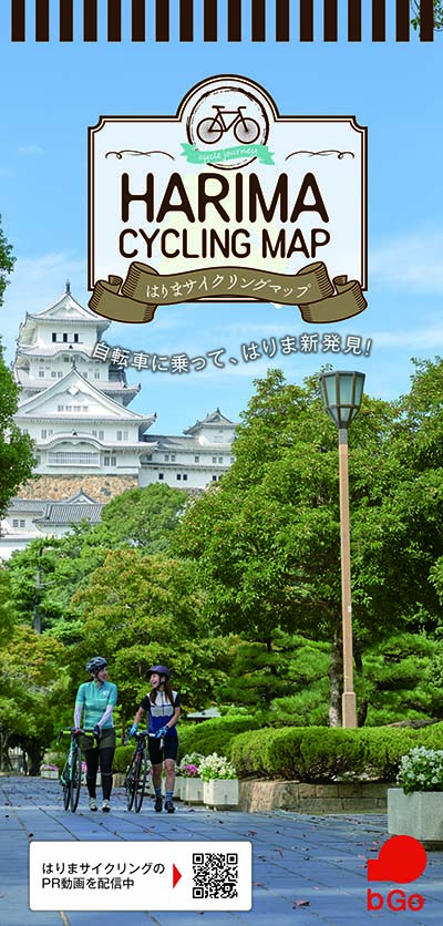
自転車に乗って、はりま新発見!
マップ詳細へ※オンラインの地図上でサイクリングルートが閲覧できるウェブサイト「ルートラボ」が2020年3月末でサービス終了したため、「bikemap」に変更したことで、bikemap内の距離や高低差に誤差が生じている場合がありますが、ご理解ご了承の程、よろしくお願いします。
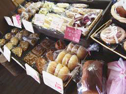
北条鉄道の法華口駅は、パン屋さんと駅が合体したユニークな駅。「駅舎工房 Mon Favori」には20種類ほどのできたてパンがズラリ。加西市産の米粉と地域食材をふんだんに使った、こだわりのパン目当てのお客さんが、10時のオープン前から行列をつくる。※自転車レンタルあり
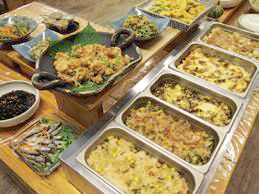
「安心な地元・加西のお米、朝獲り新鮮野菜や卵を使った手作りごはん」をテーマにした食事処「えぇもん王国」では、モーニング、ランチを楽しめる。加西市を中心とした「播磨のえぇもん」が大集結の農家直売所コーナーも要チェック。11時30分からスタートのランチバイキングには、オープン時間前にお客様が集まる人気ぶり。
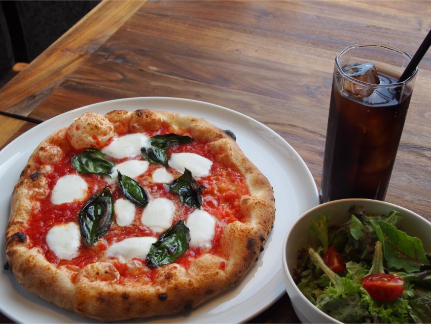
2016年6月、北条鉄道の播磨横田駅前に誕生したピッツェリア。本場ナポリで修業して腕を磨いた店長の藤原さんが、地元・加西産の美味しい野菜を多用したピッツァを提供。
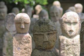
素朴な表情の石仏500体がズラリと並ぶ「北条石仏」。いつ、だれが、なんのために作ったか、それを解き明かす史実も、資料も、確かな言い伝えも、何一つとして存在していないそう。
いつも明るい笑顔でお客様を迎える山中さんご夫婦とのおしゃべりを楽しみに、足しげく通うファンも多い。
山陽~山陰地方を結ぶ旧街道のうち、北条町横尾西端から東の地蔵さん辺りまでは「横尾歴史街道」と呼ばれ、昔ながらの旧家のまち並みが残る。その街道沿いにある国登録有形文化財「水田家住宅」が、2014年7月より「横尾歴史街道町かど亭」という名前で、カフェ&旅館に。水田家住宅は「かぎまん」の屋号で親しまれた荒物の卸問屋兼住宅として1922年(大正11年)に建築された趣深い建物。コーヒー200円(税込)やカレー350円(税込)などを楽しみながら、地域の歴史、文化にふれることが出来る。長年、地元のボランティアガイドとして活躍している建物の所有者である水田加代子さんのお話を聞くのも楽しみ。
