


![]()
![]()
![]()
![]()
![]()
![]()
![]()
![]()
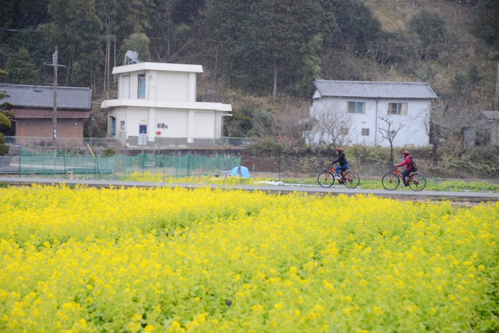


姫路城の西、雪彦山から書写山のふもと、播磨灘まで流れる夢前川に沿って、田園風景を肌で感じるサイクリングコース。高低差も少ないので楽チン!道中黄色がまぶしい★菜の花畑を横目にビューン!書写山でロープウェイにのるのもよし、ヘルシーランチや美味しい珈琲を堪能したり、ゆったりと雪彦温泉でリフレッシュも♪
A cycling course where you can feel the rural scenery firsthand along the Yumesaki River, which flows west of Himeji Castle, from Mt. Yukihiko to the foot of Mount Shosha, to the Harima Sea. There are few differences in elevation, so it's easy! The yellow color is dazzling along the way ★ Viewed sideways through a field of rapeseed flowers! You can ride the ropeway at Mount Shosha, enjoy a healthy lunch and delicious coffee, and relax and refresh yourself at Yukihiko Onsen ♪
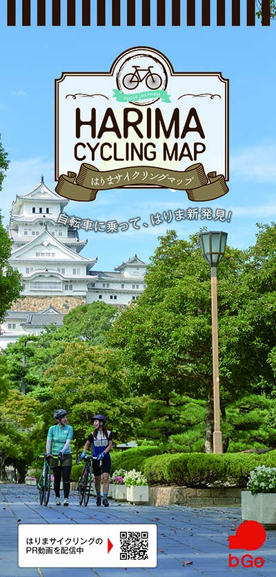
自転車に乗って、はりま新発見!
マップ詳細へ※オンラインの地図上でサイクリングルートが閲覧できるウェブサイト「ルートラボ」が2020年3月末でサービス終了したため、「bikemap」に変更したことで、bikemap内の距離や高低差に誤差が生じている場合がありますが、ご理解ご了承の程、よろしくお願いします。
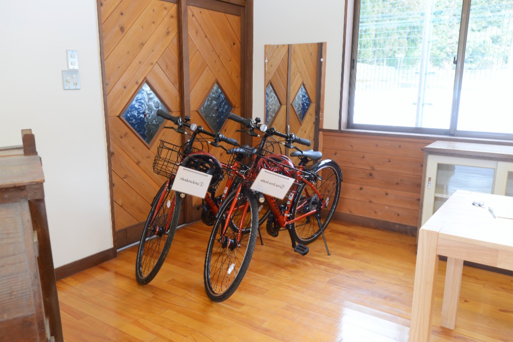
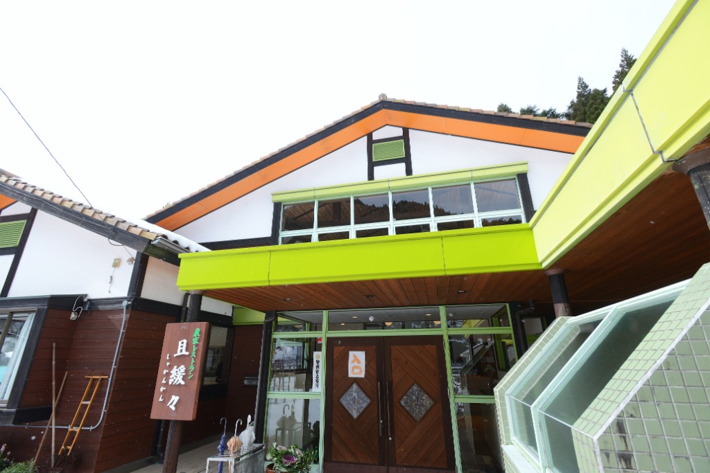
農家レストラン「且緩々(しゃかんかん)」内のサイクルステーション。レストランは完全予約制のランチバイキングなので前日までに必ず連絡を。ランチタイム以外はカフェ休憩できるほか、靴を脱いでくつろげる休憩室や上質なハーブ用品(化粧品、アロマ、ハーブティーなど)を購入できるお店もあり、多目的に利用できる。
地元の子供たちが通っていた幼稚園をリノベーションした農家レストラン。バイキングスタイルで楽しめる約20種のメニューは地元野菜を多用。その力強い滋味は一度味わうと忘れられないほど美味!
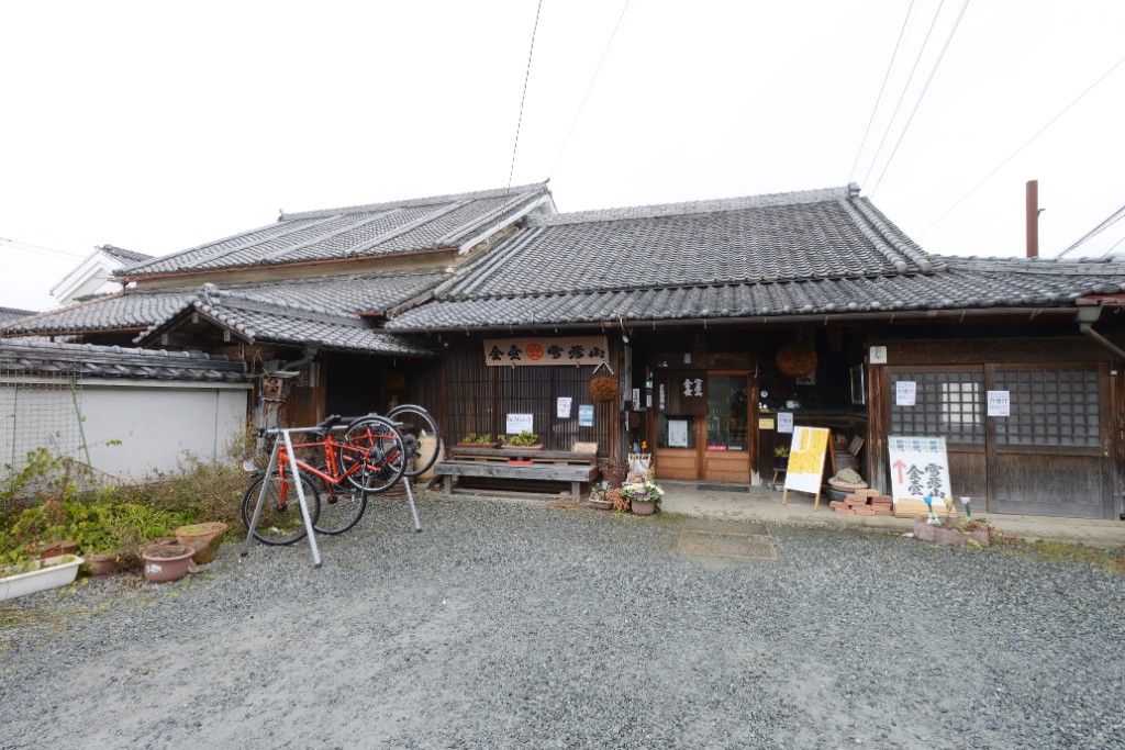
創業200年の歴史を感じる小さな酒蔵。「Bicycle-5」の看板を掲げ、エコな自転車での来店者には感謝を込めて買物総額から5%オフサービス!清酒からリキュール、珍しいなでしこ酵母酒など、お土産に買って帰ると鼻高々♪なお酒がズラリ。
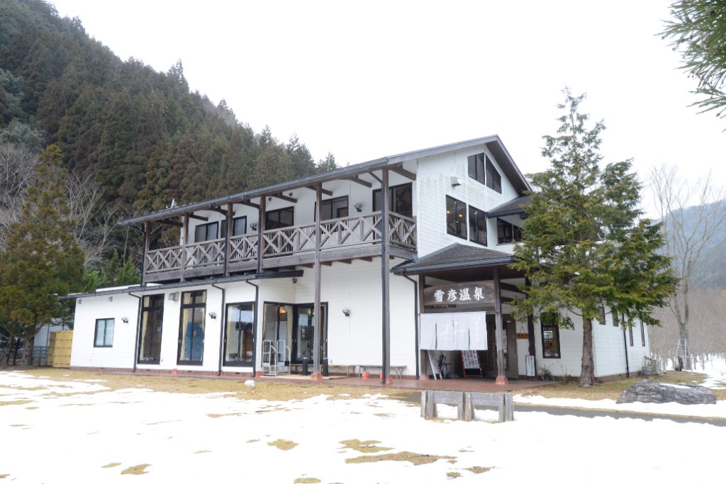
100%源泉、加水なしという極上の温泉を日帰りで気軽に利用できる。美しい夢前川のせせらぎと、雪彦山麓に抱かれた閑静な山峡の秘湯にゆったり浸かれば、サイクリングで疲れた身体もたちまち元気いっぱいに。
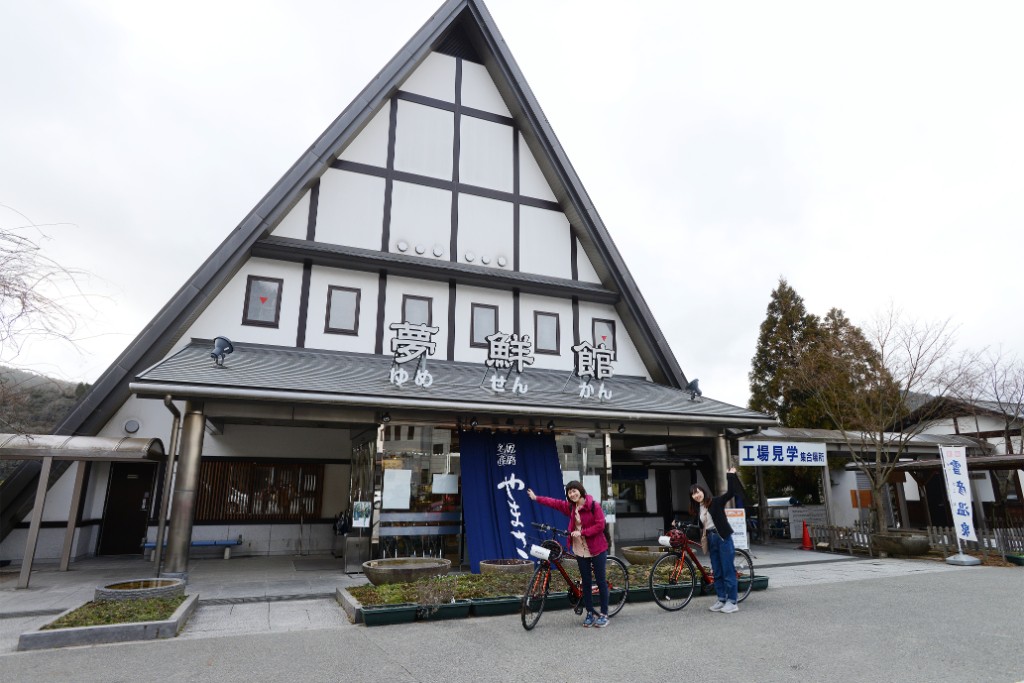
工場直送のかまぼこ、揚げたての天ぷらなど、お土産はココで決まり!かまぼこ工房「夢鮮館」ほか、無料で利用できる雪彦温泉の足湯、だんごや珈琲が評判のカフェ「茶房一福」など、広大なスペースにうまいものが満載!
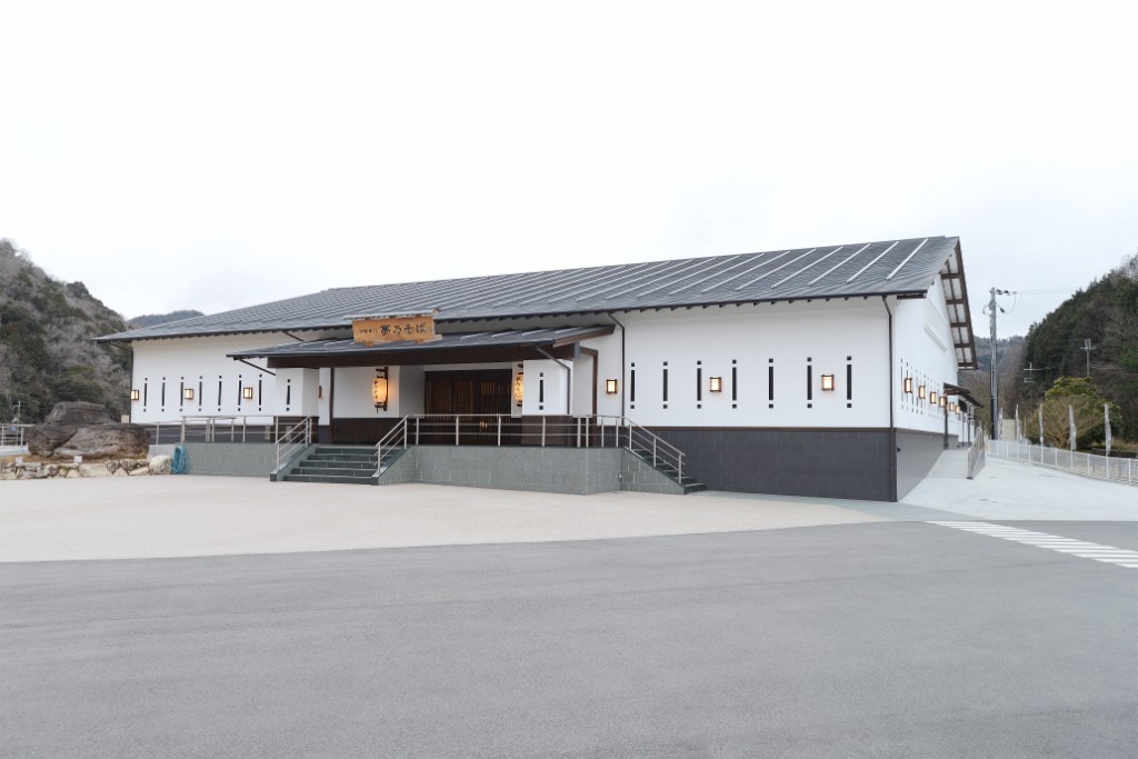
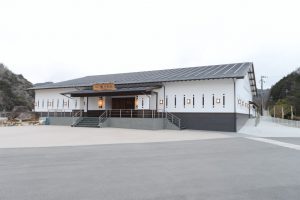
2016年2月、「夢鮮館」から南へ200mの場所に移転オープンしたお食事処。最大500名が一堂に食事できる巨大レストランスペース(要予約)ほか、気軽に利用できるそば屋もあり。
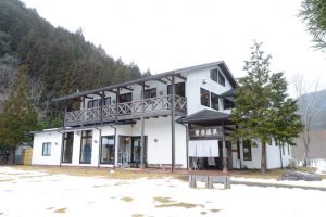
1874年創業、「塩田温泉 湯元 上山旅館」は、奈良時代から脈々と湧き続ける源泉を守り、樹齢300年を超える樅の木と赤い橋がシンボルの温泉旅館。飲泉可能な温泉は、かつて胃腸病によい湯治場として栄え、現在は人里離れた静かな環境で懐かしい温泉情緒を味わえる。
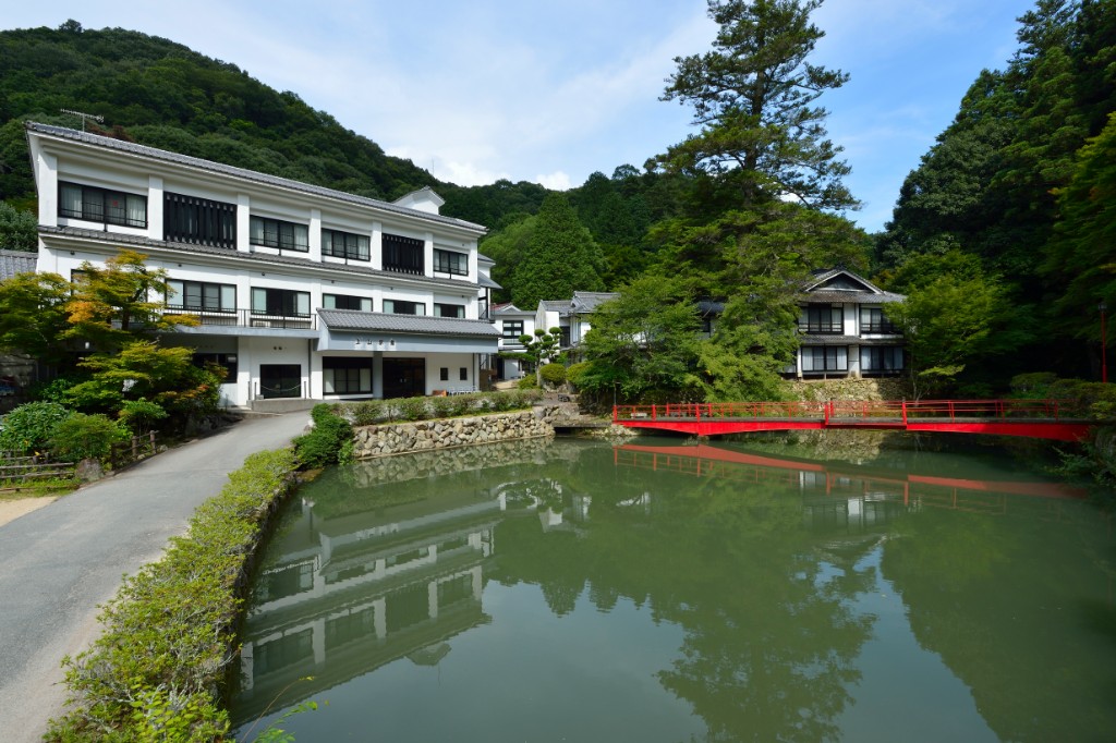
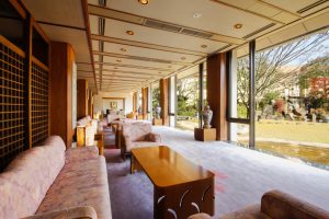
姫路の奥座敷として親しまれているお宿「姫路ゆめさき川温泉夢乃井」。清流・夢前川のほとりで周辺にはのどかな田園風景が広がり、山里の静けさ、眺望が抜群!ロビーから望める滝の流れる庭園は旅の疲れを癒してくれる。
